Ben Lomond vs Bowen Peak, Queenstown, NZ


Ben Lomond and Bowen Peak, north of Queenstown. Notice Arthur’s Point, northeast of Bowen Peak.
Screenshots of the NZ topographic map are licensed as CC BY 4.0 by Toitū Te Whenua Land Information New Zealand (LINZ).
Ben Lomond, the classic Queenstown hike, is often crowded. Just east of it is the much quieter Bowen Peak. Both are accessed from Queenstown, or from Arthurs Point, via a few tracks which intersect at Ben Lomond Saddle.
Ben Lomond is rockier than Bowen Peak, so standing on Bowen Peak to view Ben Lomond provides a view of a more interestingly shaped neighboring peak.
Times
Starting from the Old Skyline Road track, which is off of Queenstown’s Lomond Crescent, it took me about 1 hour 50 minutes to reach Ben Lomond Saddle. (Alternatively, it took me 4 hours to reach the saddle on the Moonlight Track from Arthurs Point.) From the saddle:
It took me about 1 hour to reach Ben Lomond Peak. (I didn’t keep track of the descent.)
It took me around 50 minutes to reach Bowen Peak. Descending to the saddle took around 30 minutes.
I always take the Skyline Gondola down to town, to spare my knees the final four hundred meters of descent or so. This is a 15 or 20-minute walk through town from the starting point on Lomond Crescent. The route to the gondola is indicated in bright green on the topomap screenshot.


Screenshots of the NZ topographic map are licensed as CC BY 4.0 by Toitū Te Whenua Land Information New Zealand (LINZ).
Bowen Peak Route
Countless pages on other sites cover Ben Lomond, so I won’t discuss its route.
For the Bowen Peak round-trip, from the top of Skyline Gondola, AllTrails reports an elevation gain of 934 meters and a length of 10.9 kilometers. For the round-trip from town to the Gondola, AllTrails reports an elevation gain of 436 meters and a length of 3.5 kilometers. Combined, those are 1370 meters and 14.4 kilometers.
Following the Ben Lomond Track a few minutes past the saddle, to the northeast, leads to a faint impact track diverging right/uphill on Bowen Peak. My photo shows roughly where the divergence is, but it does not show the impact track itself.
The impact track fades out sometimes. Where the impact track disappeared, it was not difficult to cross tussock and dirt patches. Bowen Peak is somewhat steep in places, but the weather was good and I didn’t find this much of a challenge.
I was the only hiker on Bowen Peak that afternoon. There were dozens coming to and from Ben Lomond.
Comparison of conditions
If 1 is an easy track, and 4 is using hands and feet on exposed rocks, I give both Ben Lomond and Bowen Peak a 2, for different reasons:
As mentioned above, Bowen Peak’s faint impact track is steep in places and fades out in places.
Ben Lomond’s track is rocky and irregular near the peak, as seen in the first photo of the left column, just below here.
The track from Lomond Crescent to Ben Lomond Saddle is a 1.
Photos from Ben Lomond (left) contrasted with photos from Bowen Peak (right).


Panorama from Ben Lomond. Bowen Peak in shadow at far left.

I’ve taken many mountain panoramas with my smartphone. This blog only displays a few of them, because they’re mostly bad. This one was taken just 1 hour 50 minutes after sunrise. It looks better better than most of my panoramas. Could it be because there’s less sunlight in the sky?
Panorama from Bowen Peak. Ben Lomond at right.

Other comparisons of the two peaks
Other posts on Bowen Peak
https://hikingscenery.com/bowen-peak-one-mile-track-queenstown/
https://www.alltrails.com/trail/new-zealand/otago/bowen-peak-track
Another novel way to hike Ben Lomond: https://www.alltrails.com/trail/new-zealand/otago/ben-lomond-ridge-line-track (I haven’t tried, and it looks dangerous)
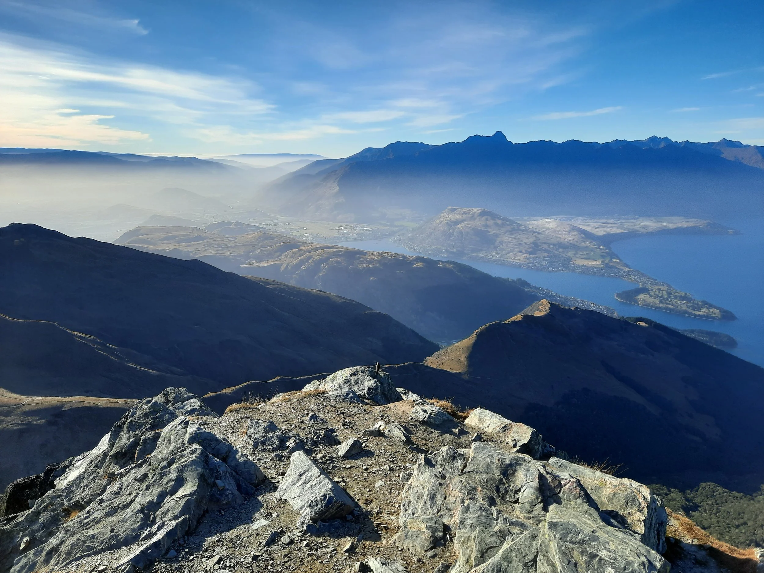
The mountains seen from elsewhere


But what about Queenstown Hill?
So many people have blogged about this gentle little one. I can only find one thing to say, and it’s about airplanes. Queenstown Hill is better than both Bowen Peak and Ben Lomond for watching airplanes descending from the east and landing at the airport in Frankton. There is probably less of a difference for views of flights taking off, which go west over the lake.

East toward Frankton from Queenstown Hill. Peninsula Hill/Kelvin Heights at right, and the Remarkables behind them. Imagine an airplane here - I was just too slow to get a photo!
This picture is duller than the rest because it’s using my old Ricoh GR II camera, which doesn’t default to nice colors the way my smartphone camera does.