Point 1658 via Johnstone’s Creek Track, St Bathans, NZ

Trailhead is the parking icon.
Green is conservation land.
Screenshots of DOC publications are Crown Copyright and licensed as CC BY 4.0 by DOC.
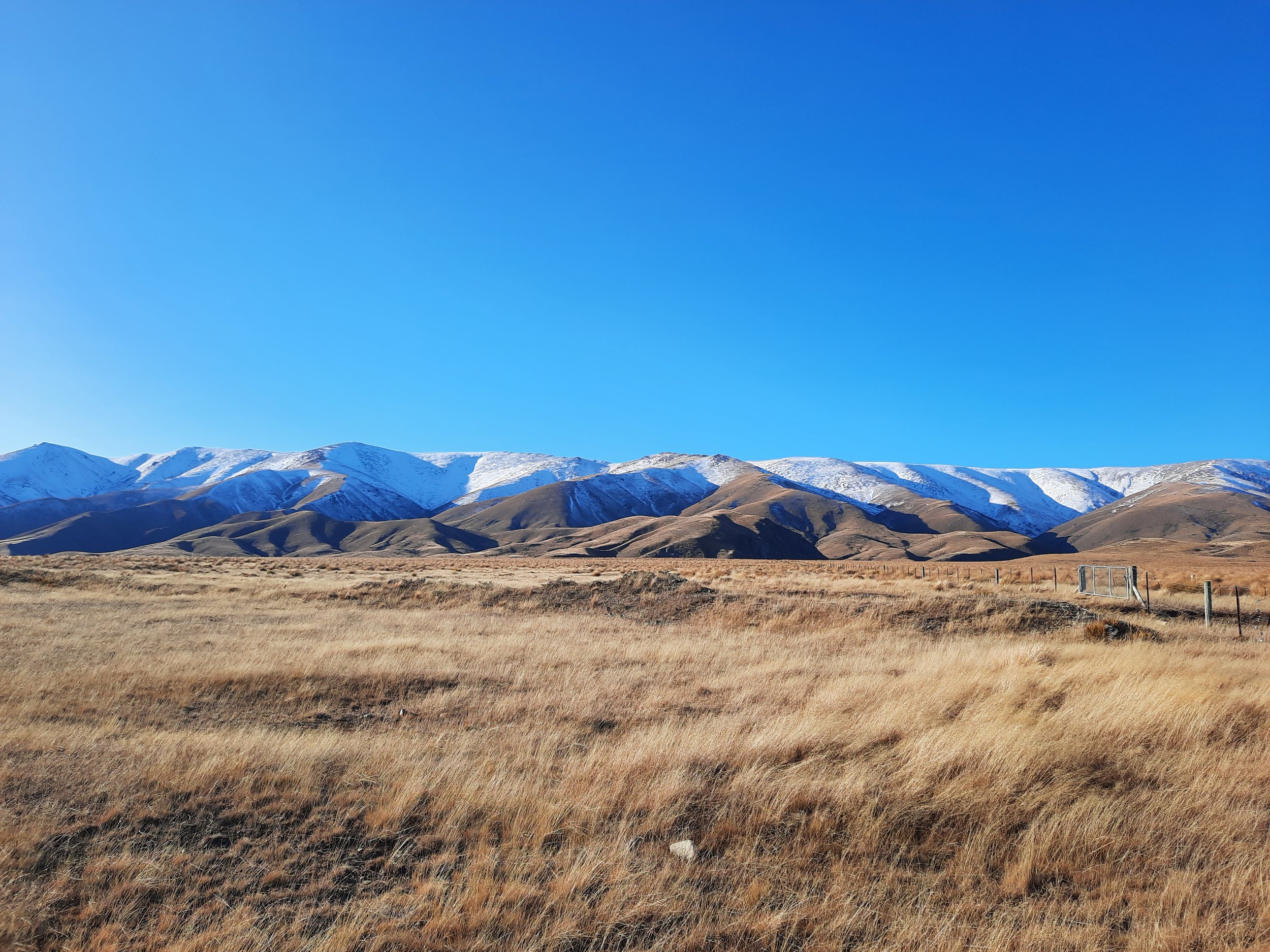
The Hawkdun Range is an escarpment on the east side of the upper Manuherikia Valley in Central Otago, South Island. You might recognize it from Jane Campion’s film The Power of the Dog or area resident Grahame Sydney’s paintings.
One of the 4WD tracks ascending the escarpment is Johnstone’s Creek Track, so named because its lower portion runs beside Johnstone’s Creek. In winter snow, I followed it as far as the nondescript Point 1658. Pat Barrett appears to refer to this spur as Homestead Spur in Wilderness Magazine.
The trailhead is around 30 minutes by car from St Bathans, around 35 minutes from Ranfurly and Omakau, and around 60 minutes from Alexandra.
St Bathans has a hotel/pub, but no gasoline and no convenience store. People stay there because it is a cute and unusual hamlet, not because it’s convenient. I was happy in Ranfurly.
This magazine also provides a good 3D map of the whole escarpment.
Time

Somewhere between the two blue dots, there is a sign warning about a zone of unexploded ordnance in the tussock beside the track. I would have marked it more precisely if I recalled where.
Screenshots of the NZ topographic map are licensed as CC BY 4.0 by Toitū Te Whenua Land Information New Zealand (LINZ).
The round-trip took me around 5 hours 40 minutes. This includes breaks.
Route
From this point on Home Hills Runs Road, a 4WD track with farm gates at both ends leads to a DOC parking lot on a bluff overlooking Johnstone’s Creek. This 4WD track takes about 5 minutes. A car with low ground clearance would not be able to drive along it.
I don’t know where Johnstone’s Creek Track officially starts, but my guess is this parking lot. From there, the 4WD track leads through undulating tussock to the base of the spur.
Somewhere between 800 meters and 920 meters of elevation, a sign warns us against stepping off the track, due to unexploded explosives (‘ordnance’). I neglected to take a photo of the sign, but I found a record of it on page 19 of this DOC PDF. Their road is 4WD overall, but maybe they consider this lower section 2WD.

My guess is this is due to risk from gelignite, used in mining more than a century ago. Please comment below if you know more!
The sign was easy to see, and the track is wide enough for a vehicle, making it hard to step off of it accidentally.
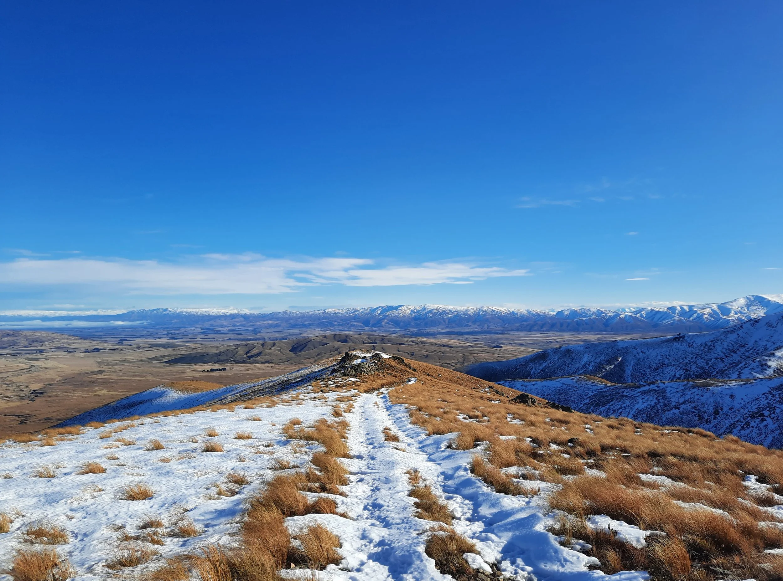
Ascending past the danger zone, the 4WD track continues up the spur all the way to the escarpment. It is periodically in bad condition, but I didn’t find it difficult to find a place to walk.
The snow started about halfway up the track. The only other hiker drove his Land Cruiser to around 1100 meters of elevation, below the snow.
On the plateau, I lost sight of the track beneath the snow and ice. Sometimes there was a thin layer of ice directly above rock, while other times the ice was atop a layer of snow up to 30 centimeters or so deep.
To avoid crunching through the ice into this snow, I didn’t walk directly to Point 1658. Instead, I plotted a hook-shaped route. Somewhere I stepped over a collapsed fence.
The point isn’t worth visiting anyway, because it is barely prominent.
If 1 is an easy track, and 4 is using hands and feet on exposed rocks, I give this track a 2 on parts of the spur and a 1 on other parts, especially the flat beginning. Had the slope - instead of just the plateau - been icy, I would probably give it a 3.
Or if you step off of the track onto the ordnance, and it explodes, we can extend the scale beyond 4 for you.


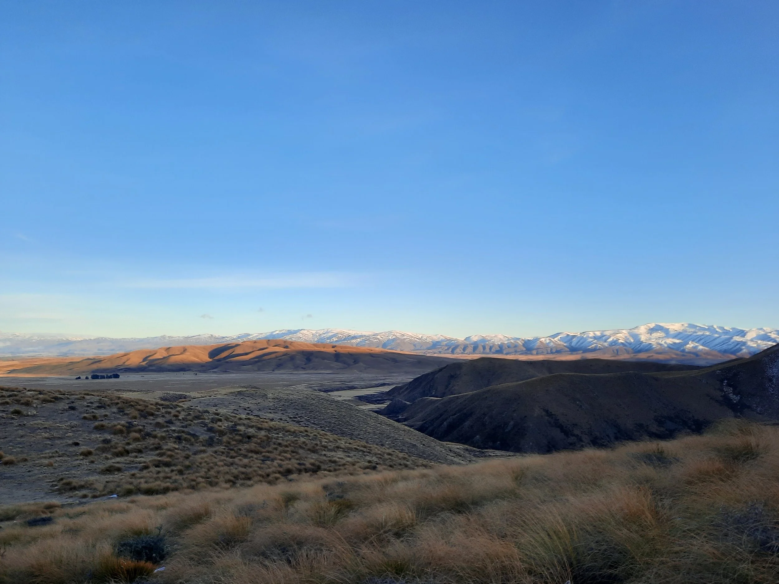


Johnstone’s Creek isn’t easily visible, but you can see its valley near the center of the 7th, 8th, and 9th photos above.
Hunting
After the beginning of the track, the entire route is in a hunting area. Hunters are forbidden to “discharge firearms near tracks, huts, campsites, road-ends or any other public place.” I have hiked in more than 30 hunting areas, and only passed hunters twice - this wasn’t one of those hikes.
Here is the DOC topomap with all hunting areas visible.
This hike
https://overlandnavigator.co.nz/track/johnstons-creek-4q062y
https://wildkiwi.site/2022/01/15/tour-te-waipounamu-retrospective-day-9-hawkdun-range-to-beaumont/ (mountain biking)
Next came a big drop off the Hawkduns to the plains below. At first descending was gentle and fun but it soon morphed into fear-for-life. While the 4wd track was well defined, there were lots of large, sharpened rocks, giant ruts, and the gradient was at times extreme.
This may or may not be the same track. If it is, it’s a reminder that something which is very challenging for a bicycle is only a mild challenge on foot. Every mode of transport has its advantages and disadvantages.
Pages about different Hawkdun hikes
https://hikingscenery.com/hawkdun-range-summit-1857m-maniototo/
https://www.alltrails.com/trail/new-zealand/otago/mount-ida-water-race-track
https://tramper.nz/7480/ascents-of-mt-st-bathans-and-mt-ida/
Lists of other Hawkdun hikes
https://www.wildernessmag.co.nz/wp-content/uploads/2015/09/Hawkdun-Range.pdf
https://www.wildernessmag.co.nz/tag/oteake-conservation-park/
Regional info
https://www.stuff.co.nz/travel/destinations/nz/central-otago-lakes/300552813/how-to-visit-film-locations-from-oscar-winner-jane-campions-the-power-of-the-dog (the Hawkdun Range masquerades as Montana in the film’s backdrops)
https://teara.govt.nz/en/otago-places/page-15 (Manuherikia, region of Alexandra, Omakau, and St Bathans)
https://www.nzgeo.com/stories/maniototo-in-july/ (Maniototo, region of Ranfurly and Naseby)
The Maniototo is nicknamed ‘Thomson’s Barnyard’ due to the many waterways (burns) with names like Kye Burn and Gimmer Burn. What was Thomson thinking?
Thomson had originally obtained Māori names for local rivers from Māori living at Lake Taieri. When some officials and runholders thought these names were too difficult to pronounce, Thomson chose names that reflected the Northumbrian dialect for an animal and the Gaelic word `burn’.
(https://www.aworldofdifference.co.nz/x,964,765,0/maniototo.html)
Kye is kine, i.e. cows. A gimmer is a ewe of a certain age.