Mt Lyndon to Red Hill, Castle Hill, NZ


Mt Lyndon (1489m) and Red Hill (1641m) are the two ends of a long ridge attached to the southern end of the Craigieburn Range in the Castle Hill area of Canterbury, South Island. Lake Lyndon separates them from the Korowai-Torlesse Tussocklands Park, including Trig M, which I have also hiked.
Red Hill should not be confused with the Red Hills of Marlborough, in northern South Island.
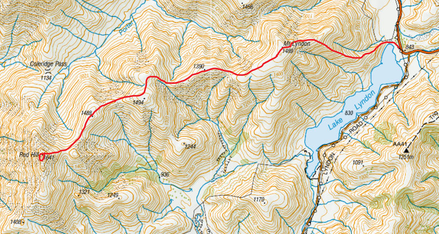
Screenshots of the NZ topographic map are licensed as CC BY 4.0 by Toitū Te Whenua Land Information New Zealand (LINZ).
Time
Including short breaks and a long break, this hike took me around 10 hours 30 minutes. Portions:
around 1 hour 30 minutes from the trailhead to the summit of Mt Lyndon;
around 3 hours 30 minutes from there to the summit of Red Hill;
around 1 hour 15 minutes of rest on Red Hill;
around 4 hours 15 minutes to return to the trailhead.
Route
Red Hill at left. Craigieburn Range at right.
When I started the video, I hadn’t spotted the kea yet! I was just aiming in what sounded like the right direction. This may be an established practice in animal videography.
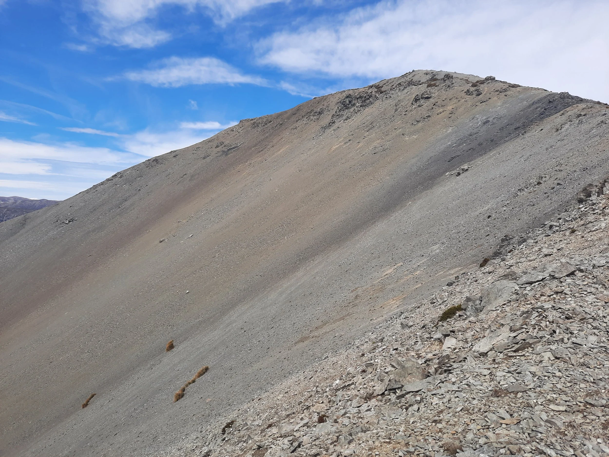
From the parking lot on the northern shore of Lake Lyndon, I walked west along a well-established impact track and ascended the nearest spur of Mt Lyndon. A lot of the ascent was steep, and some parts were loose; it was harder to descend on the return. The most difficult area was between roughly 1100 meters and 1340 meters of elevation; it finishes maybe five minutes below the summit.
On the summit of Mt Lyndon, I was delighted to encounter a kea. It flew over me (see video), then landed nearby (see gallery).
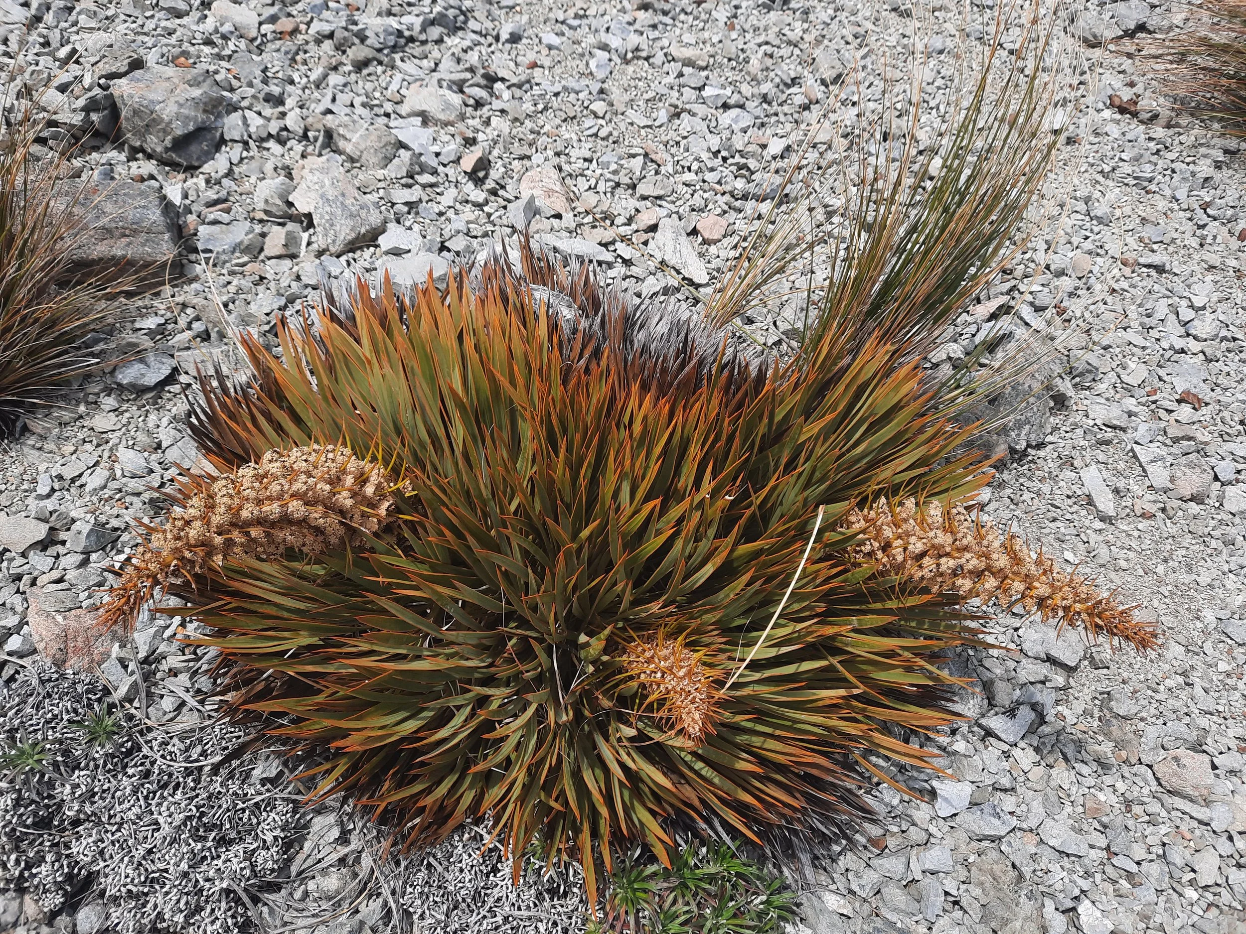
The walk to Red Hill was windy but otherwise uneventful. I followed an impact track much of the way. There were a few gravelly and somewhat narrow ridges connecting different humps in this chain of hills, but it was mostly tussock and dirt.
Red Hill offered fine views over Lake Coleridge, including Peak Hill, a medium-length hike I’ve done.
If 1 is an easy track, and 4 is using hands and feet on exposed rocks, this traverse was mostly a 2 but with some 3 on the loose slopes, and overwhelmingly a 1 on the flatter parts.


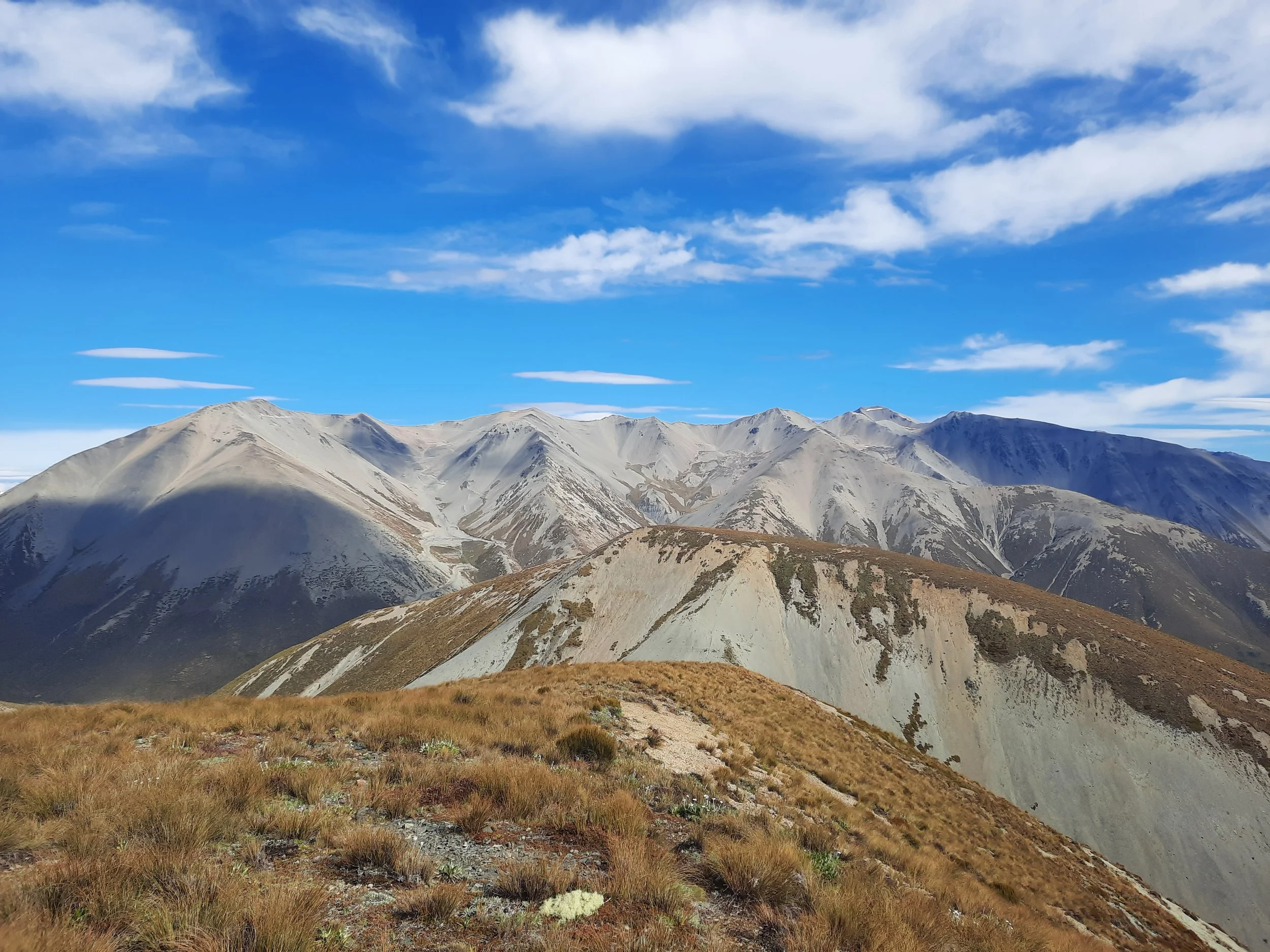


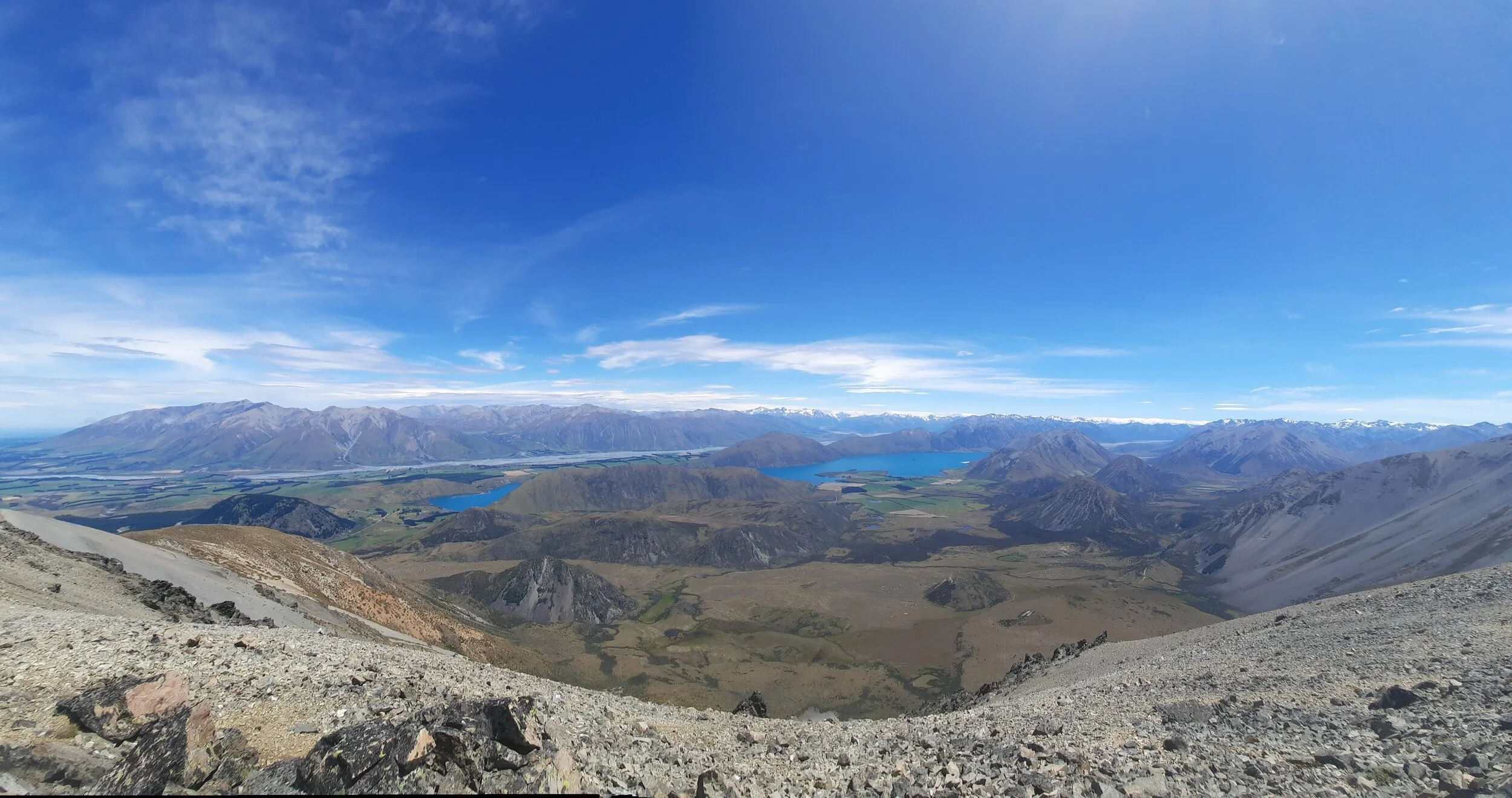
Left to right, back row: Mt Hutt Range, Black Hill Range, Palmer Range, Southern Alps.
I need to learn how to take a panorama correctly at some point.

Lake Lyndon and Trig M, just right of center.
Hunting
Most of the route is in a hunting area. Hunters are forbidden to “discharge firearms near tracks, huts, campsites, road-ends or any other public place.” I have hiked in more than 30 hunting areas, and only passed hunters twice - this wasn’t one of those hikes.
Here is the DOC topomap with all hunting areas visible.
Other pages about Mt Lyndon
https://hikingscenery.com/mt-lyndon-ascent-korowai-torlesse-tussocklands-park/
https://www.alltrails.com/trail/new-zealand/canterbury/mt-lyndon-track
Other pages about Red Hill
https://hikingscenery.com/red-hill-via-porter-river-korowai-torlesse-tussocklands-park/
https://www.wildernessmag.co.nz/trip/red-hill-korowai-torlesse-conservation-park/ (GPX)


