Mt Haast, Springs Junction, NZ


Screenshots of the NZ topographic map are licensed as CC BY 4.0 by Toitū Te Whenua Land Information New Zealand (LINZ).
Mt Haast (1587m) is a mountain in inland Buller District, West Coast, South Island. It is around 10 minutes west of Springs Junction and around 30 minutes east of Reefton. I did a medium-length out-and-back hike to its summit.
It was easily my favorite hike in the southern part of Northern South Island, by which I mean the band running west to east along highway 7 from Buller to Lewis Pass to Hurunui (Hanmer Springs) and then highway 1 to Kaikōura. It is also one of my two favorite medium-length hikes in NZ, along with Brow Peak in Arrowtown.
Don’t confuse it with:
the other Mt Haast in the West Coast region. That one is a far more challenging peak in central Westland, near Aoraki (Mt Cook).
Haast Pass, which separates the Makarora Valley of Otago from the Haast Valley of southern Westland. The nearby hike is Brewster Hut/Glacier on Mt Armstrong.
Haast Range, on the Arawhata River in southern Westland, south of Haast village.
Time
DOC estimates that the hike takes 6 hours return.
The hike took me around 5 hours 20 minutes return, including breaks. My time was about evenly divided between ascent and descent, and I spent less than 15 minutes at the summit. This time doesn’t include a prolonged photoshoot I had with South Island robins right at the trailhead, before I started hiking.
Route
DOC reports that it’s 5km round-trip. Wilderness Magazine reports 922m of elevation gain.
There is a parking area with space for around 6-10 cars beside the trailhead, which is on the south side of the road, just west of a small bridge and a few minutes west of Rahu Saddle. The DOC sign at the trailhead is visible from the road.
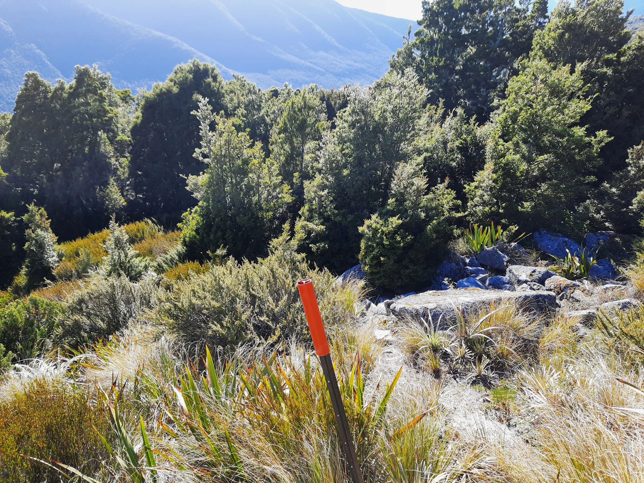
The route up through the forest is obvious, both because of the shape of the track and the orange markers. The first 100-150 meters of the hike were quite muddy, so I highly recommend boots and gaiters, such as my OR Crocodile gaiters. After that, the ascent through the forest was somewhat steep, but the track was in good enough condition that it didn’t feel challenging. I expected worse based on other blog post descriptions.
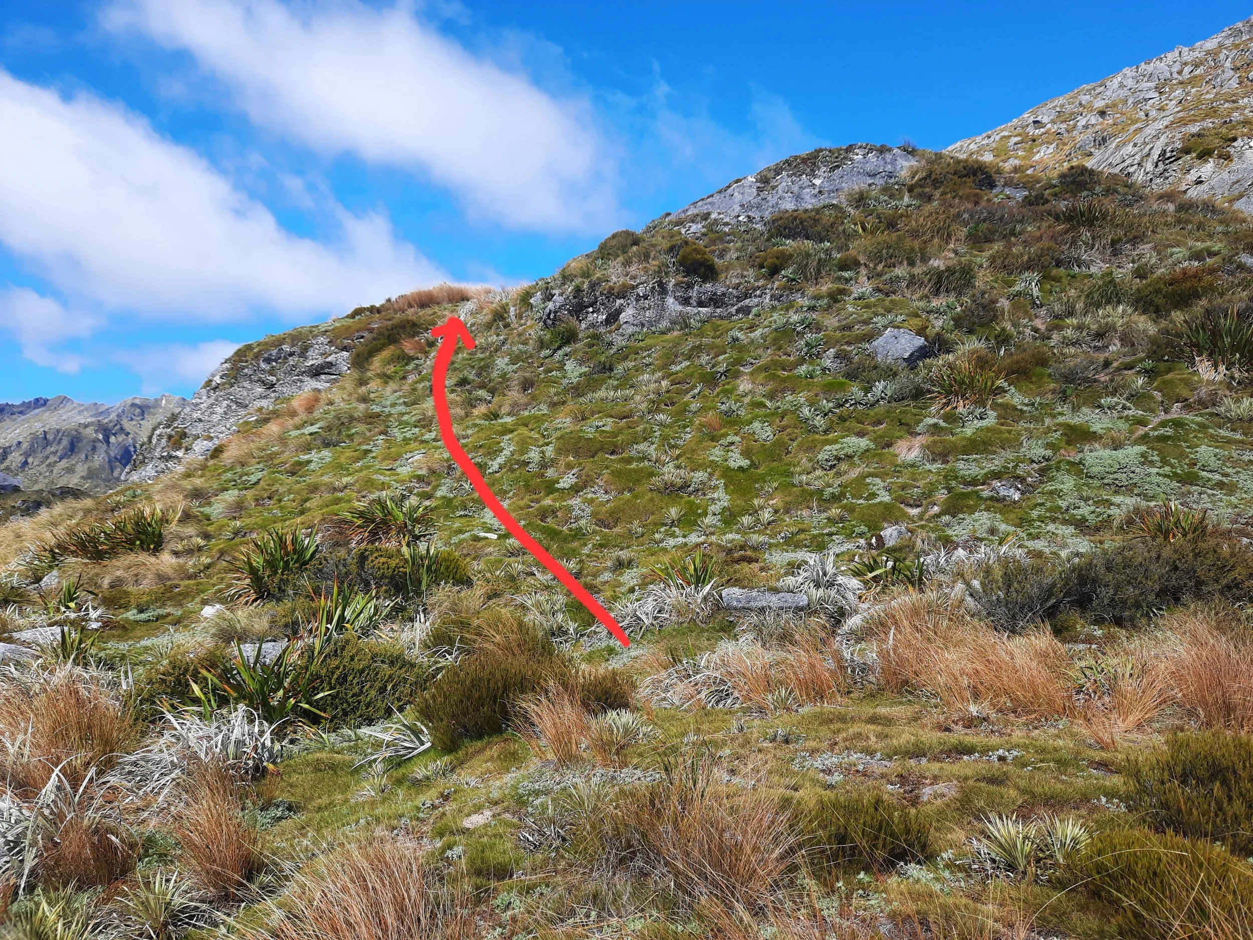
Exiting the forest, the path briefly disappears amidst bushes, which I had to push through. See annotated photos pointing the way, below.
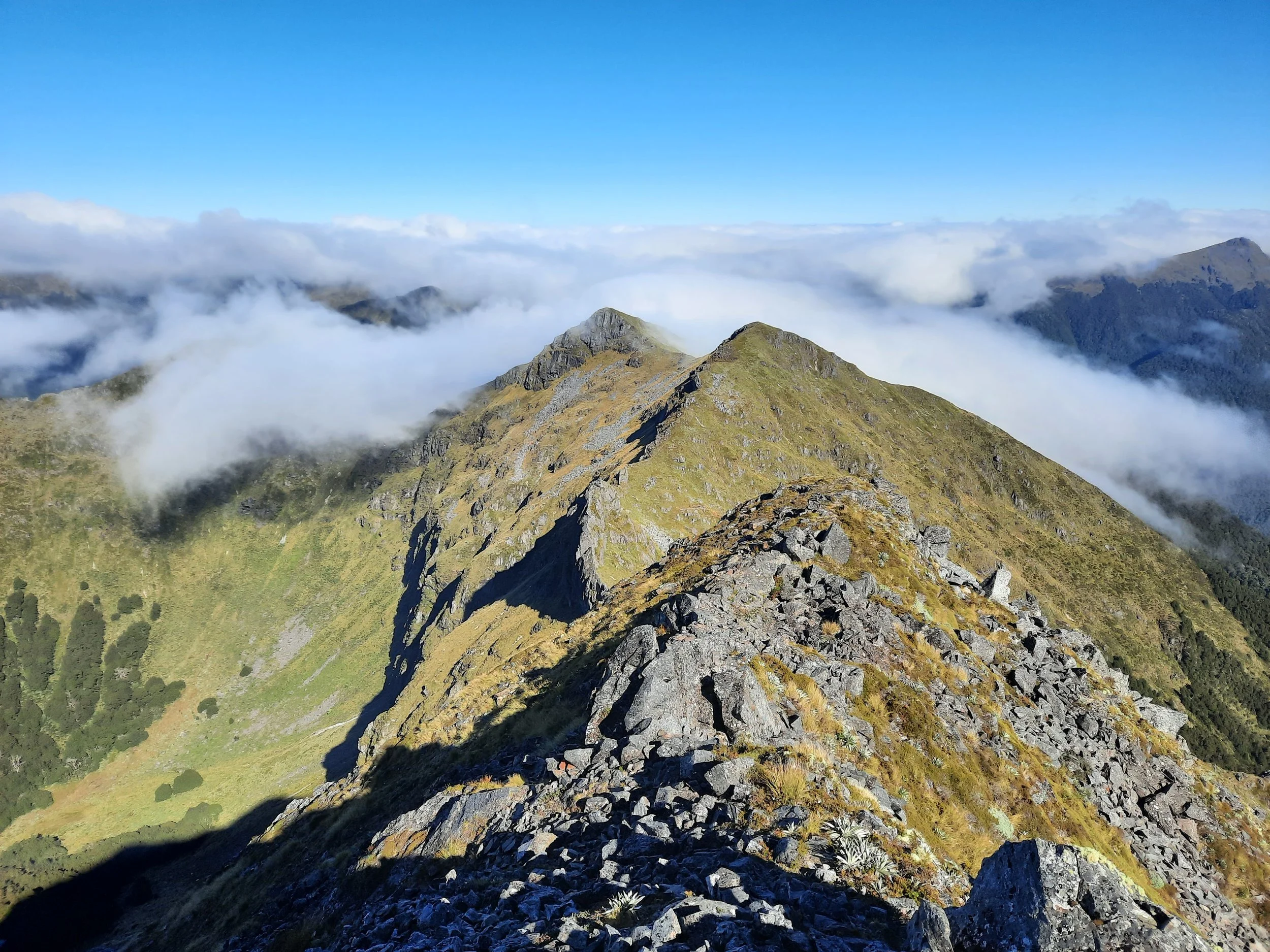
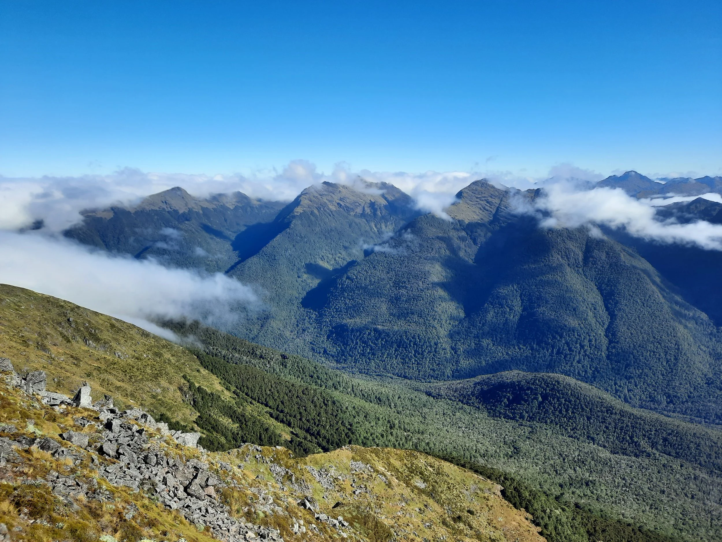
Once properly out of the forest, there is a steep hike up through tussock. there are sporadic orange poles part-way to the summit. It was often difficult to see the next pole, and in some places I also had doubts about the wisdom of the route that a hiker would follow walking obediently from one to the next. An impact track fades in and out, not always as near the poles as you would expect. I went up long fields of boulders whenever possible, to avoid the confusion of not knowing what the poles were suggesting I do and the frustration of frequently losing the impact track. If I lived in Reefton, I would adopt this route and try to do something to make navigation easier.
The summit area is fairly small. It has a cairn, atop which I built a little arch from four small stones. I wondered if my arch would survive the wind until the following day.
Just as it was a bit difficult to exit the forest, it was also a bit difficult to re-enter it. So the final photos in the gallery are additional annotated images pointing the way.
If 1 is an easy track, and 4 is using hands and feet on exposed rocks, I give this hike a 3 at worst.


Hunting
The entire route is in a hunting area. Hunters are forbidden to “discharge firearms near tracks, huts, campsites, road-ends or any other public place.” I have hiked in more than 30 hunting areas, and only passed hunters twice - this wasn’t one of those hikes.
Here is the DOC topomap with all hunting areas visible.
Other pages about this hike
https://www.wildernessmag.co.nz/wild-trips-mt-haast-victoria-conservation-park/ (GPX)
https://jontynz.com/2021/06/04/mt-haast-route-klondyke-spur-track-alborns-track/
https://hikingscenery.com/mt-haast-route-victoria-forest-park/
Pages about traversing Mt Haast to Mt Kemp
This is one of the most appealing-looking off-track multi-day hikes I know of.
Pages about nearby hikes
https://hikingscenery.com/best-day-tramps-hanmer-springs-lewis-pass-reefton/
https://www.wildernessmag.co.nz/trip/klondyke-valley-track-victoria-forest-park/
Faust, between Lewis Pass and Hanmer Springs