Mt Karioi via Wairake Track, Raglan, NZ


Mt Karioi (756m) is in far western Waikato, North Island, by the Tasman Sea. It has a longer northwestern track - Karioi Track - and a shorter southern track - Wairake Track. I took Wairake Track. Its trailhead is about 20 minutes from Raglan (Whāingaroa) and 50 minutes from Hamilton (Kirikiriroa).
The lower part of the hike is an easement through a dairy farm. DOC says we may only access this during daylight. I have not seen such restrictions on South Island farm easements.
Time
DOC estimates that Wairake Track takes 2-3 hours to the summit and 2 hours back. This seems generous. Perhaps it is aimed at residents of nearby Hamilton who rarely hike.

The light blue dot indicates an electric fence very close to the track.
The maroon dot shows Ruapuke Beach, and the purple dot shows the other trailhead (and Te Toto Gorge).
Screenshots of the NZ topographic map are licensed as CC BY 4.0 by Toitū Te Whenua Land Information New Zealand (LINZ).
AllTrails users report an average of 3 hours 3 minutes round-trip.
It took me around 1 hour 40 minutes to reach the summit and around 1 hour 30 minutes to descend, including short breaks but excluding my break at the summit.
For the other track, Karioi Track, DOC estimates 3 hours 30 minutes one-way while AllTrails users report 3 hours 36 minutes round-trip.
Route
AllTrails reports 536 meters of elevation gain over 6.6 kilometers, out and back.
From the parking lot, the track starts through a hilly dairy farm. Orange marker poles distinguish the track from intersecting farm tracks. Several places were quite muddy.
Shortly after the trail diverges from the farm track, it ascends a slope, with forest on the left and an electrified fence on the right. The electrified wire is less than half a meter from the trail. I’ve marked the location on the map. Anyone could accidentally touch it, going up or down, on a muddy day or a dry one. But descending the track while the track is muddy is probably the biggest hazard. I emailed the Hamilton DOC office, asking them to mention this hazard on their page for Wairake Track, and post signs on the track itself.
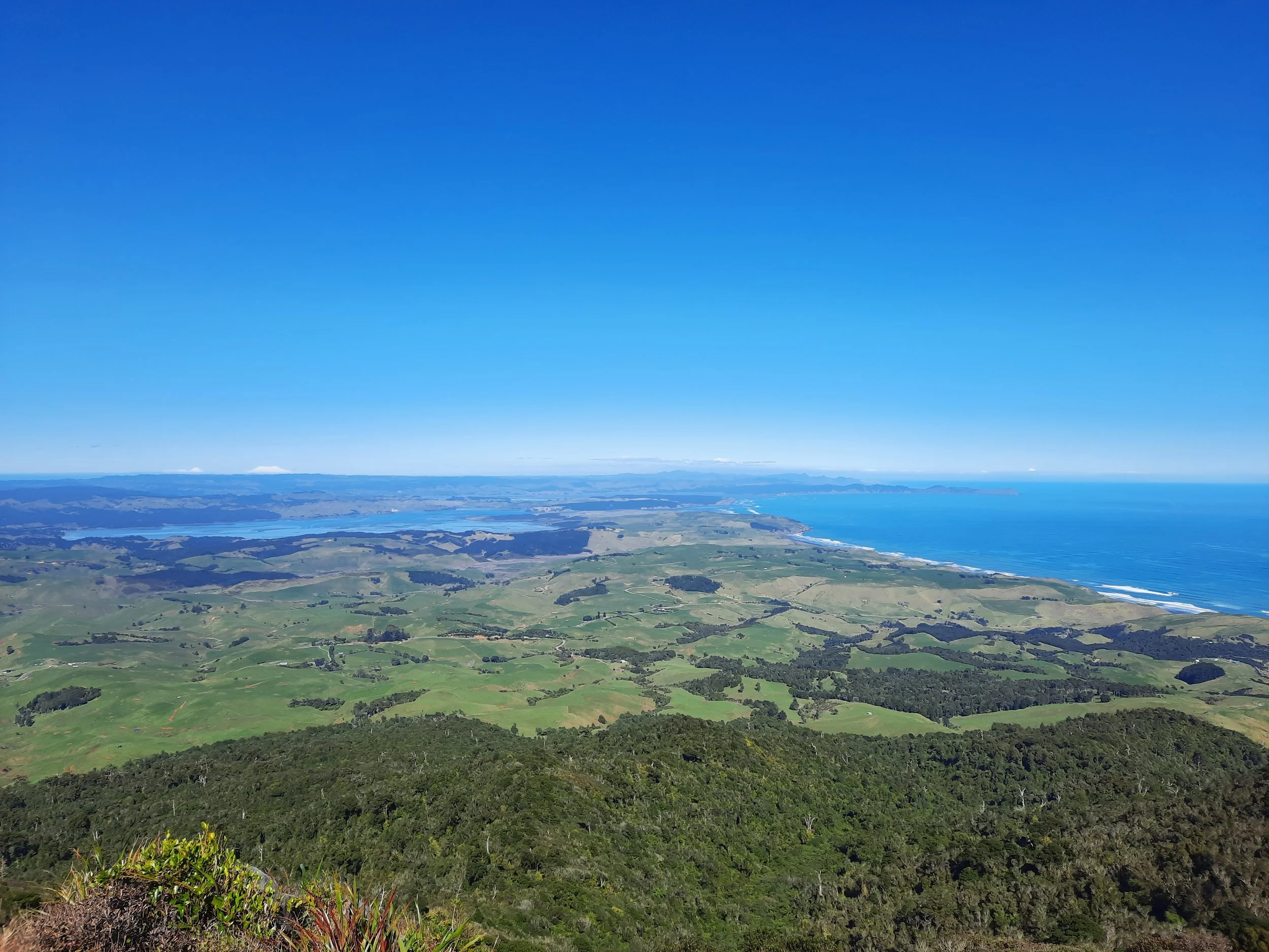
At the top of the hill, the forest begins. It is moderately steep, sometimes rocky but not that much, with minimal views. One minute before the summit, I climbed two ladders to arrive on a concrete helicopter landing pad. The platform was a good place for photos and lunch. Had there been high wind, I would have rested in the forest.
The trailheads are far apart, so I returned the way I came.
If 1 is an easy track, and 4 is using hands and feet on exposed rocks, I give this track a 3 at worst. It is mostly a 2 in the forest, and a 1 on the farm.


This hike reminded me of the bigger Mt Kaimon (Kaimon-dake), a volcano which juts into the sea near the southern tip of Kyūshū, Japan.
Around the mountain on Whaanga Road
After my out-and-back hike on Wairake Track, I drove north along the mostly gravel Whaanga Road, between the mountain and the Tasman Sea. The scenery was a mixture of grazed hillsides and wooded valleys, with few views of the sea. One of two good views of the sea came from making a sidetrip downhill to the black sand Ruapuke Beach.
Next, I drove north and reached the trailhead of the longer Karioi Track. The trailhead is a minute away from a clifftop viewpoint over the mouth of Te Toto Gorge, where Te Toto Stream flows from Mt Karioi into the sea. After that, I continued northeast along the road to Raglan.
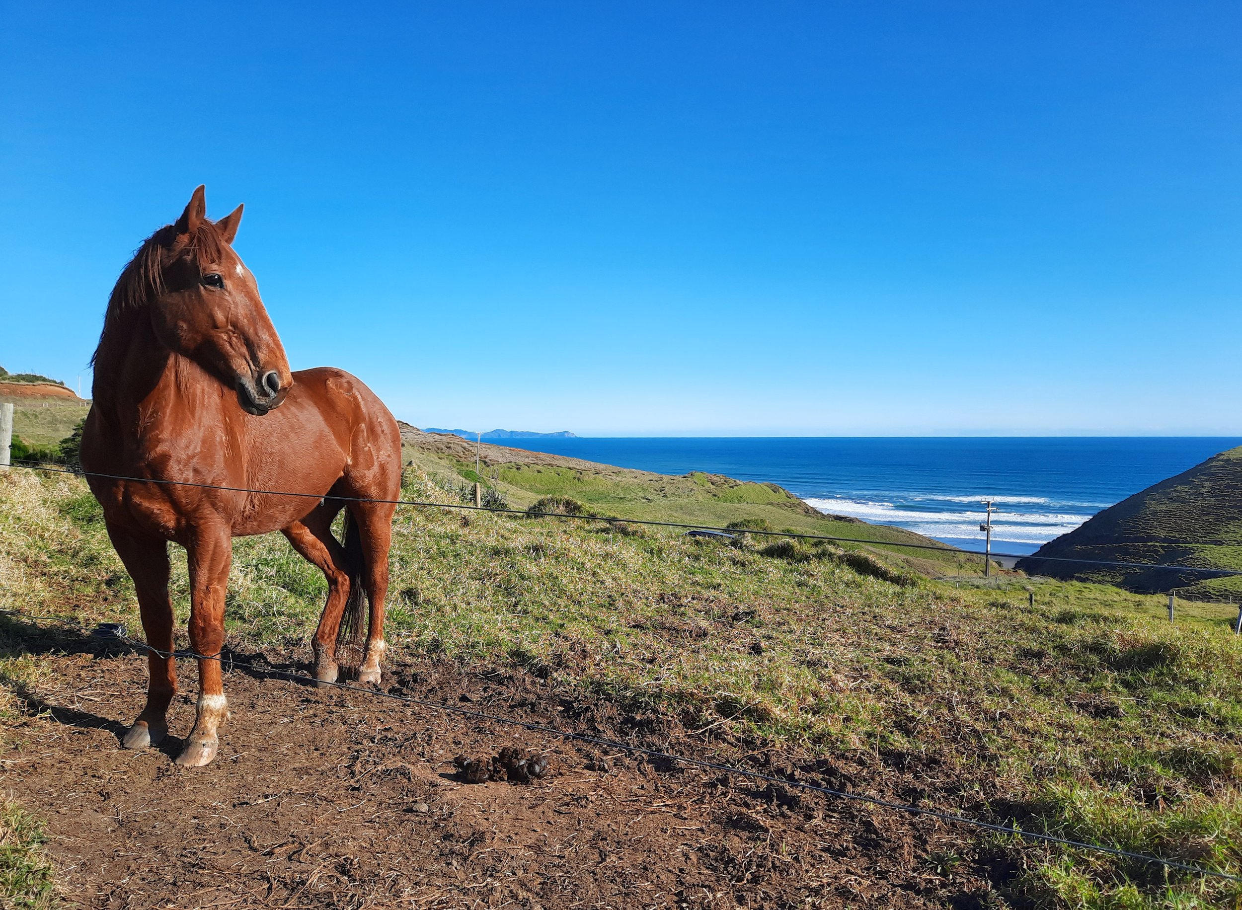
Whaanga Road is one of the windiest roads I have ever driven along. It would be a bad road for a campervan, but apparently not impossible, since there was a derelict campervan near the horse. It would also be bad for bicycling, not just because of the hills but also because of the danger from drivers coming around blind corners. So I don’t think a solo through-hike which involves parking at one trailhead, then bicycling to the other trailhead, is a good idea. But it seems like a fine hike for a key-swap involving a friend with their own car.


Hunting
Beyond the farm, the route is in a hunting area. Hunters are forbidden to “discharge firearms near tracks, huts, campsites, road-ends or any other public place.” I have hiked in more than 30 hunting areas, and only passed hunters twice - this wasn’t one of those hikes.
Here is the DOC topomap with all hunting areas visible.
Other pages about this hike
Pages about the hike from the other trailhead
https://www.alltrails.com/trail/new-zealand/waikato/mount-karioi-track
https://www.wildernessmag.co.nz/trip/mt-karioi-raglan/ (GPX)