Mt Takorika, Havelock, NZ


Mt Takorika (721m) is a forested mountain next to Havelock in the Marlborough Sounds, South Island. A short hike to the summit is accessible on foot from town.
This is Marlborough District Council land, rather than DOC land. The tracks are not visible on the DOC topomap.
Don’t confuse the small town of Havelock with the large town of Havelock North, which is near Napier in the Hawke’s Bay Region of North Island.
Time
Nelson Trails estimates that it takes 3-4 hours return, probably on Main Track.
On a mix of routes (see below), it took me around 85 minutes to reach the peak and about 95 minutes to descend, not counting a break at the summit.
Route
The trailhead is around 40 meters above sea level, while the summit is at 721 meters.
Main Track is said to be the easiest track. This seemed to be true for the several hundred meters of ascent that I spent on it.

I ascended clockwise. The question mark indicates the first portion of my ascent, which I didn’t record on my maps app. I have not found a comprehensive bird’s-eye map of all the trails.
Screenshots of the NZ topographic map are licensed as CC BY 4.0 by Toitū Te Whenua Land Information New Zealand (LINZ).
From the trailhead on Lawrence St, I started on Main Track, then took the first link track to Waterfall Track and reached the lower waterfall. All of this was easy walking. Just below the waterfall, I crossed the stream by stepping on a few rocks, then took the second link back to Main Track. This link track was steep and loose; there was a rope at one point. (I only know there is an upper waterfall, too, from the below-linked blog posts.)
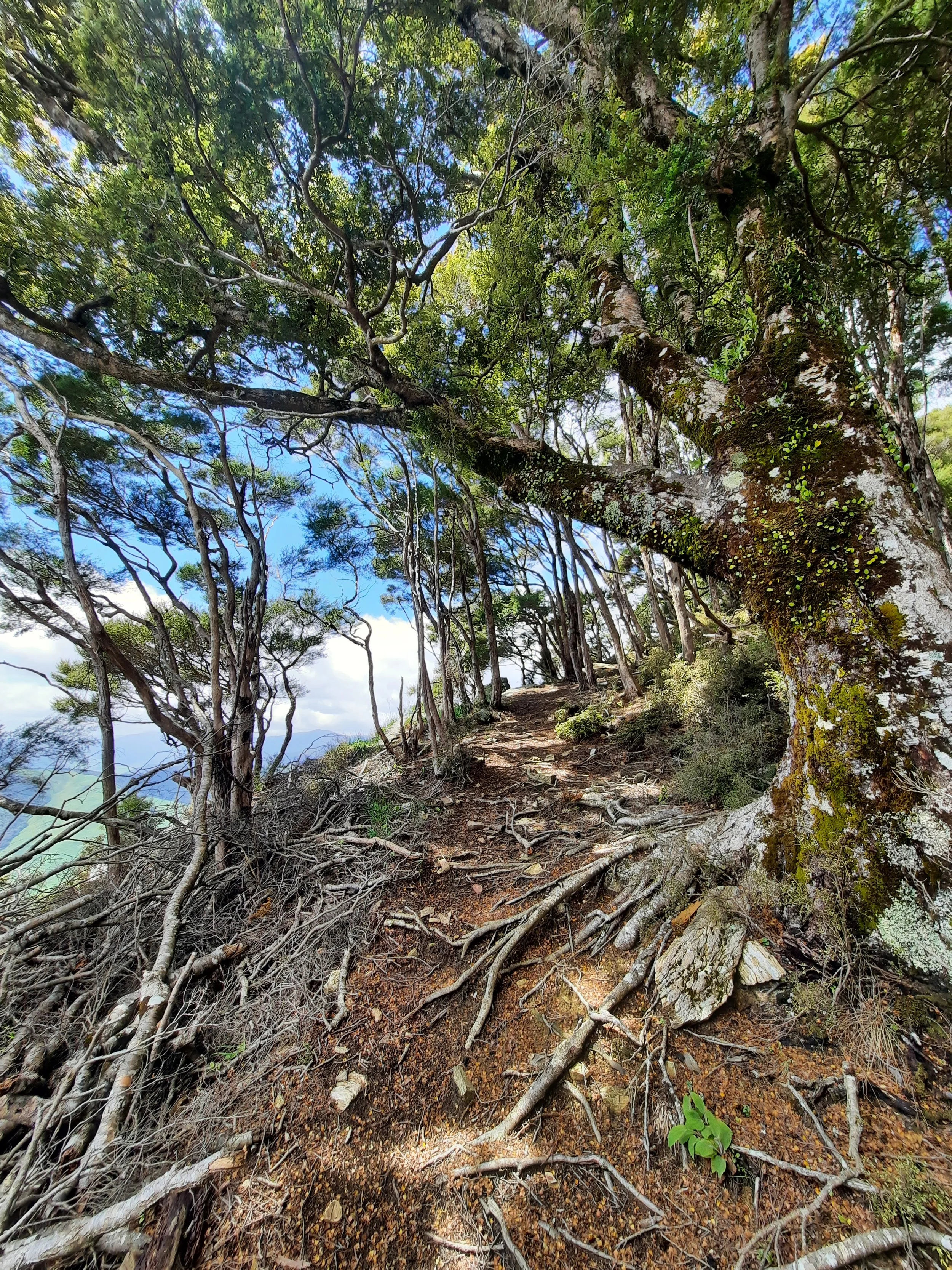
Back on Main Track, I continued uphill until the juncture with Lookout Track. I took Lookout Track and then Escarpment Track to the summit. Parts of these were steep and narrow, requiring careful footwork. I liked the view from Lookout Track a little more than the view from the summit.
At the summit there is a utility building. It has a front deck facing Havelock, Cullen Point, and Pelorus Sound. This is a good place to sit down.
Unable to find the top of Main Track, I instead descended along the road to the flat area on the ridge indicated by a triangle, at around 530 meters of elevation. There is an electric something or other here, bigger than the mast at the summit. From this flat area, I followed Ridge Track back to the trailhead. There were some steep portions of this track, and also some mud, making me glad of my trekking poles.
If 1 is an easy track, and 4 is using hands and feet on exposed rocks, I give this track a 3 at worst. It is mostly a mix of 1 (Main Track and the road) and 2 (much of the remaining tracks).


Other pages about hikes on Mt Takorika
Nearby hikes
https://www.alltrails.com/explore/trail/new-zealand/marlborough/kaituna-ridges-walk
https://www.alltrails.com/explore/trail/new-zealand/marlborough/waikakaho-saddle-from-cullensville
https://www.alltrails.com/explore/trail/new-zealand/marlborough/moetapu-bay-overlook

