Mt Aso traverse, from Sensuikyo to Sanjo, Kyūshū, JP


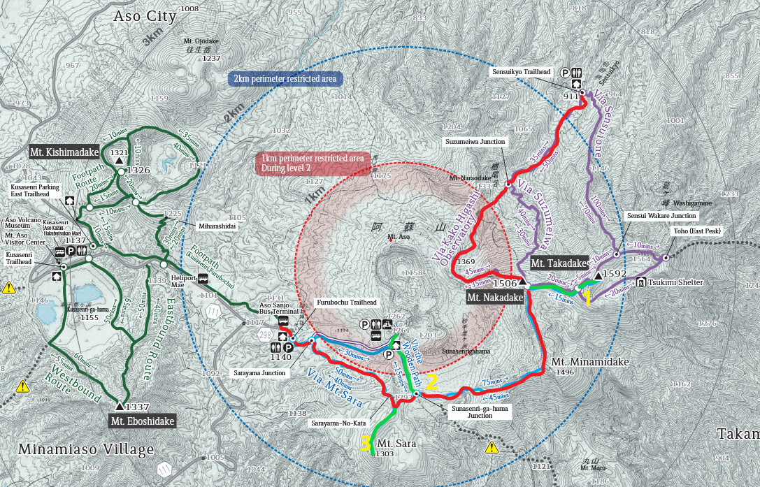
For a full traverse in one day, I would start at upper right and follow the red line, taking the three out-and-back side-trips shown in green. Side-trip #2 is the most scenic, because it gets closest to the main crater.
Map used under Government of Japan Standard Terms of Use (GJSTU).
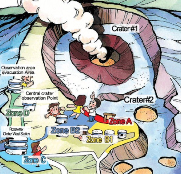
Zone A is always closed. Some or all of the other zones are closed based on volcanic and wind conditions. The park staff make this clear for visitors present.
Map used under Government of Japan Standard Terms of Use (GJSTU).
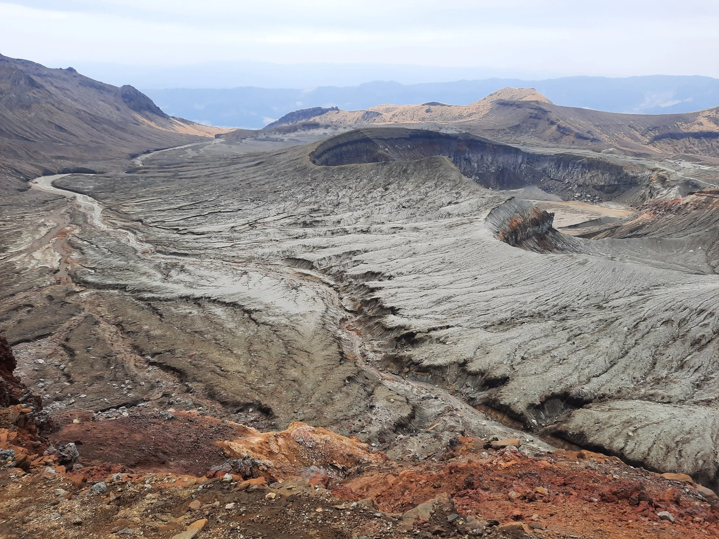
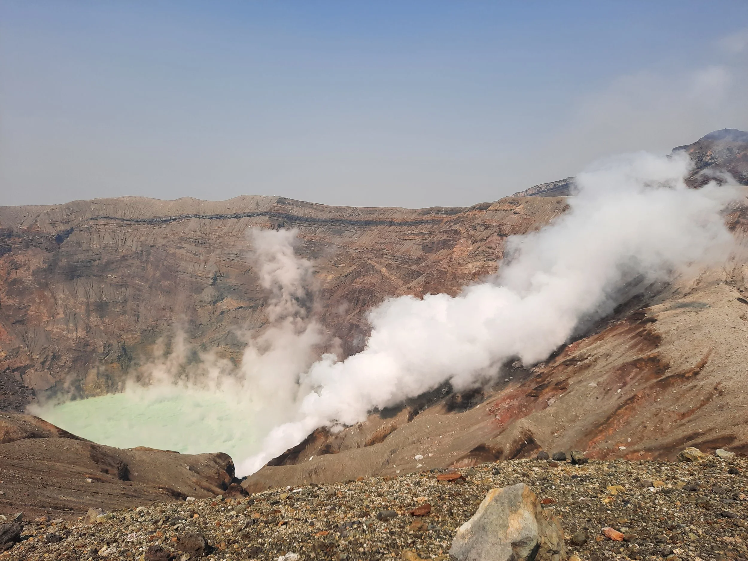
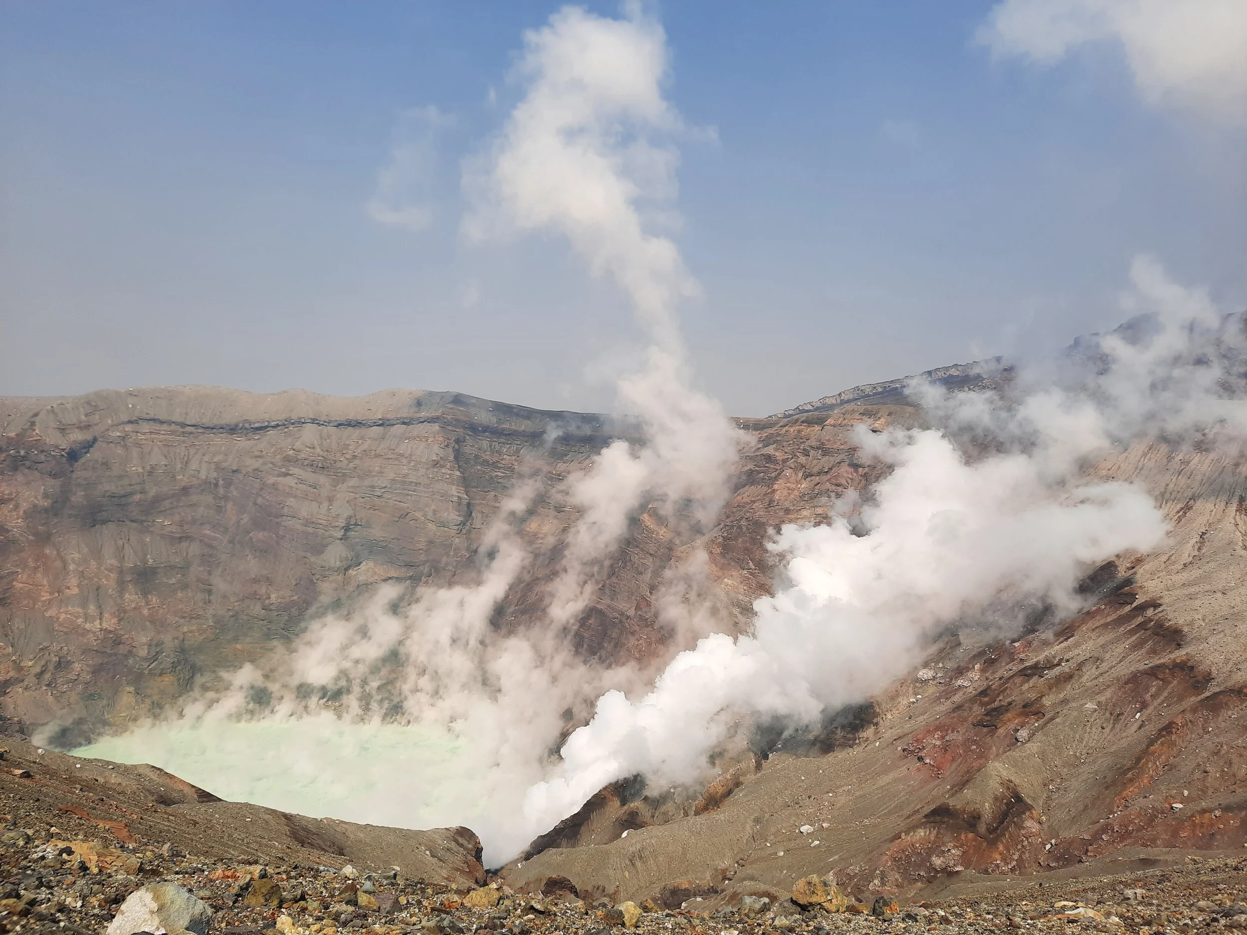
Mt Aso (Aso-san) is a cluster of volcanic peaks near Aso City in central Kyūshū, rather than one distinct mountain. The high peak is Taka-dake (1592m). The chief attraction is viewing the gigantic crater and its steaming blue lake. The crater is active, and depending on volcanic conditions and wind conditions, various areas are closed to hikers and bus-tourists. The official website announces this.
I did two separate day-trips, but I will use this post to describe how to do one day-trip, covering the interesting parts of both days. So this post will cover:
main route from Sensuikyo trailhead to Naka-dake
side-trip from Naka-dake to Taka-dake, and back
main route from Naka-dake to Sunasenri-ga-hama Junction
side-trip from Sunasenri-ga-hama Junction to main crater viewpoint (near Crater West Station), and back
main route from Sunasenri-ga-hama Junction to Sara-yama ridge (this is only a few minutes)
side-trip from Sara-yama ridge to the peak of Sara-yama, and back to Sara-yama ridge
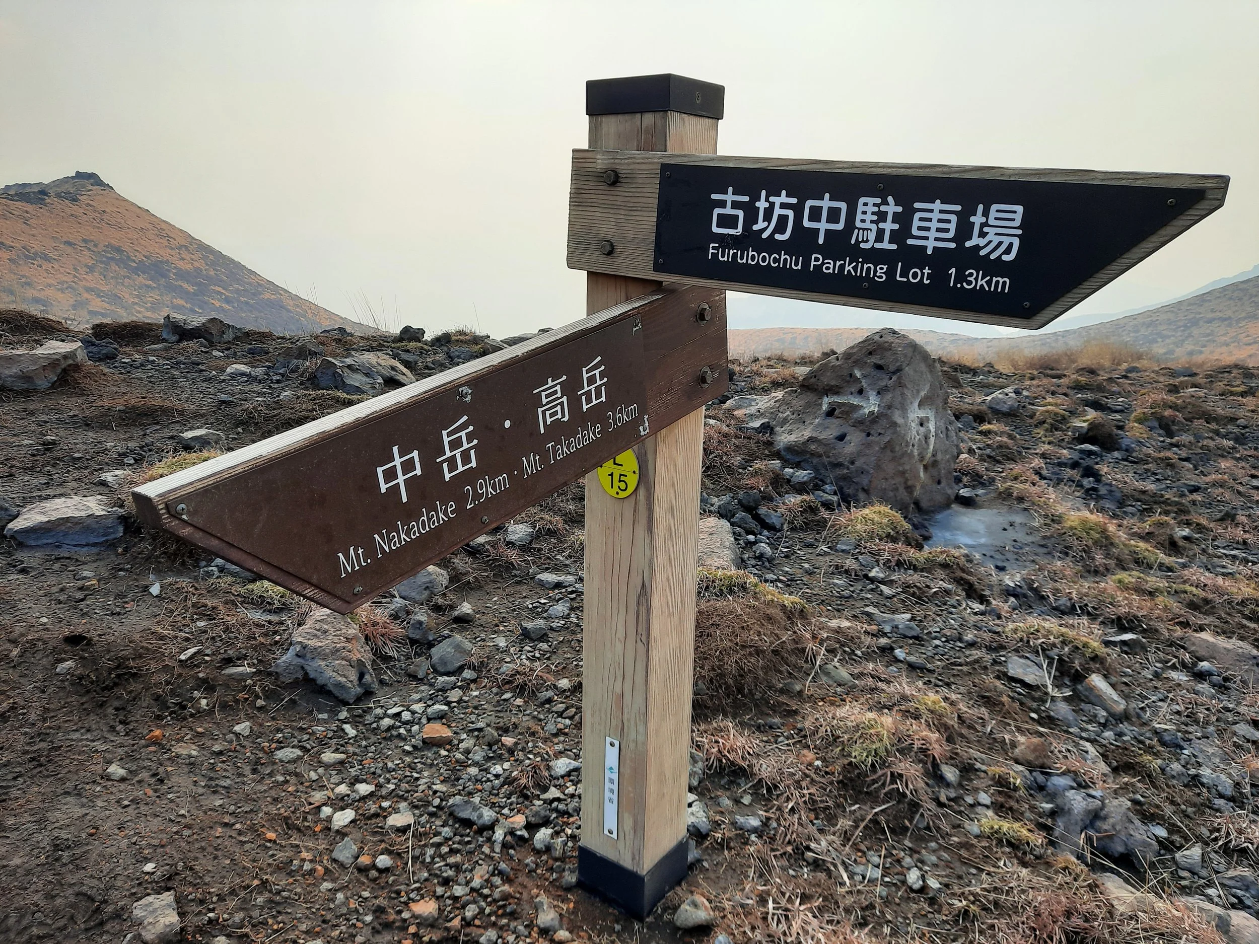
main route from Sara-yama ridge to Furubochu trailhead, and then along the paved sidewalk to Aso Sanjo Terminal nearby
Access
I took the JR Hohi Line east from Aso Station to Miyaji Station, then took a taxi from directly outside Miyaji Station to Sensuikyo trailhead. The driver did not speak much English, but was clearly familiar with the trailhead and hiking. He advised me in Japanese to be careful on my hike.
It would also have been possible to take a taxi directly from Aso Station to Sensuikyo trailhead. Using the train part-way saves money.
I chose to start my hike at Sensuikyo because it has no regular public transport. Finishing at Aso-Sanjo Terminal makes it easy to take a bus to Aso City, so long as the hiker arrives in time for the last bus in the late afternoon. I was told that it was a 3-hour walk to Aso Station, in case I missed the last bus.
Another variant is finishing at the main crater viewpoint, taking one bus from Crater West Station to Aso Sanjo Terminal, and then the other bus from Aso Sanjo Terminal to Aso Station. This is what I did on one of my two hikes.
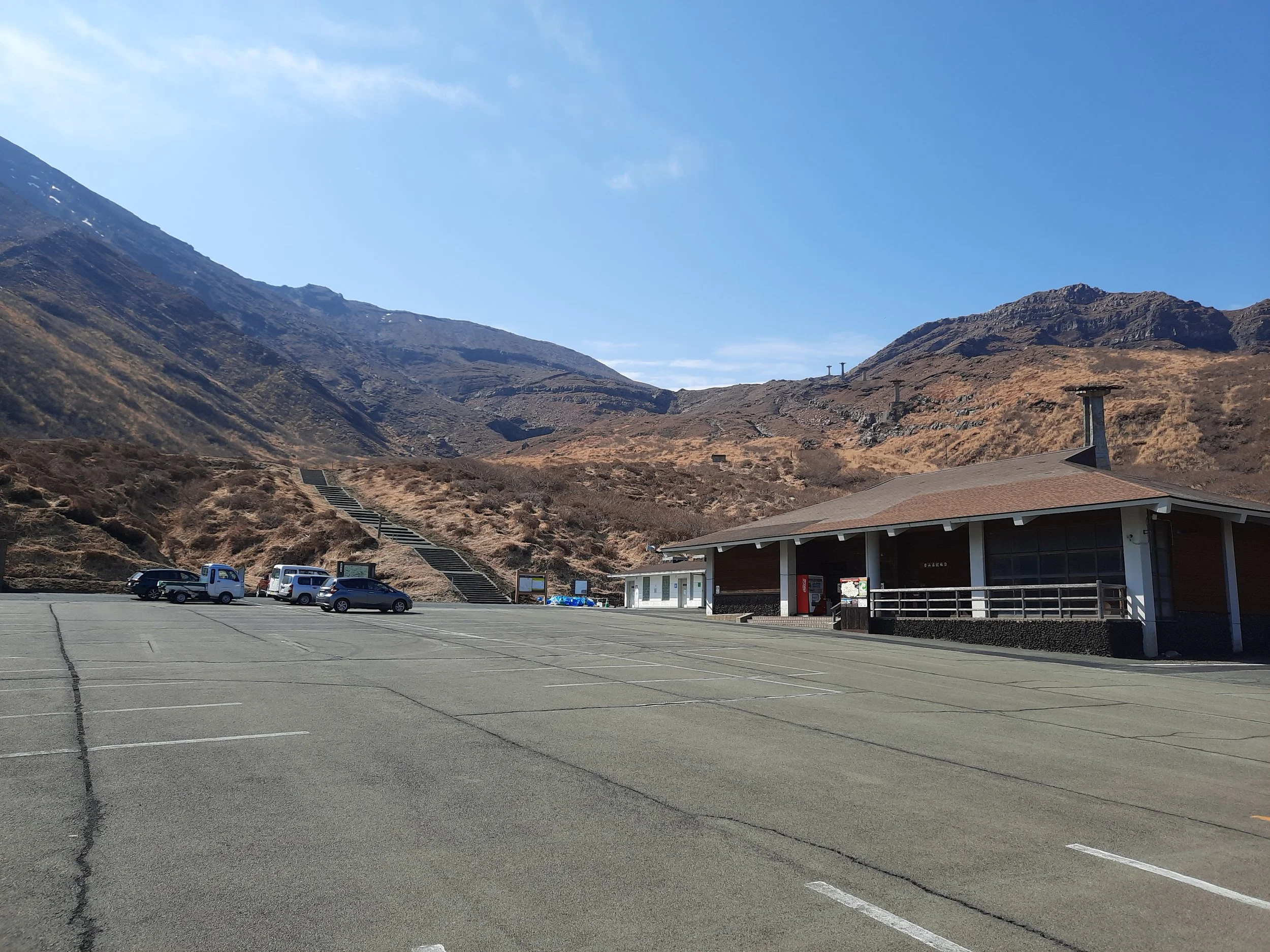
Sensuikyo trailhead has a medium-sized parking lot, so it’s possible to do an out-and-back hike after arriving by car. I don’t know if it is paid parking. The parking lot was 90% empty when I visited on a sunny day in late winter.
Time
It took me about 4 hours 20 minutes from Sensuikyo parking lot to Susasenri-ga-hama Junction, on my second day. On my first day, it took me around 2 hours 10 minutes to walk from Crater West Station, to the crater viewpoint, to Susasenri-ga-hama Junction, up to the Sara-yama ridge, to Sara-yama peak and back, down to Furubochu trailhead, and along the sidewalk to Aso Sanjo Bus Terminal. That makes 6 hours 30 minutes across both days, not counting time spent taking a break at the Aso West Crater rest stop, which has toilets and sells a limited choice of food.
My route is not available on AllTrails, yet.
Route
From Sensuikyo parking lot and its unstaffed rest building, I walked uphill for a minute or two, to a paved clearing. I had the option of a right or a left turn. Here I turned right, and ascended a moderately steep path which was partly steps. It eventually met another trail coming from the left, which I believe was the trail coming from the left of the paved clearing.
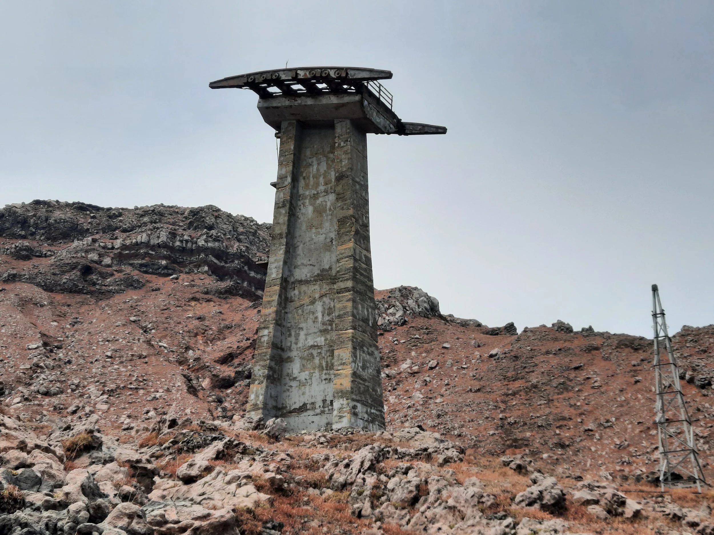
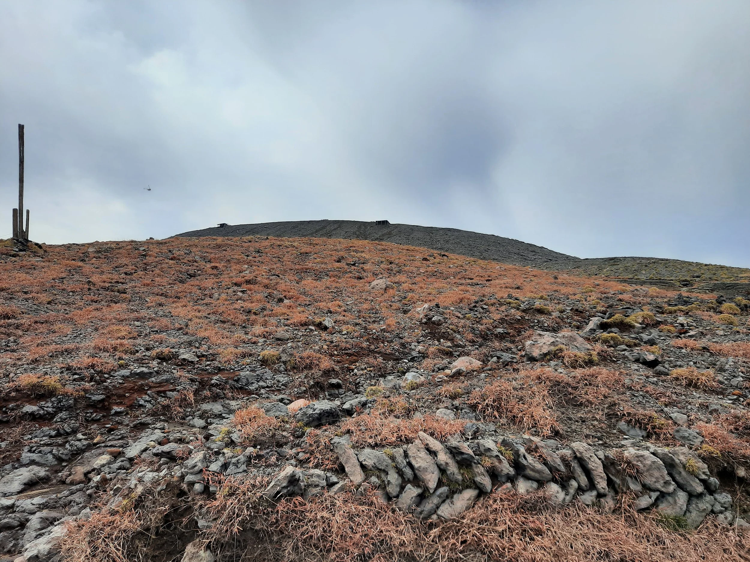
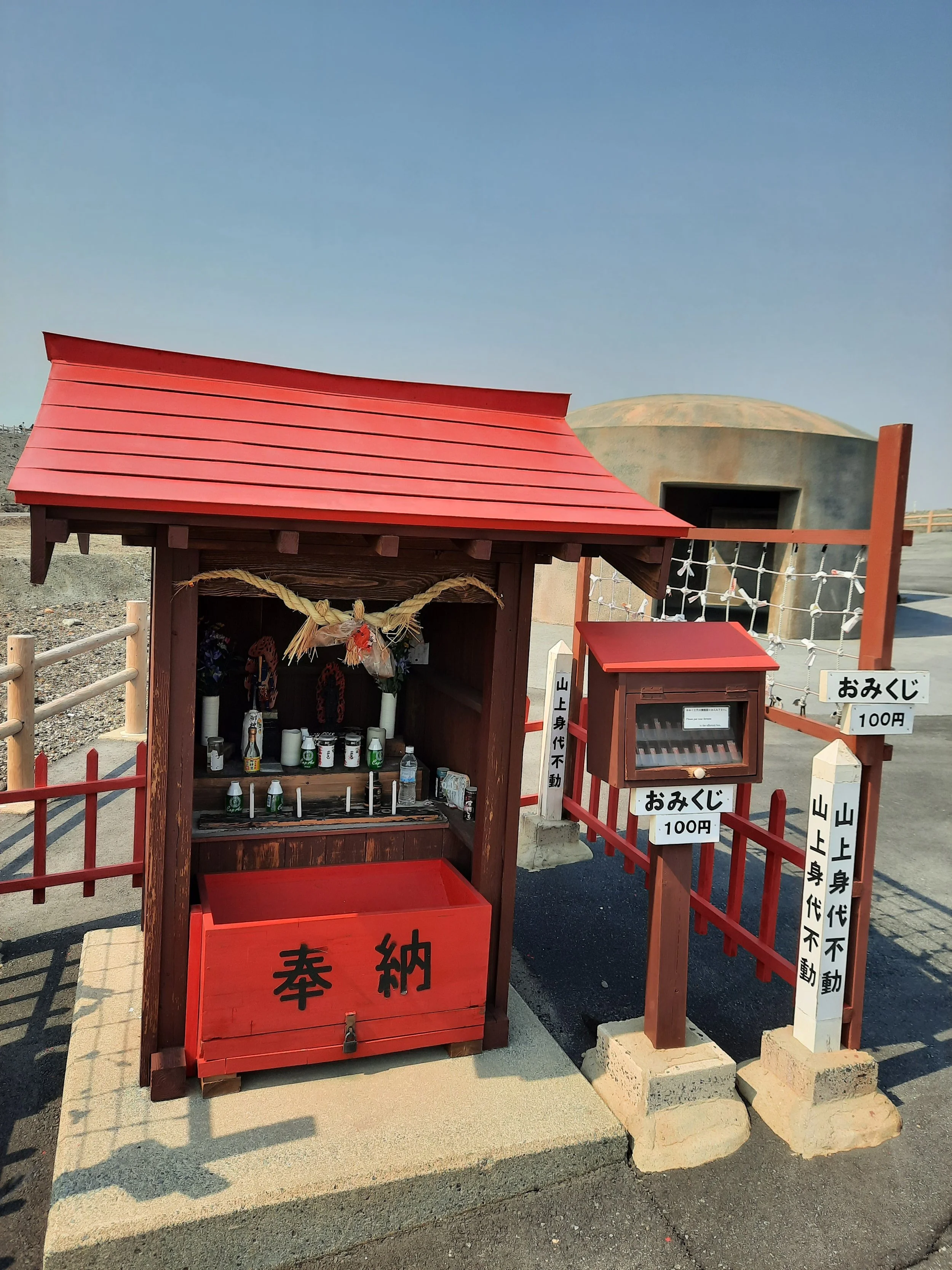
Continuing uphill, I passed a deconstructed chairlift or cable car of some sort on my right. Above this, the trail turned into a gently sloping paved path. There were several volcanic shelters along the way, reminding me of images of Albania’s pill bunkers. (Albania had a dictator who feared invasion.) These were the last shelters for a few hours, until I reached the main crater.
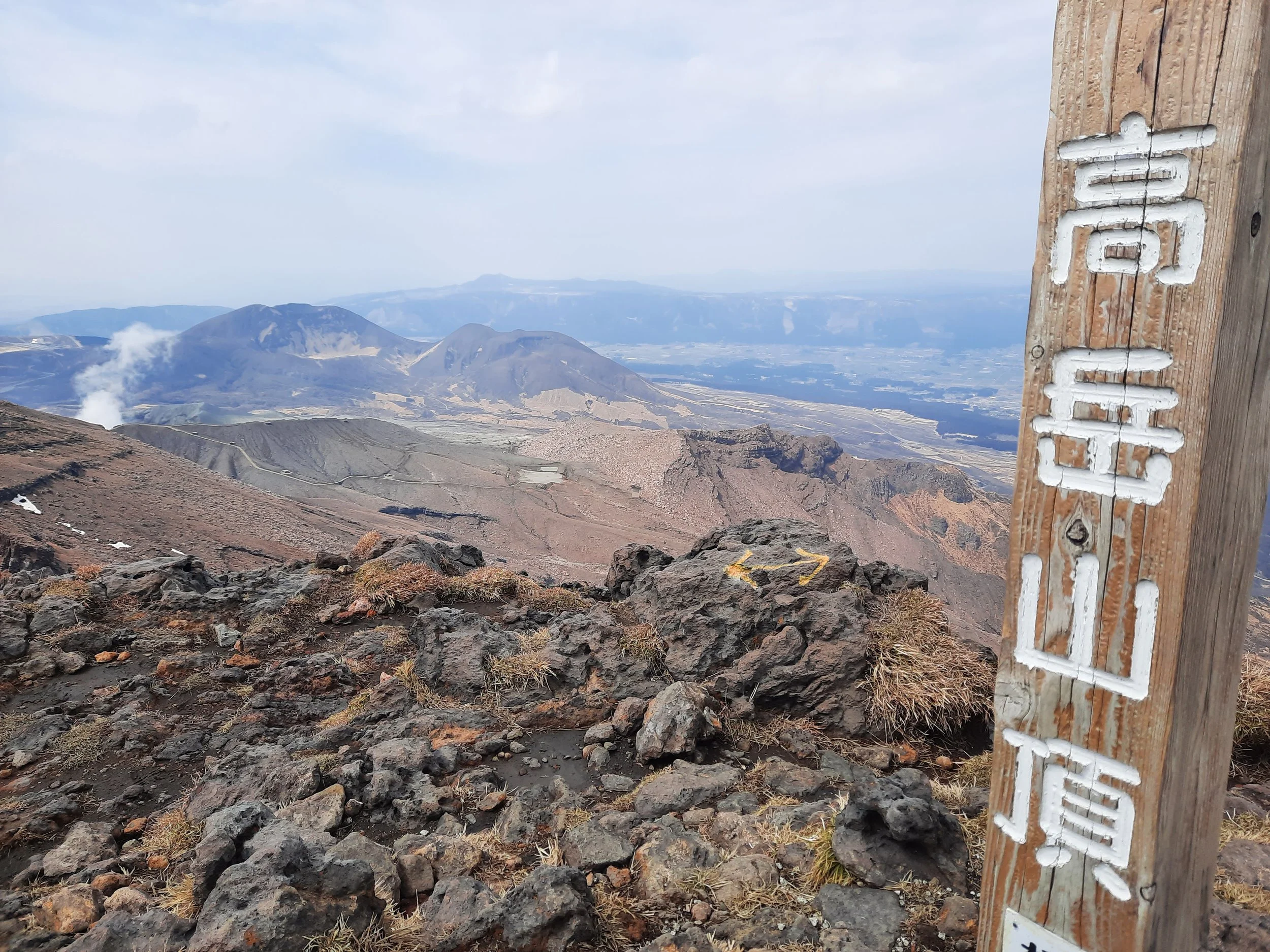
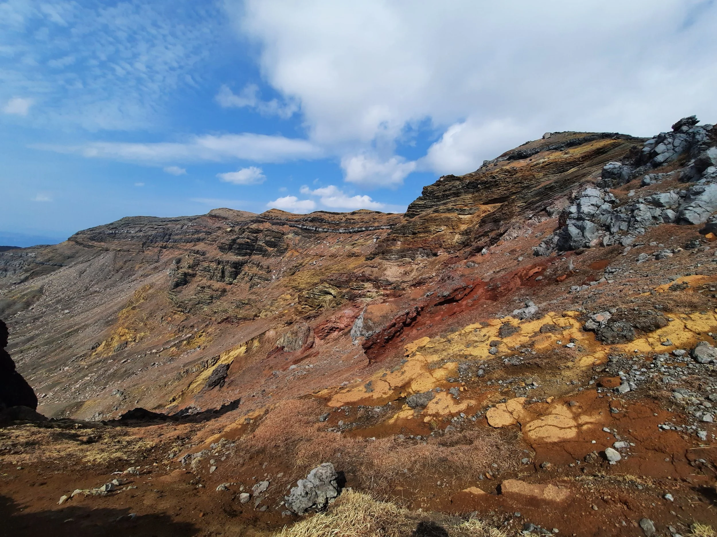
At a junction, I kept right to reach Crater East (Kako Higashi) Observatory, which looks down on the crater. The crater lake is not visible, but it’s otherwise more scenic than the heavily touristed main observatory on the other (west) side of the crater. This route could potentially be closed, depending on volcanic conditions and wind.
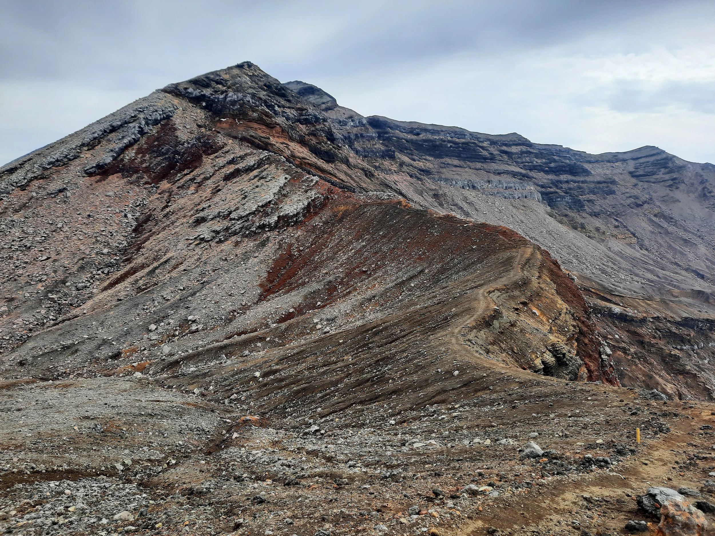
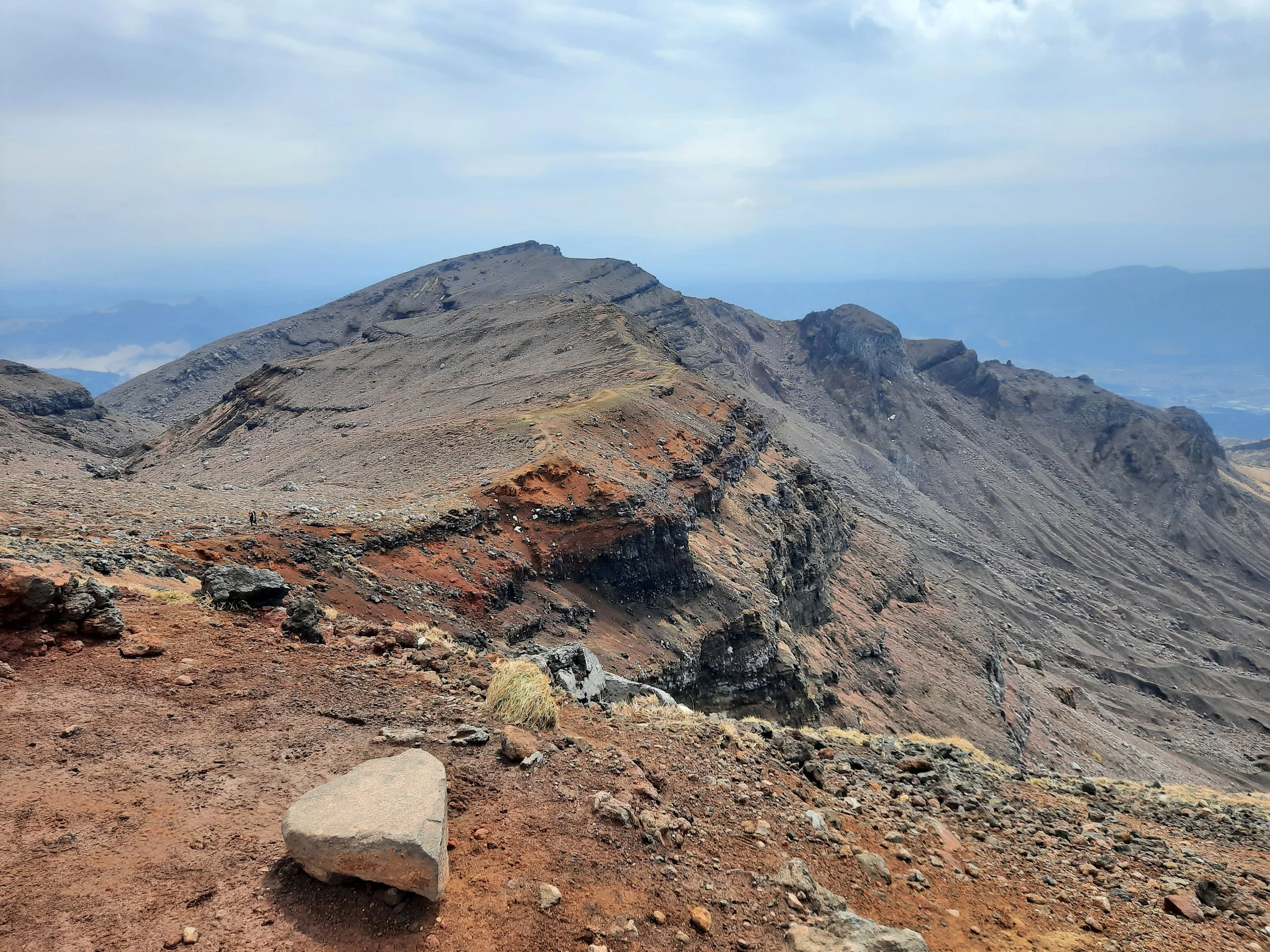
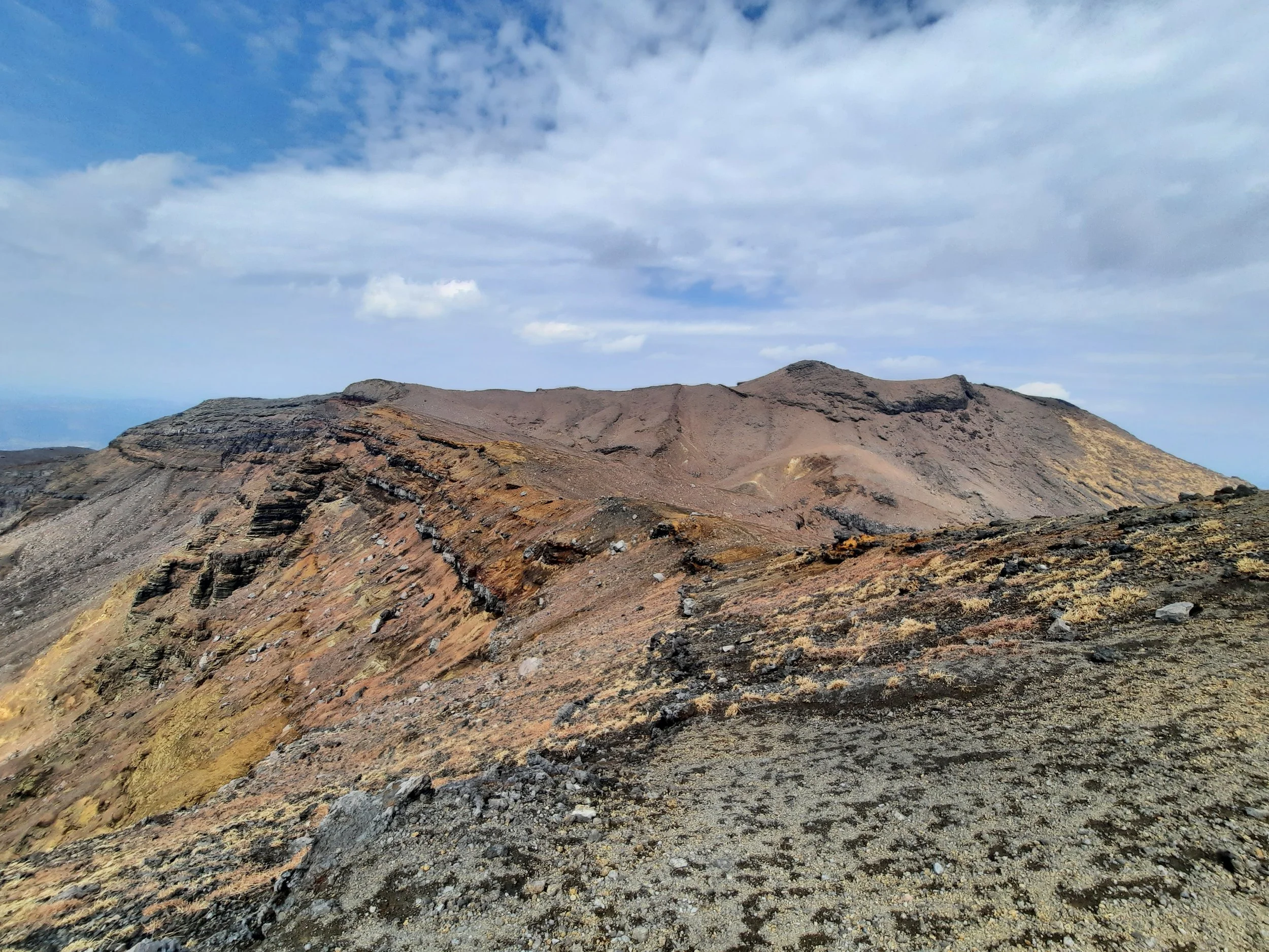
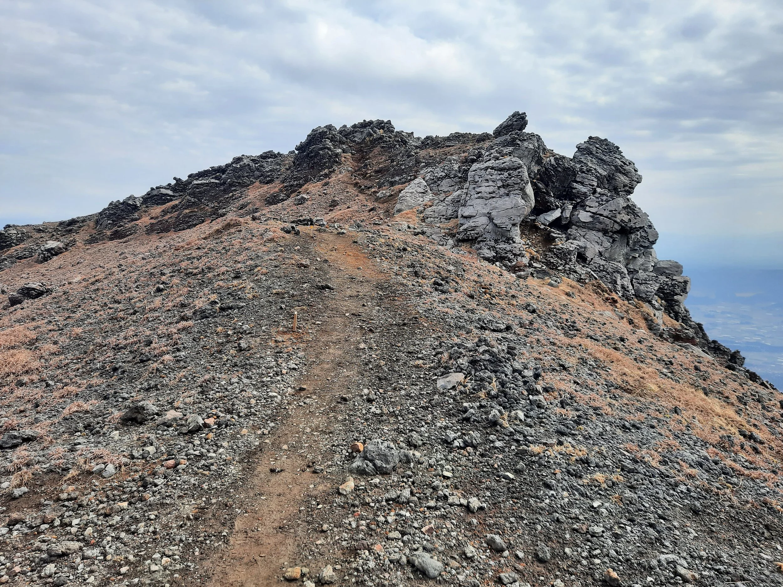
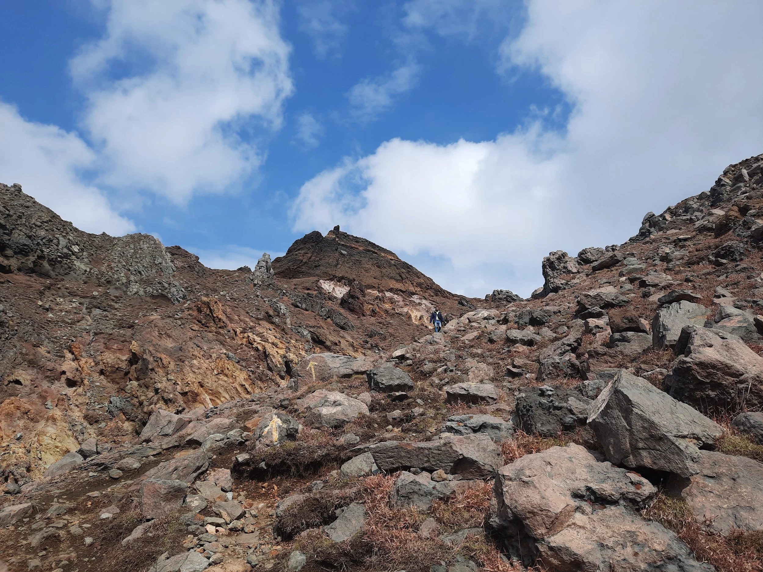
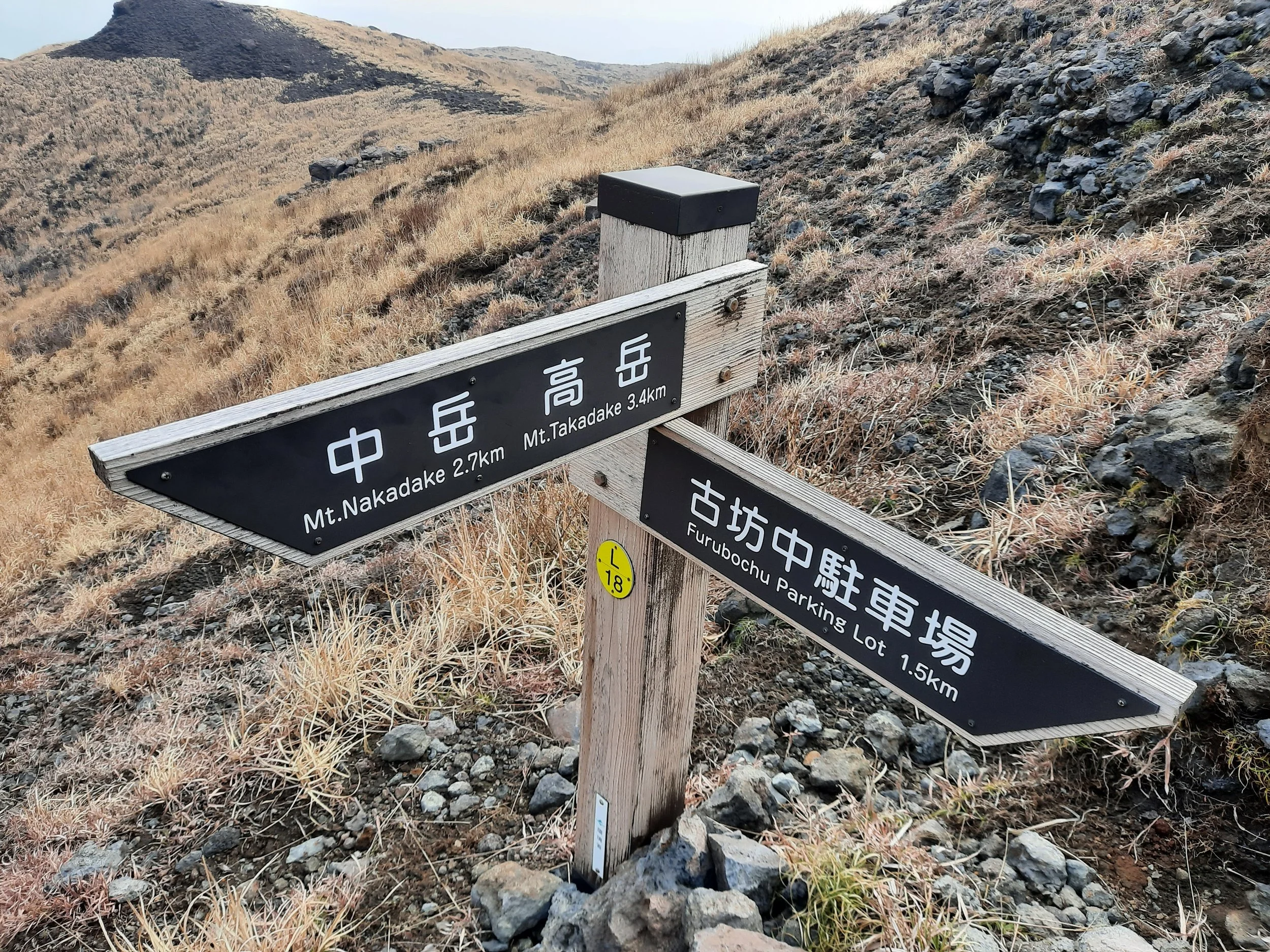
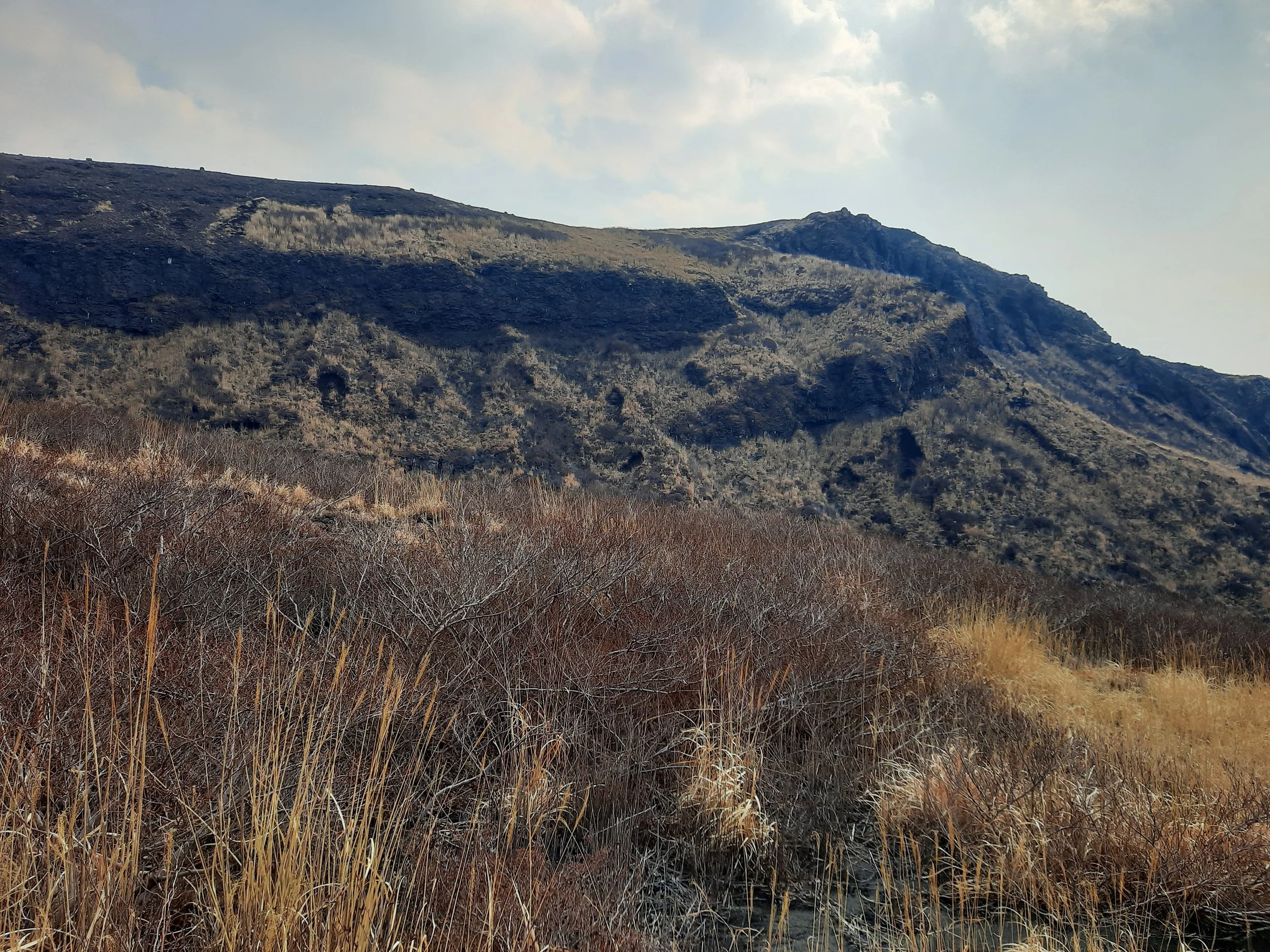
The ridge turned away from the crater to take me to Naka-dake (1506m), one of the five peaks of Mt Aso. There were a few minutes of moderately challenging uphill, with some scrambling over rocks. From Naka-dake, I chose to make a side-trip to Taka-dake (1592m), the highest peak. It was mostly pleasant ridge travel. It took me further away from the main crater, and offered slightly improved views of the rest of the mountain. Most interesting was the view of Neko-dake (Cat Mountain).
From the peak of Taka-dake, I retraced my steps to Naka-dake, then turned south onto a new ridge for an easy walk to the turnoff (toward Sunasenri-ga-hama Junction) below the peak of Minami-dake (1496m). From the turnoff, it was a few minutes’ walking and scrambling up to the peak. I didn’t draw this in green as a side-trip on the map above, because it is too short to be easily visible.
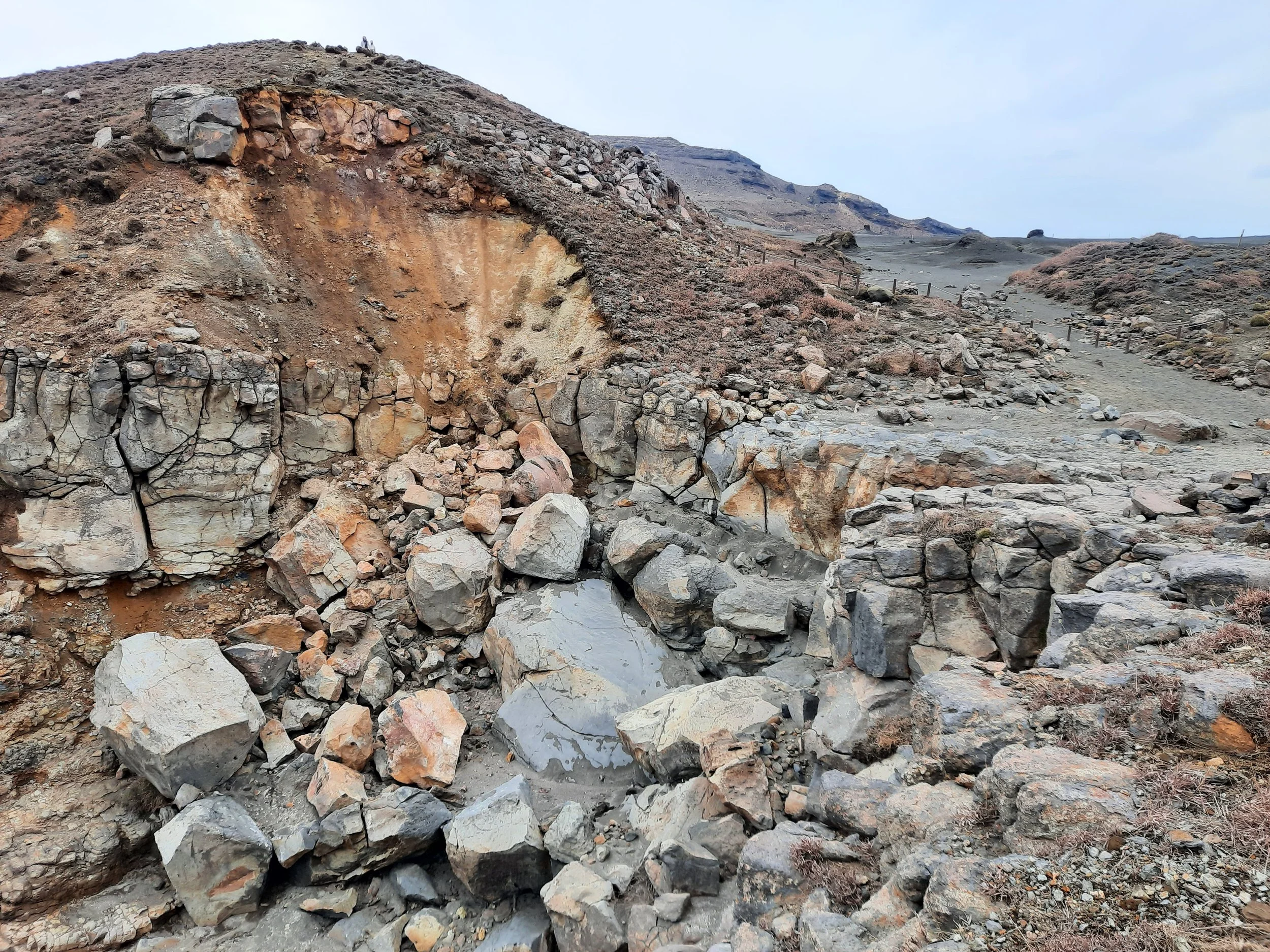
The descent from the turnoff was moderately difficult for the next 20 minutes or so, before getting easier as the slope became less steep. Ascending this slope would have been tiresome, so I’m glad I didn’t traverse in that direction. At the foot of the slope, there is a dry gully which was easy to cross. I’m not sure if meaningful amounts of water flow through it, or it was just carved by lava long ago.
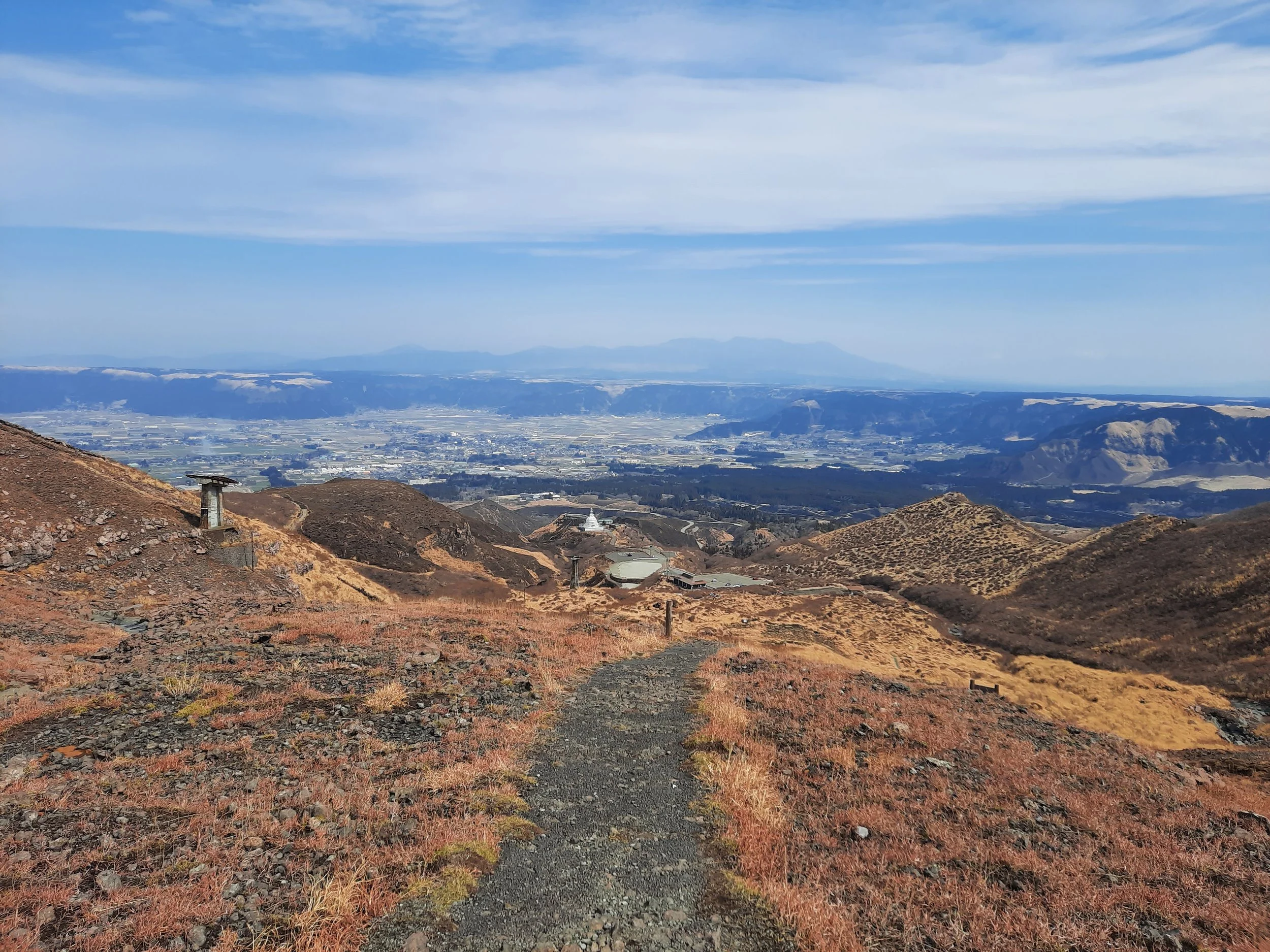
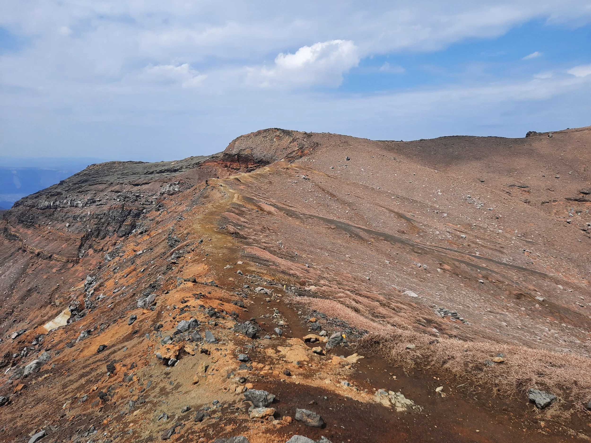
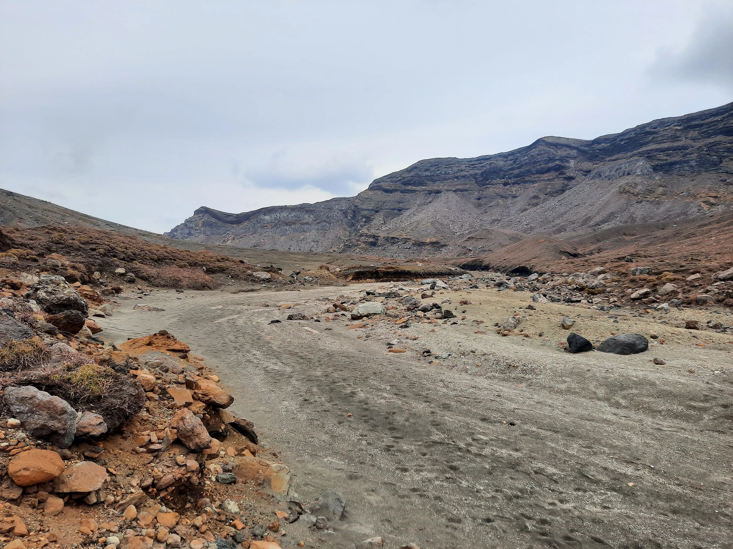
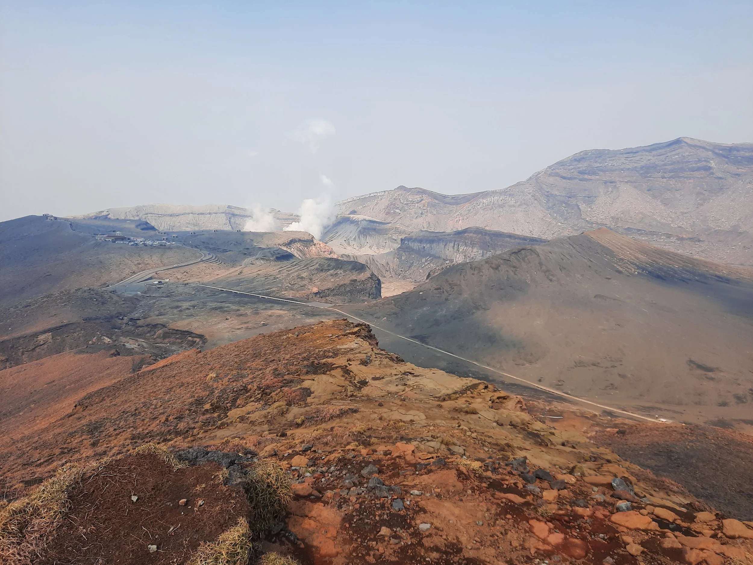
Then I ascended about one minute to a small ridge, and followed it west to Sunasenri-ga-hama Junction. Sunasenri-ga-hama seems like the name of the large, flat lava plain just to the north of this trail.
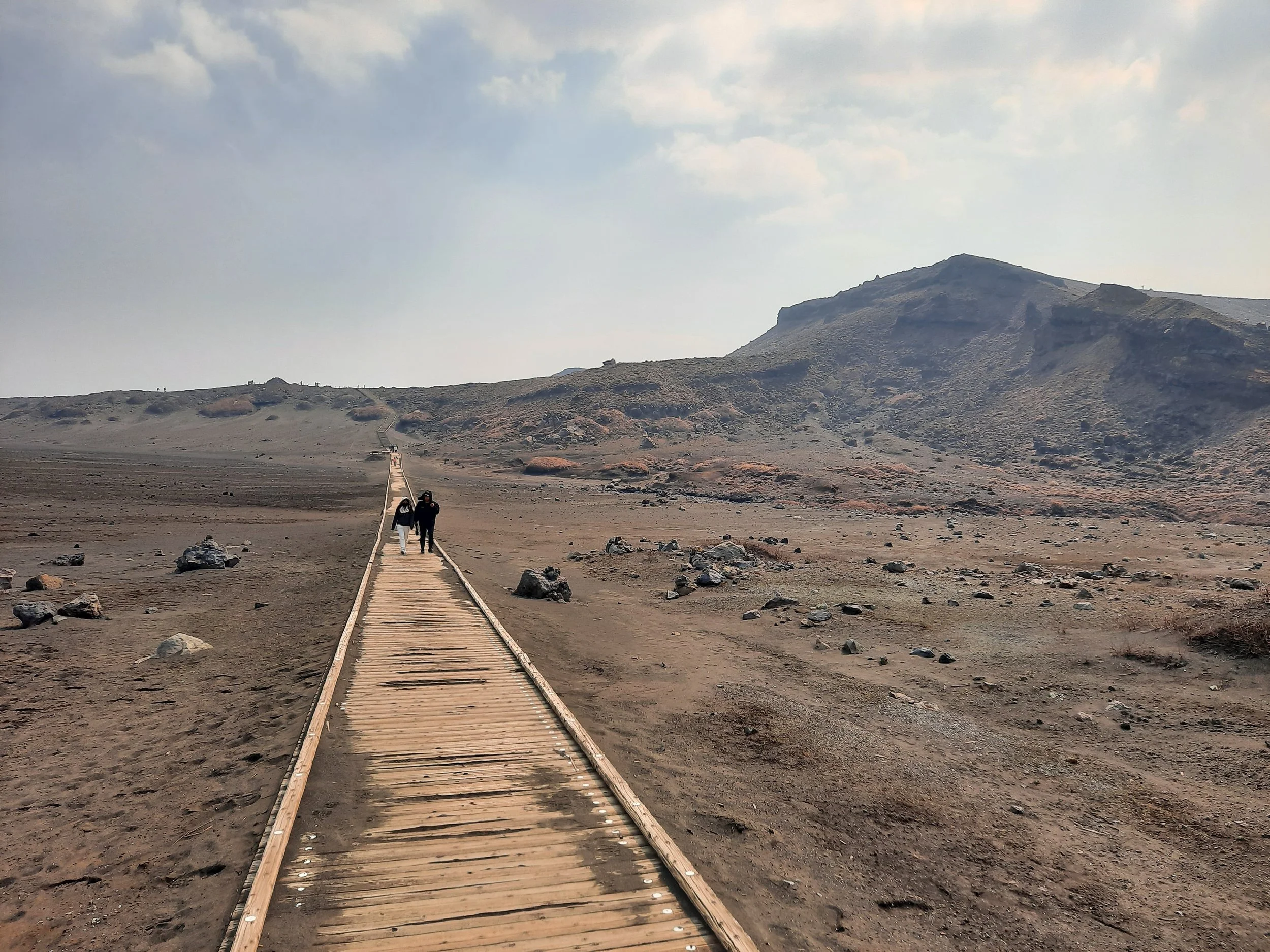
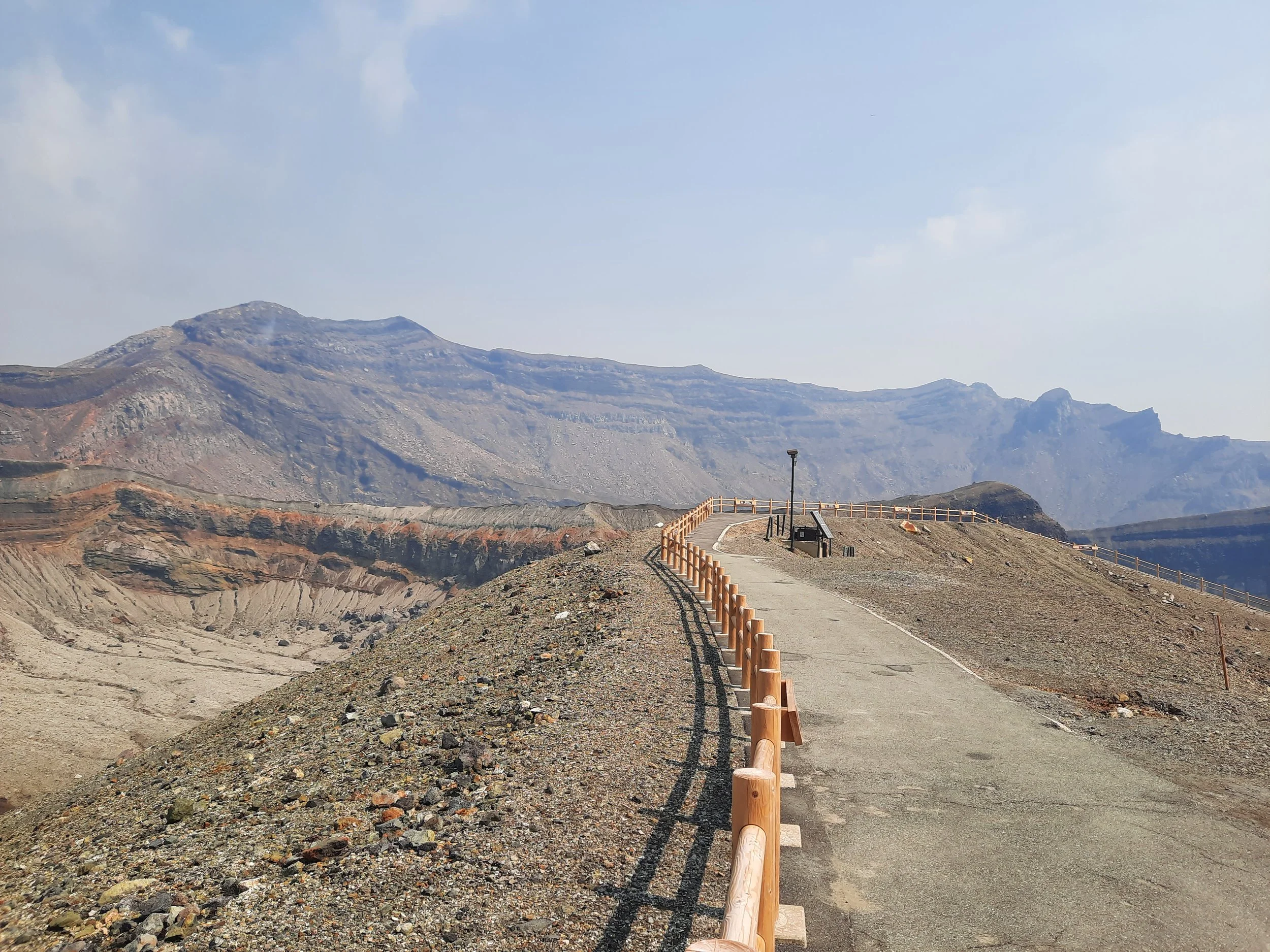
At the junction, I turned north and followed a wooden boardwalk to the paved walkway along the main crater viewpoint. There are several volcanic shelters in this area. Then, I took the bus down from West Crater Station. But to continue the narrative as if it were one hike, we return to my hike the previous day.
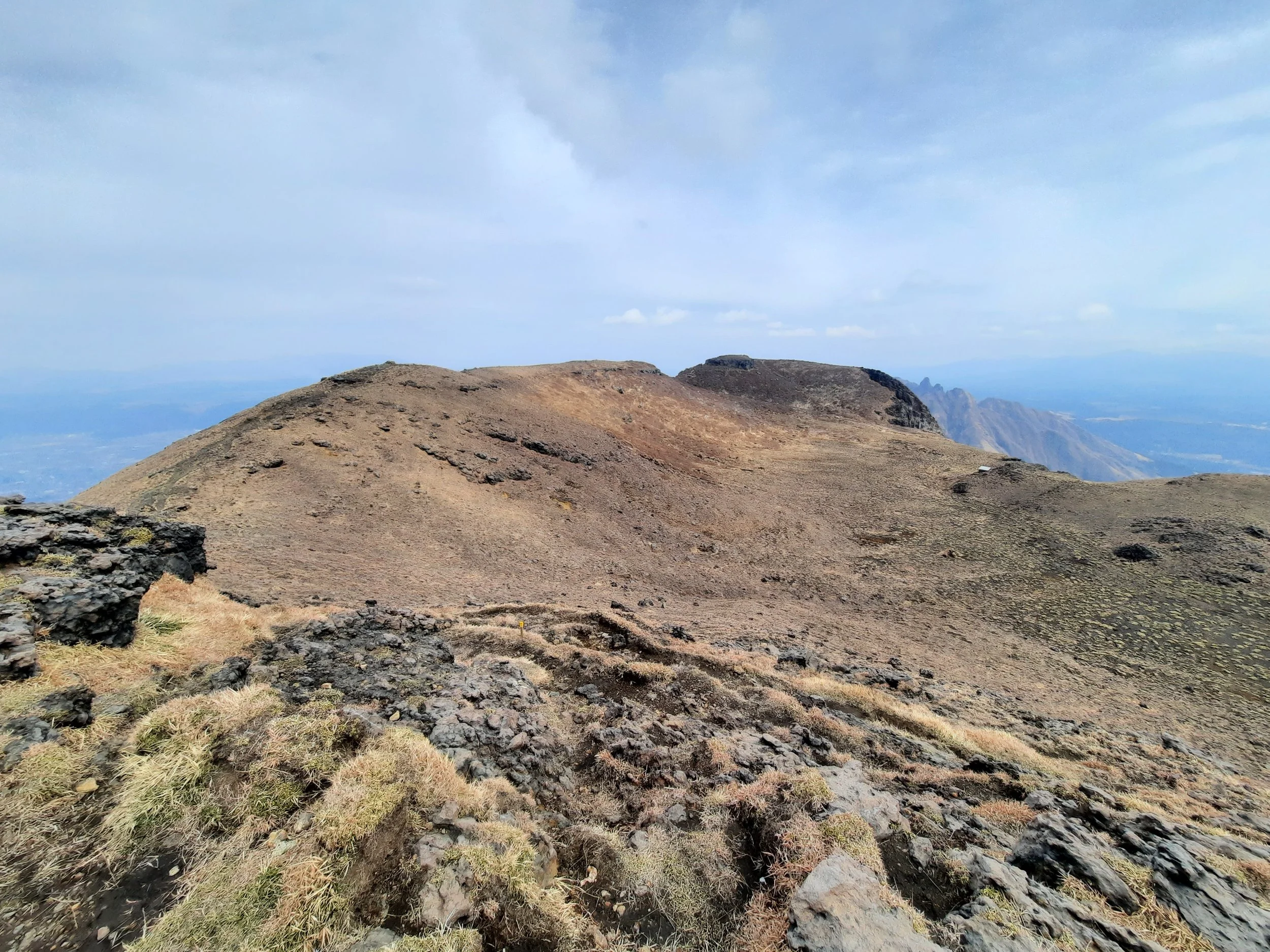
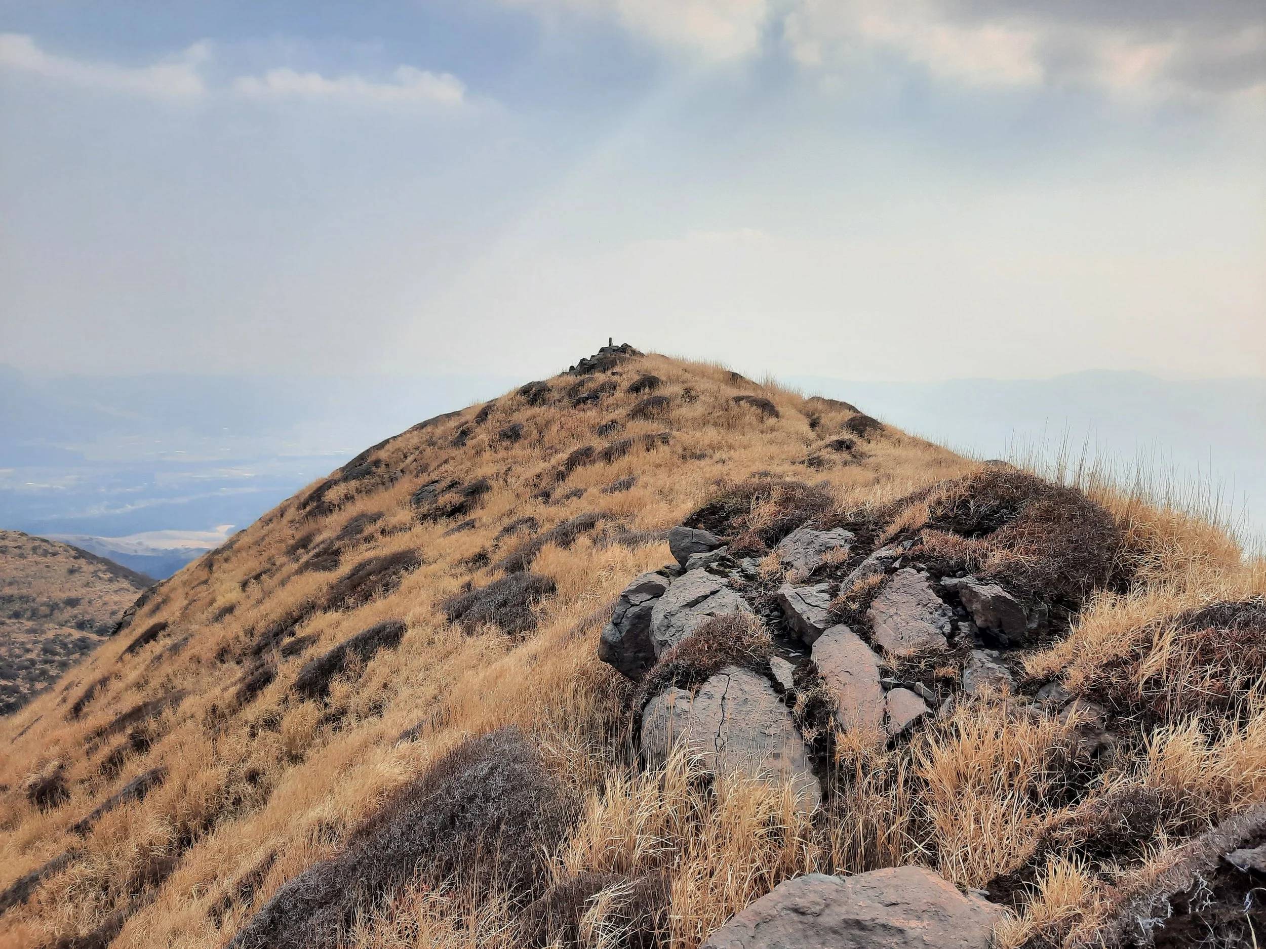
That day, I walked south along the boardwalk, from the main crater viewpoint to Sunasenri-ga-hama Junction, then turned west and ascended for a few minutes to the Sara-yama ridge. This was moderately steep but not difficult. It was then a mostly easy walk, thought at times obscured by long grass, along the ridge to Sara-yama peak (1303m), and back. Next came a moderately steep descent west down from the ridge. Along the way, the vegetation thickened from just grass to large bushes.
Shortly before Furu-bochu trailhead, there was a small, nearly dry stream that I easily crossed on rocks. From there, I took a staircase up to a sidewalk. From here it was a short walk to Aso Sanjo Terminal.
The trails were easy to see throughout, so I never lost them.
If 1 is an easy track, and 4 is using hands and feet on exposed rocks, I give this hike a 3 at worst, for the ascent to Naka-dake and the descent from the turnoff near the peak of Minami-dake, as well as the adjoining, optional ascent to the peak of Minami-dake.
Traversing from Sensuikyo trailhead to Sunasenri-ga-hama to the main crater viewpoint


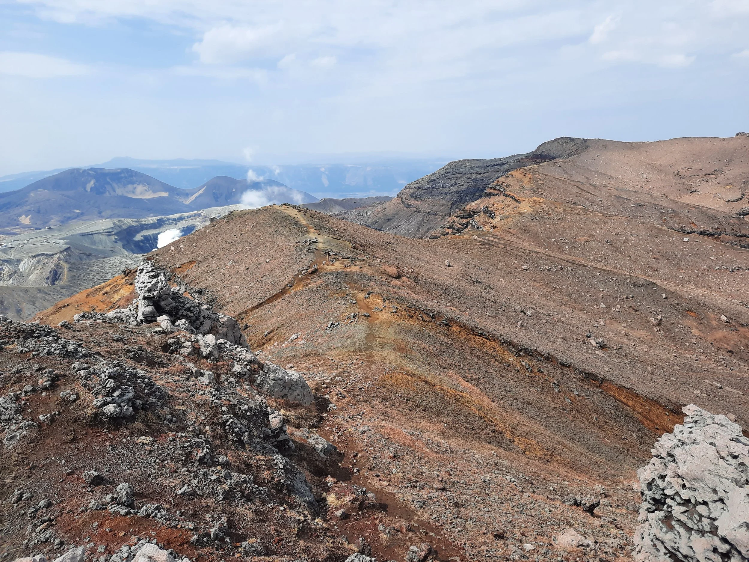


From the end of the traverse (Sunasenri-ga-hama Junction) to the main crater viewpoint
The other choices at the end of the traverse are the out-and-back trip to Sara-yama, or a hiking down to Aso Sanjo Terminal on a trail that ends with a short stretch of sidewalk, or taking the sidewalk down the entire way to Aso Sanjo Terminal.


Side-trip along Sara-yama ridge to the peak of Sara-yama


Descent to Aso Sanjo Terminal


Other pages about traverse hikes
https://www.aso-volcano.jp/eng/index.html (safety restrictions)
Pages about other hikes on these peaks
from Sensuikyo
https://www.alltrails.com/trail/japan/kumamoto/sensuikyo-parking-lot-mount-aso-loop
https://www.alltrails.com/trail/japan/kumamoto/sensuikyo-parking-lot-mount-takadake
https://www.aso-denku.jp/recommend/2024/10/hike-takadake-nakadake/
https://www.alltrails.com/trail/japan/kumamoto/senkyo-one-route-mount-takadake-mount-nakadake-loop
https://www.alltrails.com/trail/japan/kumamoto/senkyo-one-route-mount-takadake
from the west
Crater West Station
Kusasenri-ga-hama (further west from Aso Sanjo Terminal): https://www.alltrails.com/trail/japan/kumamoto/kusasenri-ga-hama-mount-aso-loop
Pages about hikes on adjacent volcanoes
https://www.alltrails.com/trail/japan/kumamoto/mount-neko-east-peak-oto-one-route
https://www.alltrails.com/trail/japan/kumamoto/otonoguchi-mount-neko-east-peak
https://www.alltrails.com/trail/japan/kumamoto/mount-kishima
https://www.alltrails.com/trail/japan/kumamoto/kusasenri-parking-lot-mount-eboshi-loop
Other hikes in Aso-Kujū National Park

Mt Aso (left) seen from the center of Aso City.