Mt Crichton, Queenstown, NZ
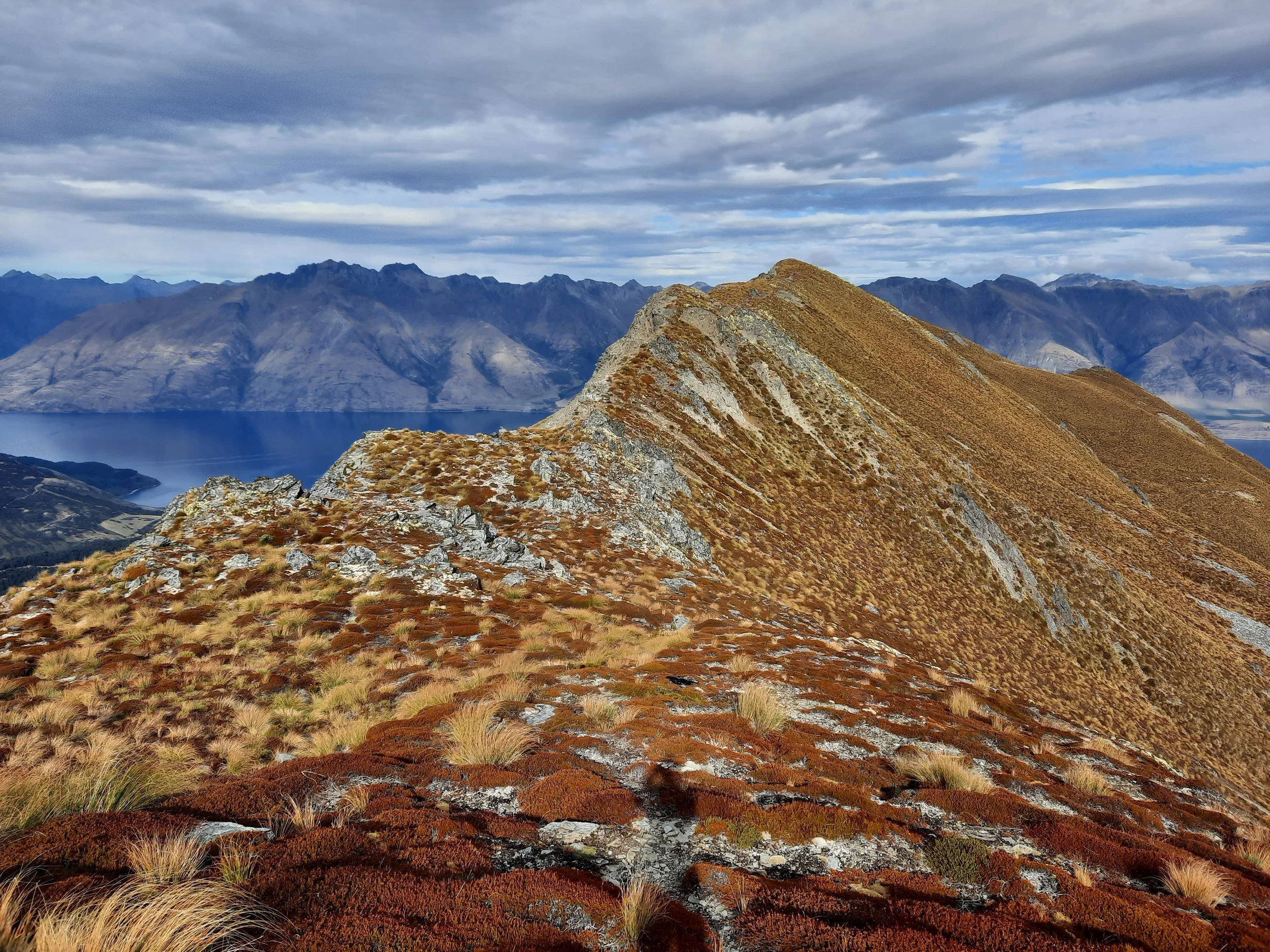

Mt Crichton (1873m, rhymes with ‘triton’) is in the Richardson Mountains, near the corner of the Lake Wakatipu between Queenstown (to the east) and Glenorchy (to the north), in Otago, South Island. It is also spelled ‘Creighton’ in some sources. Although the true summit is at Point 1873 (not shown on topomap screenshot below), most hikers aim for the more accessible Point 1870. It can be hiked from both shores of the lake:

Screenshots of the NZ topographic map are licensed as CC BY 4.0 by Toitū Te Whenua Land Information New Zealand (LINZ).
the southern trailhead, at the Mt Crichton Loop Track parking lot, is approximately a 15-minute drive from Queenstown;
the western trailhead near Bennett’s Bluff, for the Avalanche Creek route described by Edward (https://hikingscenery.com/mt-crichton-avalanche-creek-queenstown/), is approximately a 25-minute drive from Queenstown.
I hiked the southern route as far as Point 1723.
Time
It took me a little over 6 hours to reach Point 1723, and a little under 6 hours to return the same way. This includes breaks.
Route

As of April 2022, a tree was blocking - but also marking - the turnoff.
Coming from Queenstown, the parking lot turnoff is shortly after the Twelve Mile Delta parking lot turnoff. Both are on the left (the lake side). There is a dedicated spot for hikers to cross the highway.
The Mt Crichton parking lot also serves the low-elevation, forested Mt Crichton Loop Track. The Loop Track is much easier, much shorter, and much more popular than hiking Mt Crichton itself.
For Mt Crichton, one takes the western/left portion of the Loop Track until the turnoff pictured. It took me about 40 minutes to reach it. It is shortly after crossing Maori Gully creek on a wooden bridge.
The rough track through the forest was steep and unmaintained. Gaiters and/or long pants are worth wearing.
Above the treeline, I found it easiest to follow the impact track along the ridge. My attempt to deviate from this on the way back, by descending from Point 1390 in an attempted shortcut, landed me in a field of boulders. I’ve left this deviation off my route topomap.
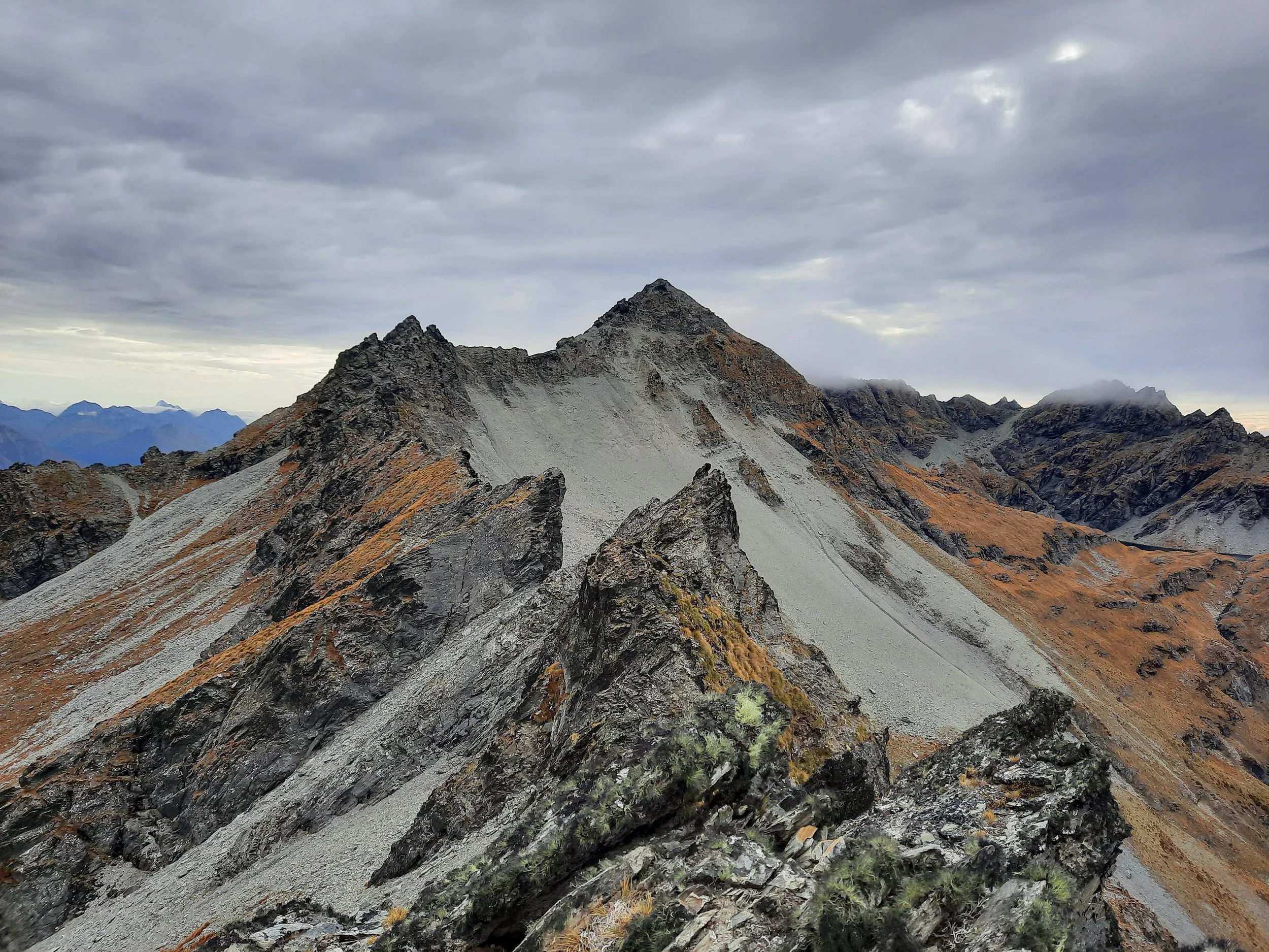
Cautiously I improvised a path up steep rocks to Point 1723.
Anyone aiming for Point 1870 should read Edward’s blog post (https://hikingscenery.com/mt-crichton-ascent-queenstown/) on getting there via the southern route. This is a different post from his above-linked blog post on the western (Avalanche Creek) route.
If 1 is an easy track, and 4 is using hands and feet on exposed rocks, I give this track a 4 at its worst (at Point 1723), and a 3 in parts of the steep forest. The ratings would probably be the same if I had ascended Point 1870, instead of Point 1723.


Hunting
After exiting the Mt Crichton Loop Track, the entire route is in a hunting area between April 1 and October 1. Hunters are forbidden to “discharge firearms near tracks, huts, campsites, road-ends or any other public place.” I have hiked in more than 30 hunting areas, and only passed hunters twice - this wasn’t one of those hikes.
Almost all of the hunting areas I mention on this blog are open (requiring only a general permit), but this area requires a specific permit.
Click here for the DOC topomap with all hunting areas visible.
Other pages on the southern route
One of the Queenstown DOC employees, who had done this route himself, was able to advise me.
Pages on the western (Avalanche Creek) route
Through-hike from southern trailhead to western trailhead: https://churnewzealand.com/summiting-mount-crichton-traverse/

