Lyttelton-Crater Rim circuit, Christchurch, NZ
We ascended at the leftmost orange path (one of two tracks labeled with an orange 2). We descended the unmarked gully a little to the left of the rightmost orange path (one of two tracks labeled with an orange 1).
Copyright Rod Donald Banks Peninsula Trust (https://www.bankspeninsulawalks.co.nz/lyttelton-walks/). All rights reserved. Used with permission.
On the coast of Canterbury, South Island, the Port Hills separate the main part of Christchurch (Ōtautahi) from the picturesque suburb of Lyttelton (Whakaraupō). Lyttelton is sometimes treated as part of the Banks Peninsula, and sometimes isn’t, because it is so close to Christchurch.
Along a large part of the Banks Peninsula ridge runs a multi-day route, called the Crater Rim Walkway. There are several ways to do a day-hike on this as a circuit from Lyttelton.
This page describes a short clockwise circuit that my friend Jacob and I did, starting in the west on Harman’s Rd.
We ascended Stan Helms Track through Whakaraupō Reserve to the Crater Rim Walkway.
Notable points on the Crater Rim Walkway:
Mt Cavendish (Oketeupoko, 445m), which has a cafe;
Mt Pleasant (Tauhinu Korokio, 499m), the high point.
We descended an overgrown, unofficial track to Brenchley Road in the northeast of Lyttelton. I recommend against this track.
Wherever a hiker re-enters town, there are lots of simple routes across Lyttelton back to wherever they parked.
Access
Those without a car can take bus 8 from the airport to Lyttelton: https://www.metroinfo.co.nz/timetables/8-port-to-port/.
Time
From Stan Helms trailhead to Brenchley Road trailhead took around 3 hours 45 minutes, including breaks, of which the longest was around 40 minutes at the Mt Cavendish gondola station cafe. Google Maps says crossing the town takes around 45 minutes; we actually spent a long time at a bookshop and having lunch in a restaurant before finishing the circuit.
Walking the entire circuit without three lengthy breaks indoors is what I would call a short hike: less than 4 hours.
Route
Red is our clockwise route. Purple shows some alternatives. The cyan circle is the cafe at the top of the gondola.
Screenshots of the NZ topographic map are licensed as CC BY 4.0 by Toitū Te Whenua Land Information New Zealand (LINZ).
We started at the trailhead of the Stan Helms Track in the late morning. We wanted to ascend as soon as possible, before it got even hotter, and cross the town in the afternoon, to have lunch somewhere there. If you’re starting early in the day, then crossing the town to find somewhere for breakfast might make sense, with the gondola station cafe for lunch.
Somewhere on the Stan Helms ascent, we passed someone’s scribble promising us it was 400 steps to the ridge. (It took me 353 steps, and that was with deliberately short strides.) We found a bench and the Pioneer Women’s Memorial beside a parking area on the ridge. Then we turned east and climbed the ridge to the upper station of the gondola. The cafe here was a fine place to rest, so rest we did. This is the second time I’ve had ice cream in the middle of a hike, after Mt Tsukuba near Tokyo.
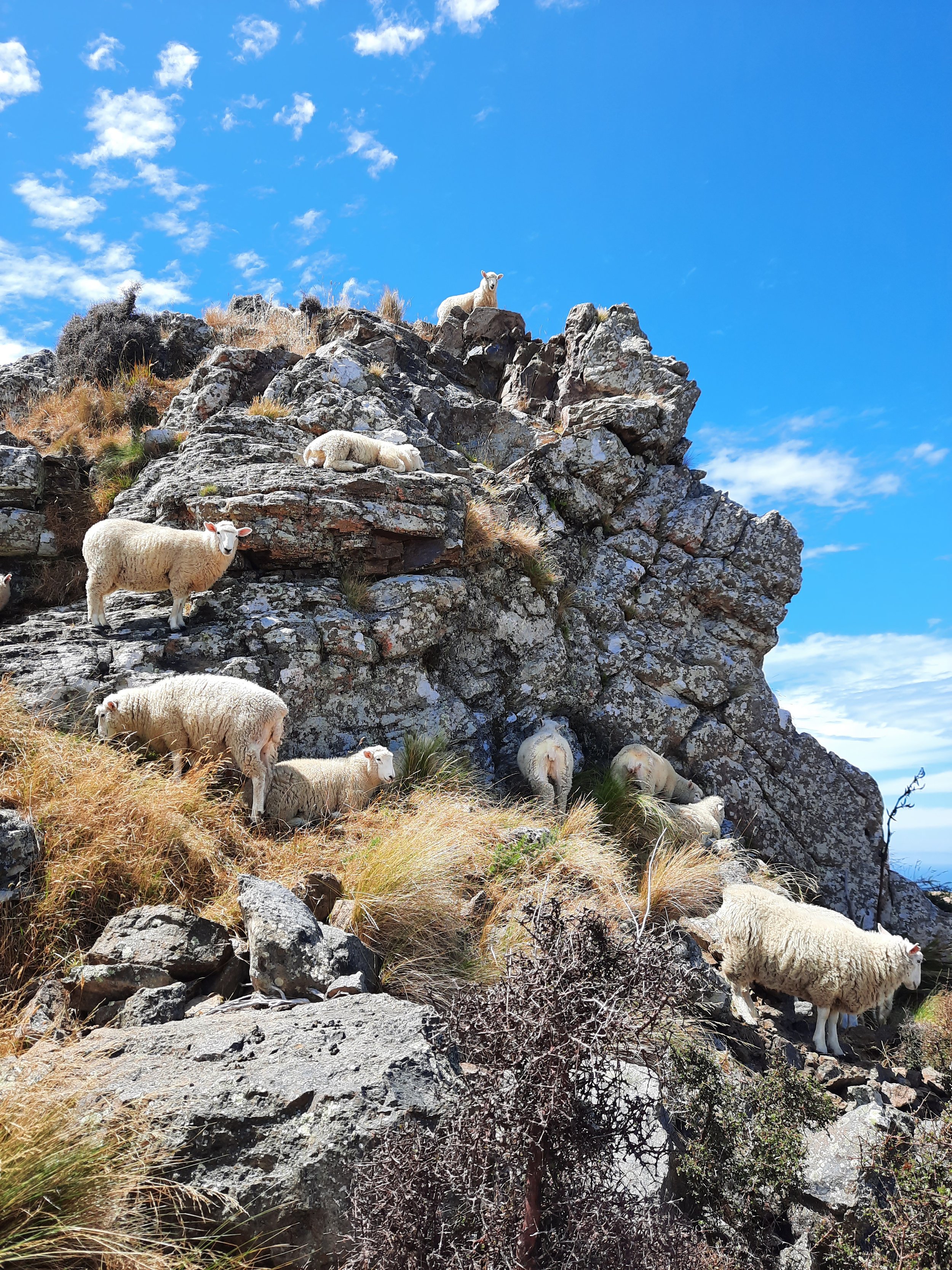
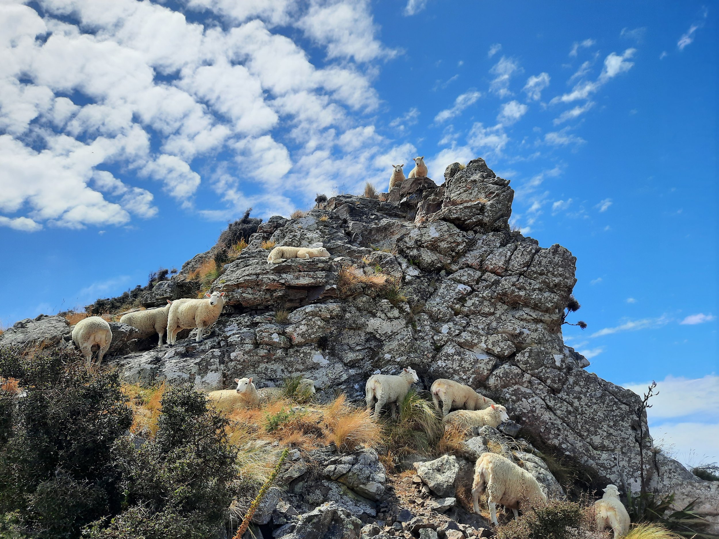
From there, we descended to a saddle, then climbed again to the high point of the hike, the summit of Mt Pleasant. Our next descent took us past WWII gun emplacements and through sheep pasture in which 4-5 farm workers were rounding up some of their sheep, perhaps for shearing. We enjoyed looking at other sheep resting themselves precariously on the ledges of a few rock formations. We debated whether they were more motivated by instinctive safety from predators or the comfortable (?!) feeling of the rock.
As we reached the saddle just north of Point 358, I decided we needed to hurry down to Lyttelton, because I wanted to visit the secondhand London Street Bookshop before it closed at 16:00. So we took a forest track from the saddle directly downhill to the Brenchley Road trailhead. It was overgrown, and not pleasant. Jacob kindly tolerated all of this. Here is the trailhead where we exited onto Brenchley Road. A sign on the gate warned us of rockfall.
Here is an alternative eastern trailhead, on Foster Terrace. It corresponds to the right-most purple line drawn on the topomap screenshot. This track, through Urumau Reserve, is probably an easier connection between the town and the ridge. If I were to do this hike again, I would take it.
We had lunch at Civil and Naval Bar & Eatery in the compact commercial center of Lyttelton, before returning to my rental car.
If 1 is an easy track, and 4 is using hands and feet on exposed rocks, I give this hike a 2 at worst. This is for the overgrown descent from the eastern ridge to Brenchley Road. The rest was a 1.
Seen from Lyttelton. The top of the Stan Helms track is somewhere at far left, or just out of sight. To its right is the gondola station, beneath blue sky. At center-right, Mt Pleasant under cloud. At right, the tawnier Point 385, also under cloud; hidden at left of it is our descent route. At far right, Urumau Reserve, including the better descent route (not obviously visible).
Pages about overlapping circuits
https://www.ccc.govt.nz/parks-and-gardens/explore-parks/port-hills/bridle-path/stan-helms-track/
https://hikingscenery.com/urumau-crater-rim-circuit-lyttelton/
Pages about other hikes in the Port Hills, as far as Gebbie’s Pass
https://hikingscenery.com/christchurch-adventure-park-gondola/
https://hikingscenery.com/harry-ell-track-sugarloaf-circuit/
https://hikingscenery.com/ohinetahi-reserve-circuit-governors-bay/
https://hikingscenery.com/crater-rim-track-sign-bellbird-coopers-knob/
Pages about hikes on the main part of the Banks Peninsula
https://hikingscenery.com/mt-bradley-gebbies-pass-banks-peninsula/
Mt Herbert, Diamond Harbour
Stony Bay Peak circuit, Akaroa


