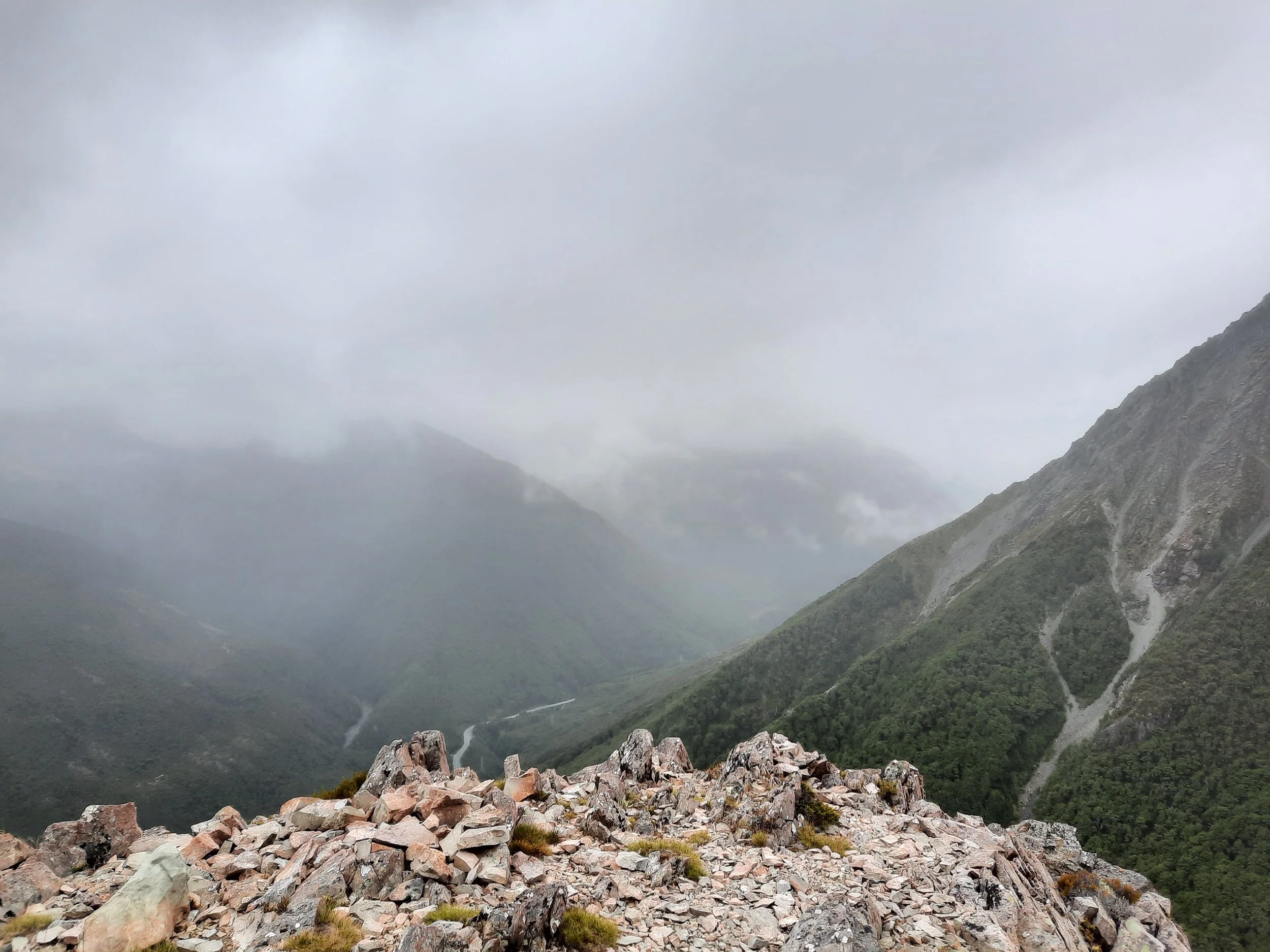
Near Point 1844, Mt Aicken, Arthur’s Pass, NZ


Mt Aicken is one of several hikes accessible on foot from Arthur’s Pass, a village in Canterbury, South Island. It is on the east side of the valley. Reaching the summit, or the more popular turn-around point near it, would make for a long or very long day-hike. However, when I hiked, rain was approaching, so I cut my hike short. I reached a spot on the ridge just below Point 1844.
Mt Aicken is apparently not in the Aicken Range, which is to the east, across the Mingha and Deception Rivers from Mt Aicken and its neighbors.
Time
DOC estimates 3 hours 30 minutes round-trip to the bushline (around 1340m) and back.
It took me about 2 hours 45 minutes to reach my turn-around point, a little below Point 1844. I’m just guessing where it was on the topomap screenshot. To reach the bushline alone normally takes me around 90 minutes on Arthur’s Pass hikes, and it probably did here too.

The waterfall track viewpoint is indicated with a purple dot.
Screenshots of the NZ topographic map are licensed as CC BY 4.0 by Toitū Te Whenua Land Information New Zealand (LINZ).
Route
AllTrails reports that the full round-trip hike - which I didn’t do - gains 1248 meters of elevation over 9 kilometers.
The trailhead is shared with Devils Punchbowl, a tall waterfall. Before reaching the waterfall, I turned off uphill to the right.
The ascent through the forest is classic Arthur’s Pass: steep and rugged. I call these forest ascents ‘broken staircases’.
Graeme of ArthursPass.com offers a thorough, safety oriented guide to reaching Point 1863. He says that the true summit near Point 1863 is rarely reached, because the ridge is tricky there.
The scree gully above Punchbowl Creek that he mentions was the most difficult part for me. It was my first time ascending or descending on such loose material. I’ve since encountered these types of steep scree slopes on a variety of NZ hikes, so I would probably be more confident now.
On my descent, I took a side-trip to the north (right) to see the Devils Punchbowl Waterfall.
If 1 is an easy track, and 4 is using hands and feet on exposed rocks, I give this track a 4 for everything starting with the scree gully (I didn’t continue on up to where the ridge is said to get easier). The forest ascent is largely a 3. The tussock terrain between the bushline and the beginning of the intimidating rocky part is mostly a 2.


Hunting
The entire route is in a hunting area. Hunters are forbidden to “discharge firearms near tracks, huts, campsites, road-ends or any other public place.” I have hiked in more than 30 hunting areas, and only passed hunters twice - this wasn’t one of those hikes.
Here is the DOC topomap with all hunting areas visible.
Other pages about this hike (all of which went further up the ridge)
https://ctc.org.nz/index.php/trip-reports?goto=tripreports%2F912
https://www.alltrails.com/trail/new-zealand/canterbury/mount-aiken-track
Pages about other hikes involving Mt Aicken
https://www.arthurspass.com/index.php?page=58 (I’ve done two of the three traverses on this page. The third, the traverse involving Mt Aicken, sounds too difficult for me.)
https://ctc.org.nz/index.php/trip-reports?goto=tripreports%2F836
https://ctc.org.nz/index.php/trip-reports?goto=tripreports%2F279
https://ctc.org.nz/index.php/trip-reports?goto=tripreports%2F546
https://ctc.org.nz/index.php/trip-reports?goto=tripreports%2F510
Pages about nearby day-hikes that I haven’t done
https://hikingscenery.com/mt-omalley-arthurs-pass/ & https://hikingisgood.com/mt-omalley-in-arthurs-pass/
https://hikingscenery.com/goat-hill-via-barrack-creek-route-arthurs-pass/

