Mt Cassidy - Blimit - Temple Col Traverse, Arthur’s Pass, NZ


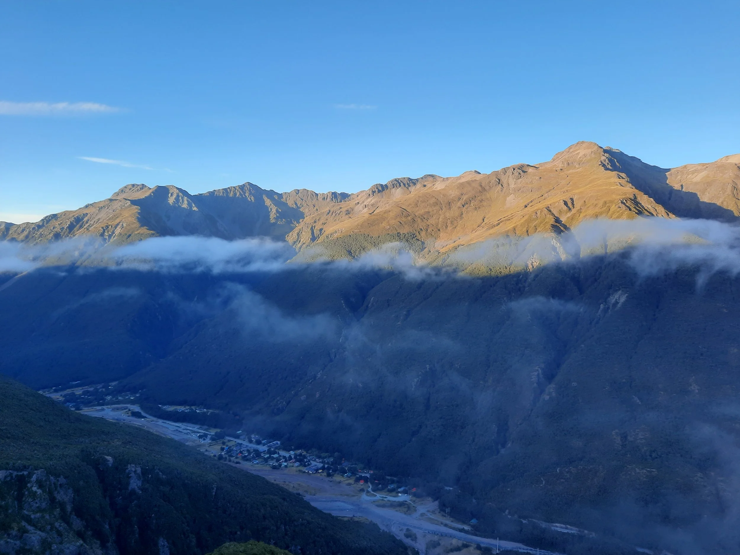
Arthur’s Pass is a village in Canterbury, South Island. It seems to be the best place in New Zealand for doing a variety of long day-hikes which are accessible on foot from the village. On the east side of the valley, Mt Cassidy (1850m) (via Cons Track) and optionally Blimit (1921m) too can be traversed to the upper basins of the Temple Basin ski area. Those basins are Bill’s Basin in the south (directly below Blimit), and Downhill Basin further north.
The traverse can also be done in the opposite direction.
Arthur’s Pass Walking Track, on the floor of the valley, connects the two trailheads. The Mt Cassidy trailhead is near the village itself.
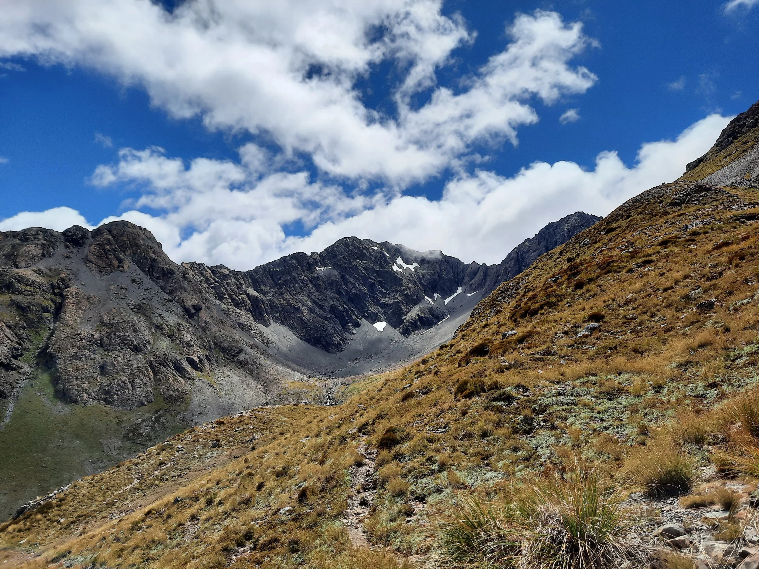
In my case, I extended my time on the ridge by traversing from Blimit to Temple Col (1774m), rather than descending to Bills Basin or Temple Basin. The Blimit-Temple Col ridge was more rock-climbing than hiking. I wouldn’t do it again.
Time

Note the text, where I explain which part I wouldn’t do again because it was so challenging.
Screenshots of the NZ topographic map are licensed as CC BY 4.0 by Toitū Te Whenua Land Information New Zealand (LINZ).
From the Mt Cassidy trailhead to the Temple Basin trailhead, my hike took around 12 hours 30 minutes, including breaks. Some segments:
about 15 minutes from my motel to the trailhead;
from there, about 1 hour 30 minutes to the treeline on Cons Track
from there, about 3 hours 30 minutes to the summit of Mt Cassidy
from there, about 1 hour to the summit of Blimit
I then hitchhiked back to Arthur’s Pass, thanks to a francophone visitor. I’ve seen estimates from 45 to 90 minutes for the valley walking track that I didn’t take.
Route
Day-trippers can park in the parking lot between the DOC office and the train station.
The town trailhead is for several tracks. Following the signs for Cons Track leads to the individual trailhead for this fairly steep, rough ascent through the forest. This is typical Arthur’s Pass forest track - similar to a broken staircase.
Graeme at ArthursPass.com has annotated a photo about avoiding mistakes beyond the bushline on the Mt Cassidy page, and posted a more detailed written guide on the Traverses page. Using these and some of the blog posts linked near the foot of this page, I more or less knew where to go until I reached the ridge. From there on it was sometimes tricky footing, but easy navigation, to Mt Cassidy’s summit and then the summit of Blimit.
To reach Temple Col, I improvised my way downhill to the north from Blimit. This rock-climbing made this hike one of my three hardest hikes, and a little harder than my Mt Bealey - Avalanche Peak Traverse across the valley. (Without the rock-climbing to Temple Col, this hike would have been notably easier than the Mt Bealey - Avalanche Peak Traverse.) Several times I dropped down below the ridge, always on the Bill's Basin (left) side, to sidle for a while.
Just before Temple Col, I left the ridge and headed downhill toward the upper ski field towline. I sort of rappelled down Downhill Basin using this towline and reached Page Shelter, then followed the track toward Temple Basin. After that, I rappelled downhill again using the lower towline and rested in DOC’s Lockwood Shelter. Finally, I followed the main track down to the carpark. It’s easy to take a wrong turn on the easy tracks just below Lockwood Shelter, so pay attention.
The endpoint of the hike is a medium-sized parking lot beside the highway. I hitchhiked with the first passing car.
I took my best photos of the village’s keas (parrots) once I got back. See Animals of New Zealand.
If 1 is an easy track, and 4 is using hands and feet on exposed rocks, then this track has a lot of 4. It’s a 4 from the approach to Blimit’s summit all the way to just before Temple Col. It’s also a 4 on the steep portion of the ascent to Mt Cassidy. Other parts of the Mt Cassidy ridge are a 2 or a 3, and the forest ascent ascent is mostly a 3. Between the two ski towlines is mostly a 2. After Lockwood Shelter, it’s a 2 or a 1.


Panorama from Blimit.
The above photos include a few that I took on a separate hike to the Bills Basin tarns.
Blimit or B’limit is said to be short for “the bloody limit.” It sounds like a 19th-century British pioneer's way of saying he could hike no further.
The importance of paying attention
Somewhere on the difficult ridge, I dragged a new Powerade bottle out of the depths of my hiking backpack. In doing so, I must have set my black glasses case (containing my normal glasses) down among the gray rocks.
If you find the case, please let me know. I’ll pay you to ship it to me in Auckland, plus an NZ$30 reward. Otherwise, please give it to the local DOC office.
I had packed back-up normal glasses in my suitcase, so I didn’t have to wear sunglasses for the rest of my trip.
Hunting
The entire route is in a hunting area. Hunters are forbidden to “discharge firearms near tracks, huts, campsites, road-ends or any other public place.” I have hiked in more than 30 hunting areas, and only passed hunters twice - this wasn’t one of those hikes.
Here is the DOC topomap with all hunting areas visible.
Pages about Cassidy-Blimit traverses (except for Temple Col)
Portions of the full loop
https://www.alltrails.com/trail/new-zealand/west-coast/cons-track
https://www.alltrails.com/trail/new-zealand/canterbury/arthur-s-pass-walking-track
Pages about nearby day-hikes that I haven’t done
https://hikingscenery.com/mt-omalley-arthurs-pass/ & https://hikingisgood.com/mt-omalley-in-arthurs-pass/
https://hikingscenery.com/goat-hill-via-barrack-creek-route-arthurs-pass/
This hike seen from Mt Bealey

The broad spurs on the right are from Mt Aicken. Left of them, other spurs rise to form Mt Cassidy, with the brightest snowpatch in this half of the photo just before its peak. Further right is the higher peak Blimit. To its left, just above Mt Cassidy’s summit, is the round mound of Temple Peak. To the left of Temple Peak, large but covered by cloud, is Phipps Peak.
The beginning of this hike seen from Avalanche Peak

Mt Cassidy. The route goes steeply up the left slope. Phipps Peak is mostly obscured by cloud.
Mt Cassidy and Blimit seen from across Punchbowl Creek, on Mt Aicken

Mt Cassidy at left. Blimit at center-left, amidst snow (which hasn’t melted because it’s south-facing).
From Mt Aicken at right, to Blimit, is said to be a more challenging traverse than Mt Cassidy to Blimit. It’s obviously longer than my challenging Blimit-Temple Col traverse. I’ll probably never know if it’s more challenging as well, because I think the chances of not finishing during daylight are too high.