Mt Guy, Lake Clearwater, NZ


Mt Guy (1319m) can be hiked as a medium-length circuit from Lake Clearwater village in the Hakatere (Ashburton Lakes) region of Canterbury, South Island. The holiday village (which has no shops) is on the southern shore of Lake Clearwater, while Mt Guy is on the northern shore.
The nearest settlement with food and gasoline is Mt Somers village, around 30 minutes away. The nearest proper town is Methven, around 55 minutes away.
Alternative versions of this hike include an out-and-back hike to the top of Mt Guy (entirely on the eastern side of the mountain and the lake), or a full circuit of Lake Clearwater. See links below to blog posts about these.
After finishing the hike, I drove west on Hakatere Potts Road to get a closer view of Mt Potts. Beside the road, I came across a brave hedgehog that walked right up to me and sniffed my hiking boot. Click here and scroll down for a photo and a video.
Time

The muddy part was at the uppermost corner of the route, beside the pond, and continued downhill to the left from there.
Screenshots of the NZ topographic map are licensed as CC BY 4.0 by Toitū Te Whenua Land Information New Zealand (LINZ).
DOC says that it’s 3 hours from Lake Clearwater to the summit.
Tramper.nz gives this breakdown for the version I did:
Lake Clearwater Circuit Track: 25 minutes
Mount Guy Track: 1 hour 10 minutes
Unmarked route to saddle: 45 minutes
Te Araroa Trail: 15 minutes
Eastern Link Track: 25 minutes
Lake Clearwater Circuit Track: 35 minutes
Those segments took me a little less than 7 hours, including breaks.
Route
According to AllTrails, there are 688m of elevation gain for the out-and-back hike. My circuit probably involved slightly more. The out-and-back track is 8.5km total; based on that and the map, I estimate my route was around 16 km.
It’s a long drive from Mt Somers (and longer from Methven), much of which is on Ashburton Gorge Road / Hakatere Potts Road. The road became gravel before it reached Lake Clearwater village, but its condition was good until after the village.
When I arrived in the village, I looked for a parking space right by the trailhead on Mount Darchiac Street, by the shore of Lake Clearwater in the northern part of the village. For some reason that I can’t recall, I wasn’t satisfied with parking there, so I drove back to a parking lot just to the left of Hakatere Potts Road, beside the western end of Lake Camp. The parking lot is just across Hakatere Potts Road from the beginning of Mount Jollie St.
From the parking lot, I walked through the village, along the eastern shore of the lake, on an easy track seen in photos four and five, below. The track up Mt Guy wasn’t good, but it wasn’t bad either. See it in the second panorama, below the gallery.
From the summit, I followed an impact track northwest and then downhill to a saddle, intersecting the Te Araroa track just left (south) of a pond. The land around the pond was muddy, and the Te Araroa track was too, as I descended somewhat steeply along it for 15 minutes or so.
At a junction, I turned left onto the Eastern Link Track, which took me back to the Lake Clearwater Circuit. After a little while, I returned to the section of the circuit which I had followed north in the morning, and followed it south.
This was one of the most pleasant medium-length hikes I’ve done.
If 1 is an easy track, and 4 is using hands and feet on exposed rocks, I give this track a 3 at its worst - the brief steep, muddy descent on Te Araroa trail. Overwhelmingly, it was a 2 on Mt Guy and a 1 on the tracks by the lake.


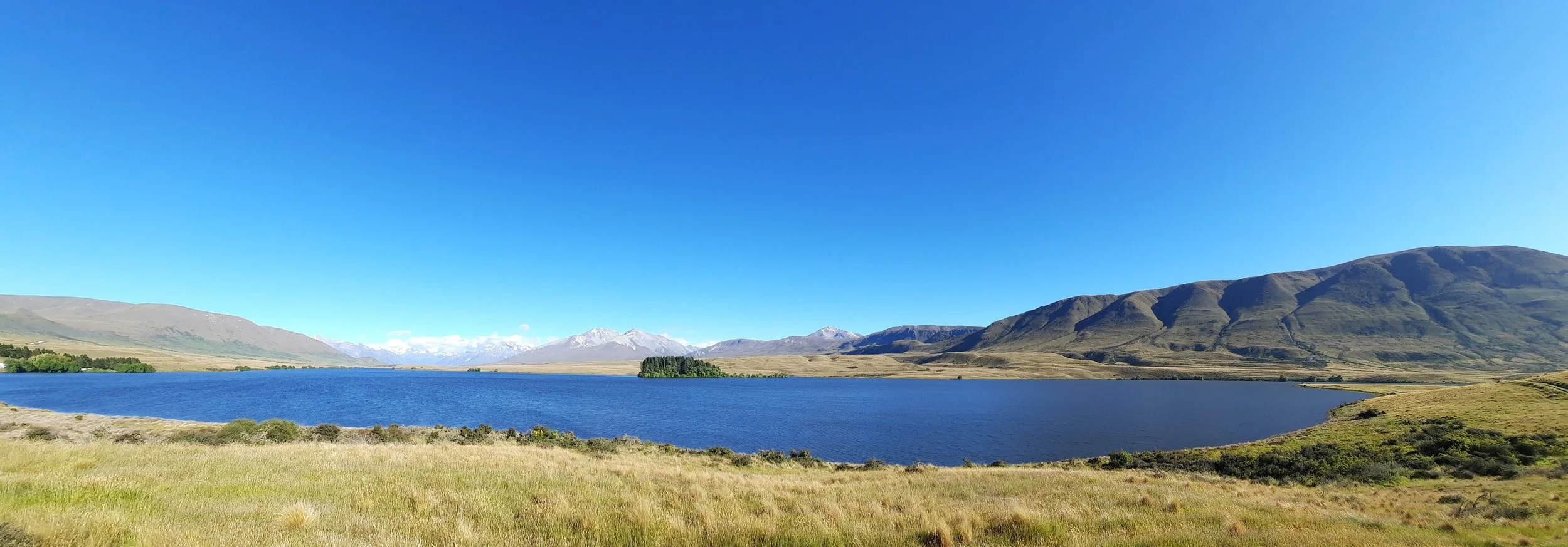
Harper Range at left. Center-right, Mt Potts. Right, Mt Guy.

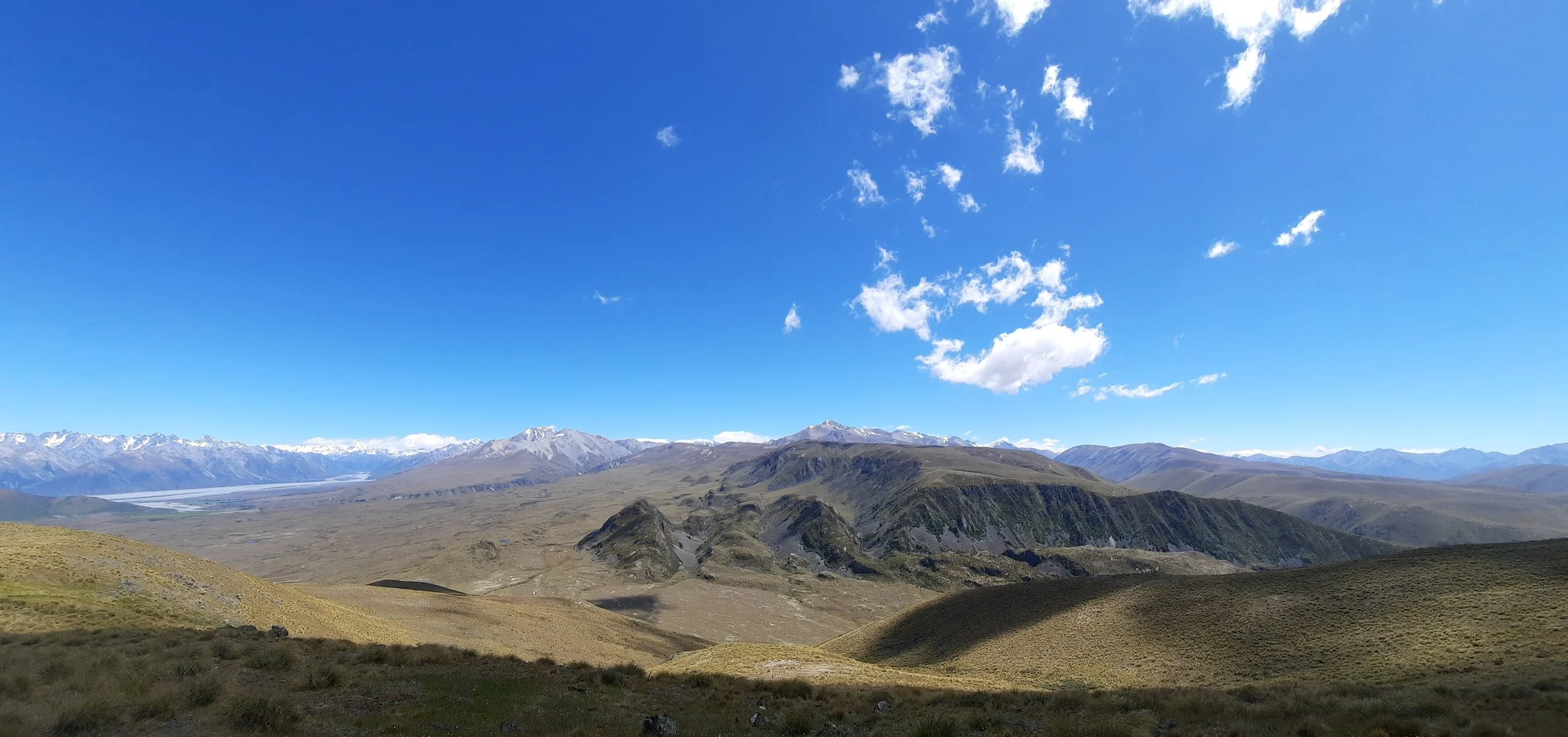
Taken from Mt Guy. Probably Mt Possession far left. Harper Range central, with Mt Harper highest at center left. Lake Clearwater village, just right of center. Two Thumb Range Southern Alps far right, across the Rangitita. Not clear if Mt D’Archiac, the high point in this area, is visible.
Mt Barrosa is just left of center. I’m not sure if Mt Somers is visible above Mt Barrosa. Left of Mt Barrosa is Mt Taylor. Far left, the Southern Alps.
Trinity Hill is just right of center. To the right of it are Mt Possession, Lake Emma, and Mt Harper in the Harper Range. At far right is the Two Thumb Range.
Hunting
The entire route is in a hunting area. Hunters are forbidden to “discharge firearms near tracks, huts, campsites, road-ends or any other public place.” I have hiked in more than 30 hunting areas, and only passed hunters twice - this wasn’t one of those hikes.
Here is the DOC topomap with all hunting areas visible.
Other pages about this hike
Pages about the out-and-back hike to Mt Guy summit
https://www.alltrails.com/trail/new-zealand/canterbury/mount-guy-track
https://www.wildernessmag.co.nz/trip/mount-guy-hakatere-conservation-park/
Pages about a full circuit of Lake Clearwater
Pages about this region
https://www.doc.govt.nz/globalassets/documents/parks-and-recreation/places-to-visit/canterbury/raukapuka/hakatere-conservation-park.pdf (history and hiking)
Nearby hikes that I haven’t done
https://hikingscenery.com/moorhouse-range-tops-tenahaun-conservation-area/
https://hikingscenery.com/mt-taylor-ascent-hakatere-conservation-park/
https://hikingscenery.com/mt-harper-circuit-hakatere-conservation-park/
Mt Guy seen from Mt Barrosa

Mt Guy is just right of center. The Harper Range, including Mt Harper, is just left of center and extends into the distance beyond Mt Guy.