Mt John, Lake Tekapo, NZ

Mt John is a hill on which I went for a short hike. It is on the southwestern shore of Lake Tekapo (Takapō) in the Mackenzie Basin region of Canterbury, South Island. It is accessible on foot from the town of Lake Tekapo, on the southern shore of the lake.
Not to be confused with the Mt John near Dunedin.
Time

My ascent route is on the west, while the descent route is by the lakeside on the east.
Screenshots of the NZ topographic map are licensed as CC BY 4.0 by Toitū Te Whenua Land Information New Zealand (LINZ).
DOC says the circuit takes 3 hours.
AllTrails users report an average of 2 hours 49 minutes.
The circuit took me around 4 hours 30 minutes, including a long break.
Route
Round-trip, AllTrails reports an elevation gain of 393 meters and a length of 8.2 kilometers.
The walk from town to the foot of the hill is a pleasant one along the lake shore. The track then goes up through a forest and onto the upper slopes, which were snowy during my hike. There is a cafe at the top, where I ate lunch. It was proper warm food.
After eating, I continued downhill on the far (north) side of the hill, then returned south to town along the lake shore.
The tracks were easy, even in snow at higher elevations. I didn’t use my trekking poles, and I didn’t regret not bringing my Kahtoola micro-spikes. For such limited effort on my part, I am quite pleased with the views I got. Photos below show Aoraki Mt Cook and its neighbors in the Southern Alps.
If 1 is an easy track, and 4 is using hands and feet on exposed rocks, I give this track a 1.


It’s hard to tell if I need to rotate this more, or if the terrain at right is accurately sloping down as shown on a zoomed-out topomap of the area. What do you think?
Bird-watching at the cafe. Are these sparrows or finches?
Ducks.
Geography
Mt John is a roche moutonnée, which means 'muttoned rock' in French. What is a muttoned rock? It is a rocky hill with a particular shape, smoothed on one end and steep on the other, due to a glacier flowing over it in a colder era. Mutton was once used to keep the hair in early modern French wigs in place. If we were naming this type of hill today, we might call it a 'gelled rock', a 'slicked-back rock', or even a ‘Don Draper rock’.
Other pages about this hike
Nearby hikes
Double Peak, Lindis Pass
Sealy Tarns, Mt Cook village
Mt John and Lake Tekapo seen from the air
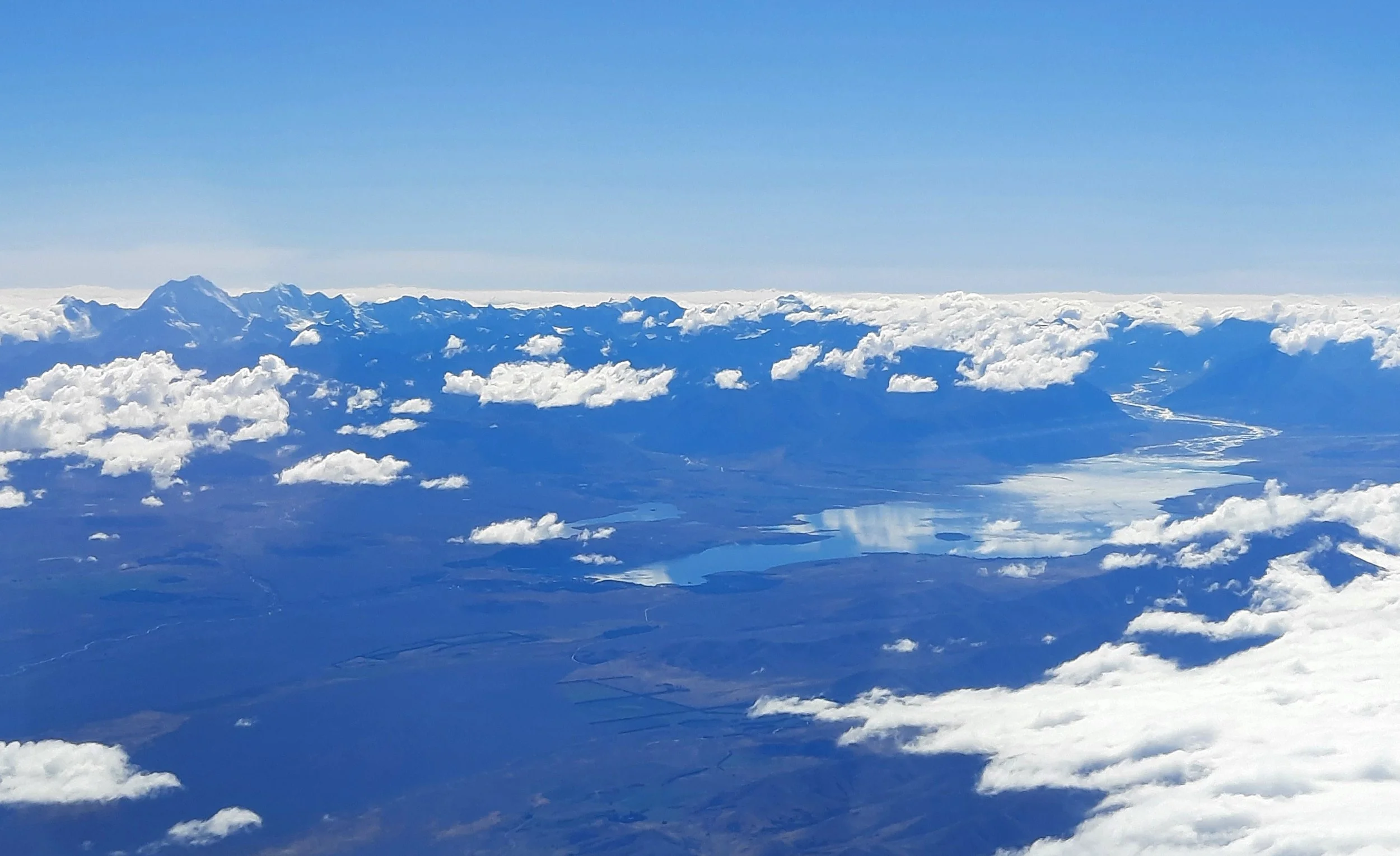
Mt John is the dark lump beneath the small cloud, just left of center and a little below the vertical midpoint. Further left in the distance is Mt Cook.