Angelus Hut (via Robert Ridge) as day-hike, Nelson Lakes, NZ


Lake Rotoiti is one of the Nelson Lakes in the Tasman region of South Island. The village of St Arnaud is on its northern shore. The Travers Range lies on the west side of Lake Rotoiti, and Robert Ridge is the northernmost ridge in the range, starting near St Arnaud and running southwest to Lake Angelus (Rotomaninitua). Angelus Hut sits beside the lake, near where Robert Ridge Track intersects three other tracks. One of those tracks follows the shore of Lake Rotoiti.

The Nelson Lakes. This hike takes place near the word ‘Range’, in the lower center. See below zoomed-in map with route.
My other, much shorter Nelson Lakes hike was along the track in the upper left: the St Arnaud Range Track. It helped me gain fitness for this hike, two days later.
Screenshots of the NZ topographic map are licensed as CC BY 4.0 by Toitū Te Whenua Land Information New Zealand (LINZ).
Although it’s possible to walk to the trailhead from St Arnaud, I think most people drive to the foot of Mt Robert (Pourangahau). From there, hikers take either the western Pinchgut Track (my choice) or the longer eastern Paddys Track up Mt Robert to Robert Ridge. Those two tracks also make Mt Robert a medium-length circuit.
The hike along Robert Ridge is normally part of a two-day hike, with hikers spending the night in Angelus Hut. I did the round-trip in one very long summer day. I passed about 30 hikers returning from or heading to Lake Angelus; based on our conversations and their timing, I think they were all doing a two-day hike.
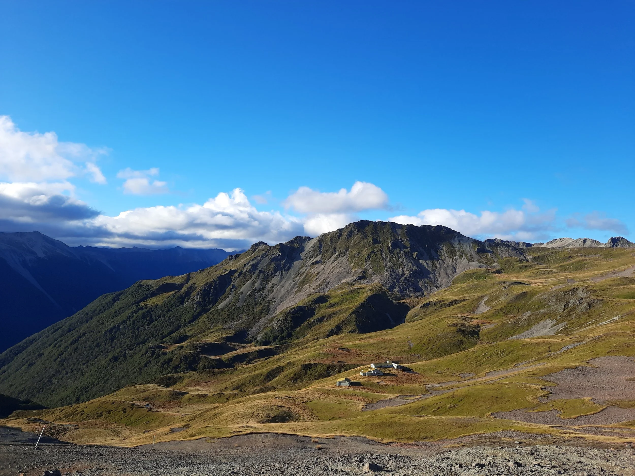
I’ve put ‘Angelus Hut’ in the post’s title, to make this post easier to find via search engines. I actually stopped at the edge of Robert Ridge, overlooking Lake Angelus and the hut. This is probably where the best views are.
Don’t confuse Robert Ridge with Angelus Ridge, a much less accessible ridge southeast of Lake Angelus.
This was my favorite hike in Northern South Island.

The two cyan dots superimposed on the red route line indicate - roughly - the beginning and ending of where the footing is tricky. I am less confident about the location of the lower cyan dot.
The purple dot indicates Angelus Hut. That is the destination for the overnight hike.
Screenshots of the NZ topographic map are licensed as CC BY 4.0 by Toitū Te Whenua Land Information New Zealand (LINZ).
Time
DOC reports that it is 6 hours one-way from the parking lot to Angelus Hut.
It took me about 5 hours 30 minutes from the parking lot to the slope overlooking Lake Angelus. Then, I rested for a long time. The return trip took me around 5 hours.
I estimate it would have been around an additional 45-minute round-trip to descend to Angelus Hut, then return up the slope overlooking Lake Angelus.
Route
Round-trip, AllTrails reports an elevation gain of 1335 meters and a length of 22.4 kilometers.
From the parking lot, I chose to ascend Mt Robert by Pinchgut Track because it was shorter. The track was in good condition, and I didn’t feel my gut was pinched by the ascent.
After around an hour, I reached the treeline. Above treeline, there is a little more ascent, and then a long, rocky, undulating ridge with an easy walking track.
The ridge is quite exposed to the wind, and the wind was quite strong during the mid-morning. For perhaps the first time, I used one or both of my trekking poles to help me keep steady as I moved forward. (Normally I just use them to cushion the impact when descending.)
I considered turning back due to the wind, but it calmed down by late morning.
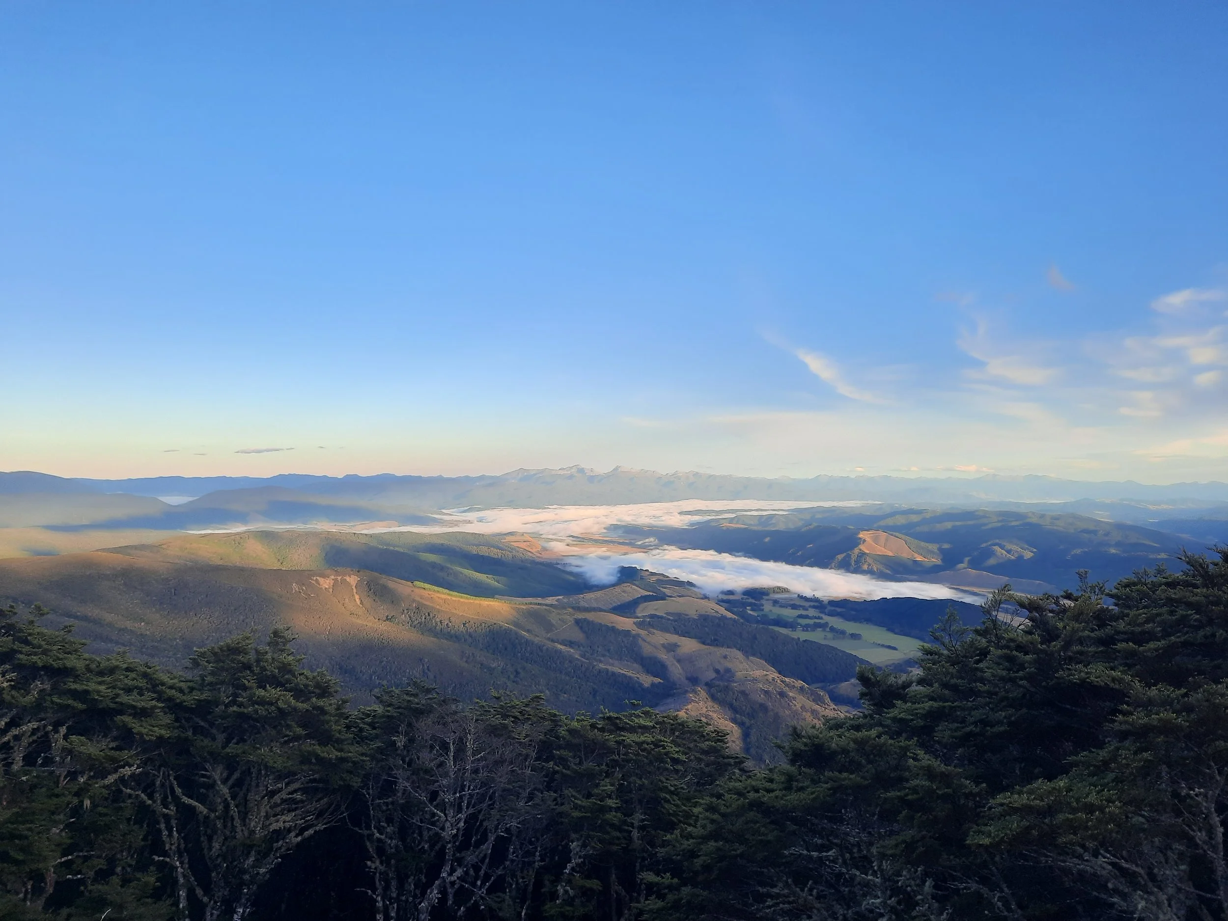
That was good timing. Starting around the location of the upper cyan dot superimposed on the topomap screenshot, the track went through several stretches of more difficult footing. Some of these moderately difficult stretches were on a gravel track sidling along rock-and-tussock slopes, while other quite difficult stretches were among rocks along the highest portions of the ridge. I wouldn’t do this in high wind.
Not long before the junction with Speargrass Creek Route, the footing became easy again. It was no difficulty ascending the hill overlooking Lake Angelus, and a fine spot for lunch when the wind is light.
One of the highlights of the hike was the views to the east into the five basins above Lake Rotoiti and the streams feeding into it.
If 1 is an easy track, and 4 is using hands and feet on exposed rocks, I give this track a 4 for a few meters at a time, and otherwise a 2 or a 3, in the difficult interval shown on the map. I give the rest of it a 1, including Pinchgut Track. This is just about terrain, not the wind I experienced.
Safety
Robert Ridge is highly exposed to wind and rain. High winds have blown people off their feet - turn back if you have to.
Between 2010 and 2019, one in 700 trampers heading to Angelus Hut have needed search and rescue assistance.
For comparison, it would help to know the corresponding proportion of trampers needing assistance for each of DOC’s nine Great Walks.
Also, the actual proportion of hikers needing assistance must be a little smaller. All hikers who book a bunk in the hut are counted, regardless of whether they need assistance. But day-hikers are uncounted unless they need assistance. In other words, my unproblematic hike should be part of the denominator, but it isn’t, whereas I would have been part of the numerator if I had needed assistance.


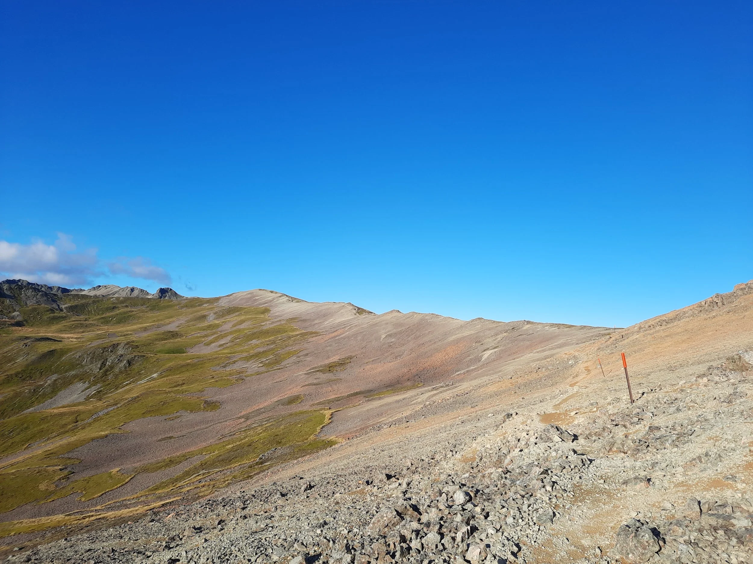


Maniniaro (Angelus Peak) at center-left. Further left, Angelus Ridge (which is higher than the peak, 2093 meters vs 2075 meters).

The route follows the main body of Robert Ridge, which veers to the far left. Center-left is Point 1885. Far right, Point 1805.
Hunting
Most of the route is in a hunting area. Hunters are forbidden to “discharge firearms near tracks, huts, campsites, road-ends or any other public place.” I have hiked in more than 30 hunting areas, and only passed hunters twice - this wasn’t one of those hikes.
Here is the DOC topomap with all hunting areas visible.
Other pages about this day-hike
https://tinytramper.com/mount-robert-to-angelus-hut/ (she jogged part-way)
Pages about Angelus Hut as a two-day hike
The brothers who recommended that I visit Angelus Hut spoke highly of staying there for the night, then returning to St Arnaud via the track along Lake Rotoiti, because it provided a contrast with Robert Ridge. It was their most recommended hike in NZ. Most but not all of this track is visible at right in my zoomed-in screenshot.
https://www.theoutbound.com/new-zealand/backpacking/winter-overnight-in-lake-angelus-hut
https://www.hikingproject.com/trail/7091444/robert-ridge-route-to-lake-angelus
https://hikingscenery.com/lake-angelus-hut-via-robert-ridge/
https://www.youtube.com/watch?v=aYobdR2vvYI (winter snow)
AllTrails
Other hikes involving Angelus Hut
Mt Robert circuit (day-hike)
Regional info
https://www.theprow.org.nz/places/nelson-lakes-national-park/
https://storymaps.arcgis.com/stories/697d4fa85294493e8282c49635b0cb12
https://www.theprow.org.nz/assets/files/the-top-house-tragedy.pdf
Have you hiked both Robert Ridge and the St Arnaud Range Track, on the east side of Lake Rotoiti? If so, I’m curious about the winds that you experienced. My second hike was the day after my first, and the prevailing winds came from roughly opposite directions. Did you experience this? Whether you did or didn’t, please let me know below.
Mt Robert seen from Tophouse

Mt Robert is at center-right, with Robert Ridge extending behind it. I ascended Pinchgut Track, on Mt Robert’s right spur.
Robert Ridge seen from the St Arnaud Range

Robert Ridge at left, across Lake Rotoiti. St Arnaud at center-right, separated from the shore by woods.