Rocky Mountain, Wānaka, NZ


Screenshots of the NZ topographic map are licensed as CC BY 4.0 by Toitū Te Whenua Land Information New Zealand (LINZ).
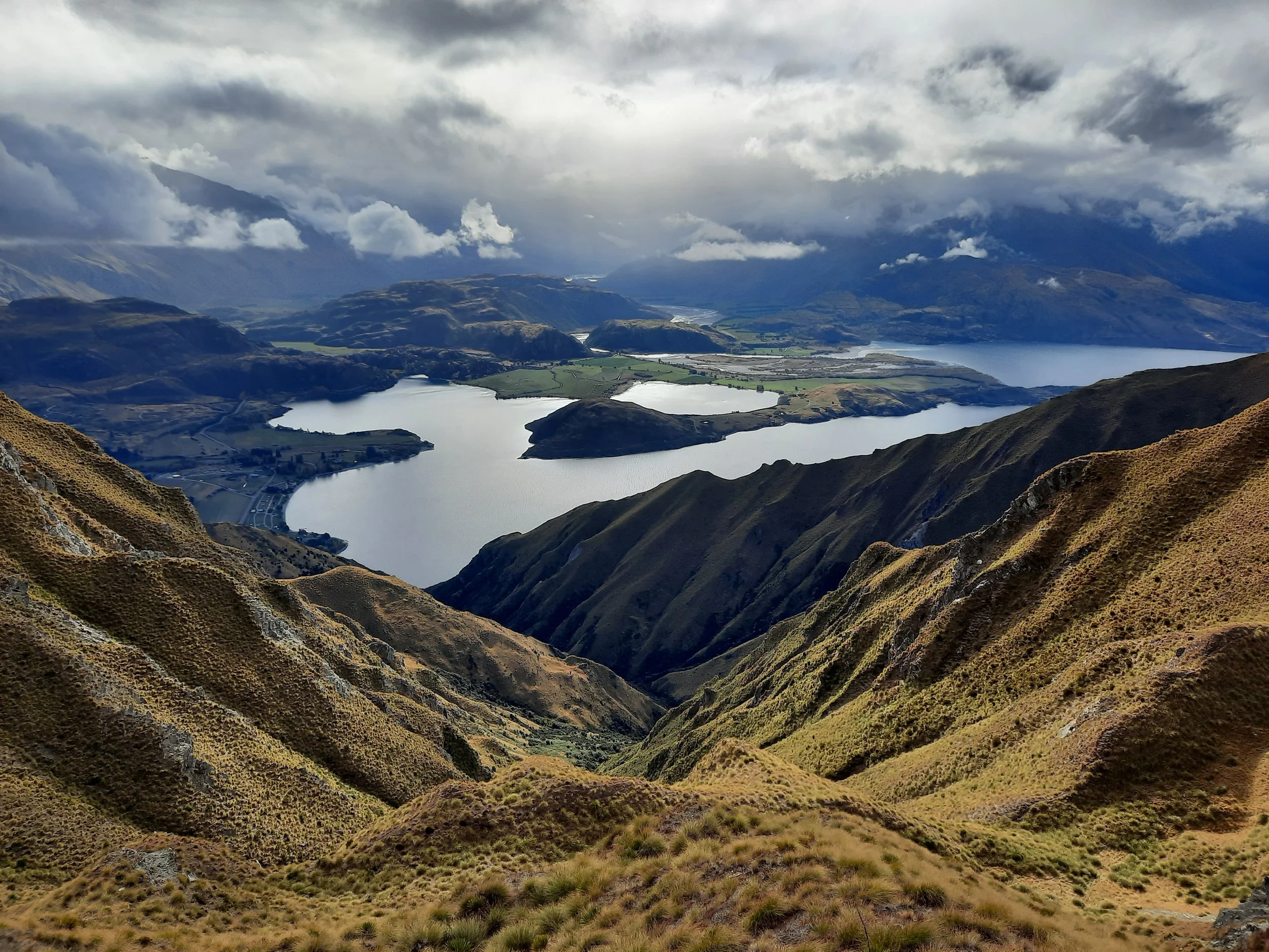
Rocky Mountain is a short hike 20 minutes northwest of Wānaka, Otago, South Island along Wānaka-Mount Aspiring Road.
Some visitors walk uphill only as far as Diamond Lake, while others hike beyond on rougher tracks to the summit.
Time
DOC says that the summit is a 3-hour return trip.
AllTrails users reported an average time of 2 hours 57 minutes. The default AllTrails route includes two sections I skipped: The Lake Wanaka Lookout Track, and the east side of Diamond Lake.
It took me about 1 hour 15 minutes to reach the peak, and about 1 hour to descend. This does not include a long break at the peak. Perhaps because the summit was much lower in elevation than it is on my typical hikes, it was warmer and less windy than I am accustomed to.
Route
Round-trip, AllTrails reports an elevation gain of 490 meters and a length of 7.1 kilometers. My hike was somewhat less of each.
From Diamond Lake Conservation Area parking lot, a broad track goes uphill to Diamond Lake.
Beyond this there are two routes, forming a lower circuit, and then another two routes, forming an upper circuit.
In an attempt to avoid steep descents while seeing a variety of terrain, I traced a figure 8 based on the contour lines shown on the topomap.
This meant ascending by the left portion of the lower circuit, then the right portion of the upper circuit.
From the peak, I took the mirror image route, descending by the left portion of the upper circuit, then the right portion of the lower circuit.
This worked overall, but the right portion of the lower circuit had one brief, very steep bit of descent. I had to use my hands. However, there was minimal exposure.
If 1 is an easy track, and 4 is using hands and feet on exposed rocks, I give this track a 1 as far as Diamond Lake, but a mixture of 3 and 2 beyond that.


Other pages about this hike
https://www.alltrails.com/trail/new-zealand/otago/diamond-lake-and-rocky-mountain-track
https://www.walkmyworld.com/posts/rocky-mountain-summit-track-wanaka
https://hikingscenery.com/rocky-mountain-diamond-lake-circuit-wanaka/
https://planmywalk.nz/tracks/diamond-lake-and-rocky-mountain-walks