Mt Taranaki summit, Inglewood, NZ


North Egmont is on the northeastern slopes of Mt Taranaki, underlined in purple. The trailheads for my other two hikes are also indicated.
Screenshots of the NZ topographic map are licensed as CC BY 4.0 by Toitū Te Whenua Land Information New Zealand (LINZ).
Mt Taranaki (Taranaki Mounga; Mt Egmont; 2518m) is an active stratovolcano in the Taranaki region of western North Island which last erupted in 1854. There are several trailheads on the slopes of the mountain, for a variety of hikes, most of which do not go to the summit. The shortest poled route to the summit starts from North Egmont parking area and visitor center, which is around 20 minutes from Inglewood and 30 minutes from New Plymouth.
This route is usually a very long day-hike, although some break it into a short hike to Tahurangi Lodge, where they spend the night, followed by a long hike to the summit and then back to the parking area. It’s also possible to stay in the DOC lodge at North Egmont, but this doesn’t break the hiking into two portions.
There are alternative routes, of which these are the most popular:
A poled route which starts from Stratford Plateau (East Egmont) and joins this main route. One advantage is easier parking during busy times of year. It also has less elevation gain. I decided against it because it supposedly has some rough lateral terrain to cross.
An unpoled route which ascends the southern face from Fantham’s Peak.
Access
There is only one road to the North Egmont parking area. During popular periods, incoming traffic is limited in a one-car-in, one-car-out system. Make sure to do some research about when this will be. Keep in mind the East Egmont alternative parking area mentioned above.
Time
DOC estimates that the ascent takes 5-6 hours and the descent takes 3-4 hours. On AllTrails, I saw times as low as 8 hours and as high as 12 hours.
It took me around 11 hours altogether, including breaks.
around 5 hours 40 minutes ascending, including short breaks
hour-long break on the summit
around 4 hours 20 minutes descending, including short breaks

The tiring scree section is next to the word “Summit” in “Northern Summit Route”.
Screenshots of the NZ topographic map are licensed as CC BY 4.0 by Toitū Te Whenua Land Information New Zealand (LINZ).
Route
According to AllTrails, it’s 1559 meters to the summit and back, over 11.9km. DOC recommends that normal hikers go between January and April, to encounter the least ice.
North Egmont visitor center has an intentions book in a red wooden box, on the left side of the enclosed vestibule to the building. The door to this space remains unlocked even when the main part of the visitor center is closed.
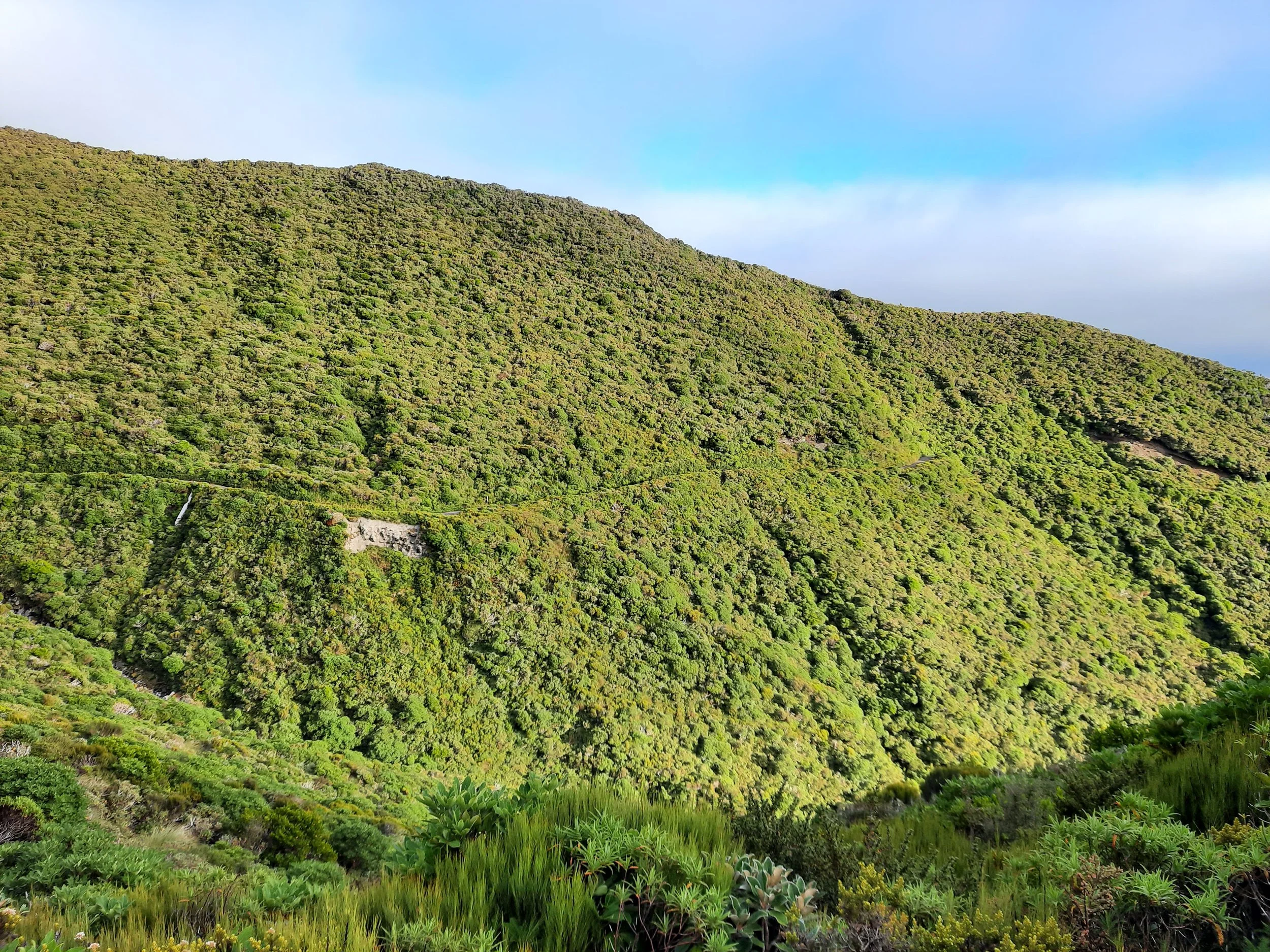
From the visitor center, I followed a boardwalk to Translator Road, which climbs at first gently and then steeply to Tahurangi Lodge. The steep part is known as the Puffer, because it makes most people huff and puff. I rested on a bench part-way up, and others joined me there.
Tahurangi Lodge is privately owned. It’s the black square equally near ‘Tahurangi’ and ‘Hen’ on the topomap screenshot. I rested outside the lodge, in the shade.
Then I ascended through the misty Hongi Valley, weaving around boulders. I just followed a man ahead of me, but Alice has advice if you’re alone:
There were quite a few paths in the boulder field. But so long as you aim for the end of the right-hand cliffs, you’ll be heading the right way.
You can see Hongi Valley on the map, directly above the word ‘Tahurangi’. I don’t recall seeing the stream on the map.
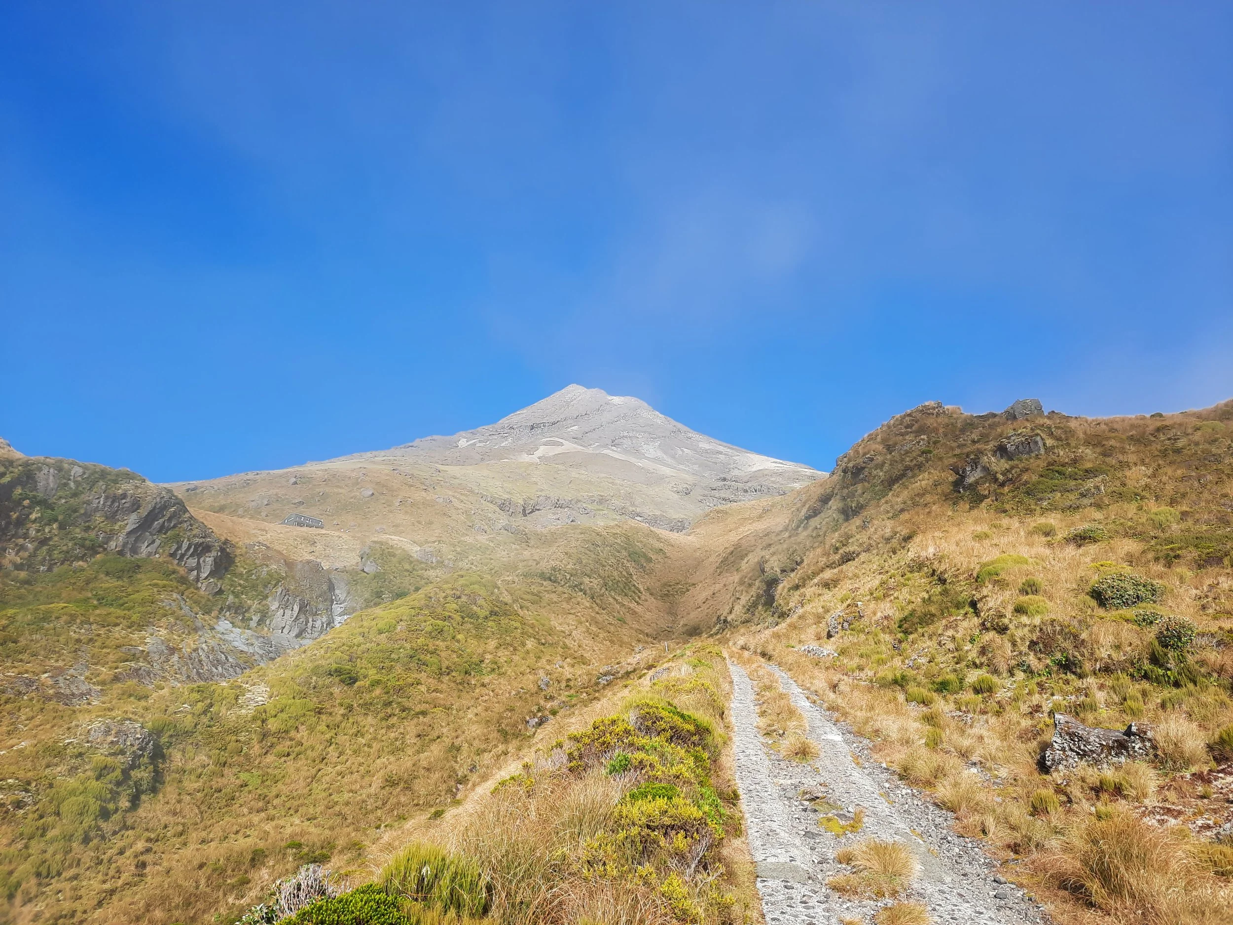
At the top of the valley is a long flight of wooden stairs. These end near the bend in the route, by the word ‘Route’ on the map.
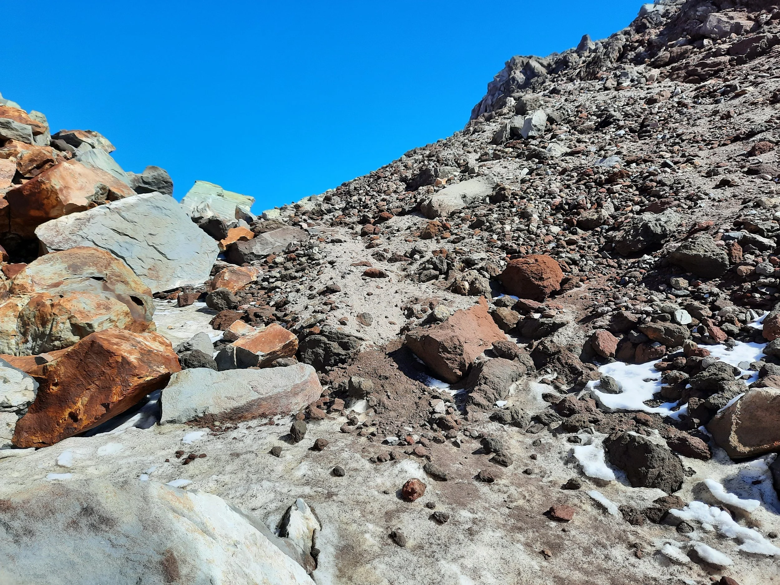
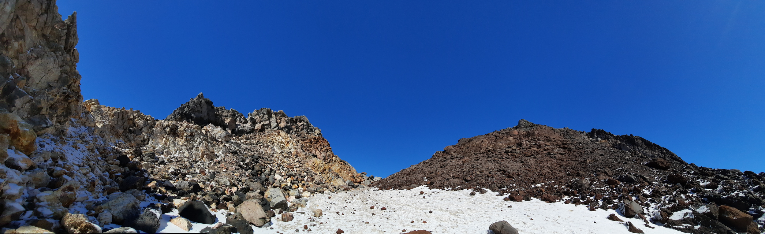
Next came an intermediate zone, in which the rocky ground was somewhat loose, above the word ‘Route’ on the map. See photos 19-21 in the gallery below. I was relieved that the notorious scoria wasn’t as bad as other blogs had made it sound. But I was mistaken. There really is a tiresome scoria section - see photos 25-27 - above the so-so scoria section. My OR Crocodile gaiters mostly kept the little stones out of my boots. This section is above the word ‘Summit’ and the ‘ern’ in ‘Northern’ ont he map.
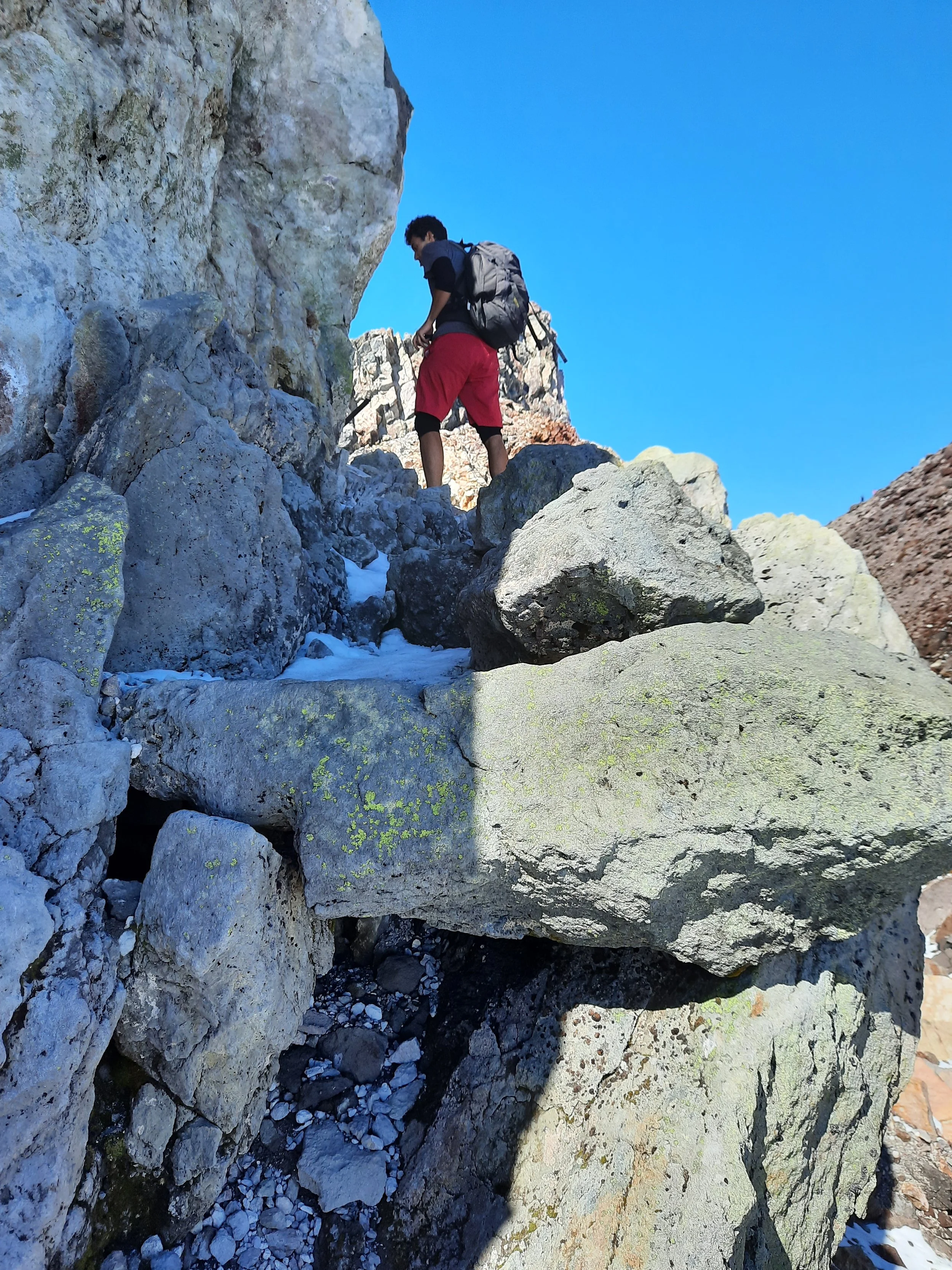
Above the scoria is the Lizard, a solid and somewhat sharp formation of dried lava. My pants and gloves were valuable here. I found it easier than the Puffer and the scoria.
At the top of the Lizard, there is a high route along a narrow ledge, and a broader low route over boulders, into the crater. The orange poles follow the high route, so I decided to follow it. It is 5-10 meters above the low route.
This is also where I put on my Kahtoola MICROspikes and a ski helmet. Why did I bring a helmet and spikes in early April, when no other hikers did?
Mishaps on this mountain have the second-highest death toll (80+) of NZ mountains, although this is not many compared to an estimated 20,000 hikers per year. (Aoraki Mt Cook has the highest death toll, and surely a higher rate.)
There had been snow a few days before my hike, as you can see in my photos from Pouakai tarn and summit at the foot of this page. This made me think of two specific risks:
Risk of slipping on hard-to-see verglas in autumn. A DOC worker confirmed by phone that this might be present, and indeed it was, on the shaded parts of the narrow ledge.
Risk of rockfall in the crater due to thaw after the recent snowfall. This is when ice forms in cracks in the rocks, forcing the rocks farther apart, leading to rockfall once the ice melts on a warm day. I was hiking on a warm day.
The MICROspikes came in handy. I was able to walk on the ice, while other hikers had to sit down and slide downwards. I also heard regular rockfall in the distance, and I don’t think the area where I walked was much different in risk profile. So I think the helmet was a good decision.
I had purchased the helmet the previous evening at Mountain Warehouse in Bell Block, New Plymouth. It was on sale for around NZD90.
After descending the icy ledge, it was an easy walk gently uphill across the snowy crater. Finally, I turned right and ascended to the summit on somewhat loose, red and gray volcanic rock. The difficulty was like the intermediate scoria section, not the bad scoria section.
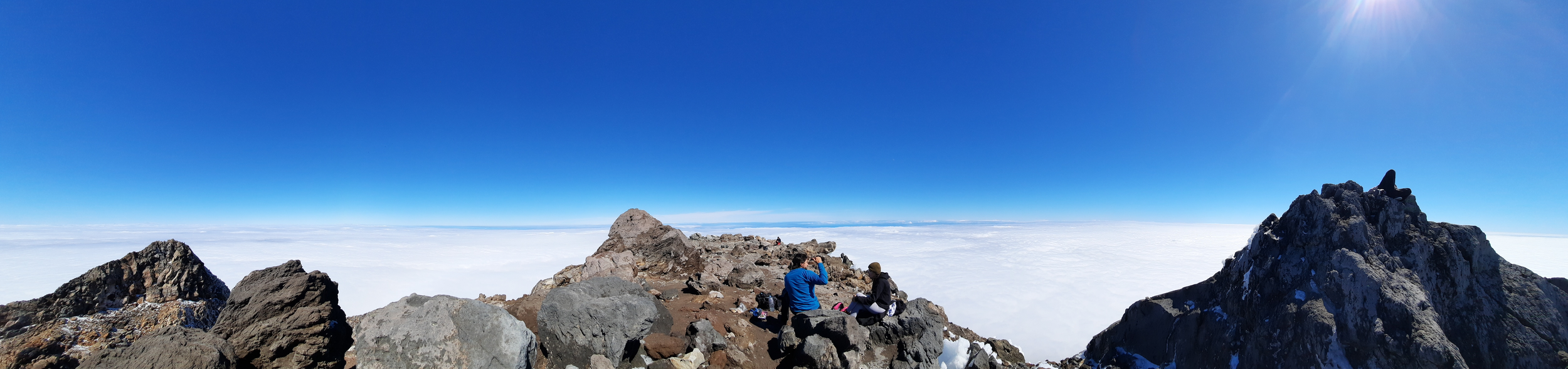
The summit plateau is broad, with plenty of small boulders to sit on. I didn’t scramble the final two meters to the summit, because local Māori tribe officials have asked people not to. I think this was my first hike in which lower elevations were entirely covered by a cloud inversion. I couldn’t tell if the sea was visible in the distance, or just the sky.
WTMC has some advice on the way back down. I recall the slight angle, but not the wooden X, so just quoting:
On the descent, at the bottom end of the Lizard where the Lizard meets the scoria, the poled route goes off on a slight angle to the right. This point was marked by a wooden ‘X’ to deter going straight ahead. If the visibility is low, this point might need extra attention.
My trekking poles were very useful on the scoria section. Some other hikers struggled without them, and even tried sitting down and sliding in places.
I saw my first Brocken specter near the top of the stairs. A Brocken specter is the visual effect of sunlight behind you casting a shadow onto the cloud/mist ahead of you.
One blogger had issues with insects bothering her. My hike was in early April, and I don’t recall any. Maybe the freeze a few days before wiped them out.
If 1 is an easy track, and 4 is using hands and feet on exposed rocks, I give this hike a 4 at worst.


View of the crater from near the summit.
Summit panorama from southeast to east to north.
Summit panorama from east to south to west.
Hunting
The entire route is in a hunting area (for goats and possums). Hunters are forbidden to “discharge firearms near tracks, huts, campsites, road-ends or any other public place.” I have hiked in more than 30 hunting areas, and only passed hunters twice - this wasn’t one of those hikes.
Here is the DOC topomap with all hunting areas visible.
Other pages about this hike
https://www.mountainsafety.org.nz/read/is-taranaki-maunga-a-safe-mountain-to-climb
https://wtmc.org.nz/trip-report/summer-climb-of-mt-taranaki/
https://www.alltrails.com/explore/trail/new-zealand/taranaki/mount-taranaki-summit-track
Logistics for special circumstances
https://www.facebook.com/taranakialpineclub annual open day with free guiding
https://taranakialpineclub.co.nz/tahurangi-lodge/ to stay the night
https://www.doc.govt.nz/parks-and-recreation/places-to-go/taranaki/places/egmont-national-park/things-to-do/lodges/the-camphouse/ to stay the night
https://www.stratfordmountainhouse.co.nz/accommodation to stay the night at Stratford Plateau, East Egmont
Pages about route from Stratford Plateau, East Egmont
Pages about other nearby hikes
https://www.wildernessmag.co.nz/10-trips-egmont-national-park/ (good 3D map of the mountain)
Background
https://www.youtube.com/watch?v=g5ozL4uRcC8 (view from helicopter)
https://www.youtube.com/watch?v=GljllvKlTac (how it was formed)
https://www.geonet.org.nz/volcano/taranakiegmont (volcanic activity)
https://www.youtube.com/watch?v=jyWibDjFv9U (what the next eruption might look like)
https://terangiaoaonunui.pukeariki.com/story-collections/taranaki-stories/volcanic-taranaki
https://www.youtube.com/watch?v=y2O_kr4TLWA (myth of the volcanoes)


