Barrier Knob via Gertrude Saddle, Milford Sound, NZ

Barrier Knob (1897m) is a point on Barrier Peak (2039m), above Gertrude Saddle in the Darran Mountains of Fiordland National Park, Southland. The hike starts around 30 minutes by car from Milford Sound, and 90 minutes from Te Anau.
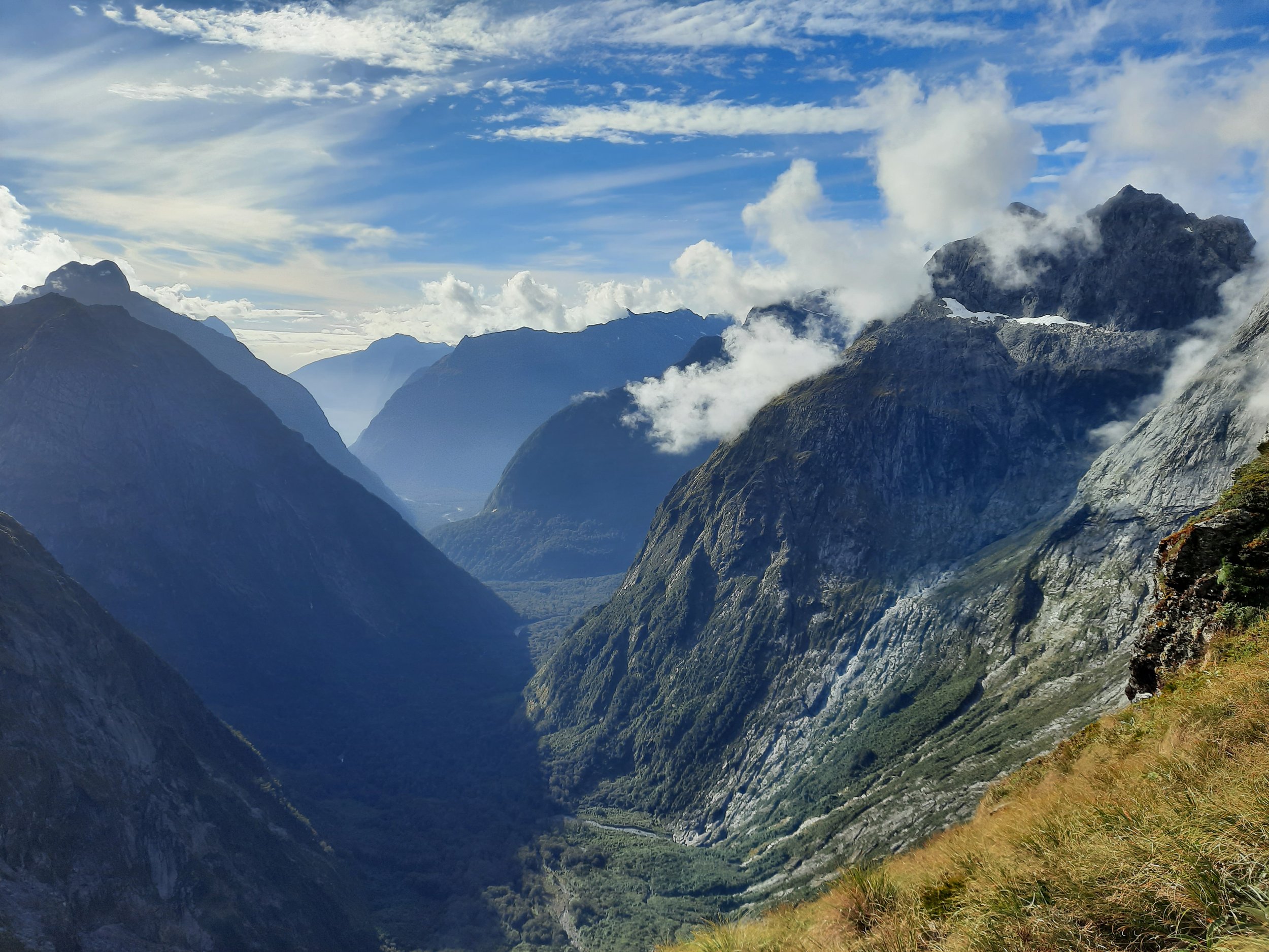
Gertrude Saddle attracts a lot of hikers who want to see its dramatic vista toward the famous Milford Sound. I was the only one to ascend to Barrier Knob that misty mid-afternoon; on days with better visibility, it probably attracts more hikers.
DOC insists that hikers not hike to Gertrude Saddle in wet conditions, because of the risk of slipping on steep granite slabs. I would avoid it during wet conditions because you won’t get a good view of Milford Sound from the saddle, and Barrier Knob is likely to have no visibility at all. Also, there can be avalanches from the peaks above, especially in spring from what I’ve read.
Time
Including all breaks, my total time was around 8 hours 35 minutes. From Gertrude Saddle to Barrier Knob and back, including all breaks, was around 3 hours 30 minutes.
DOC estimates 4-6 hours for Gertrude Saddle alone.
Route to Gertrude Saddle

The final ascent to Barrier Knob was the left (west) route, while I descended further east. There was a gully of snow between them.
Screenshots of the NZ topographic map are licensed as CC BY 4.0 by Toitū Te Whenua Land Information New Zealand (LINZ).
AllTrails reports 663m elevation gain over 8.4km, out and back, to Gertrude Saddle.
The parking lot is down a short slope on the right (north) of the Te Anau - Milford Sound highway, coming from Te Anau. It is a large, uneven expanse of gravel, much of which was not visible when I first drove into it.
I started my hike at 11:35 for unavoidable reasons, so there was no chance I would make it to Barrier Peak and descend before dark. It was just a question of whether I would have time to leave Gertrude Saddle and reach Barrier Knob.
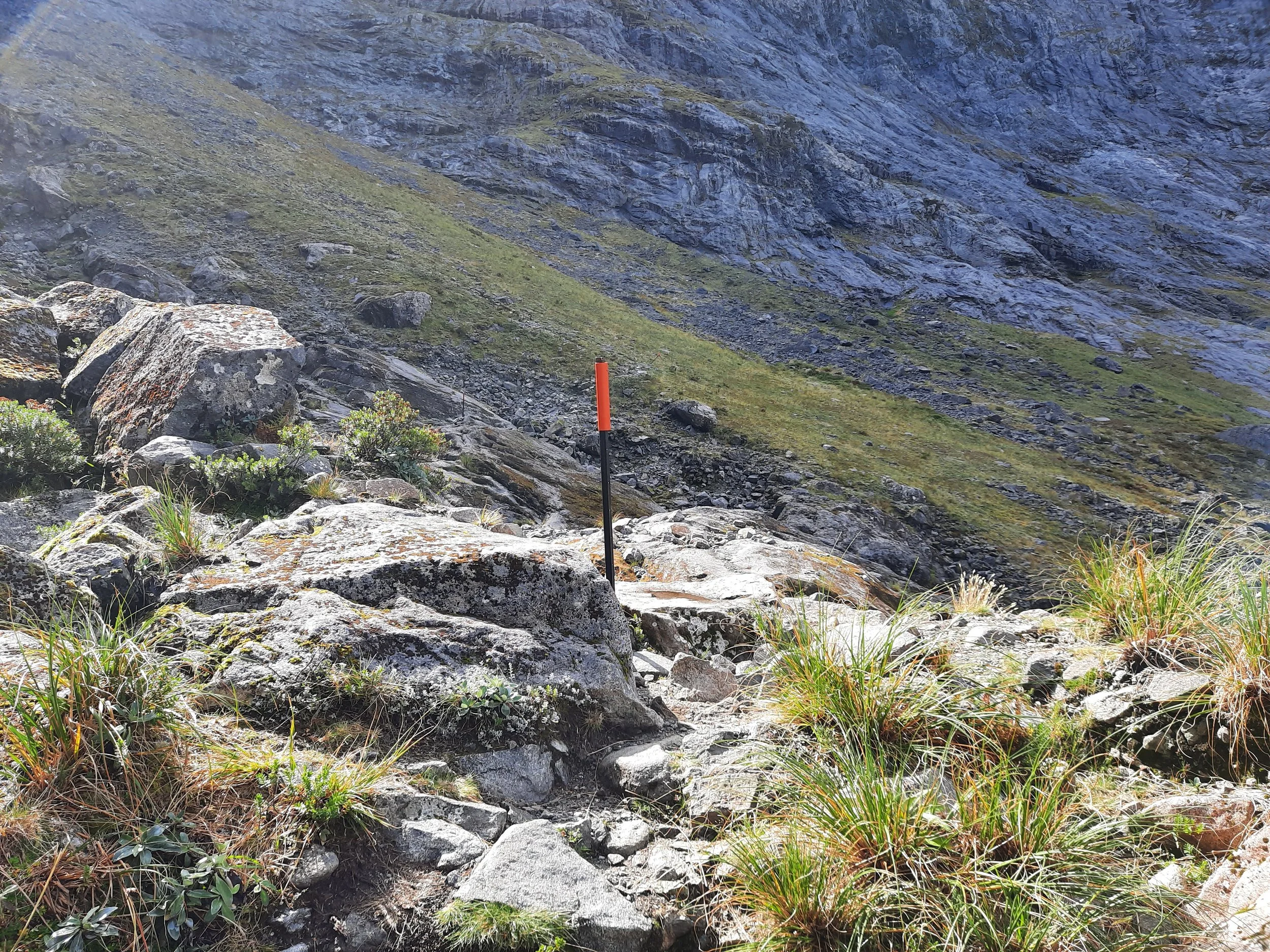
Shortly after the parking lot, the route crosses a small bridge. From here, it weaves in and out of a small forest and along rocky riverbed. The orange marker poles are far apart, so in between them there are multiple impact tracks. It’s not a pleasant walk. After 20-30 minutes the forest ends, and it becomes a choice of rocky riverbed or narrow, vegetation-obscured impact tracks, some of them muddy. The riverbeds were nearly dry for me; there must have been a flowing stream elsewhere in the valley, based on the waterfall ahead.
The route leads to the left (west) side of the valley for a fairly steep ascend through low vegetation. The stream comes into view at right. I continued ascending, following the marker poles, to the official crossing, where it was easy to cross without getting my feet wet by stepping on 2-4 big rocks. There is a waterfall upstream from here.
Once across the stream, the marker poles become more sporadic as they lead up a fairly steep, occasionally loose hillside of dirt, gravel, and vegetation. It was easier to follow the route on the way up than when it was in the shadow of Mt Talbot, on the way down.
As the route bends west toward Black Lake, the large granite slabs emerge, and there is a short section of chains to help people ascend/descend. At the top of this, the route continues directly north up some steep slabs with a much longer section of chains. I used the chains a bit going up and down; they would be essential in wet conditions, because there is no good way to arrest a slide on a granite slab.
At the top of the section section of chains, the route turns west again. It is easy walking for a while, before reaching a field of boulders and slabs. I ascended the boulders on the north, and found it easier descending the mixture of boulders and slabs (the official route) on the south later on. At the top of this is Gertrude Saddle, with its amazing view. Impact tracks continue north up the slop, for slightly different and arguably better views. Most hikers stop here.
I heard a kea on the way up and again on the way down, in the area between the waterfall and Black Lake. Another hiker saw one, but I didn’t see any. I did see a tourist boat on distant Milford Sound.
If 1 is an easy track, and 4 is using hands and feet on exposed rocks, I give this section of the hike a 4 at worst. There were chains to hold onto at the most difficult parts.
Route to Barrier Knob
AllTrails reports that the route from the parking lot is 1082m ascent over 10.5km, out and back. That’s an additional 419m of gain over the additional 2.1km out and back from the saddle. Assuming all the elevation gain is uphill, this section is thus around a 40% incline on average.
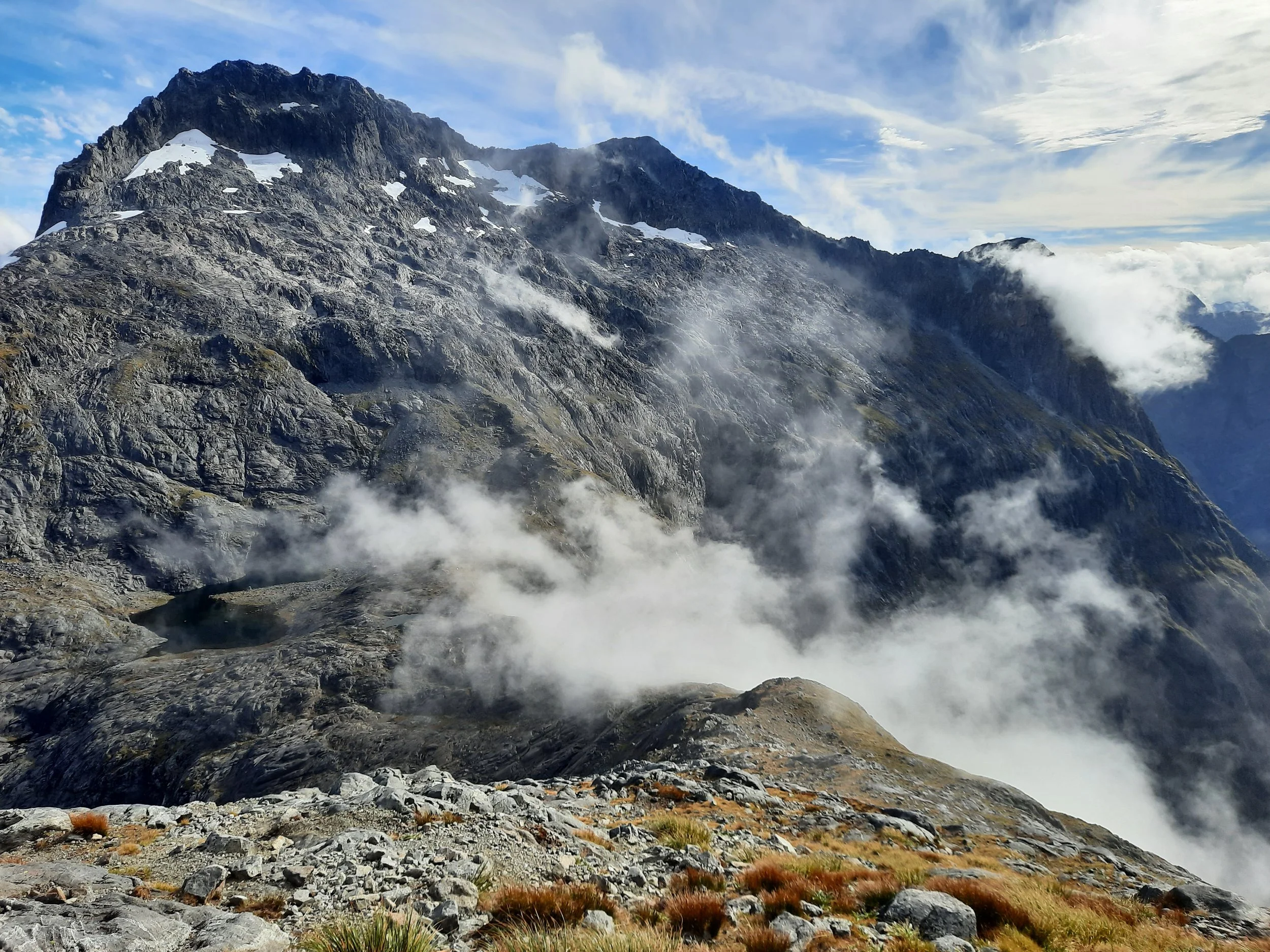
I continued northeast, going uphill from the saddle, along a sometimes-muddy impact track. It seemed clear enough, but I somehow lost it several times. Eventually it took me to the end of the vegetation somewhere between 1500 and 1600 meters. A woman who had just turned around and given up, because of the heavy mist that obscured the possible routes and entirely hid the ridge, passed me. After the vegetation ends, the southwest face of the mountain below the Knob comprises only boulders, slabs, and long patches of snow. This means that hikers have to navigate without impact tracks.
It seems there are three rough routes from the end of the impact track up to Barrier Knob.
The west-most route is how I ascended, following some small cairns. It was quite steep at times. With good visibility and careful planning, it would have been possible to walk/scramble all the way up this route. But I was in mist and in a hurry because it was already mid-afternoon. So I ended up, unhappily, doing some a little proper rock climbing on several occasions, e.g. chimneying (stemming) up a chute for a couple meters until I was again able to grab a ledge and resume pulling myself up.
The central route is the AllTrails route, with fewer cairns but definitely easier to walk without scrambling. This is how I descended, aided by better visibility.
The east-most route ascends to Point 1796, then turns west along the ridge. One of the other blogs calls this the most popular route, but I didn’t use it.
One difference between my ascent and the AllTrails descent is that I followed cairns on the west of a long (75+ meters) snow patch in a broad gully, and eventually crossed it (about 5 meters of snow) to turn east toward the Knob. By contrast, my descent was to the east of this patch of snow, assisted by at least one cairn. I eventually passed below it without touching any snow.
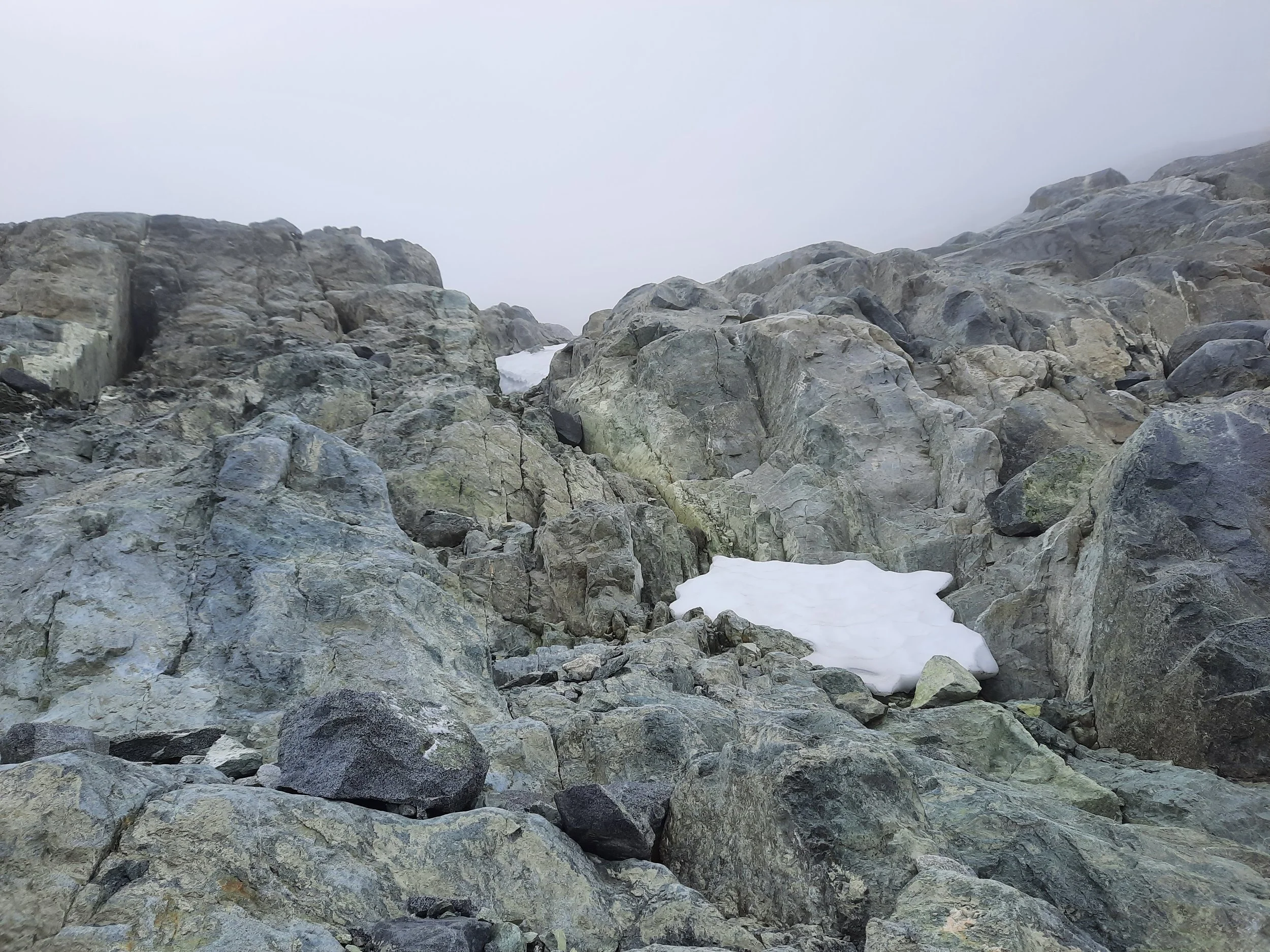
(In snowier conditions, my Kahtoola microSPIKES and an ice axe would both have been handy, but it was a warm late March.)
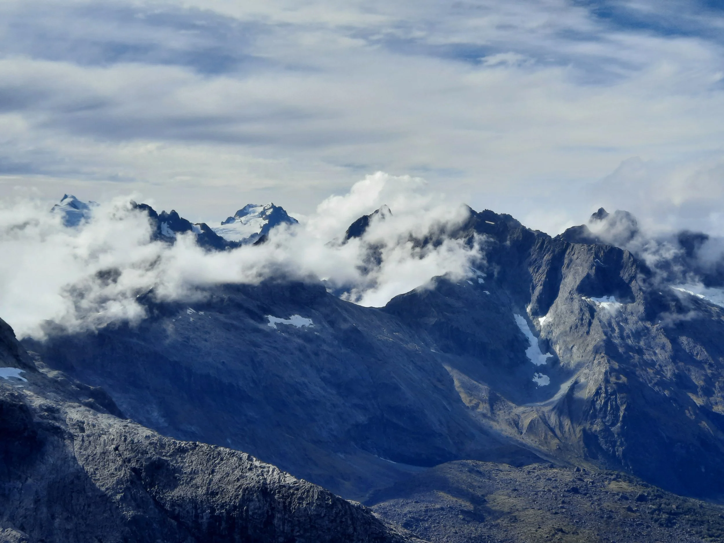
Due to mist, I got no views on my entire ascent, but luckily the wind progressively cleared the mist away before I left the ridge. The views were perhaps the most dramatic I have seen anywhere in NZ. I got a good view of everything around me, besides Barrier Peak, which remained hidden in mist apart from glimpses. Fiordland’s highest peak, Mt Tūtoko, was visible to the north.
If 1 is an easy track, and 4 is using hands and feet on exposed rocks, I give this section of the hike a 4 at worst.
Gertrude Saddle photos (in order from trailhead to saddle, including some photos from the return)


Barrier Knob photos (in order from Gertrude Saddle to the summit of the knob)


Videos
Lots to see from Barrier Knob. But only when the cloud/mist (mostly) lifts. Watch this one full-screen, with the corner-square button at right.
Twilight in Gertrude Valley.
Barrier Peak?
If I had been able to start 2.5 hours earlier, I would have attempted to continue southeast along the ridge, over Points 1796 and 1894, up to Barrier Peak. This report by climbers traversing from another valley says it was easy to descend from Barrier Peak to the Barrier Knob area without ropes.
With the last of the difficulties over, we free ourselves from the confines of the rope. We descend the easy ridge down from Barrier Peak with a spring in our step and traverse down onto big slabs overlooking the Gertrude Valley.
But because I didn’t get a good view myself, I can’t be sure I’d agree with them. Maybe someday I’ll try.
Hunting
The entire route is in a hunting area. Hunters are forbidden to “discharge firearms near tracks, huts, campsites, road-ends or any other public place.” I have hiked in more than 30 hunting areas, and only passed hunters three times - this wasn’t one of those hikes.
Here is the DOC topomap with all hunting areas visible.
Other pages about the hike to Barrier Knob (various routes)
https://hikingscenery.com/gertrude-saddle-barrier-knob-fiordland-national-park/
https://www.southernalpsphotography.com/Tramping/Fiordland/Barrier-Knob-January-2014/i-fbfsHcJ
Pages about Gertrude Saddle
Pages about Barrier Peak
Other information about the Darran Mountains
Even on a two-dimensional map the Darran Mountains look formidable: the orange contours aligned so closely that they resemble thick strands of seaweed, curling and snarling across the whole map sheet. Aside from the thin red line representing the Milford Road, mountains choke the entire map sheet, packed shoulder to shoulder.