108 different day-hikes that I took in NZ, mostly South Island. Several posts about NZ logistics and hikes/travel elsewhere.

The Apprentice via Lewis Tops, Lewis Pass, NZ
Long hike, 20 minutes from Springs Junction & 60 from Hanmer Springs.
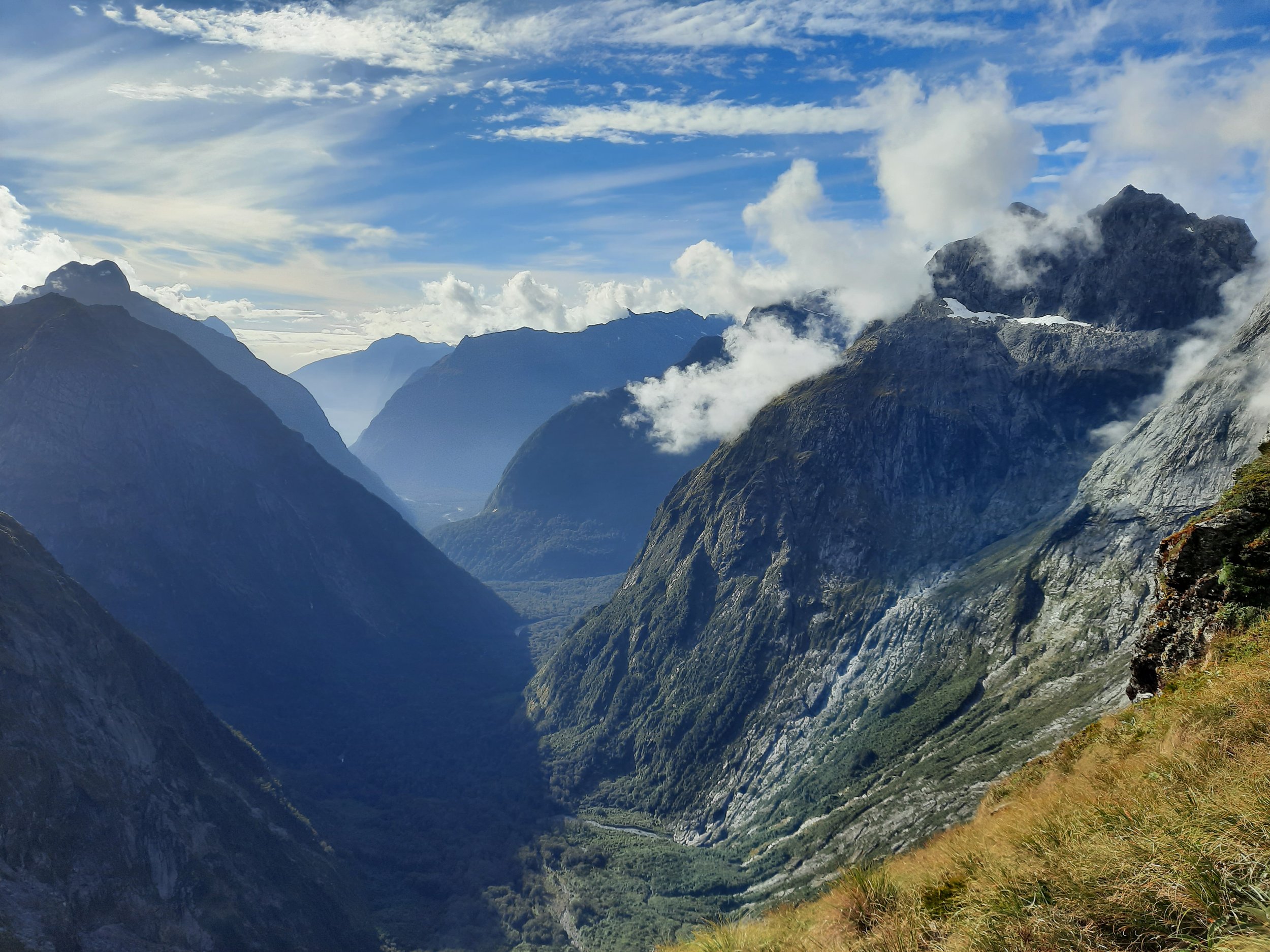
Barrier Knob via Gertrude Saddle, Milford Sound, NZ
Long hike, 30 minutes from Milford Sound & 90 from Te Anau.

Mt Kujū via Makinoto Pass, Kyūshū, JP
Long hike beside the Yamanami Highway, Kokonoe.

St Mary Peak, Wilpena Pound, South Australia
Short hike (Wangara Lookout) & long one (St Mary Peak). Wilpena Pound, Ikara-Flinders NP.

Pouakai Summit & Tarn, New Plymouth, NZ
Long hike, 20 minutes from New Plymouth. Side-trip off Pouakai Circuit.

Faust, Lewis Pass, NZ
Long hike near Lewis Pass. 30 minutes from Springs Junction, 45 from Hanmer Springs.

Mt Ida via Tourist Spur, Naseby, NZ
Long hike, 15 minutes from Naseby & 20 from Ranfurly.

Iron Hill, Cobb Reservoir, NZ
Long hike, 75 minutes from Tākaka.

Mt Peel circuit, Cobb Reservoir, NZ
Long hike, 85 minutes from Tākaka.

Mt Arthur - Horseshoe Basin circuit, Motueka, NZ
Long hike, 45 minutes from Motueka.

Altimarloch, Seddon, NZ
Long hike, entirely 4WD track. 25 minutes from Seddon, 40 from Blenheim.

Mt Ngāuruhoe, Tongariro National Park, NZ
Long hike, 20 minutes from Whakapapa village & 25 from National Park township. Mt Doom in Lord of the Rings. Active volcano.

Tongariro Crossing, Tongariro, NZ
Long hike, 20 minutes from Whakapapa village & 25 from National Park township. Active volcano.

Dome Summit on Mt Ruapehu, Tongariro, NZ
Long hike in Tongariro NP, 20 minutes from National Park township. Active volcano, sporadic lahars.

Mt Dumblane to Mt Charon, Hanmer Springs, NZ
Long hike from Jacks Pass, 13 minutes from Hanmer Springs.

Mt Herbert, Banks Peninsula, NZ
Long hike accessible on foot from Diamond Harbour. 45 minutes from Christchurch.

Mt Somers via Sharplin Falls, Mt Somers village, NZ
Long hike 12 minutes from Mt Somers village. 25 minutes from Methven.
Breast Hill, Lake Hāwea, NZ
Long hike on the east shore of Lake Hāwea. 10 minutes from Hāwea township.
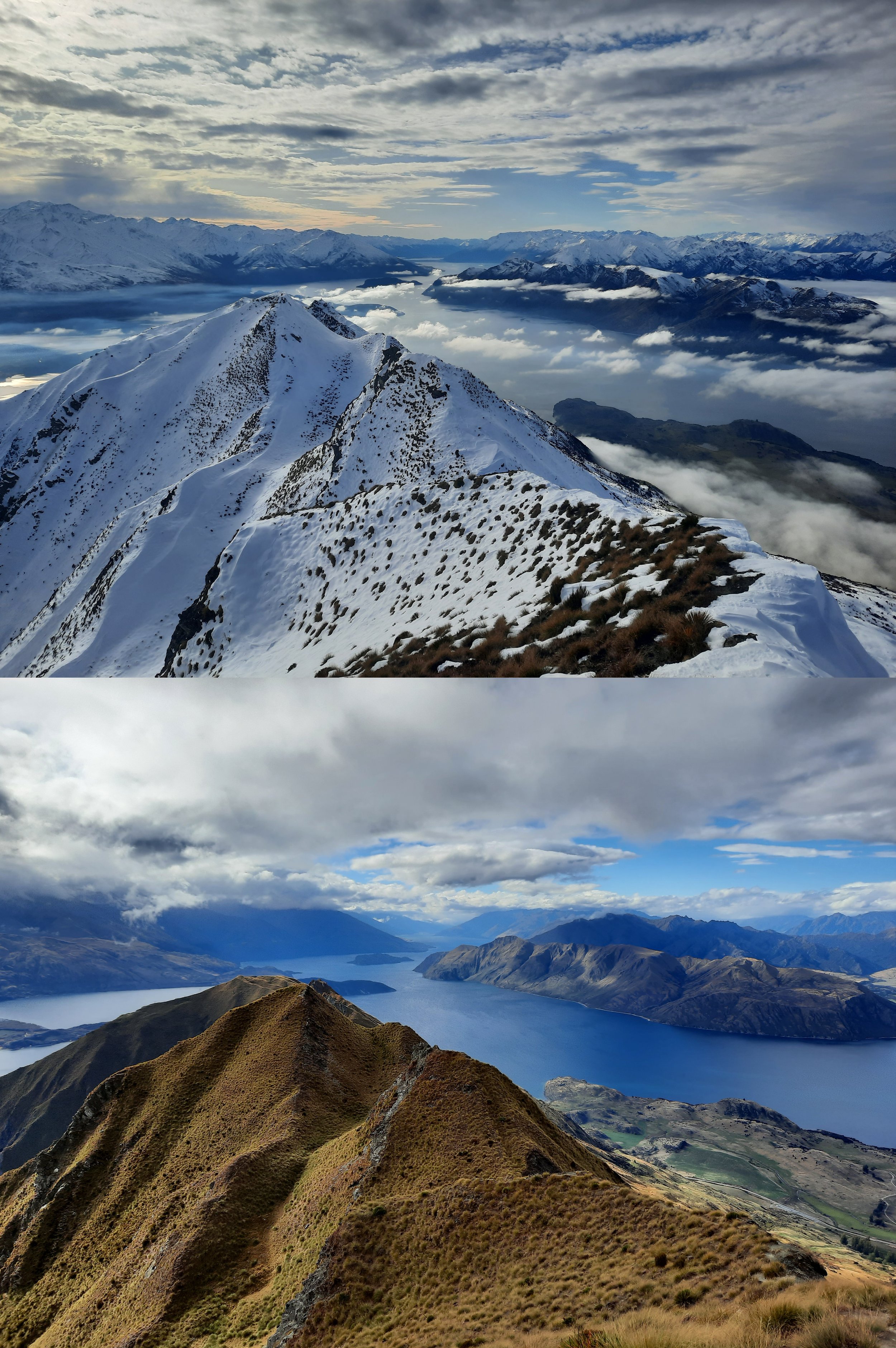
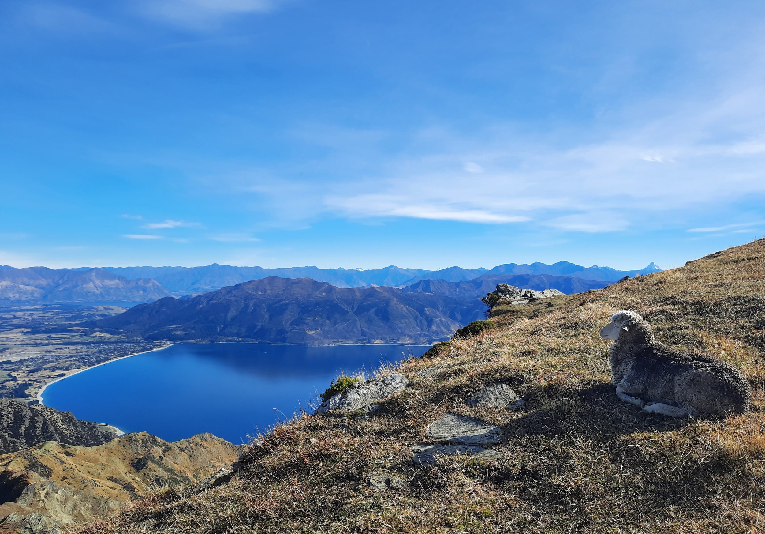
Roy’s Peak, Wānaka, NZ: Summer vs Winter
Hiking to Roy’s Peak without snow, and to the famous lookout point in snow. A long hike 10 minutes from Wānaka.

Isthmus Peak, Lake Hāwea, NZ
Long hike on isthmus between Lakes Wānaka & Hāwea. 20 minutes from Hāwea township.