Faust, Lewis Pass, NZ


Faust (1710m) is a mountain near Lewis Pass in the Hurunui region of northern Canterbury, South Island. I did a long out-and-back hike. It’s around 30 minutes from Springs Junction and around 45 minutes from Hanmer Springs. It is sometimes hiked with Mephistopheles (1736m), the next named peak north along this ridge in the Libretto Range.
The most relevant weather forecast is probably NIWA’s Devilskin Saddle.
Time
Including breaks, it took me a little under 8 hours return. Including breaks, it took a little over 4 hours to reach the peak, of which around 2.5 hours was in the forest.
Access
There are two parking places and three ways to begin. From north to south:
I parked in a small dirt/grass parking area on the east side of the highway, seen here on Google Maps. Then I hopped a barbed wire fence and followed a short impact track, which joined the official track within 2 minutes.
One could park where I did, then walk south along the edge of the highway to the official trailhead. It’s 20 seconds south, just before the Boyle River bridge begins. At the northeast corner of the bridge, there is a descent for a few meters to a stile. This is where the official track starts.
Other hikers park at Boyle Village campsite, then walk north across the bridge, and descend to the official trailhead, at the same stile I mention directly above in option #2.
See annotations below:


Route
After the tracks converged, I continued uphill onto a grass terrace, as seen in the 1st photo. Crossing the terrace, I entered the forest just to the right of the dead tree in the 2nd photo. There is a clearing with some ropes, ladders, and other equipment. I passed through it and exited it at left, going up a wooded hillside, as seen in the 4th photo. A South Island robin paid me a visit on this slope.
At the top of this slope, I kept right, following orange markers along a forest terrace (8th photo). This meant I walked near the edge of the hill I just ascended.
After these two interrupted starts to the ascent, the track finally curved left to begin the proper ascent. It was in good condition, but I wish I had worn gaiters, because my socks brushed against a lot of clingy plant things.
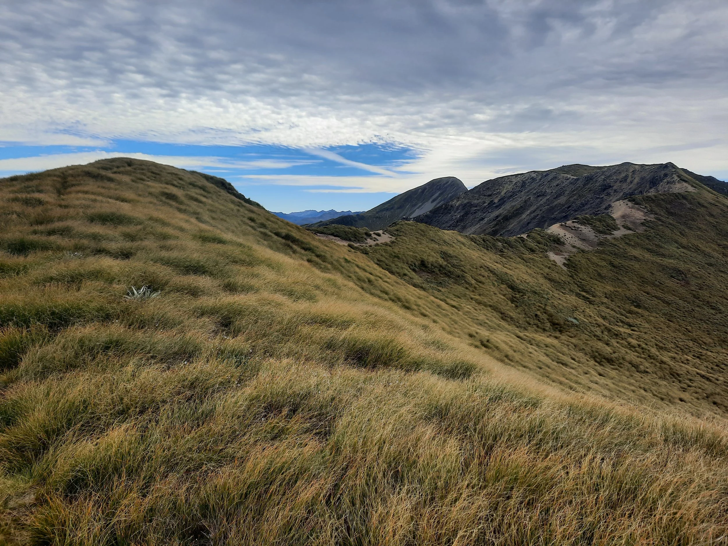
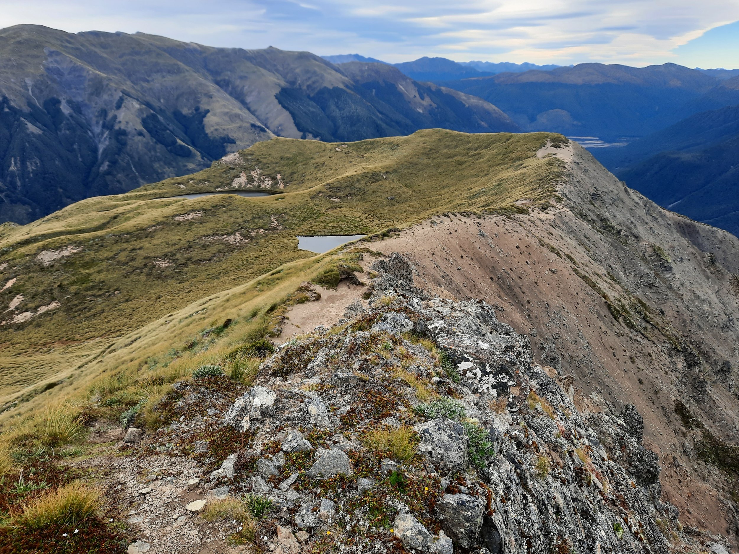
From the edge of the forest, poles led toward the ridge (15th photo). Once on the ridge, there was an impact track most of the way, or else gravel/boulders that were easy to navigate across. Occasionally, I lost the impact track in deep tussock, and found it was unusually difficult to take steps.
The hike to Faust was uneventful, with wind posing the main challenge. On a different day, I would have given the devil his due with the round-trip to Mephistopheles, but I wanted to finish early this day. Edward at HikingScenery.com says it’s around a 2-hour round-trip from Faust to Mephistopheles.
If 1 is an easy track, and 4 is using hands and feet on exposed rocks, I give this hike a 3 at worst.


Hunting
Starting at 800m of elevation, the entire route is in a hunting area. Hunters are forbidden to “discharge firearms near tracks, huts, campsites, road-ends or any other public place.” I have hiked in more than 30 hunting areas, and only passed hunters twice - this wasn’t one of those hikes.
Here is the DOC topomap with all hunting areas visible.
Name
Hikers approaching Faust see Mephistopheles behind it, at a slightly higher elevation. Art portraying the Faust legend sometimes shows Mephistopheles leaning over Faust's shoulder, e.g. here. Do you think the geography explains which peak got which name? Or do you think I'm over-interpreting?
The next peak north in the Libretto Range is named Lucia. I don’t recall a Lucia in either Marlowe’s Doktor Faustus or Goethe’s Faust. Perhaps she was added in a libretto, or perhaps it’s a reference to Lucia di Lammermoor.
Pages about other routes involving Faust
https://ctc.org.nz/index.php/trip-reports?goto=tripreports%2F977 (they visited a tarn)
https://www.wildernessmag.co.nz/trip/faust-lewis-pass-national-reserve/ (GPX; an ascent on my route and a descent on an unnamed spur - “The Faust and the spur-ious”)
https://hikingscenery.com/faust-mephistopheles-lewis-pass/ (continuing on to Mephistopheles)