Key Summit via Routeburn Track, Te Anau, NZ


Red shows the portion of my route on the Routeburn Track. Purple shows the detour to Key Summit.
Screenshots of the NZ topographic map are licensed as CC BY 4.0 by Toitū Te Whenua Land Information New Zealand (LINZ).
Key Summit (918m) is a hilltop and the northernmost portion of a long spur in the Livingstone Mountains of Fiordland, Southland, South Island. There is an Alpine Nature Walk with some posted information about wildlife.
The hill rises above The Divide, a watershed which now has an associated parking lot and shelter. The parking lot and shelter are best known as the western trailhead of the multi-day Routeburn Track, and I hiked to Key Summit with a detour off of this track.
The Divide is around 70 minutes by car north of Te Anau. The nearest accommodation seems to be Eglinton Valley Camp.
Time
DOC estimates it takes 3 hours round-trip. Including breaks, it took me 2.5 hours round-trip.
Route
AllTrails reports that the hike is 421m elevation gain over 8km. Almost all of the elevation gain is outbound.
From the parking lot, I began on the same good-condition track that Routeburn trekkers use. It rose gradually through pleasant forest, with the trickle of water audible below. I passed one or two waterfalls, and also an area where signs warned of the danger of rockslides. The purpose of the signs is to get hikers to walk through quickly, rather than lingering in the area. After that, there were a few gentle switchbacks.
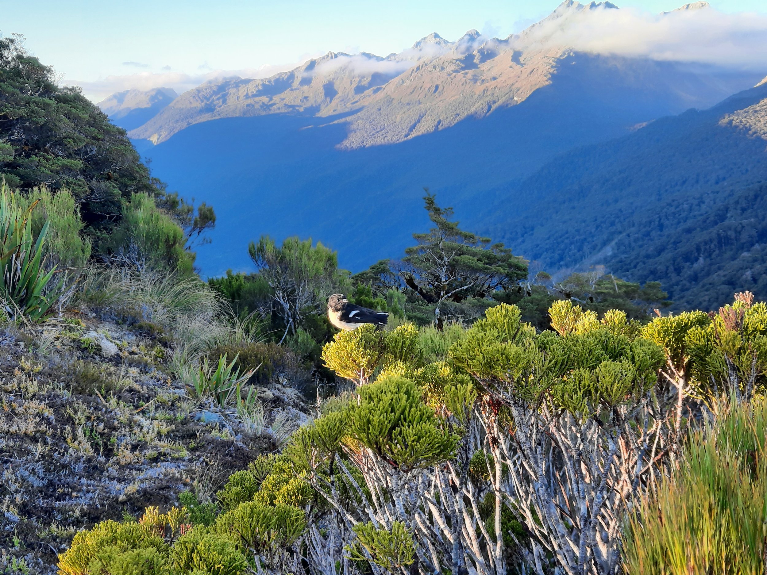
After a while walking uphill, I came to a three-way junction where the track to Key Summit diverged right, up the hill. The track became narrower and worse quality, and the forest quickly thinned to reveal the surrounding mountains (some of which overlook the Routeburn trek).
While on this track, a bird landed on my boot and pecked at it. Sweat was dripping from my forehead, as I had forgotten my sweatband that late afternoon, and was hiking quickly to finish before nightfall. But the bird didn’t seem to mind.
At the top of the northern end of the spur, the track became almost flat, and I enjoyed a pleasant walk past a tarn and amidst moss and small trees. There were boardwalks in places, because the terrain was marshy in places.
One could continue hiking south, toward Point 1086 (not pictured on my topomap screenshot) and then higher and higher in the Livingstone Mountains. I would have done so had I started in the morning, because it’s a very scenic place to hike. Instead I turned around at the end of the official track.
If 1 is an easy track, and 4 is using hands and feet on exposed rocks, I give this hike a 2 at worst, on the ascent between the three-way junction and the top of the hill.


Panorama
Hunting
The entire route is in a hunting area. Hunters are forbidden to “discharge firearms near tracks, huts, campsites, road-ends or any other public place.” I have hiked in more than 30 hunting areas, and only passed hunters three times - this wasn’t one of those hikes.
Here is the DOC topomap with all hunting areas visible.