Mt Robertson, Spring Creek, NZ


Mt Robertson (Tokomaru, 1036m) is a mountain in the Marlborough Region of South Island on which I did a medium-length hike. It can be accessed from several trailheads. My trailhead is around 15 minutes from the village of Spring Creek and 20 minutes from Blenheim. The other trailheads are further away.
Mt Robertson is the highest peak in the Robertson Range, which extends north to become the easternmost peninsula of the Marlborough Sounds. It is lower than Mt Stokes, the highest peak in the Sounds, and hundreds of meters lower than the highest peaks in the nearby Mt Richmond Forest Park. But Mt Robertson is rather more accessible to day-hikers than all of these.
Time
None of the pages linked below cover the exact route I did. I imagine that their times for this route would have been between 6 and 8 hours. The DOC signboard estimates 4 hours 30 minutes one-way from my trailhead to the summit.
Including all breaks, the hike took me around 6 hours 15 minutes. Breakdown:
around 3 hours 15 minutes to the summit, including breaks
short break at the non-scenic summit
around 2 hours 45 minutes to return, including breaks
Route

Screenshots of the NZ topographic map are licensed as CC BY 4.0 by Toitū Te Whenua Land Information New Zealand (LINZ).
Trailheads
There are two trailheads on Port Underwood Road. I used the southern one (nearer Blenheim).
There is one trailhead downhill at Whites Bay campsite. From the topomap, it appears that the Whites Bay trailhead can be used to ascend to either of the two road trailheads.
There is also a trailhead in the Pukaka Valley.
That means there are five out-and-back versions of this hike, as well as two loop versions (one using the road, and one with ends meeting at Whites Bay).
I parked a little before the trailhead here, which is the nearer to Blenheim of the two trailheads on Port Underwood Road. There was space for around three cars in a lay-by to the left (north) of the road. Whites Bay campsite probably offers more parking spaces.
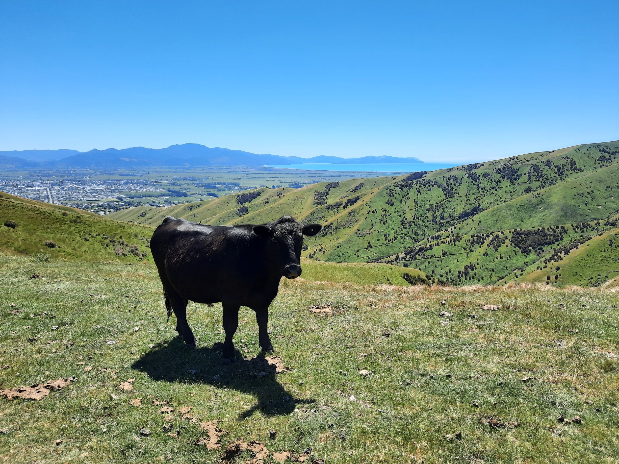
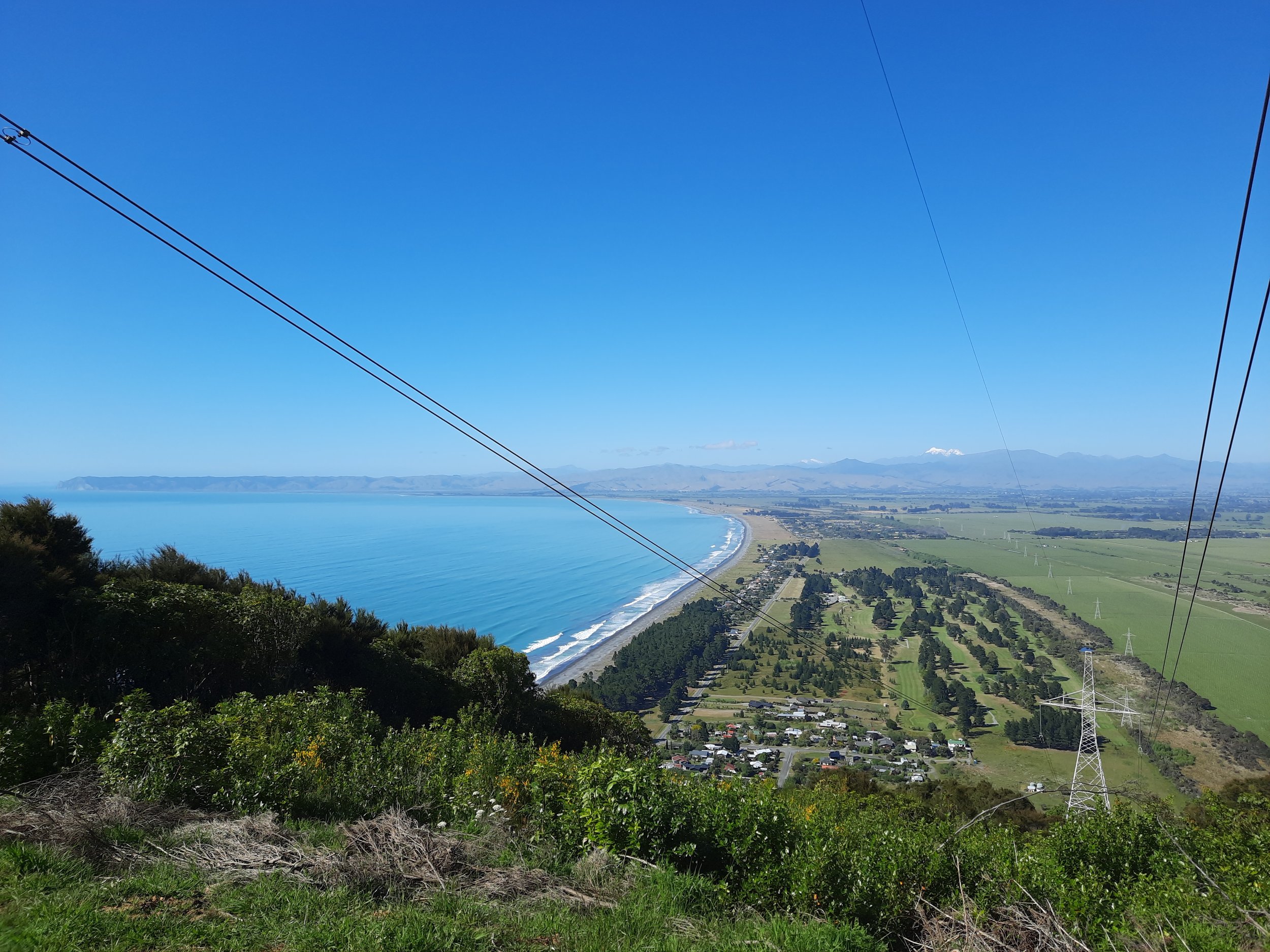
At the turnoff from the road, the hike starts on a steep, wide 4WD track. One of its corners offers the first of only two decent viewpoints toward Blenheim on the hike. Unfortunately, there are power lines in the way!
After a few minutes on this wide track, there is a turnoff into the forest up a very steep dirt slope which is less than two meters high. See photo #4 in the gallery. This is the only part of the hike where I used my hands to pull myself up. I’m surprised that DOC hasn’t made it more accessible by installing 4-5 wooden steps. The loop track otherwise seems to me like it’s a relatively friendly hike for people with only moderate flexibility.
Once in the forest, the track is only suitable to walking or mountain biking, and indeed this is one of the few hikes in NZ where I’ve passed mountain bikers. The ascent is pleasant but monotonous. There were two junctions, both of which had DOC signs indicating the correct route toward the summit. One was for Pukaka Valley, while the other was the three-way intersection with the alternative, northern ascent track.
Around 35-40 minutes below the summit is the only good view of the hike, with a good vista to the south and a more obstructed vista to the north.
At the summit, there is a white radar installation that resembles an enormous golf ball. The wooden platform attached to it is a good place to sit. There are no views over the trees! This summit is an obvious candidate for a wooden platform offering views over trees, such as that on Kakepuku Mountain in Waikato. Perhaps the radar maintainers have refused permission for such thing. (The sooner hikers get bored and leave the summit, the less likely they are to throw things at the enormous golf ball?)
If 1 is an easy track, and 4 is using hands and feet on exposed rocks, I give this track a 2 at worst, apart from the momentarily challenging entry into the forest which is more like a 3. Most of the track is a 1.


Hunting
Except for a small area at and around the summit, the entire route is in a hunting area. Hunters are forbidden to “discharge firearms near tracks, huts, campsites, road-ends or any other public place.” I have hiked in more than 30 hunting areas, and only passed hunters twice - this wasn’t one of those hikes.
Here is the DOC topomap with all hunting areas visible.
Other pages about this hike
https://www.alltrails.com/trail/new-zealand/marlborough/mount-robertson-track (starts lower than I did)
https://www.alltrails.com/trail/new-zealand/marlborough/mount-robertson-via-mount-robertson-loop-track (loop, rather than out-and-back)
https://www.wildthings.club/trails/marlborough/blenheim/the-grand-gromlet-tokomaru-mt-robertson-circuit/ (most detailed description)
https://www.waimeatrampingclub.org.nz/reports-news/trip-reports/trip-reports-list/346-mt-robertson
Local history
https://storymaps.arcgis.com/stories/f5e57832b86649c4b90e08b627b8c96a
https://www.marlboroughonline.co.nz/marlborough/information/geography/coastal-areas/port-underwood/
https://nzetc.victoria.ac.nz/tm/scholarly/tei-NHSJ03_01-t1-body1-d6.html
https://natlib.govt.nz/blog/posts/the-wairau-affray-a-series-of-unfortunate-events
https://www.taic.org.nz/sites/default/files/inquiry/documents/96-006.pdf (1996 plane crash on the mountain)