Tongariro Crossing, Tongariro, NZ

Tongariro (Alpine) Crossing is a long hike on the broad Mt Tongariro in Tongariro National Park, which lies on the boundary of the Waikato and Manawatu-Whanganui regions of North Island. It is about 25 minutes from the small town of National Park (Waimarino).
The crossing’s normal starting point is Mangatepopo parking lot, and the other trailhead is Ketetahi parking lot. Mangatepopo is at a higher elevation, thus starting there involves less elevation gain.
Both parking lots have a 4-hour time limit, which DOC enforces to discourage parking. (The exception is for people who buy a pass to stay in a hut, or go camping.) Most hikers get dropped off at Mangatepopo and picked up Ketetahi. There are several shuttle bus companies which do this, some starting quite early in the morning.
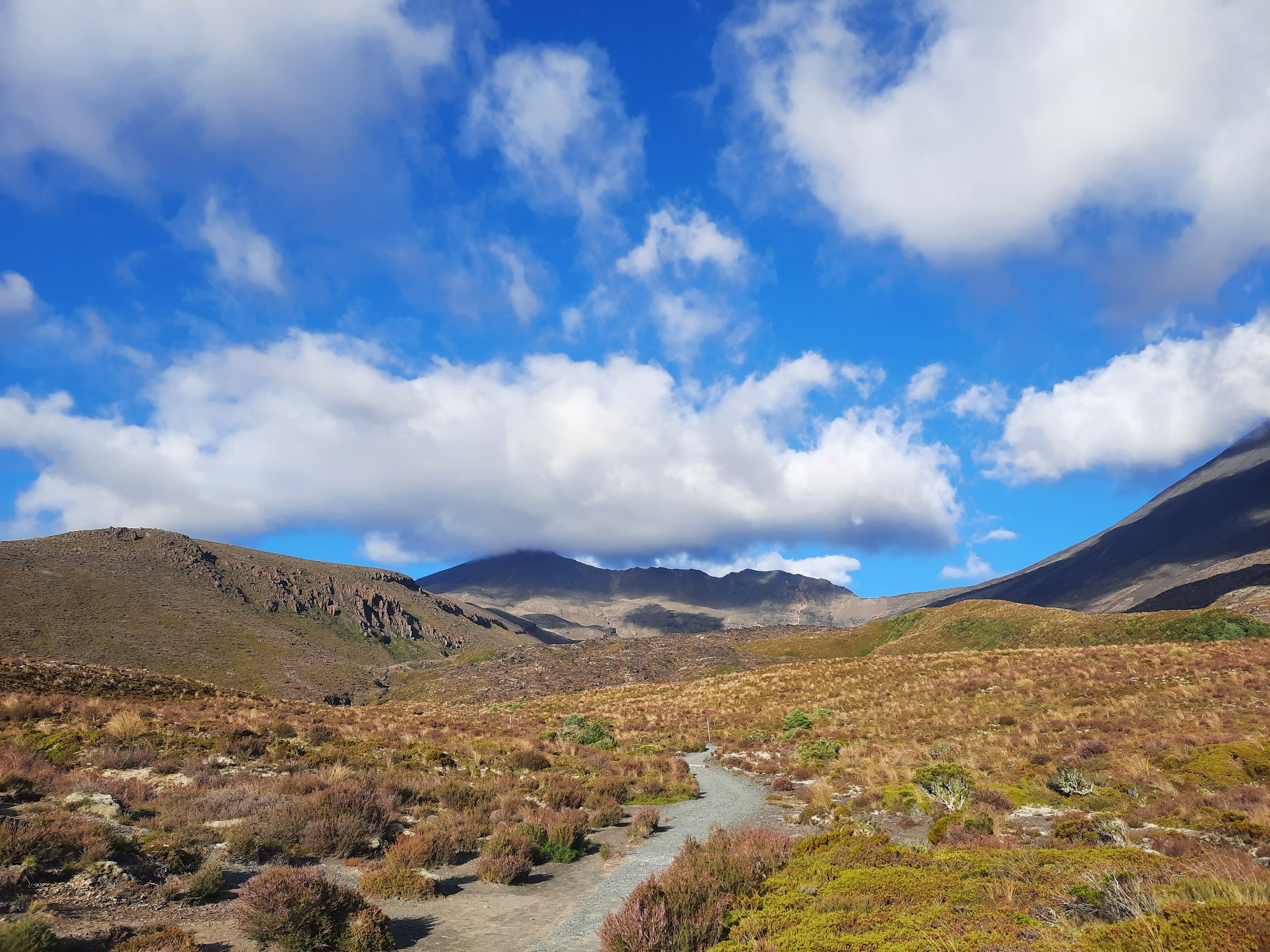
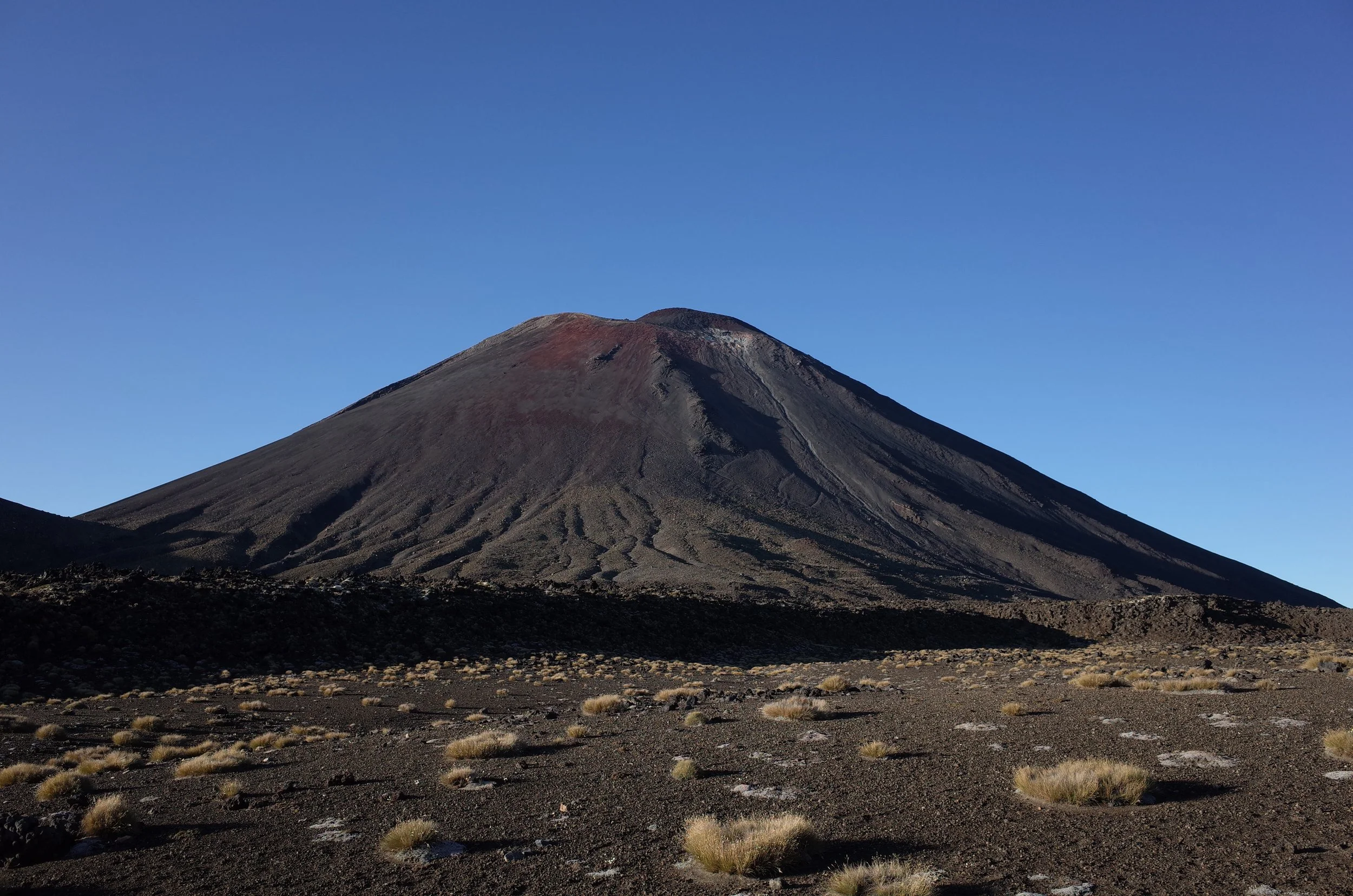
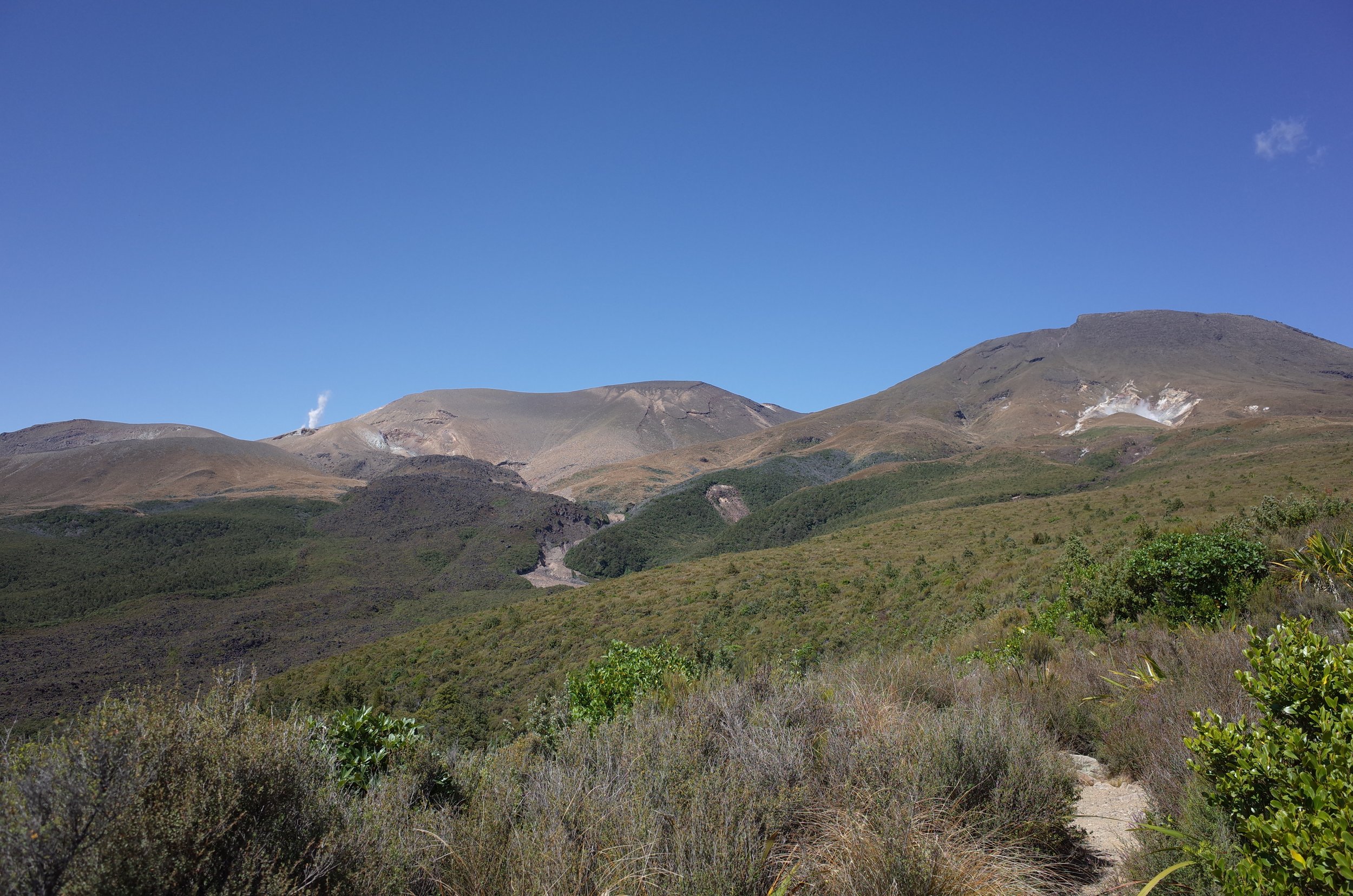
The route passes between the summit of Mt Tongariro (1967m) to the north and the imposing cone of Mt Ngāuruhoe (Mt Doom in the Lord of the Rings films; 2287m) to the south, both of which are part of the same active volcano. The route does not summit either of them. The route then winds between several other volcanic features on the very broad Mt Tongariro, pictured below, as it turns northward. The highest point is at 1868m.
The obscure Te Maari last erupted in 2012, Ngāuruhoe in 1975, and Red Crater - which the crossing ascends - in 1934. A pyroclastic rock from the Te Maari eruption destroyed a hut.
Of around 194,000 annual hikers, 30 to 40 need to be rescued each year (2019).

Tongariro Crossing is in the upper half, between Mt Tongariro and Mt Ngāuruhoe.
Screenshots of the NZ topographic map are licensed as CC BY 4.0 by Toitū Te Whenua Land Information New Zealand (LINZ).
Time
DOC estimates that it takes 7-8 hours in summer, and 9 hours in winter. Including breaks, it took me around 8.5 hours.
Route
AllTrails reports 843 meters of elevation gain over 19.8km one-way.
The crossing attracts a disproportionate number of unprepared hikers, probably because of the spectacular scenery. One person I know started in the afternoon, and finished after dark. Don’t be like that person.
I started hiking around 05:40, and finished with plenty of daylight to spare. The Discovery Lodge shuttle picked me up early in the morning, and dropped me back off at the lodge.

Mangatepopo parking lot is at left (west). Ketetahi parking lot is at the top.
The purple dot is a short side-trip to Soda Springs. The green dot is the Devil’s Staircase.
The two series of small blue dots indicate the loose terrain of the ascent and descent of Red Crater.
Most of the crossing is on a well-maintained gravel/dirt track or wooden boardwalk, including the long beginning stretch. My shuttle group started in the dark and quickly spread out. I didn’t have a headlamp, so I made sure to walk directly in front of people who did. (It worked well!)
It’s possible to take a few minutes for a side-trip to Soda Springs. This should not be done in the dark because the track is nowhere near as good.
Shortly after the turnoff to Soda Springs is the foot of the Devil’s Staircase. It leads up to the South Crater. I don’t think it deserves this intimidating name. Yes, it’s somewhat steep, but I dislike bad tracks on which I might trip (common in NZ) more than I dislike exertion.
Crossing South Crater is an easy walk. At its far side begins the ascent to Red Crater. Ascending the loose terrain here was somewhat challenging.
Descending from Red Crater is also challenging. Injuries caused by carelessness/exuberance happen here. Between 2010 and 2017, 83 people needed rescue specifically as a result of slipping, tripping, or falling; 42 of those were on this short descent.
Starting at Central Crater, almost all of the rest of the track is solid and easy. The descent to Ketetahi grew tedious; it would be the best place to distract oneself in conversation with another hiker.
If 1 is an easy track, and 4 is using hands and feet on exposed rocks, I give this track a 3 on the slopes of Red Crater, a 2 at the Soda Streams side-trip, and otherwise overwhelmingly a 1.
These photos are from two different trips, so the lighting is incongruous.


Looking back down Mangatepopo valley. Mt Tongariro center-left. Skewed shape of Ngāuruhoe at right.
In Central Crater, rotating clockwise and starting facing south.
Unusual hazards
On February 27 a hiker and his partner walked off the marked track and around the edge of the top Emerald Lake after spotting a steam vent near the lake which they decided to get closer to so they could take a photo. About two metres from the top of the vent, one of the hiker’s legs dropped through the surface crust, causing burns up to his knee.
-DOC, 2020
Other pages about this hike
https://www.youtube.com/watch?v=FznzbTCtGWA (Mountain Safety Council video)
https://issuu.com/nzmountainsafetycouncil/docs/190611.msc.ins.isag-tac-discussion_ (yes, that terminal _ is part of the URL)
Soda Springs
Pages about nearby hikes
Pukekaikiore
Tongariro Northern Circuit (multi-day Great Walk)
Mt Ngāuruhoe
Tama Lakes
Taranaki Falls (no connection to Mt Taranaki, which is far away)
Seen from Whakapapa village and Taranaki Falls Loop, on the lower slopes of Mt Ruapehu
The crossing goes from right to left between these mountains:


