Woolshed Creek Hut circuit, Mt Somers village, NZ

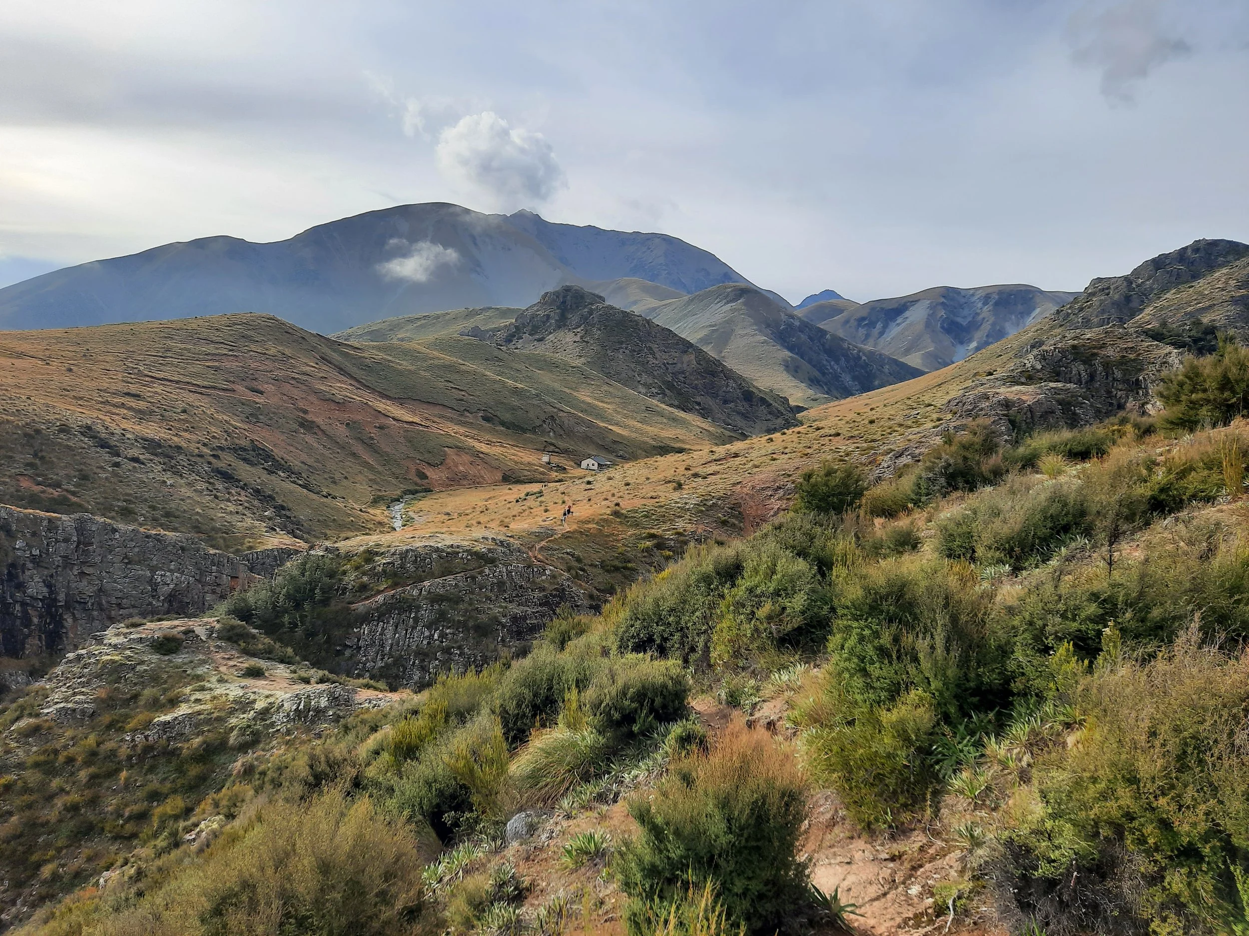
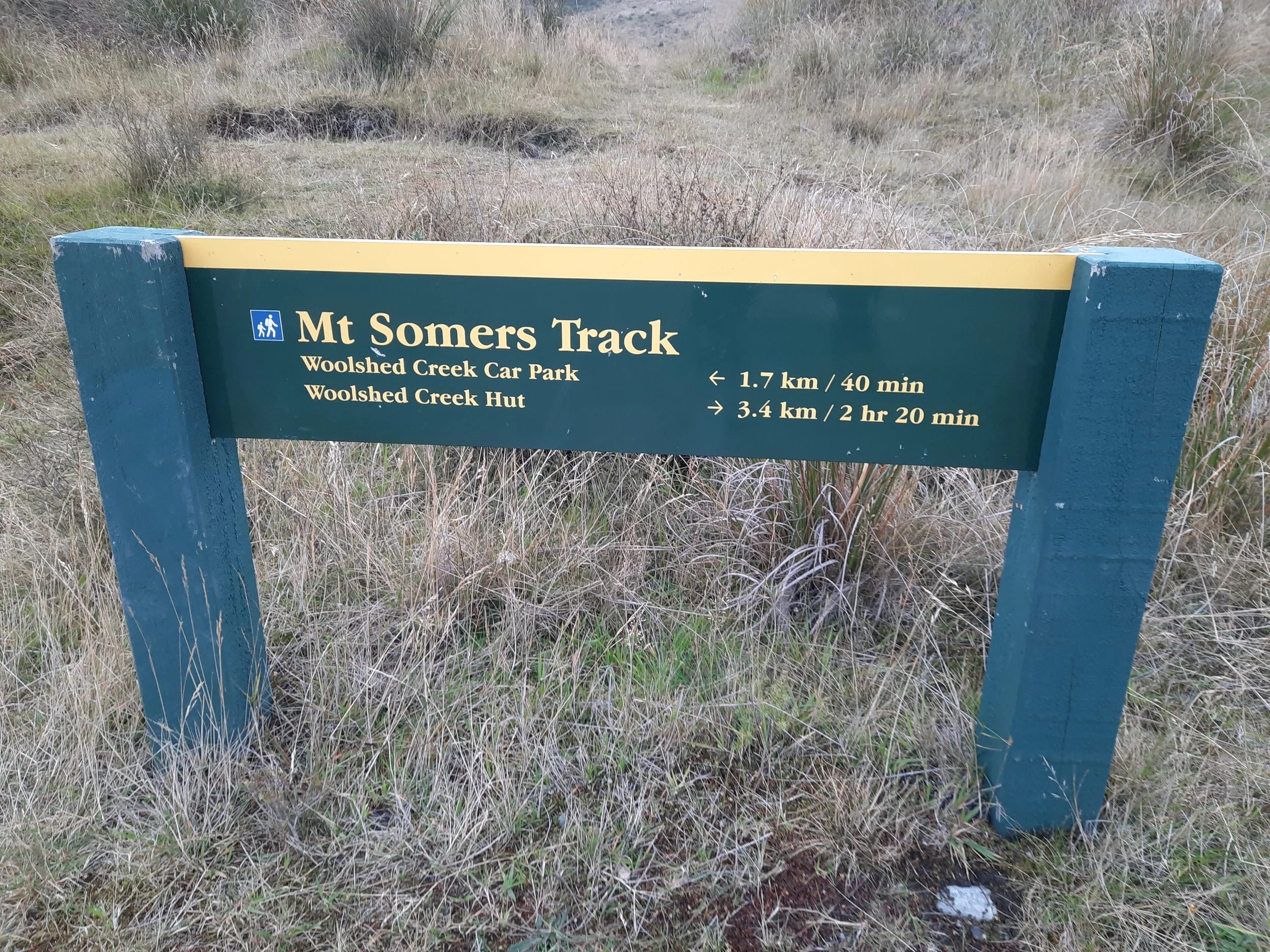
Woolshed Creek is a river in Central Canterbury, South Island, NZ, flowing between the west face of Mt Somers and the east faces of nearby hills before entering the Canterbury Plain. The Woolshed Creek Hut circuit goes north on one side of the river, crosses the river near Woolshed Creek Hut (the northernmost point), and returns south on the other side. The trailhead is 15 minutes by car from Mt Somers village.
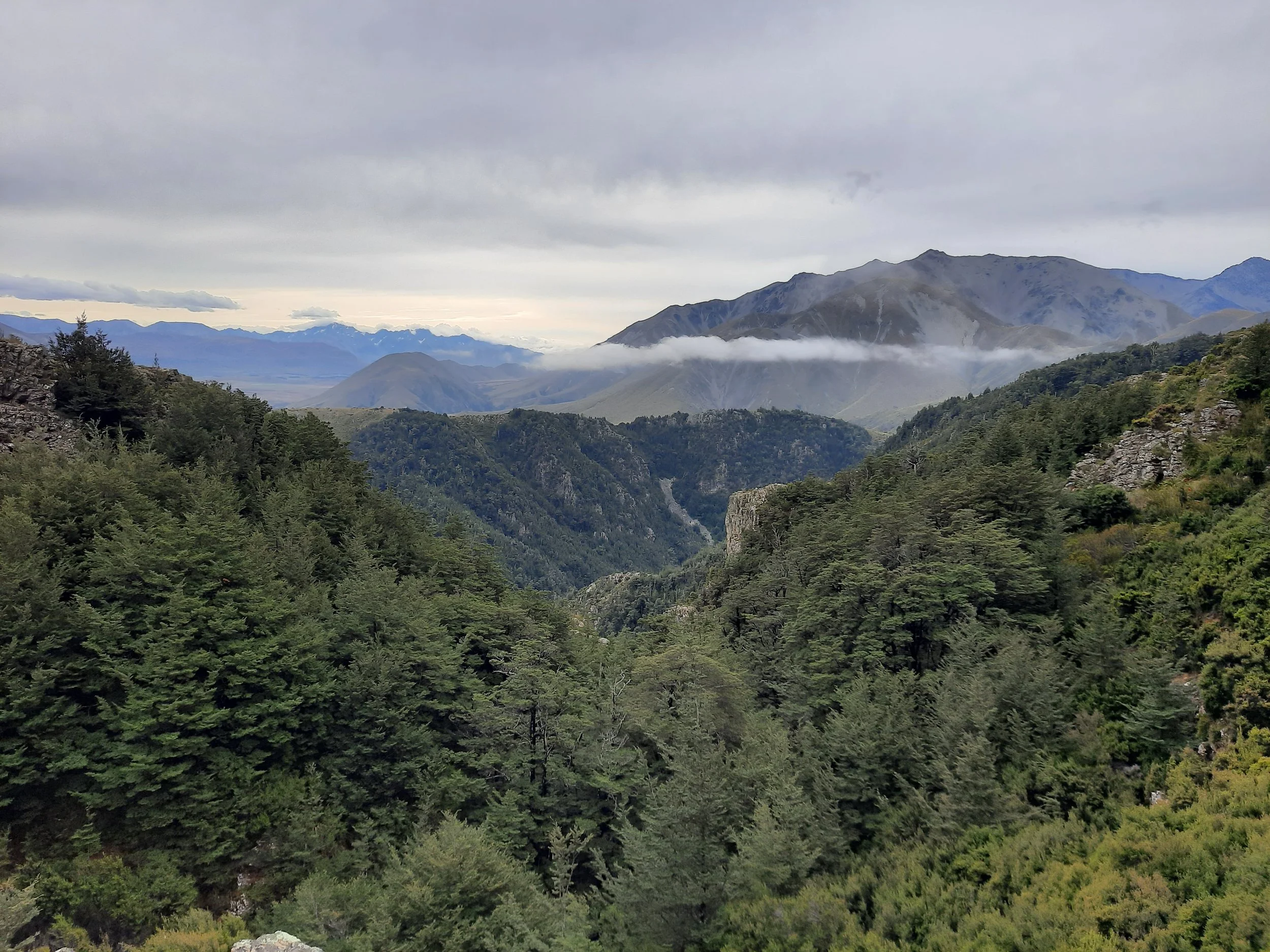
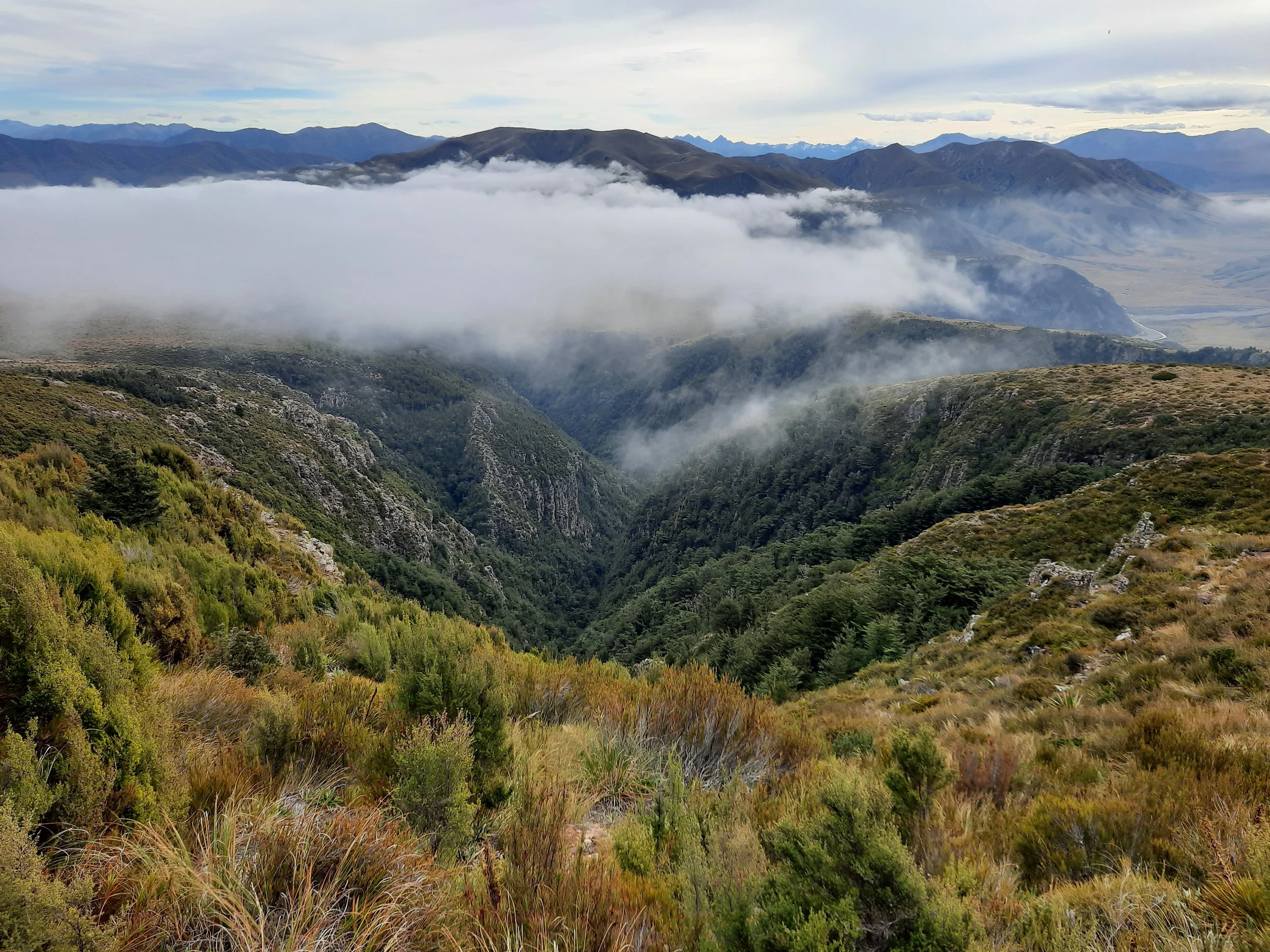
A gorge surrounds much of the creek, so Woolshed (Creek) Gorge would be a better name for day-hikers who don’t care about the hut.
The track on the east side of the river overlaps the multi-day Mt Somers Track around Mt Somers. It runs along the west face of Mt Somers.
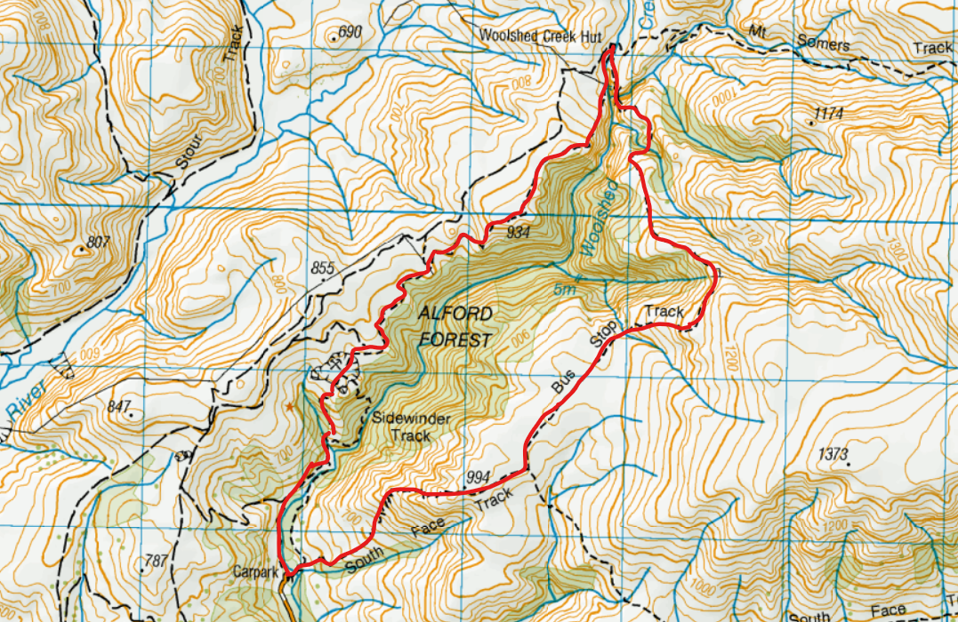
My route went counter-clockwise.
Screenshots of the NZ topographic map are licensed as CC BY 4.0 by Toitū Te Whenua Land Information New Zealand (LINZ).
Time
The counter-clockwise circuit took me around 5 hours 20 minutes.
DOC reports that the track on the west side of the river takes 3 hours one way (on what would be a clockwise route).
The Jig Is Up
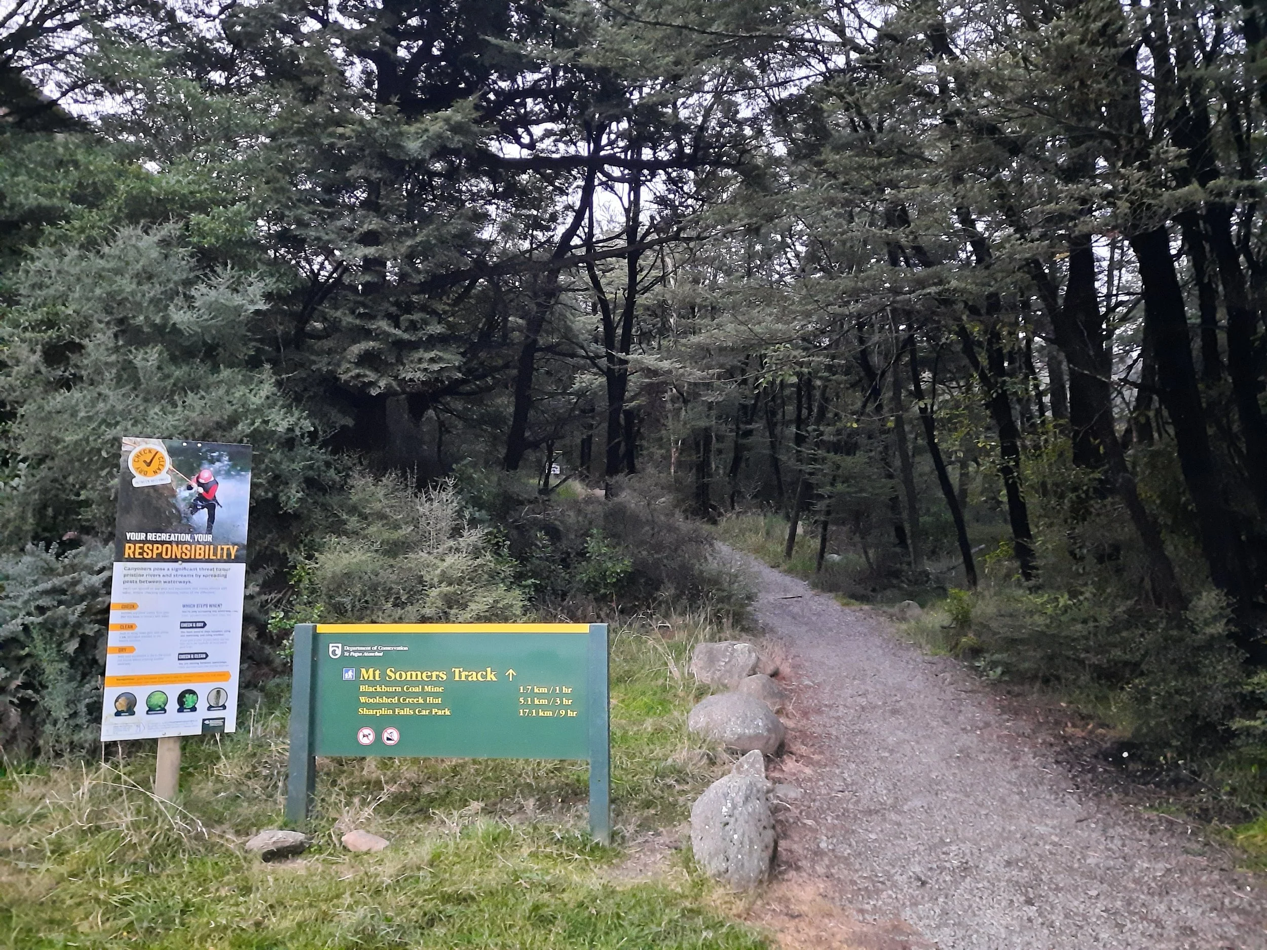
Drive uphill on Jig Rd to reach the trailhead.
The parking lot has space for 30-50 cars. I’ve read that it can fill up entirely on popular days. I chose to arrive in the afternoon on a weekend, when some hikers had already driven away.
Route
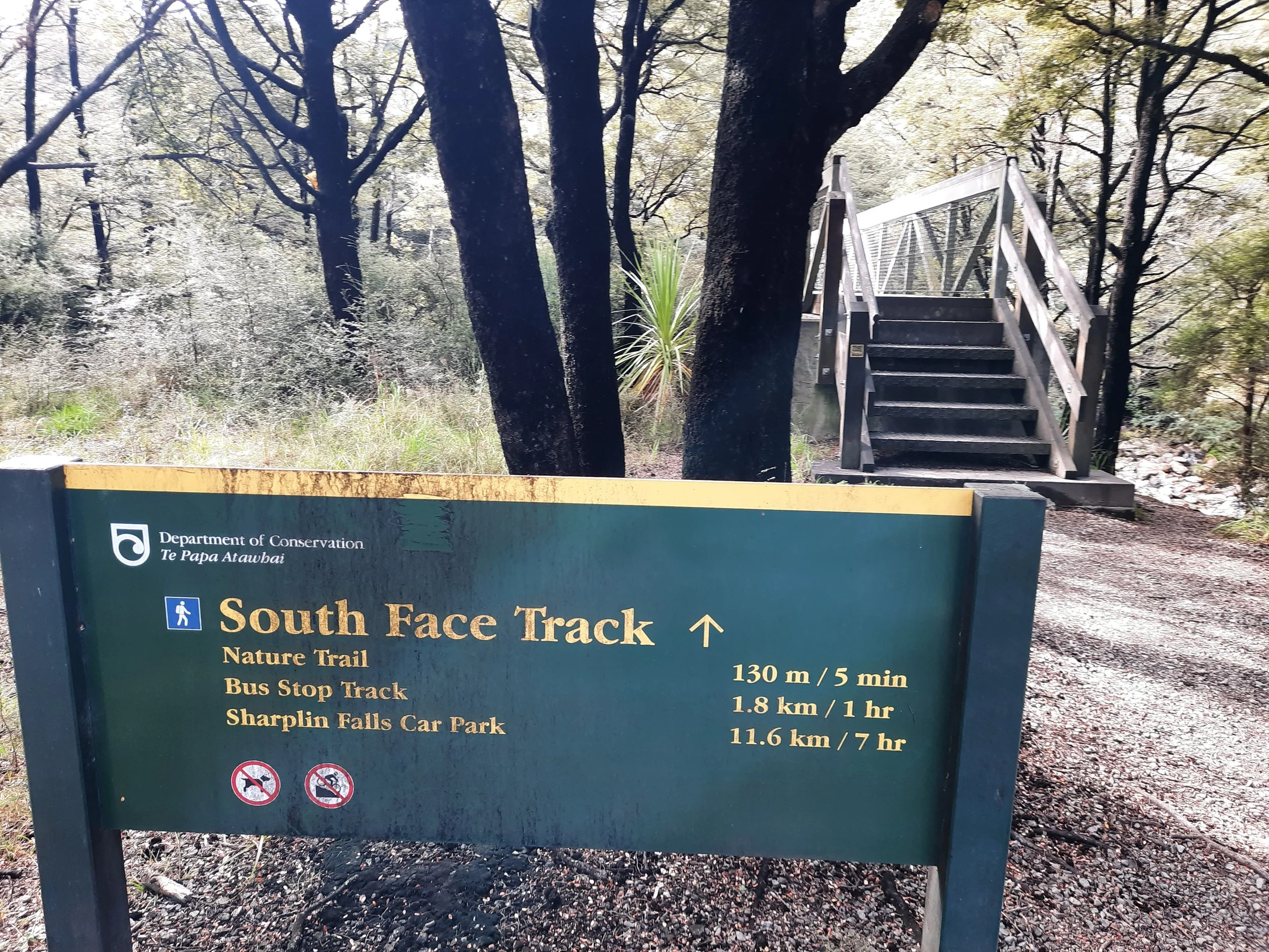
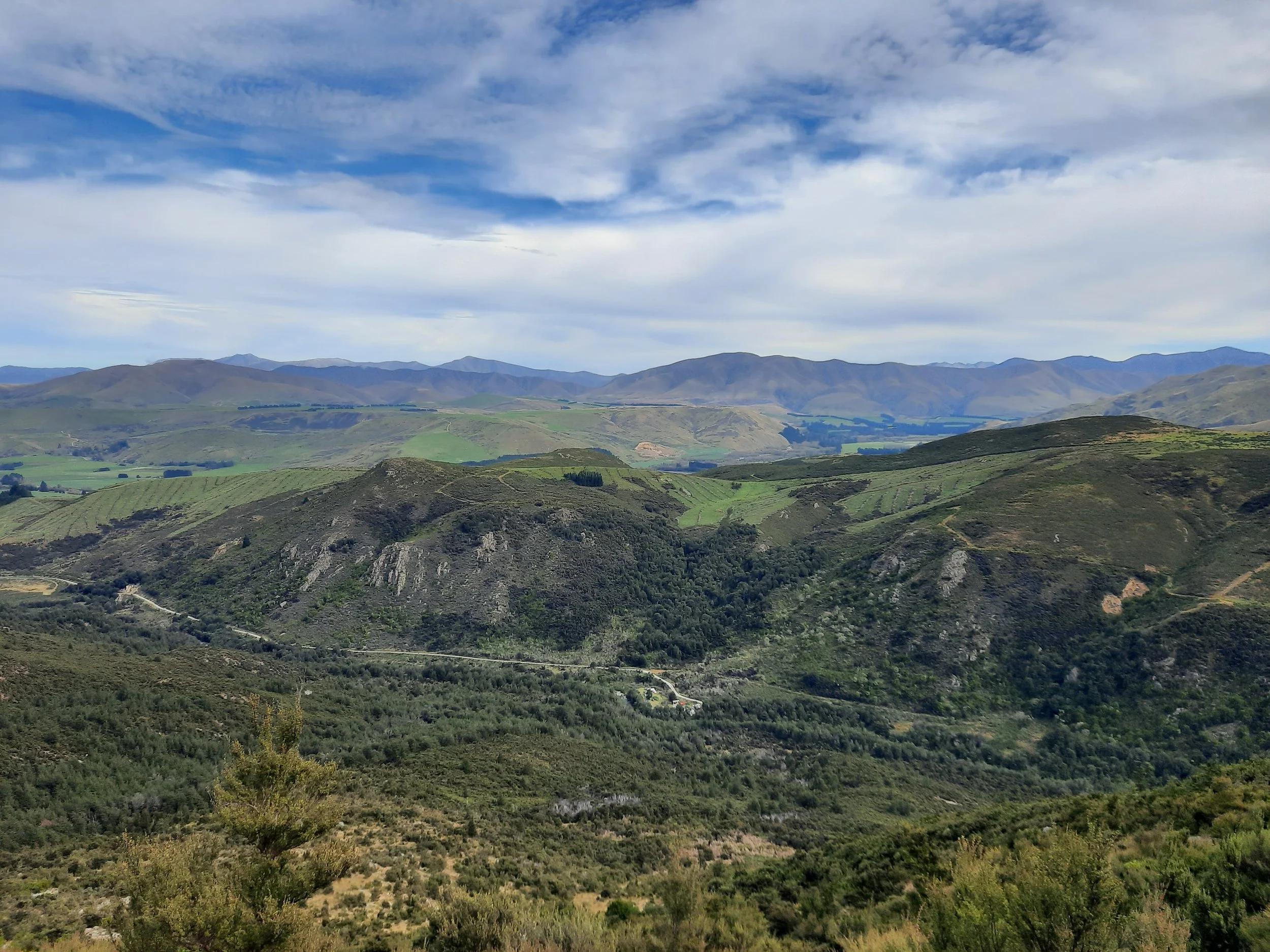
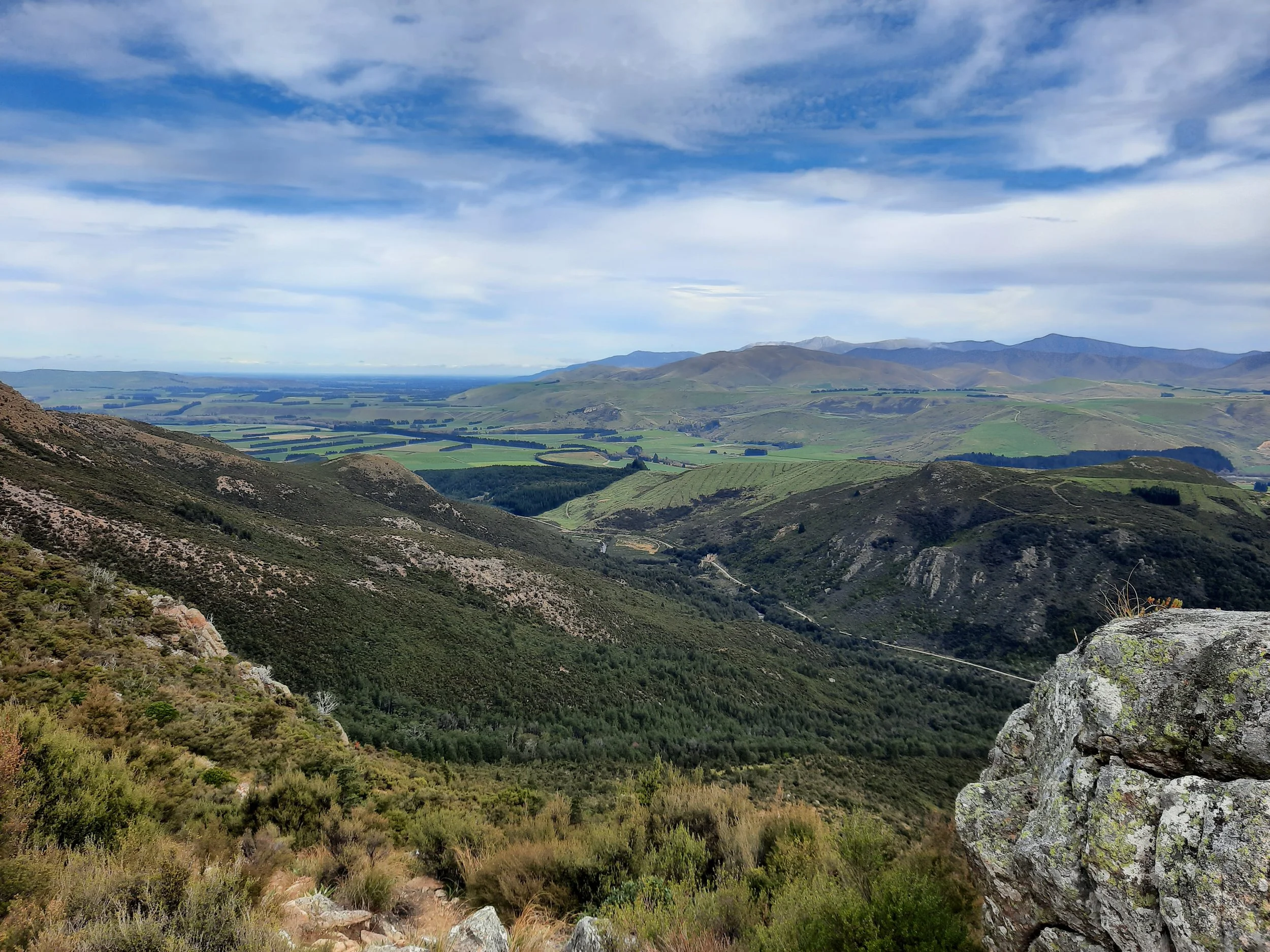
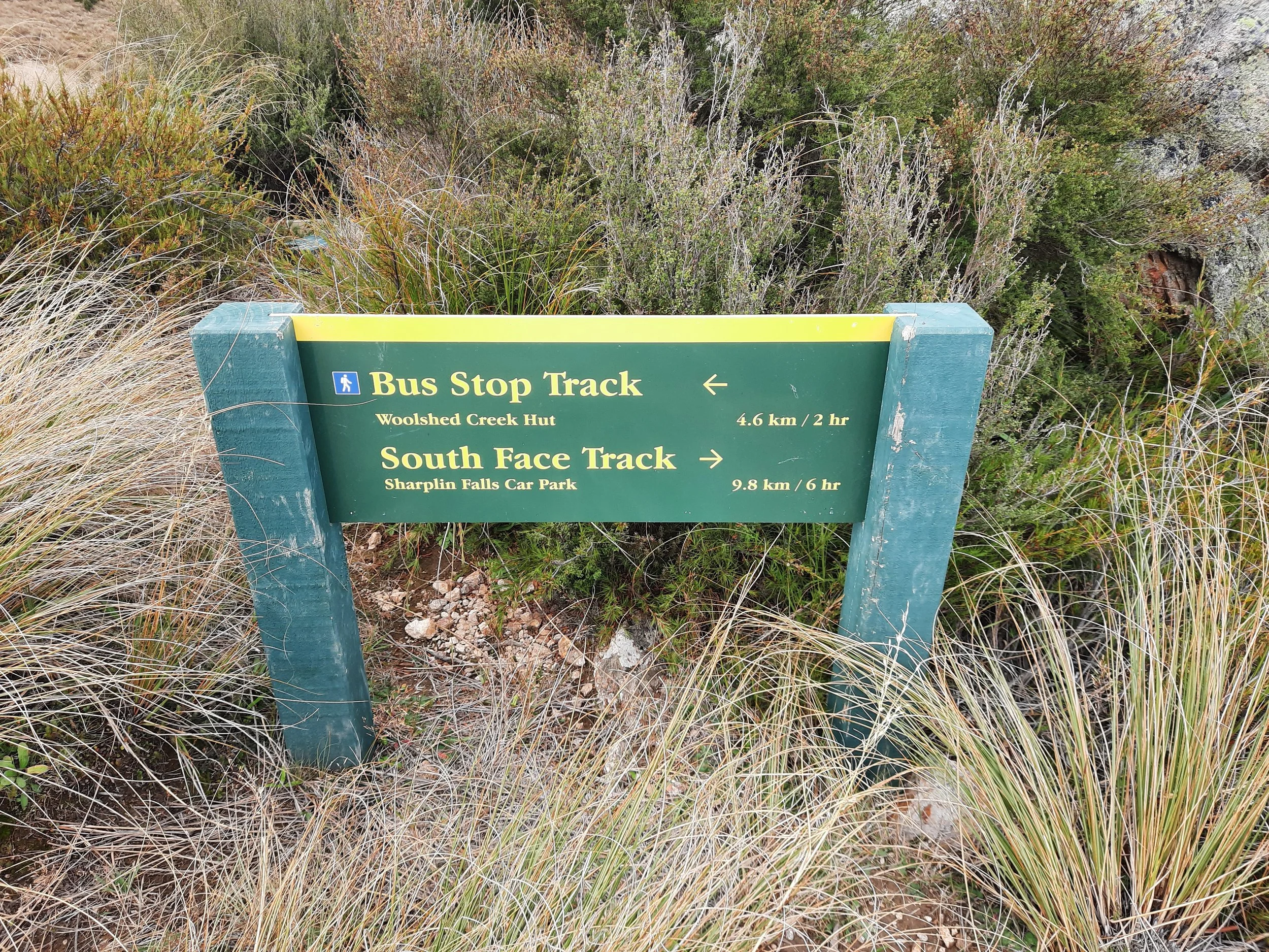
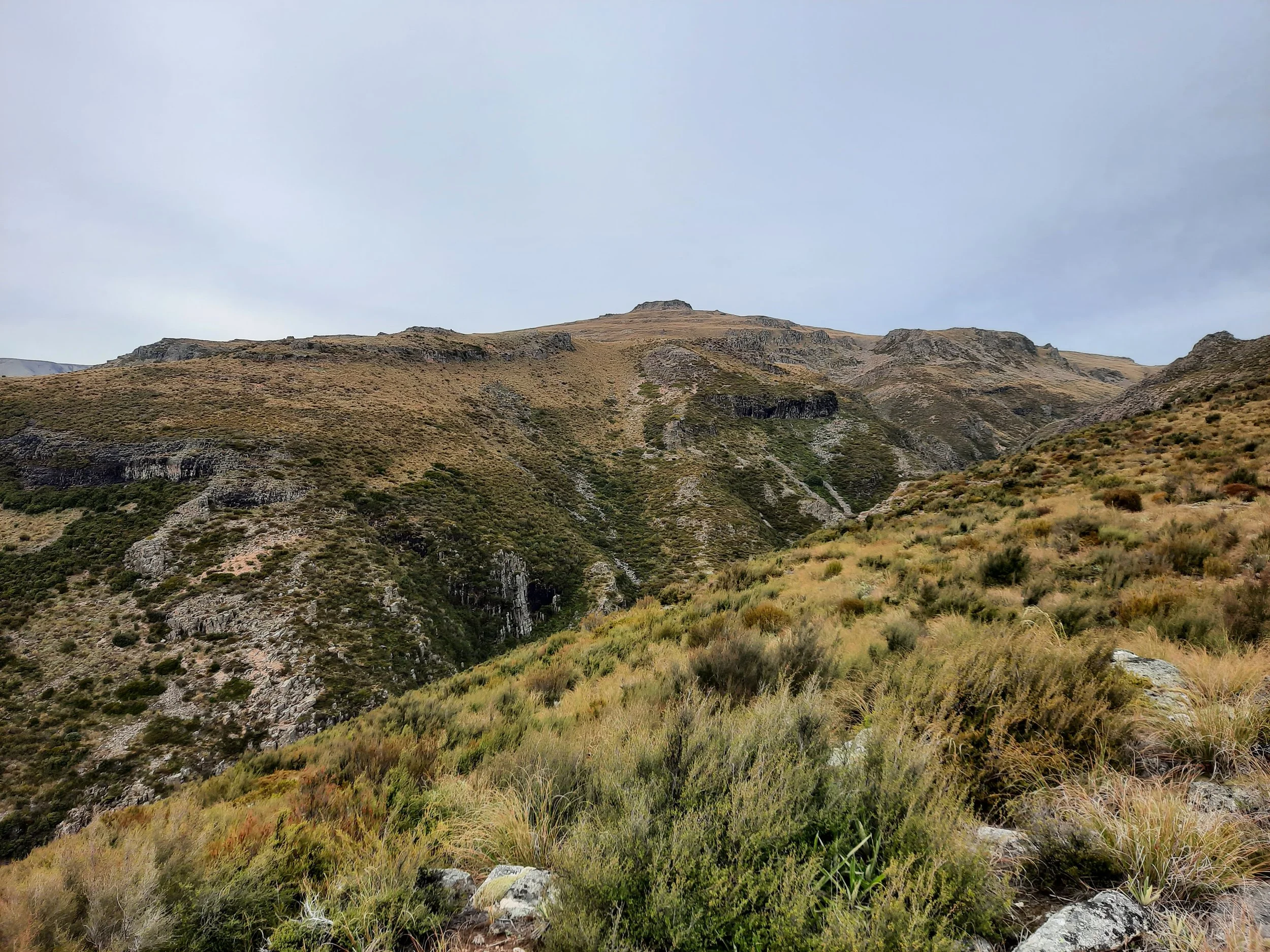
From the parking lot, I chose the counter-clockwise circuit because it put the more difficult part of the circuit - in elevation gained and in terrain - first. This meant taking a bridge over a stream to exit the parking lot. First I ascended Sidewinder Track, which was a bit tiring but straightforward. It got me out of the forest, into the tussock zone. Then I turned left onto Bus Stop Track, the first portion of which was long and gentle.
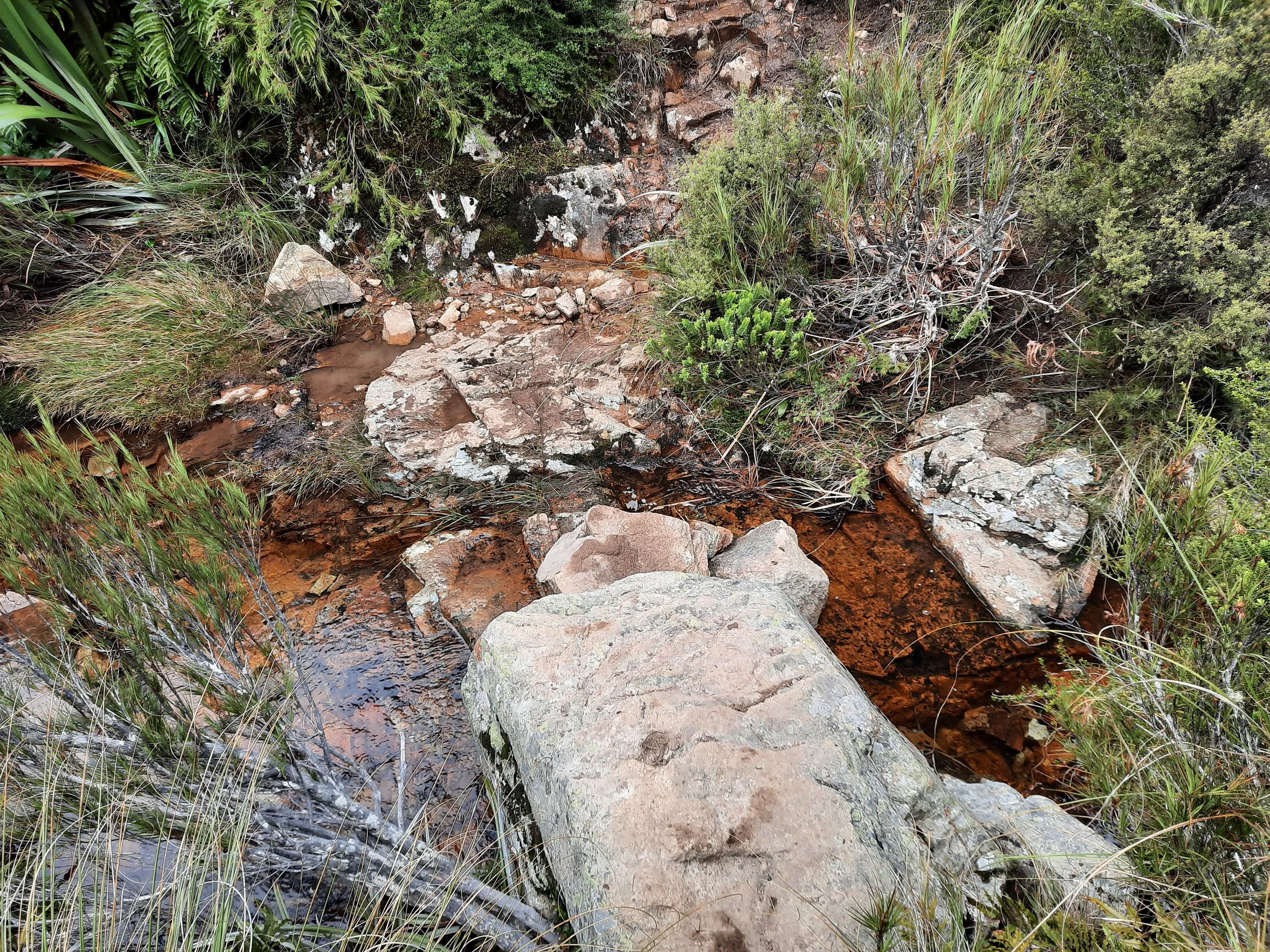
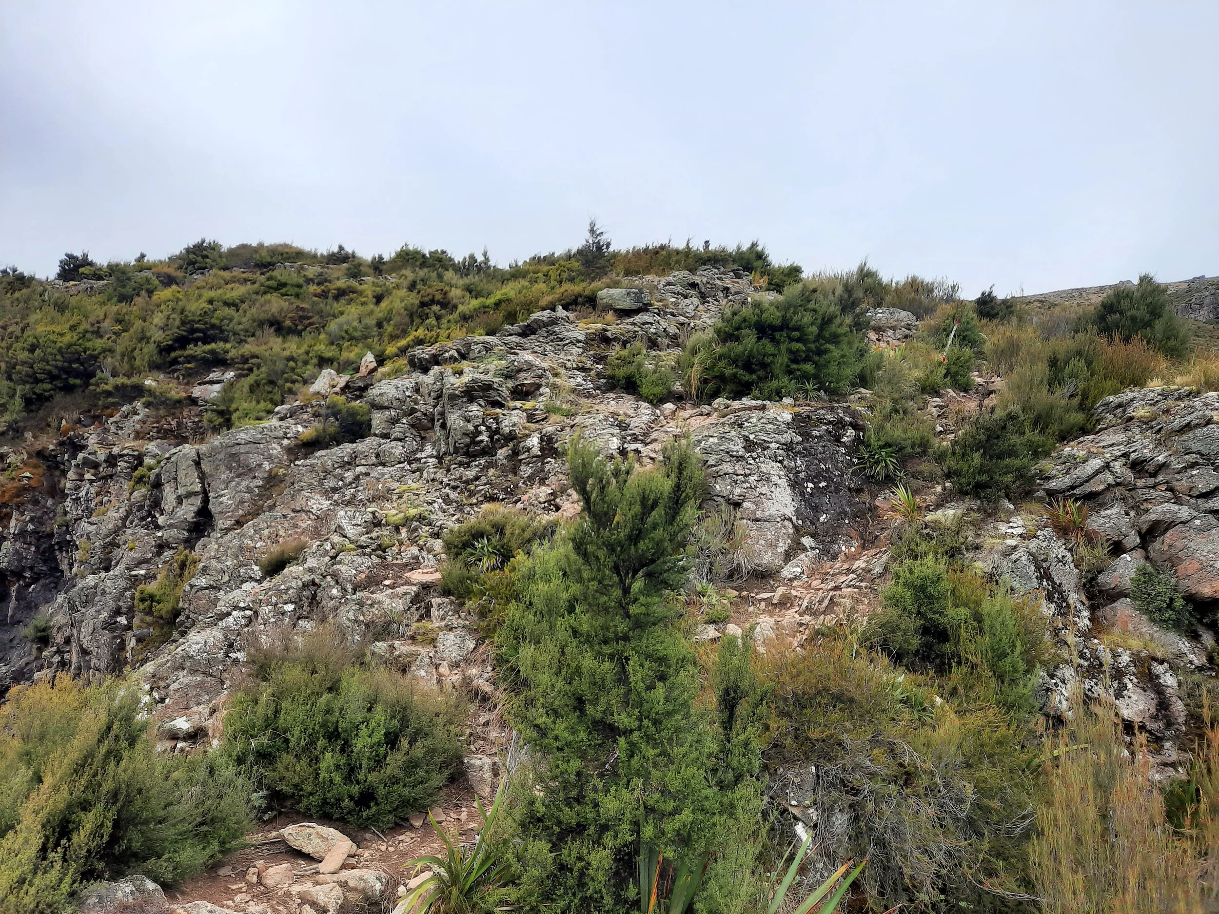
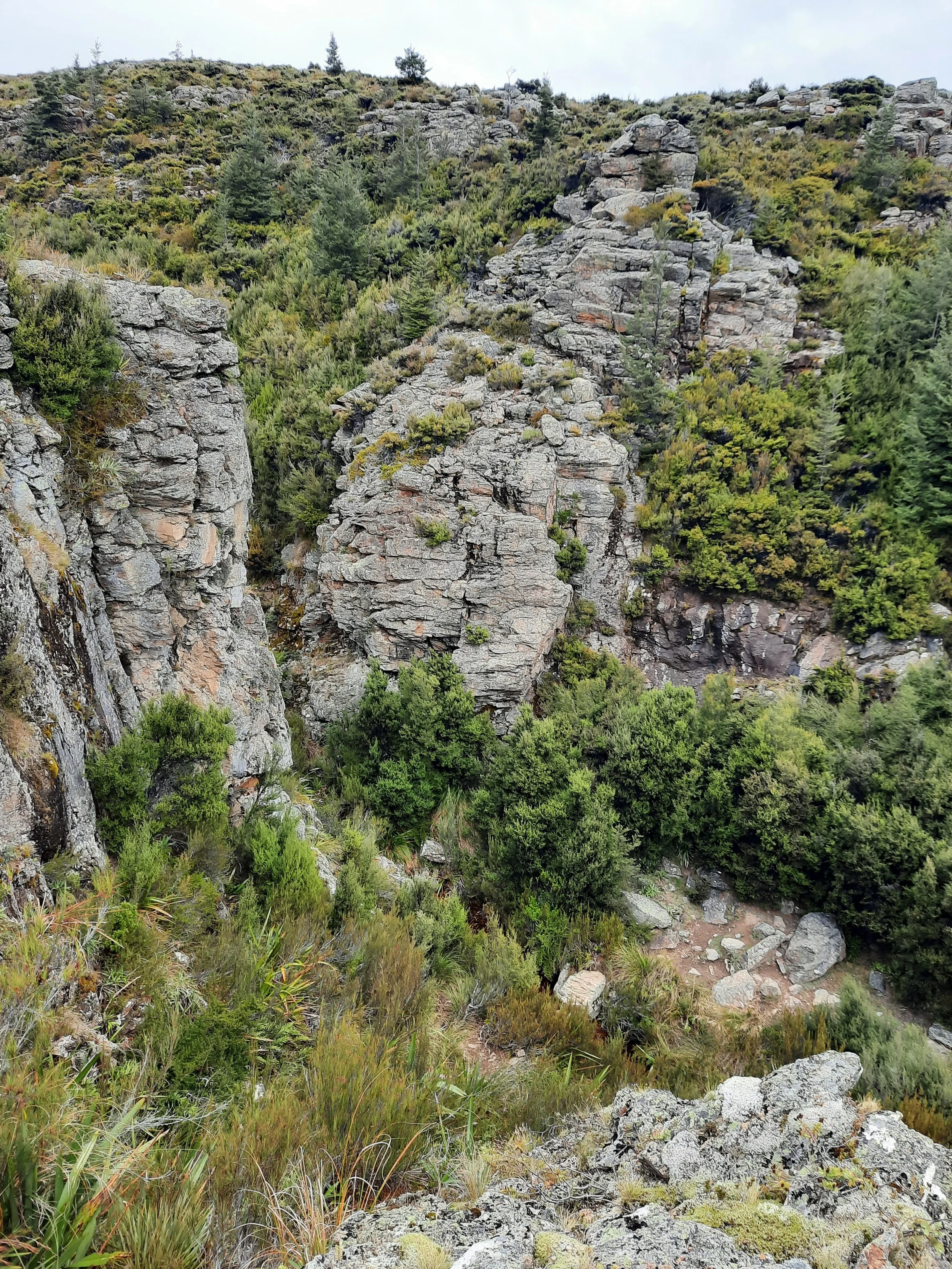
The most difficult part of the hike was shortly after crossing the first unbridged stream, as it was steep and muddy on the other side. After ascending the hill beyond the stream’s valley, the hike became easier as there is a long boardwalk section. From here, I enjoyed watching the mist rolling in. After the board walk came a red-orange rock overhand, named the Bus Stop. Reader, there is no bus save the magical one.
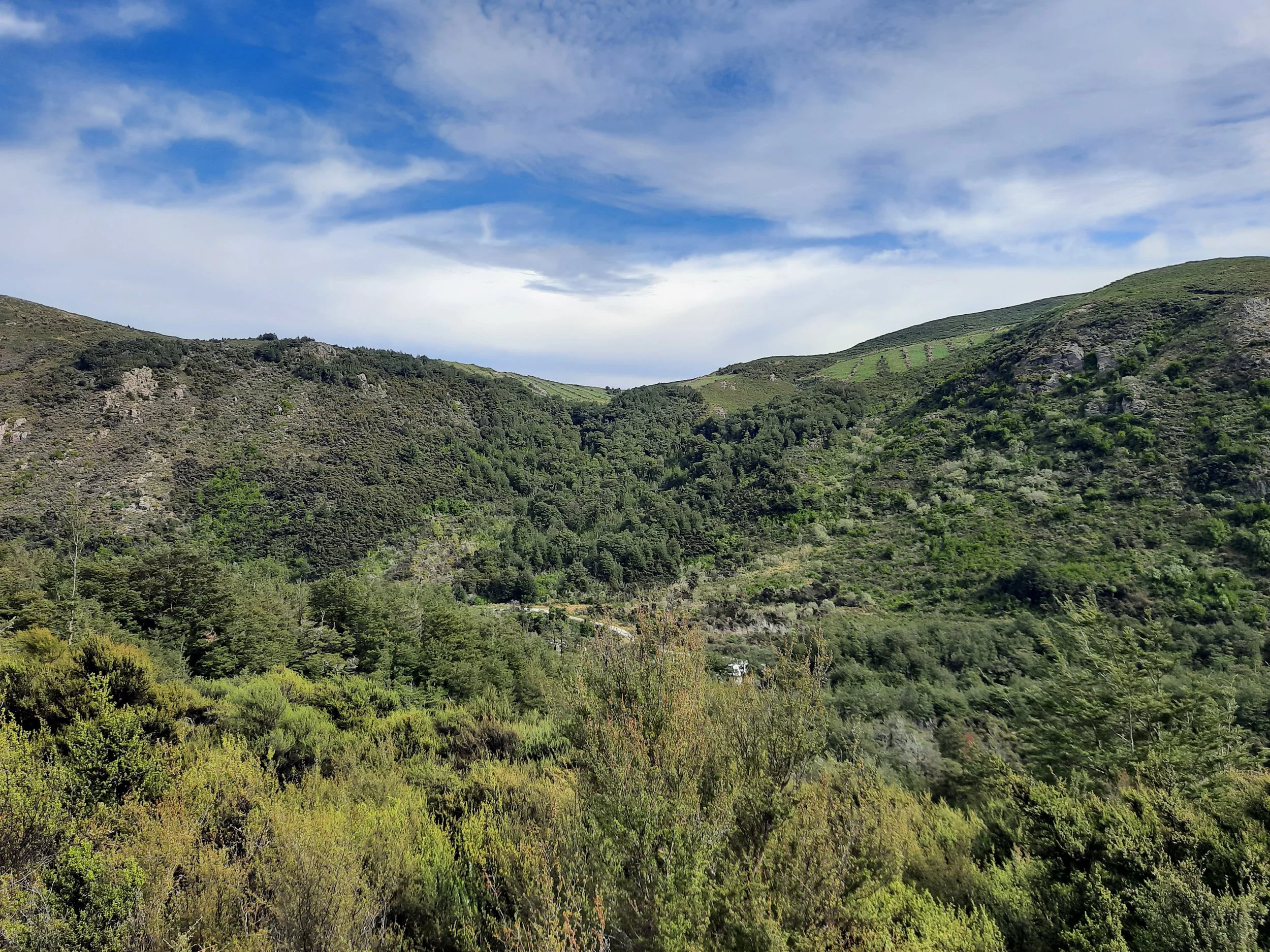
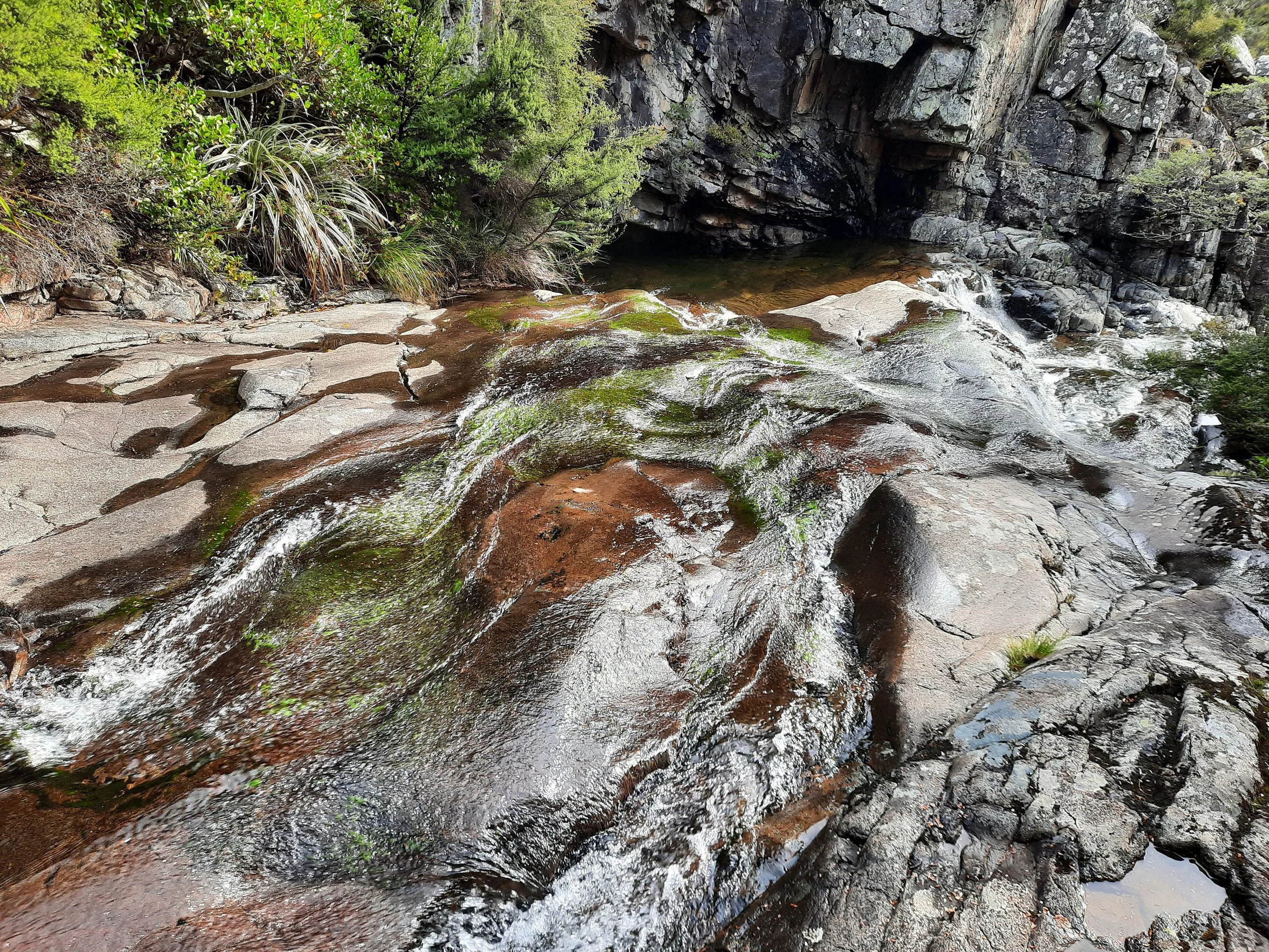
Next came a long, fairly gentle descent toward the second stream crossing, which is surrounded by a small forest. The stream crossing itself is in a narrow gorge. Before crossing, I followed a DOC sign for a short detour upstream (turning right) to see a waterfall. The pool at its foot might be called Emerald Pool.
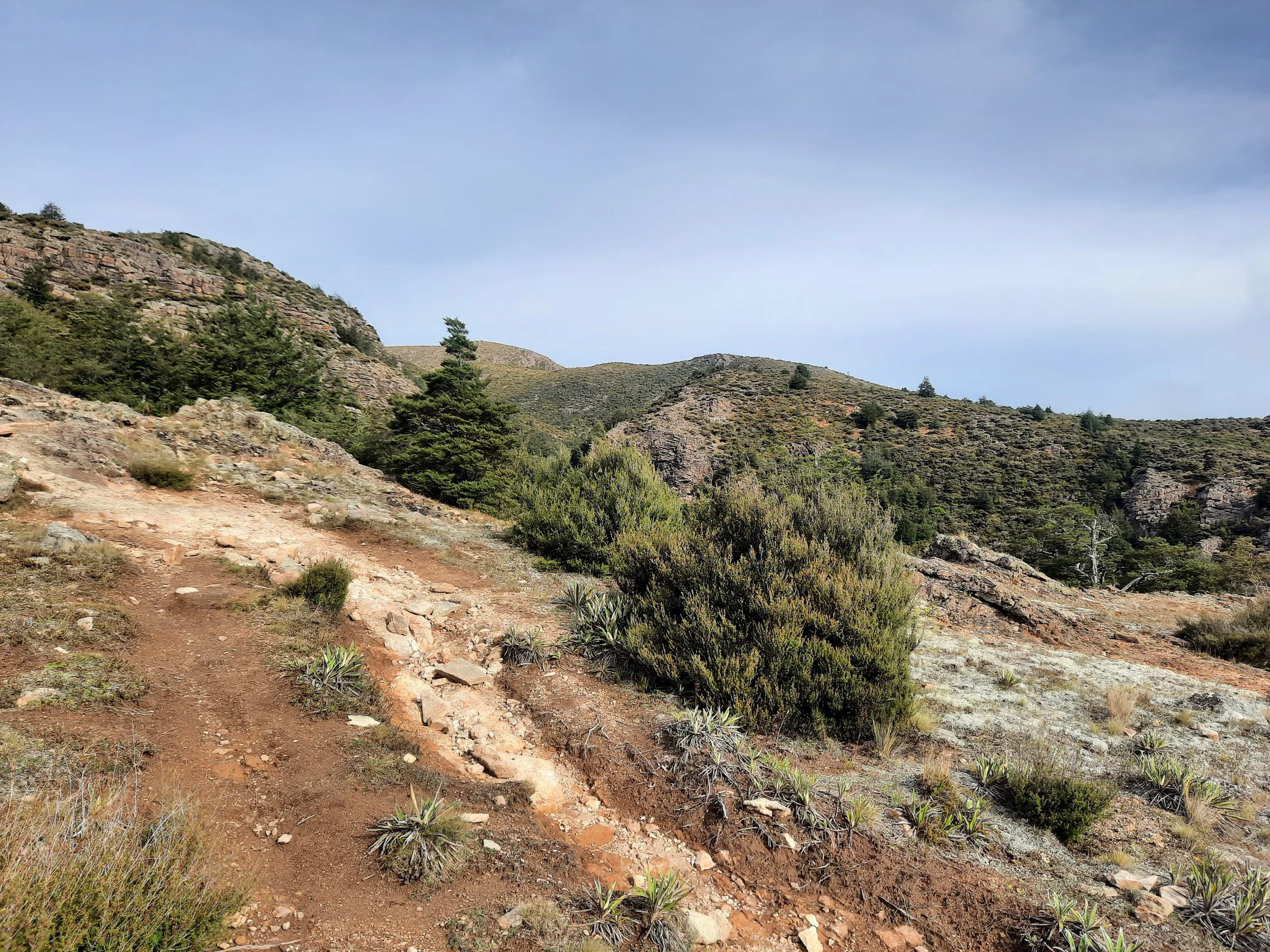
Then I retraced my steps and crossed the stream. From here there was a short but steep uphill section, after which I again exited the forest.
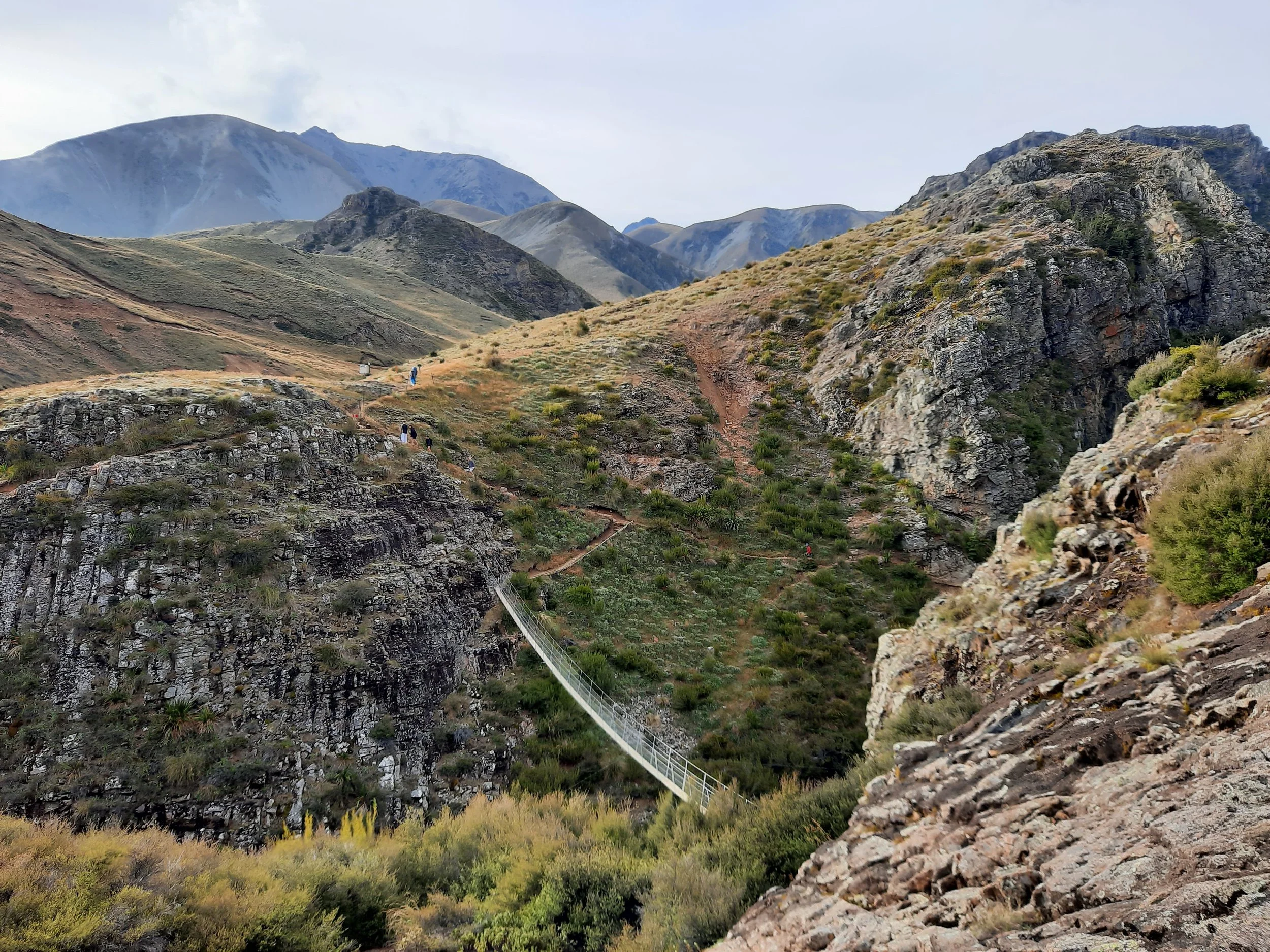
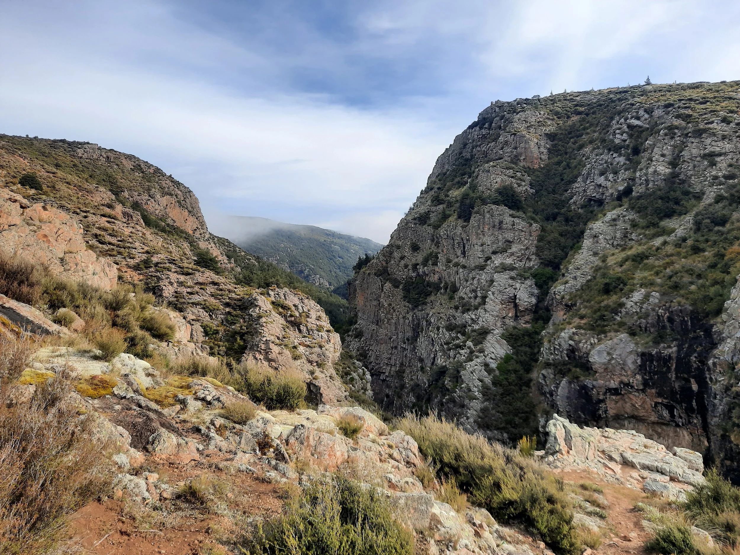
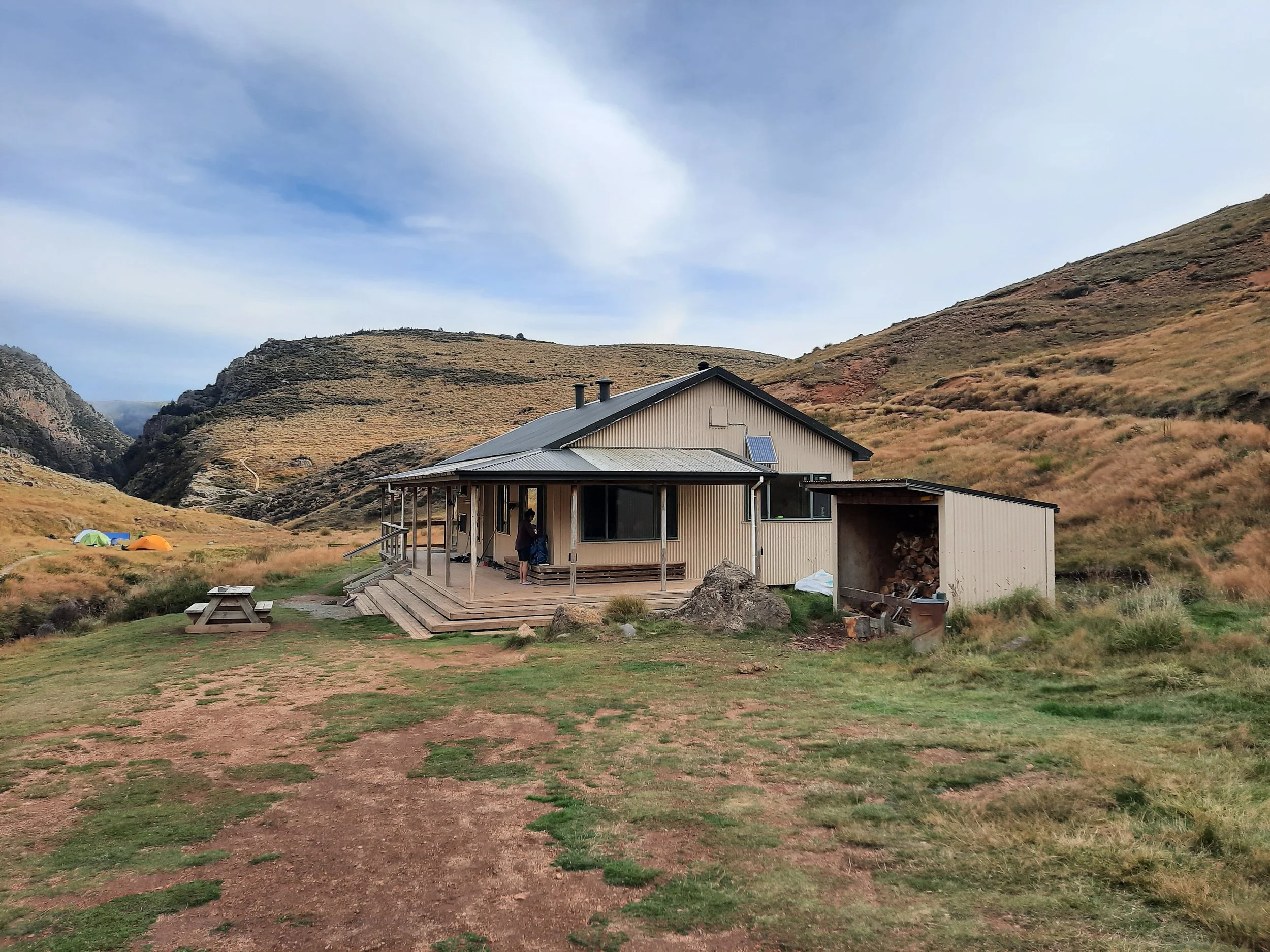
Not long after came the third waterway to cross, but here there was a bridge because the gorge would be dangerous to cross without it. Less than five minutes away, after an easy stream crossing, is Woolshed Creek Hut. There were campers with tents outside of it.
I mistakenly took the 4WD track going uphill beyond the hut for a few minutes, then crossed a tussock slope going east to get to the hiking trail on the cliff above Woolshed Creek. From there I continued ascending, not too steeply, through landscape with mostly tussock and a few trees or bushes. Eventually I crested the hill and soon began to descend. At a clearing where two tracks diverge, I kept to the right on Mt Somers Track, because I had read that the left-hand track (Sidewinder Track) was steeper.
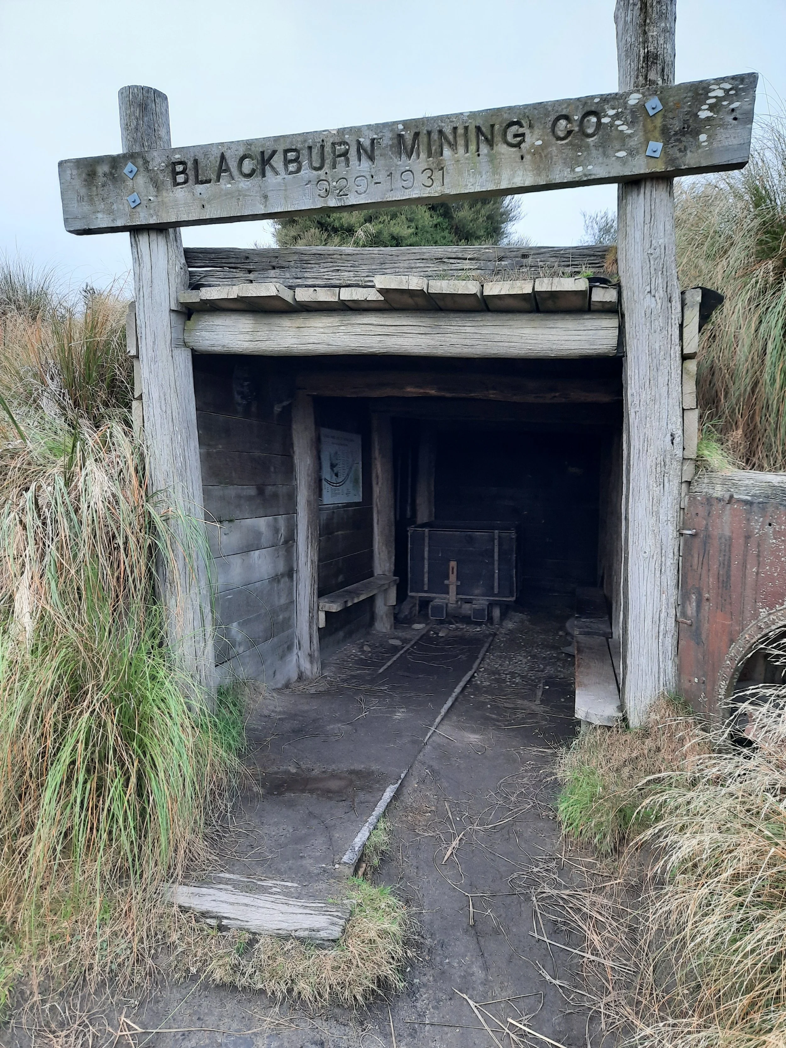
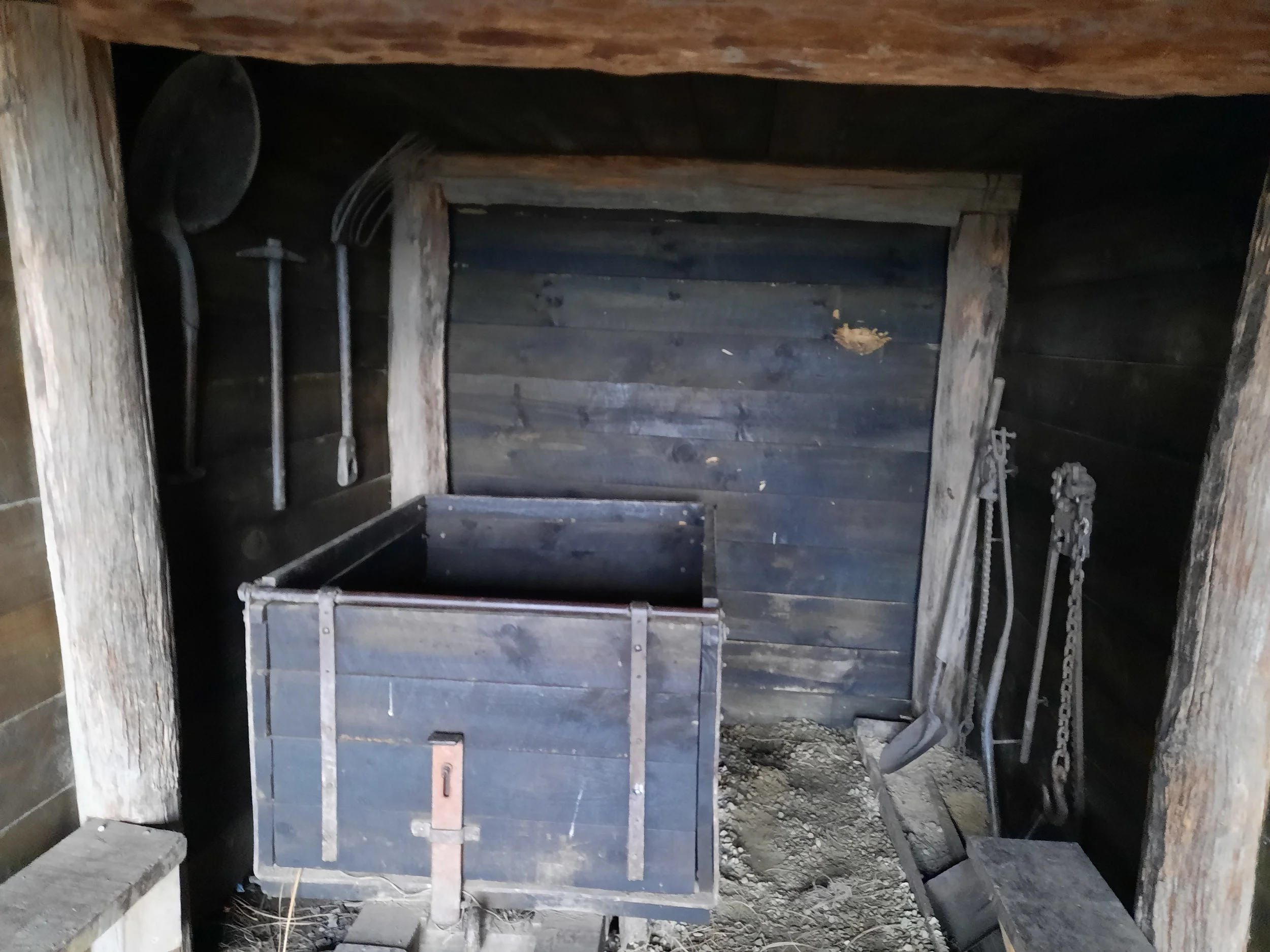
Near the divergence was an abandoned mining area, Blackburn Coal Mine, with some rusty old equipment and information placards. Kids might enjoy it. After this, the forest resumes, and I continued through forest back to the parking lot, over maybe two more easy stream crossings.
If 1 is an easy track, and 4 is using hands and feet on exposed rocks, I give this track a 3 at worst.


Hunting
All but a tiny portion of the route is in a hunting area. Hunters are forbidden to “discharge firearms near tracks, huts, campsites, road-ends or any other public place.” I have hiked in more than 30 hunting areas, and only passed hunters three times - this wasn’t one of those hikes.
Here is the DOC topomap with all hunting areas visible.
Other pages about this hike
https://hikingscenery.com/woolshed-creek-hut-circuit-mount-somers/
https://www.alltrails.com/trail/new-zealand/canterbury/mount-somers-track-via-woolshed-creek-hut (and an extra one-way portion)
booking the hut online: https://www.doc.govt.nz/parks-and-recreation/places-to-go/canterbury/places/mount-somers-area/things-to-do/huts/woolshed-creek-hut/
Pages about one leg of this hike
west leg
Nearby hikes
Mt Somers
https://www.alltrails.com/trail/new-zealand/canterbury/pudding-hill-stream-route
Mt Alford (blog post coming later this year)