Ewe Range Track, Ōmarama, NZ

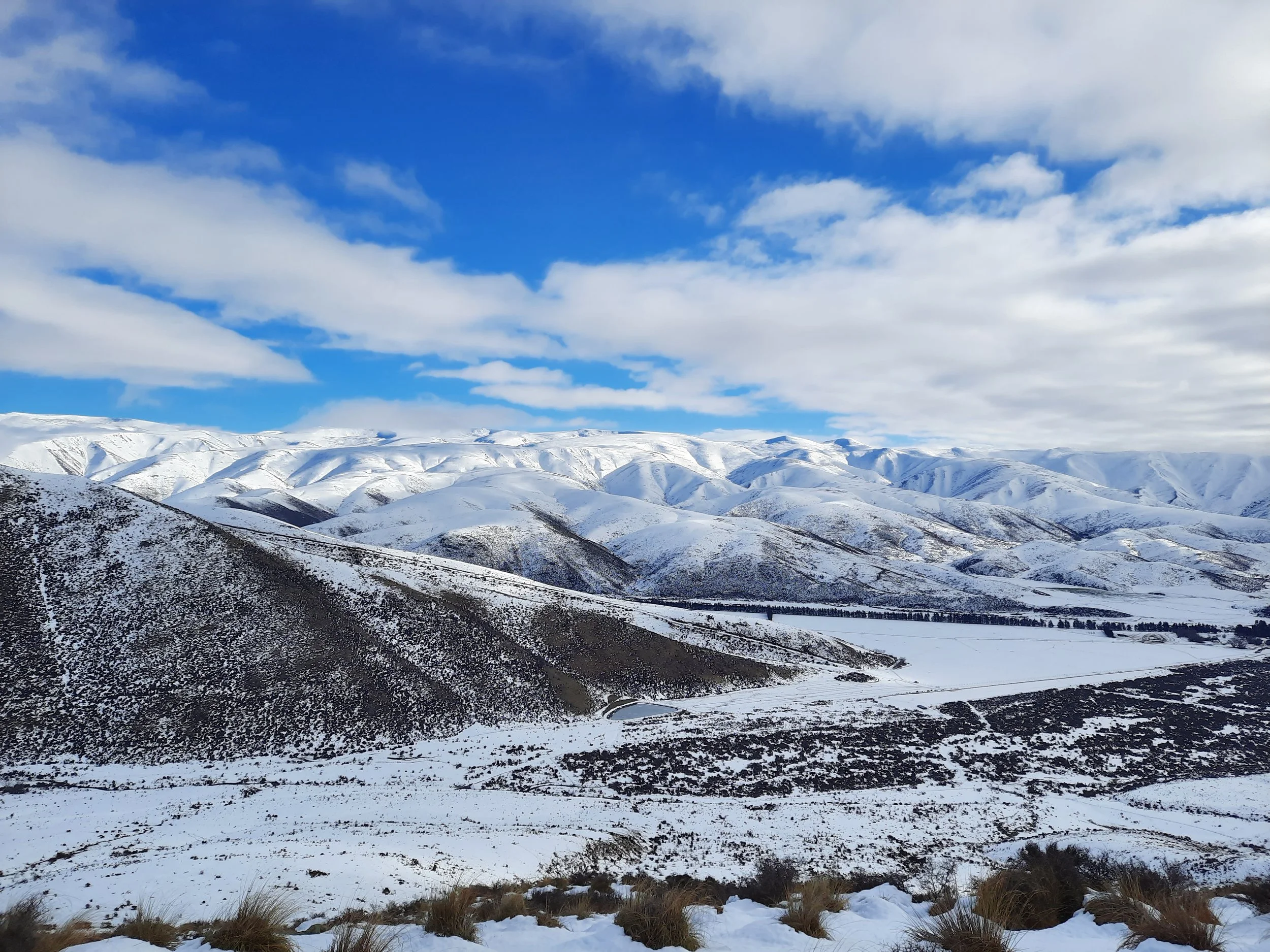
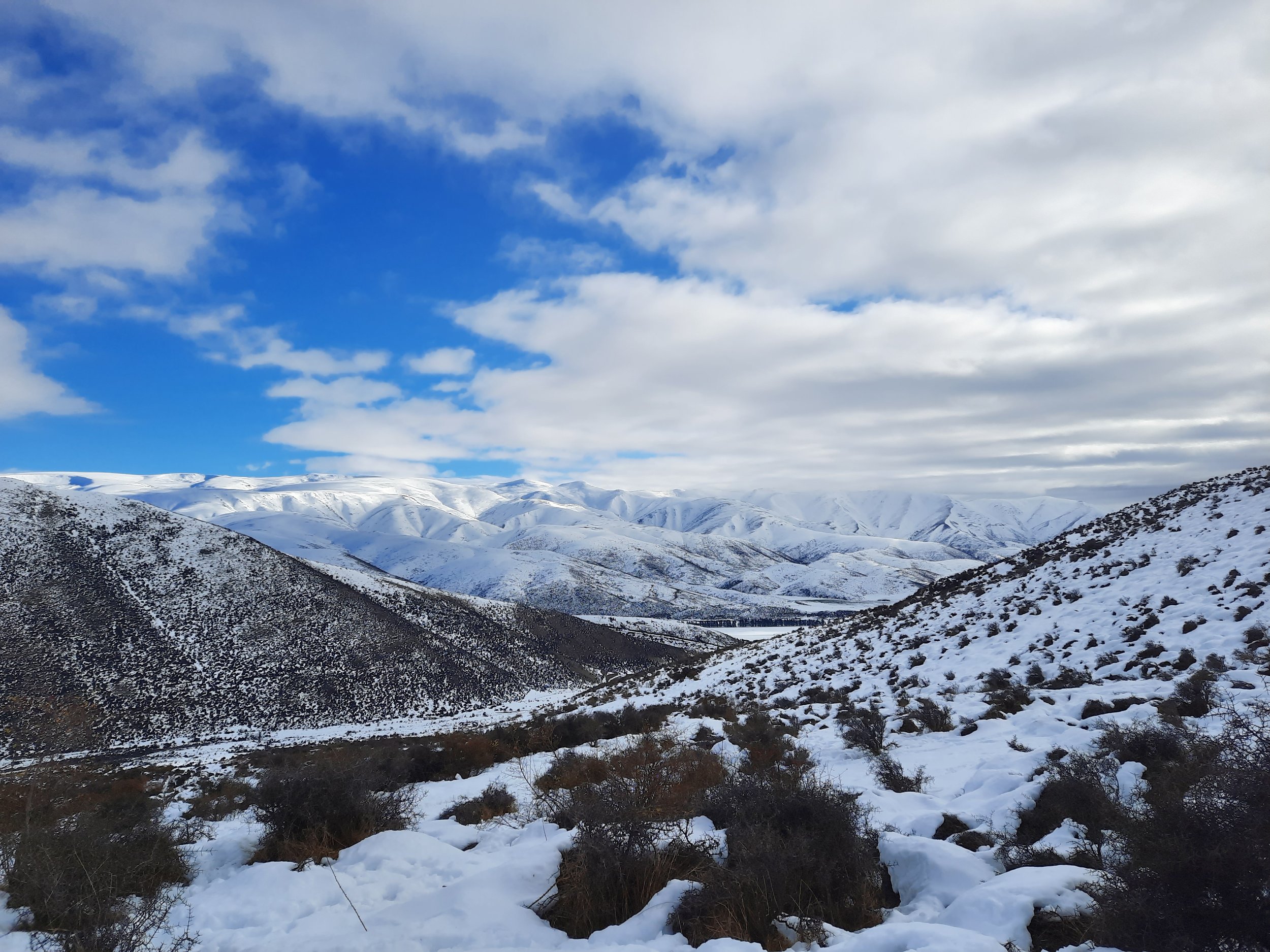
The Ewe Range is south of the town of Ōmarama, in the Mackenzie Basin of Canterbury, South Island. It connects with the Hawkdun Range, which rises above the Manuherikia Valley of Central Otago to the south.
Ewe Range Track is a farm easement that ascends on the east side of the valley of the Little Ōmarama Stream. It leads to the Oteake Conservation Area, from which multi-day routes can be followed to the Hawkdun Range and/or various other connected ranges. It is an obscure hike, mentioned on few other websites.
My hike was slow going. I turned back far below the end of the easement, after gaining about 280 meters.
Time
DOC says that it takes 3 hours to reach the Oteake Conservation Area boundary, i.e. where the purple track stops on the topomap screenshot.
WalkingKiwi.co.nz reports 4 hours 30 minutes. I can’t tell if they mean one-way or round-trip. Relative to the DOC time, it seems too long for one-way, but too short for round-trip.
In snow, my partial portion - from red dot to red dot - took me a little less than 4 hours. Without the three challenges described below, I guess that it would have taken me around 2 hours round-trip.
Route
The trailhead is down a long, flat farm road. My hike began along a flat and easy farm track. Then came the first challenge, a stream crossing.

The purple track is from a DOC topomap layer. The red dots are my start and (probable) turn-around points.
Screenshots of the NZ topographic map are licensed as CC BY 4.0 by Toitū Te Whenua Land Information New Zealand (LINZ).
The farm track turns left (east) to ford Little Ōmarama Stream. I was wearing scree gaiters, as I didn’t own water-appropriate gaiters. To cross without getting my socks wet, I moved a rock (a bit like Polyphemus in the Odyssey) so that I could step on it mid-stream.
As I climbed the hill through snowy cow pasture, I heard farm dogs barking ahead. They were running back and forth, herding the cows. I am wary of dogs, because I’ve been bitten by three pet dogs (none of which I was attempting to interact with) in the US and UK. To get around the farm dogs, I detoured directly uphill; this detour is not marked on the topomap screenshot.
As I reached the first large switchback at around 910 meters of elevation, the hoofprints of the cows gave way to almost untouched snow. It was slow-going, and deeper than my gaiters were tall. Someone had left cross-country ski-tracks, and it took energy to crunch through them. At a corner of the track facing north - almost certainly the corner at around 950 meters of elevation - I gave up and turned around.
The main novelty of this hike was watching a herd of black cows trotting downhill through the white snow. I would rename it from Cow Range to Ewe Range, both because of the cows and because I was cowed by the three challenges.
After this trip, I followed the advice of Edward (HikingScenery.com) and bought Outdoor Research Crocodile gaiters for snow and for stream crossings.
If 1 is an easy track, and 4 is using hands and feet on exposed rocks, I give my route a 3 for the stream crossing. Much of the track would probably be a 1 without snow, but it in snow I give it a 2 (for areas of trodden snow) or 3 (untrodden areas).


You can hear the dogs barking to herd the cows downhill. The farmer was somewhere in the distance on a 4WD.
Other pages about this hike
We stopped for lunch at a rocky outcrop at 1300m with fabulous views of the Ahuriri Valley, Lake Ohau and Lake Pukaki.
Pages about nearby hikes
Double Peak, Lindis Pass
Sealy Tarns, Mt Cook village