Sealy Tarns, Mt Cook village, NZ
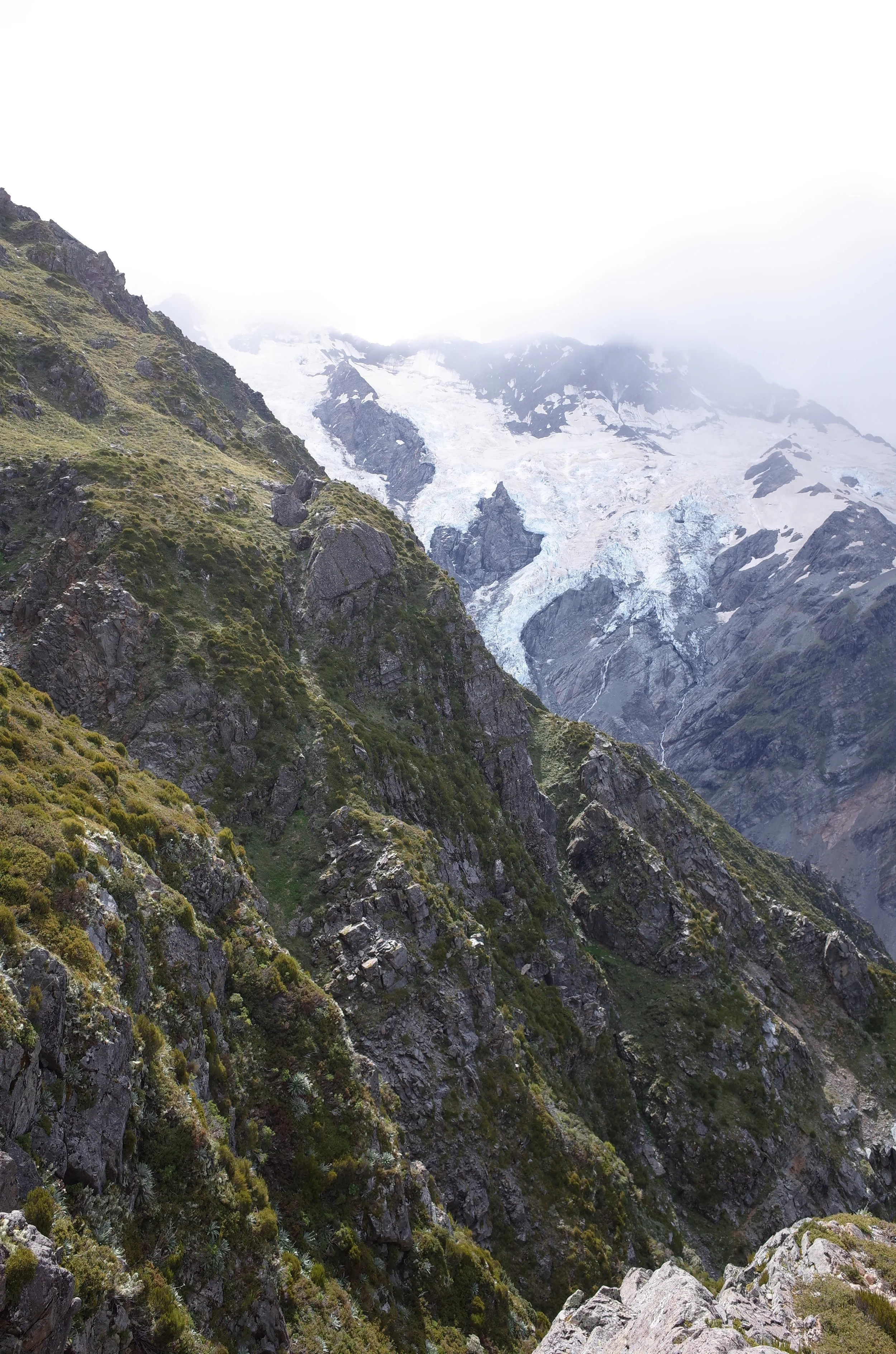
Sealy Tarns Track is a medium-length hike in Aoraki/Mount Cook National Park, Mackenzie Basin, South Island. It is accessible on foot from nearby Mt Cook village. It offers fine views of the country’s highest mountain, Aoraki/Mt Cook.

Red was my ascent route from the parking lot. Purple shows where I exited that track to walk back to the village.
Screenshots of the NZ topographic map are licensed as CC BY 4.0 by Toitū Te Whenua Land Information New Zealand (LINZ).
The Sealy Tarns themselves are a stop on the track to the much higher Mueller Hut, which is near the summit of Mt Ollivier. Mt Ollivier is in the Sealy Range. Some people - perhaps the majority - do Mueller Hut as an overnight trip. This is what DOC encourages.
If I visit the Lake Pukaki area again, I would probably try to summit Mt Ollivier as a day-hike.
Time
AllTrails users report this hike taking them an average of 2 hours 48 minutes.
Not counting the easy track between the trailhead and Mt Cook village, it took me somewhere between 3 and 4 hours.
Route
Round-trip, AllTrails reports an elevation gain of 542 meters and a length of 5.1 kilometers from the parking lot trailhead.
Sealy Tarns/Mueller Hut shares a parking lot with the easier Hooker Lake Track. I enjoyed visiting Hooker Lake too, but I won’t blog about it since it’s a walk, not a hike.
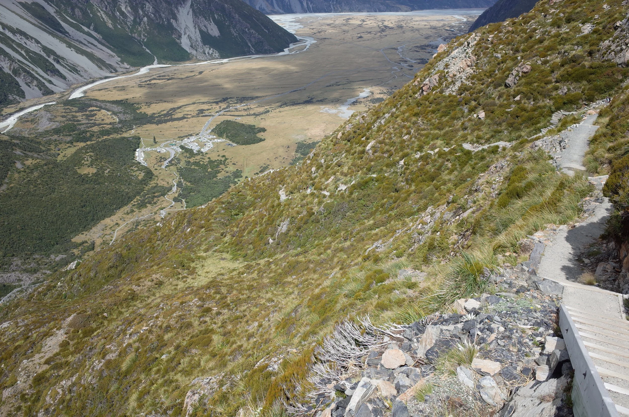
The track enters the forest, then gets steeper after the turnoff to Kea Point. There are a lot of proper stairs (see photo), making the footing quite easy. There is little to report.
I passed a DOC worker on the track. She was checking that hikers were equipped to proceed. I have never seen a DOC worker doing this on any other hike. I’m not sure if DOC does it on this track daily, or only on warm summer days when dehydration is particularly likely. Perhaps this indicates that this mountain attracts a lot of hikers with inadequate equipment and/or inadequate liquid.
The Sealy Tarns are not impressive in themselves, compared to other alpine tarns I’ve seen in South Island. Rather, they are a designated point for less fit or less ambitious day-hikers to enjoy the views before beginning their descent.
I wouldn’t drink the water in the tarns.
If 1 is an easy track, and 4 is using hands and feet on exposed rocks, I give this track a 1. I don’t mind the stairs; my goal is generally to see nice views and get some exercise by going uphill. But some people will find it too artificial.


Hunting
The entire national park is a hunting area (for tahr and chamois). Hunters are forbidden to “discharge firearms near tracks, huts, campsites, road-ends or any other public place.” I have hiked in more than 30 hunting areas, and only passed hunters twice - this wasn’t one of those hikes.
Here is the DOC topomap with all hunting areas visible.
Other pages about this hike
Pages about Mueller Hut / Mt Ollivier
https://www.alltrails.com/trail/new-zealand/canterbury/mueller-hut-route
https://www.alltrails.com/trail/new-zealand/canterbury/mount-ollivier-summit-via-mueller-hut-route