Lindis Peak, Tarras


Screenshots of the NZ topographic map are licensed as CC BY 4.0 by Toitū Te Whenua Land Information New Zealand (LINZ).
Lindis Peak is a mountain in Central Otago, South Island on which I did a medium-length out-and-back hike. It is around 12 minutes from Tarras, 35 minutes from Cromwell, and 40 minutes from Wānaka. The entire hike is on a farm easement, not public land.
Lindis Peak is not at Lindis Pass, which is about 25 minutes north. (The mountain beside Lindis Pass is Double Peak.)
DOC reports that the track is “closed for lambing 10 October to 5 December each year.”
Time
DOC estimates that the hike takes 5-6 hours return. AllTrails users report an average of 4 hours 58 minutes.
Including breaks, the hike took me a little under 5 hours.
Access
The trailhead is a few meters along a rough dirt track, Old Faithful Road. The adjacent highway has a fair numbers of cars driving rapidly between Central Otago and Canterbury’s Mackenzie Basin. It’s important to slow down well before exiting the highway, partly because of the change in road quality, and partly for a separate reason that differs based on your direction:
From the south (via Tarras/Cromwell/Wānaka): a curve hides the turnoff from view.
From the north (via Lindis Pass): turning across the opposite lane of traffic, but without space for cars behind you to pass you as you wait for a chance to turn.
Route
AllTrails reports that the hike is 11.4km out-and-back, with 842 meters of elevation gain.
The trailhead is a DOC sign. I think there was a fence with a stile beside it. Orange poles make clear that the trailhead involves going straight up a slope, rather than following Old Faithful Road to the north or following a farm track (not on the topomap) through a gate to the south. The route up this steep hillside has an obvious impact track.
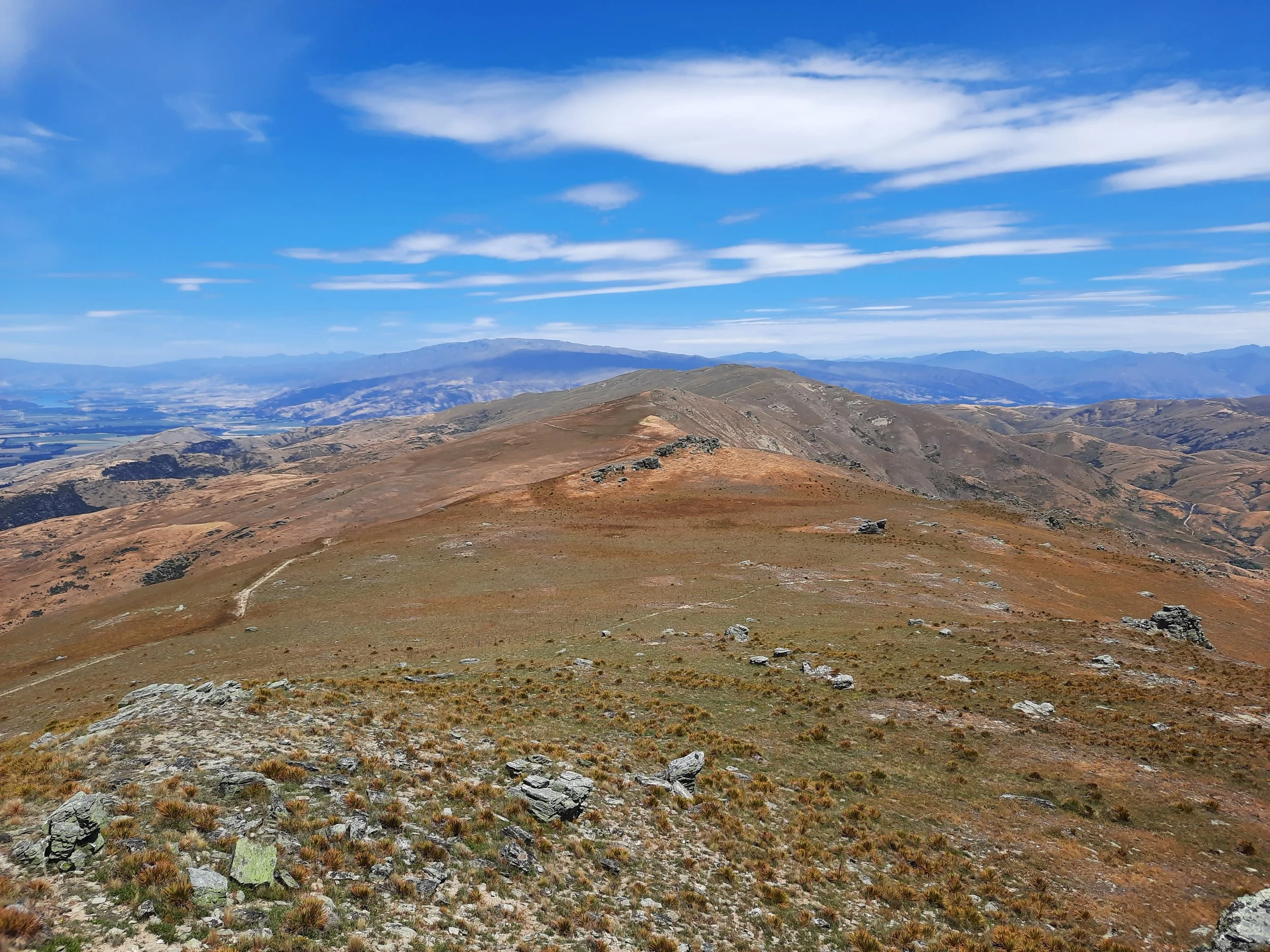
It only takes a few minutes to reach the top of this hill, where the impact track levels out and soon after joins a 4WD track. This leads nearly to the summit. There is a final short, steep ascent through boulders to the summit. Gloves were helpful for gripping the rocks.
There were more sheep droppings on this track than perhaps any other track I've hiked, yet I only saw 10-20 sheep. I think January was shearing season - I didn’t see any shearing, but I did see a lot of recently shorn sheep in low-lying fields and a lot of very woolly sheep in the hills, without many sheep at in-between stages.
Looking northwest from the summit, I had a good view of Grandview Mountain and Breast Hill, and glimpses of Corner Peak and Lake Hāwea. Private land blocks any publicly accessible through-hike from this peak to one of the others.
If 1 is an easy track, and 4 is using hands and feet on exposed rocks, this route is a 3 at worst. The scramble up the hillside at the beginning is a mixture of 2 and 3, and the final minute to the summit is a 3. The 4WD track is a 1.


Other pages about this hike
Pages about nearby hikes
https://hikingscenery.com/chain-hills-circuit-lindis-valley/
Devil’s Creek Track (not to be confused with the track of the same name near Queenstown and Arrowtown)
Lindis Peak seen from Grandview Mountain

Lindis Peak is somewhere near the left or center-left.