Corner Peak, Lake Hāwea, NZ


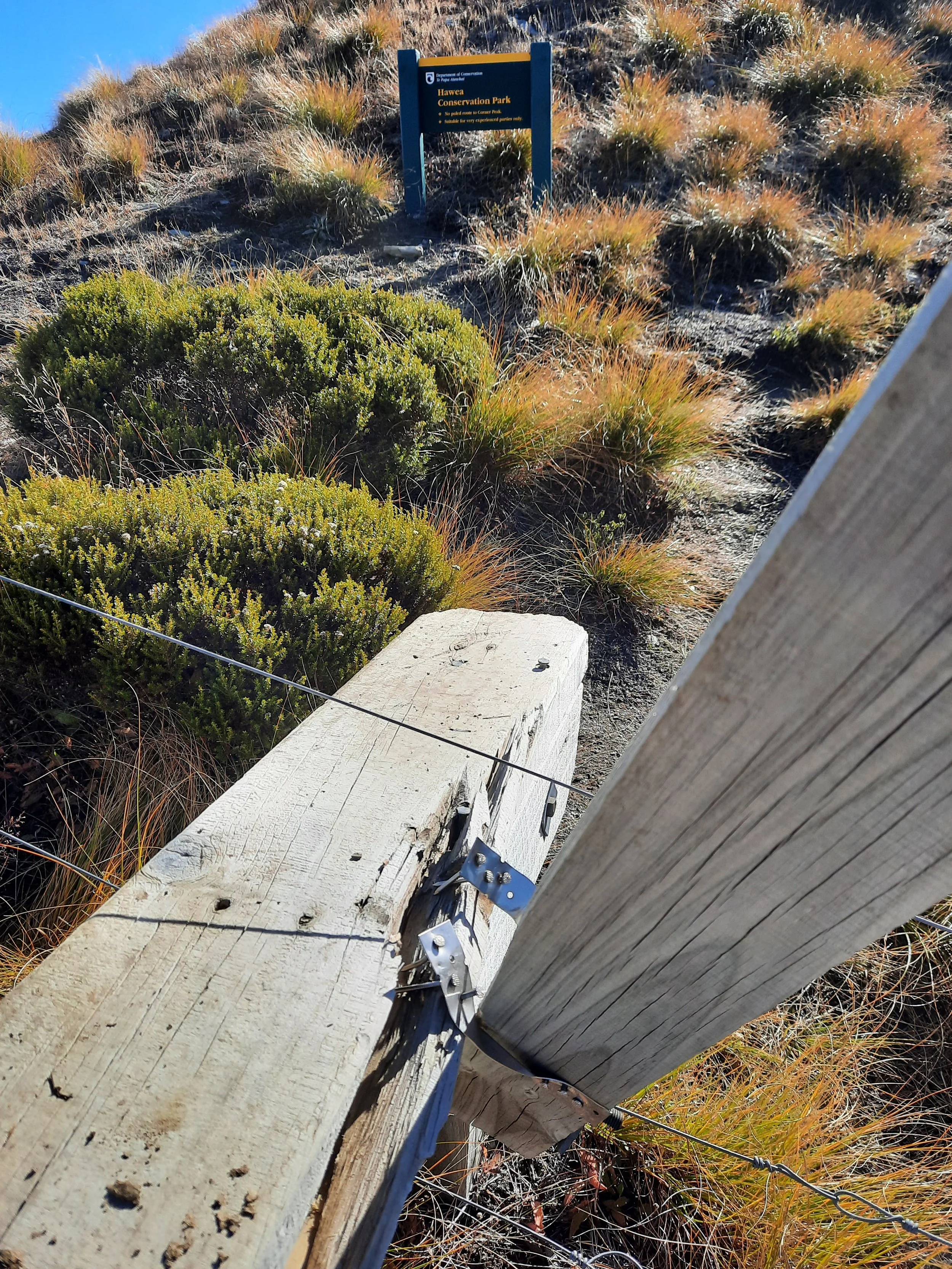
Corner Peak is a very long hike on the east shore Lake Hāwea, near Hāwea township, Otago, South Island. The latter part of the hike is in Hāwea Conservation Park. It gets its name from being at a corner of land jutting into the lake.
This hike and Sentinel Peak to the north are the two longest Lake Hāwea day-hikes which have a reputation as interesting among hikers. (It is possible to do even longer day-hikes, by following ridges across/around multiple peaks.)
Time
AllTrails users report taking an average of 6 hours 12 minutes. This seems low, for non-runners.
It took me about 11 hours altogether, including breaks.
about 10 hours was the return trip on the mountain, of which 5 hours 45 minutes was reaching the peak.
about 1 hour was the return trip along the Timaru High River Track and through the small forest.
Route
Round-trip, AllTrails reports an elevation gain of 1139 meters and a length of 12.6 kilometers.
Reaching the correct trailhead by car can be confusing (as one of the AllTrails reviewers mentions):

At the lower left, the red dot is the parking lot.
Nearby, the cyan dot is a trailhead that is not legally accessible to hikers, as far as the maps show.
The purple dot on the ridge shows a place where the track descends left off the ridge, rather than ascending to Point 1371.
Screenshots of the NZ topographic map are licensed as CC BY 4.0 by Toitū Te Whenua Land Information New Zealand (LINZ).
It is not the Google Maps destination ‘Corner Peak’, or the nearest place to that on the road.
The topomap shows a farm track leaving the road several hundred meters north of the outlet of Timaru Creek. This is visible on Google Maps, and I’ve marked it with a cyan dot on the topomap screenshot. However, there is no public right of access to the beginning of this track, according to the Walking Access Commission map. Public access only begins uphill, where the below forest track joins this and becomes the Timaru High River Track.
I parked in the medium-size parking lot beside Timaru Creek, just before the bridge over the creek; it is marked with a red dot on the topomap screenshot. I crossed the bridge and, about a minute later, entered the forest on the Timaru High River Track. This trailhead is not printed on the DOC topomap, but it is visible when you turn on the Track sections layer; it is also visible on the Walking Access Commission map.
The Timaru High River Track was fairly muddy. I was glad to be wearing boots.
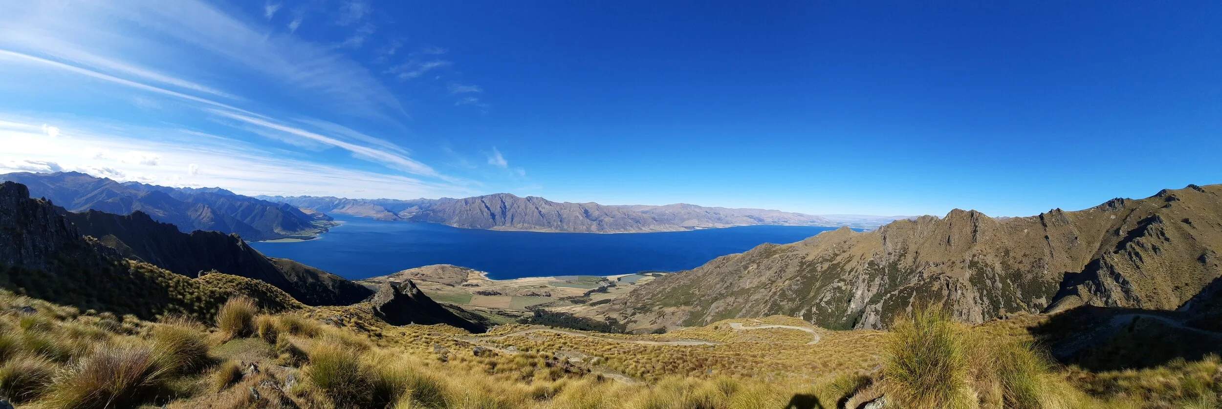
After around half an hour, I reached the foot of a steep tussock slope with a zig-zagging track uphill (first photo). A DOC worker had warned me that it was even steeper than the steep part of the Breast Hill Track. However, this portion of the Corner Peak Track was solid dirt, well anchored into the hillside. By contrast, the steep portion of the Breast Hill Track is loose dirt/gravel with some bare rock thrown in. So I much preferred this.
Above this tussock slope is the ridge. The route was usually obvious.
But there are several places where a hiker could lose the route. The most obvious would be going over the top of Point 1371. There are actually a series of poles leading much lower, along this big hump’s west (lake) side. The topomap route shows this poled route. When I did the hike, I noticed sheep or goat bones indicating where I should cross a fence to spot the first of these poles. I’ve added a purple dot to the map in case the bone markers aren’t there any longer.
Once I reached the border of the conservation area, there were no more marker poles. I followed an impact track along the east (inland) side, far below the difficult-looking rocky ridge. Lee Burty blogged about following the ridge for the fun of it.
The impact track leads to a broad saddle below the peak. From here the hike was pretty easy. However, the dropoff to the east is within a few metres of the track, and the wind is often northwesterly, i.e. blowing toward that dropoff.
The broad saddle and the peak above it are shaped kind of like a kite. I was pleased to finally be on top of the kite, after seeing it from Hawea township, Isthmus Peak, Sentinel Peak, and its neighbor to the south, Breast Hill.
Commentary on difficulty
Brook Van Reenan ran the Corner Peak Track, as well as three others I have hiked (Breast Hill, Isthmus Peak, Ben Lomond) and three others that I have not (Grandview Mountain, Mount Maude, Mount Alpha (beyond Roy’s Peak)). His perspective as a runner on Corner Peak:
I picked the hardest one to do first by a long shot…
I also found it notably more difficult than Breast Hill, Isthmus Peak, and Ben Lomond.
Sentinel Peak is a nearer match in duration and effort. It took me almost the same amount of time both out and back. For me, Sentinel Peak had two more acutely difficult sections of 10-20 minutes each, but Corner Peak was somewhat harder over hours-long stretches of hiking. I found Sentinel Peak somewhat more fun.
If 1 is an easy track, and 4 is using hands and feet on exposed rocks, I give Corner Peak a 3 on brief sections (2-15 minutes) along the ridge or sidling along steep slopes below it, but overwhelmingly a 2. Timaru High River Track would be a 1 without the mud.


Hunting
Roughly the final quarter of the Corner Peak route is in a hunting area. Hunters are forbidden to “discharge firearms near tracks, huts, campsites, road-ends or any other public place.” I have hiked in more than 30 hunting areas, and only passed hunters twice - this wasn’t one of those hikes.
Here is the DOC topomap with all hunting areas visible.
Could a day-hike reach Dingle Peak?

Corner Peak out of view to the left. Dingle Peak at left. Arrival route at right. If you have ever taken a shortcut to Dingle Peak across the irregular tussock slopes in the mid-ground, please leave a comment or email me. I would like to know about any pitfalls (literally).
A day-hike beyond Corner Peak to Dingle Peak would require more hours of daylight than I had on this day in mid-April. I would probably do a shortcut on the slopes below Corner Peak, but some runners have done the route going over Corner Peak:
Other bloggers have written up this multi-day trek to Moonlight and Roses Hut and this one and this one. The hut is on the remote southeastern slopes of Dingle Peak, so it isn’t part of the approach one would make during a day-hike.
Other pages about Corner Peak only
https://www.alltrails.com/trail/new-zealand/otago/corner-peak-track
https://www.wildernessmag.co.nz/trip/corner-peak-hawea-conservation-area/ (GPX file)
https://leeburty.com/leeburty/2013/11/23/corner-peak-hawea-conservation-area
Corner Peak seen from Breast Hill

Corner Peak rises from center to far right. Isthmus Peak center-left. Isthmus Peak at just left of center, across the lake. Mt Aspiring at left in far distance.
Corner Peak seen across Lake Hāwea, from Isthmus Peak
Sentinel Peak far left. Corner Peak center-left; Dingle Peak may or may not be visible above it. Breast Hill center-right. Hāwea township is out of sight to the far right.
Corner Peak seen from Sentinel Peak
Corner Peak seen in a panorama from Sentinel Peak. It is central at 14-15 seconds.

Last light as seen from Sentinel Peak.
Corner Peak seen from the air.

The angle is almost the same as in ‘Corner Peak seen from Breast Hill’, several photos above. Corner Peak is near the head of Lake Hāwea at center-right, a little bit more than half-way up on the vertical axis. Its peak is immediately beneath a small cloud (which is about four times as long as it is tall).