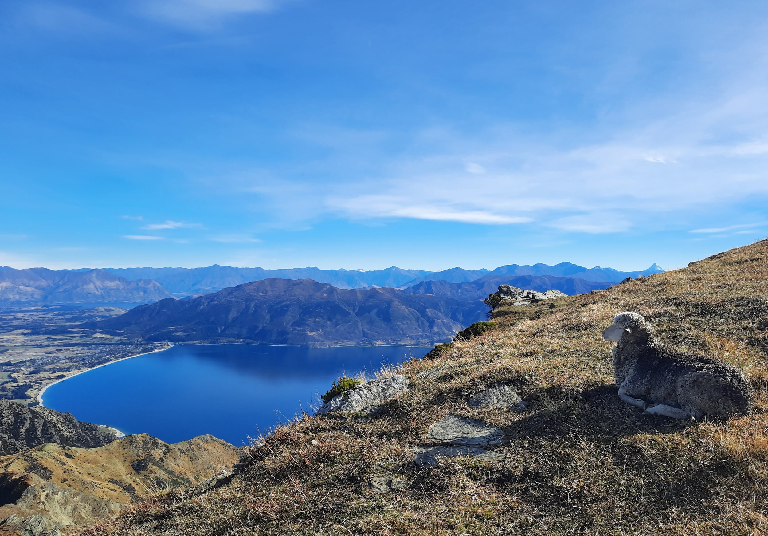
Breast Hill, Lake Hāwea, NZ

Breast Hill is a long hike on the east short of Lake Hāwea, Otago, South Island. It is 10 minutes from Hāwea township.
Breast Hill should not be confused with Breast Peak, which is a few kilometers south along the same ridge. There is a long hike taking in the lower part of the Breast Hill track, Breast Peak, and Grandview Mountain - I’ve blogged about it under the name Grandview Ridge. However, it does not include the summit of Breast Hill.
Officially, the Breast Hill Track is a 3-4-day portion of the long-distance Te Araroa trail. This hike is just one end of that portion. The other end is in the remote Ahuriri Valley, with the nearest settlement being Ōmarama.
Time
DOC doesn’t say how long it takes to reach the summit Breast Hill, but my estimate is that they think it takes 4-5 hours one-way based on Te Araroa times listed here.
AllTrails users reported that the round-trip took an average of 7 hours 22 minutes.
The ascent took me around 3 hours 20 minutes, and the descent took me around 4 hours 20 minutes. This excludes my break at the summit, where I spoke with another hiker about nearby Corner Peak.
Route

Some think that the zig-zags near the K are a challenge; the topomap makes it look that way. I didn’t think so! Instead, I found several portions adjacent to the word ‘steep’ to be challenging - but not all of it. See main text.
Screenshots of the NZ topographic map are licensed as CC BY 4.0 by Toitū Te Whenua Land Information New Zealand (LINZ).
Round-trip, AllTrails reports an elevation gain of 1341 meters and a length of 15.3 kilometers.
Timaru Creek Road runs north along the east shore of Lake Hāwea. It passes through one or two fords. I parked on the left side of the road around 300 meters past the Breast Hill trailhead. Edward at HikingScenery recommended this space.
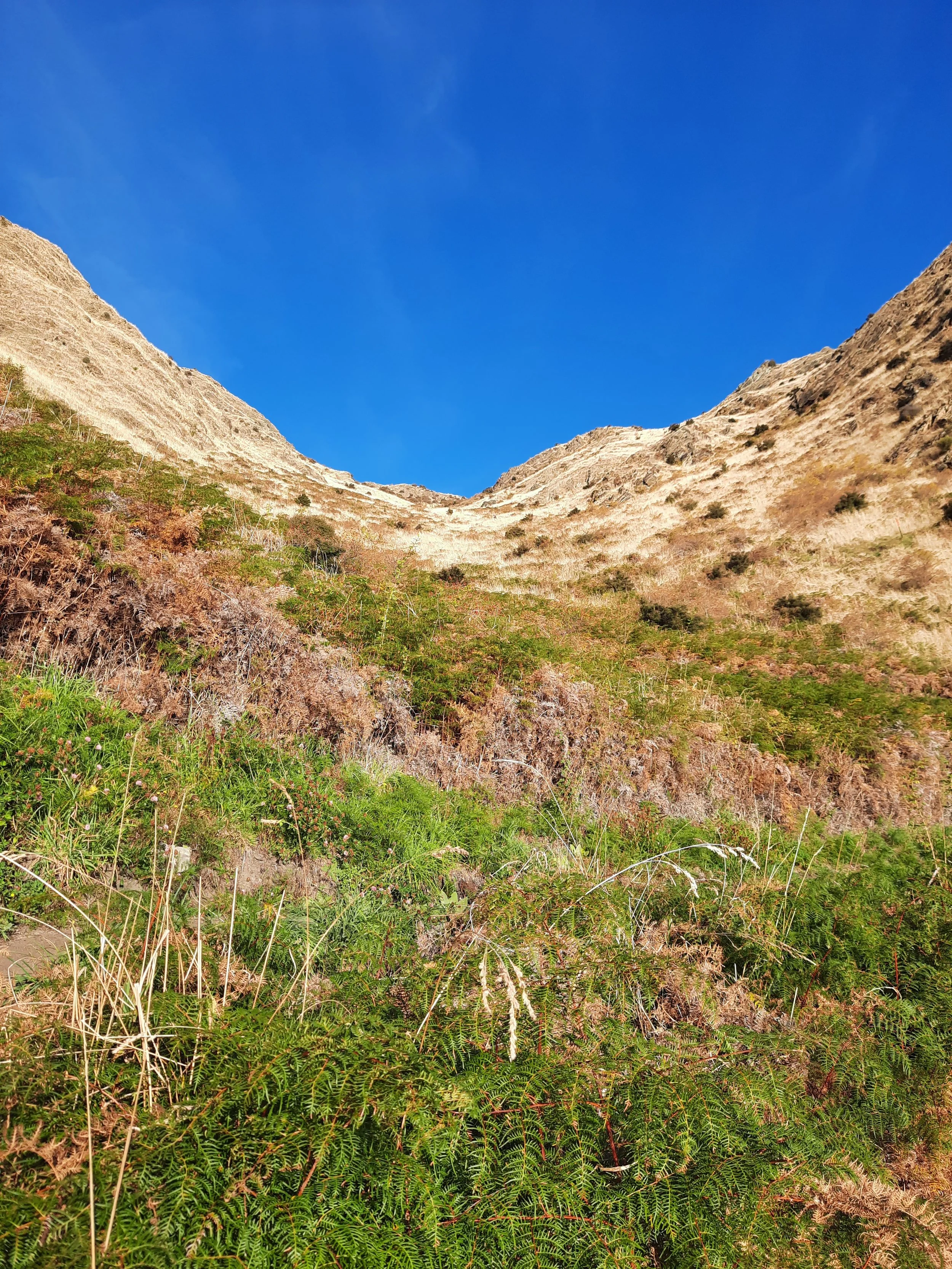
After crossing a gently sloping farm for a few minutes, the track begins a lot of zig-zags up a steep hill. See 3rd photo. The zig-zags almost negate the steepness - that’s their point, after all - so I didn’t find this part challenging on the way up or the way down. I labeled this part ‘OK’ on the topomap screenshot.
At the top of the zig-zags, around 700 meters of elevation, the track then ascends a spur for around 600 meters. I’ve labeled it ‘steep’ on the topomap screenshot. The difficult part of my hike was the steep sections of this spur, much more on the descent than the ascent. The ground was loose in places, and there were sloping bare rocks making it more difficult from time to time. This is why my descent took an hour longer than my ascent.
The mistake I imagine newcomers making is assuming that Breast Hill is similar in difficulty to nearby Roy’s Peak and Isthmus Peak, since they all take similar amounts of time. But Breast Hill involves a lot of scrambling on this spur, while Roy’s Peak has no scrambling and Isthmus Peak only has a small amount near the beginning.
At the top of the steep spur, going left (north) along the ridge leads to Breast Hill. This was an easy walk, but very exposed to the wind.
If 1 is an easy track, and 4 is using hands and feet on exposed rocks, I give Breast Hill a 3 on the often-steep middle section, but a 1 or a 2 otherwise.


Someone didn’t want to descend on foot.
Hunting
Much of the route is adjacent to a hunting area. Hunters are forbidden to “discharge firearms near tracks, huts, campsites, road-ends or any other public place.” I have hiked in more than 30 hunting areas, and only passed hunters twice - this wasn’t one of those hikes.
Here is the DOC topomap with all hunting areas visible.
Other pages about this hike
https://www.alltrails.com/trail/new-zealand/otago/breast-hill-via-te-araroa-trail
http://midpacktrailrunner.blogspot.com/2016/01/breast-hill-lake-hawea.html
https://jontynz.com/2017/01/06/breast-hill-and-timaru-river-tracks/
https://www.matthewdickinson.com/52peaks/peak-46-breast-hill/
Pages about nearby hikes
Grandview Ridge (partial overlap)


