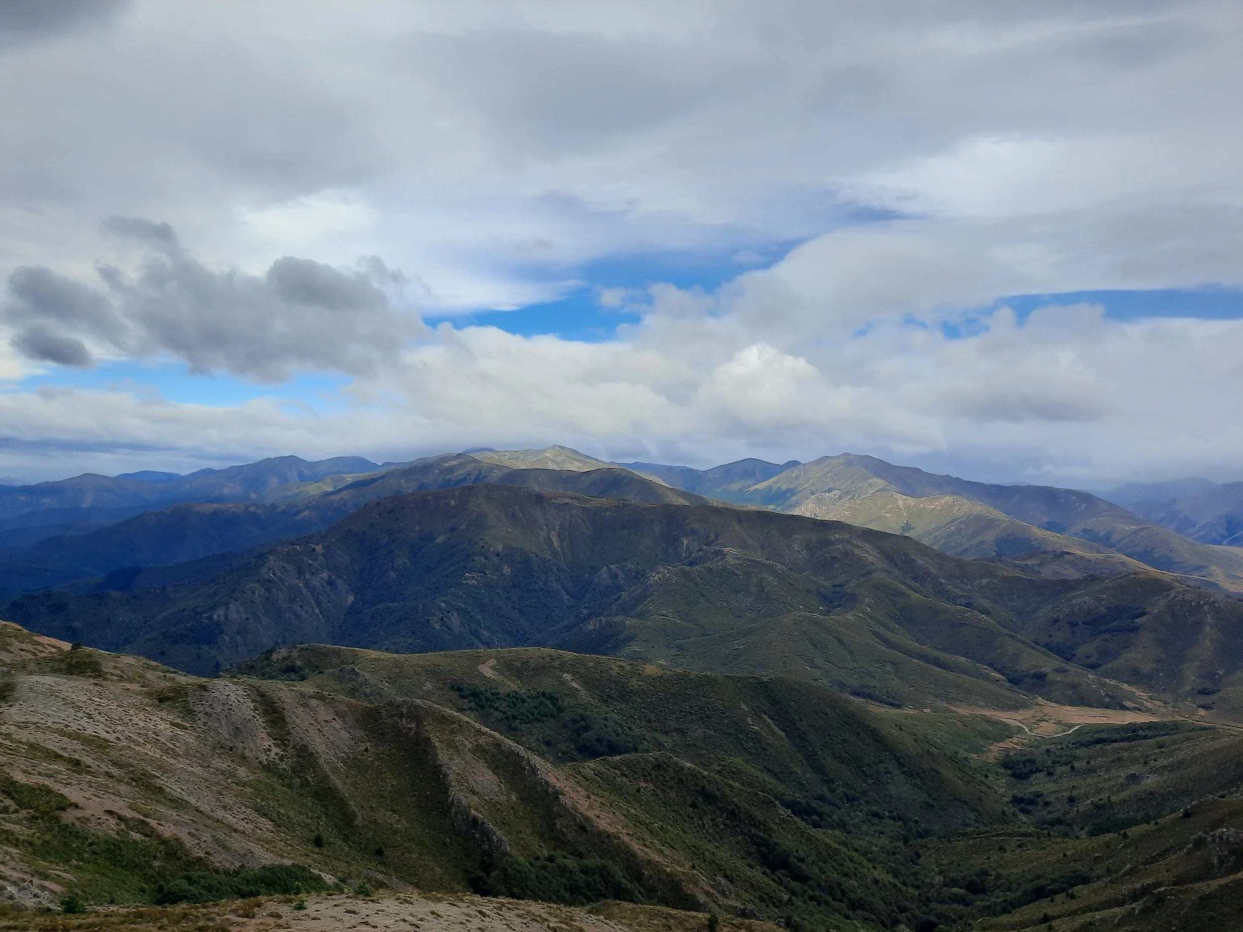
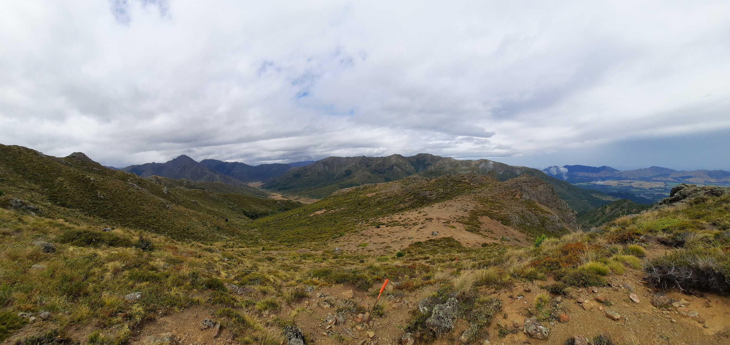
Mt Dumblane to Mt Charon, Hanmer Springs, NZ


Mt Charon at left, Mt Dumblane central (in my own added text), and Mt Isobel center-right.
Screenshots of the NZ topographic map are licensed as CC BY 4.0 by Toitū Te Whenua Land Information New Zealand (LINZ).
Mt Dumblane (1303m) is a mountain above Hanmer Springs, Canterbury in the northern part of South Island. Beyond Mt Dumblane to the west is Mt Charon (1540m, pronounced KAIR-on). Together the two peaks make a long out-and-back hike starting at Jack’s Pass. Along with Mt Isobel, on the other side of Jack’s Pass, they are part of the Hanmer Range.
This peak is spelled Dumblane, an old spelling of the Scottish Dunblane.

The purple question mark indicates the rough location of a marked track descending from the saddle.
The purple x indicates the spur down which I made a wrong turn on my return from Mt Charon.
Screenshots of the NZ topographic map are licensed as CC BY 4.0 by Toitū Te Whenua Land Information New Zealand (LINZ).
Time
AllTrails users report an average of 2 hours 44 minutes return to the summit of Mt Dumblane alone. A Hanmer Springs tourist brochure estimates 4-5 hours return for the same portion. (You may need to rotate it twice in your PDF viewer.)
Edward at HikingScenery.com reports around 8 hours for the whole trip. Pat Barrett in Wilderness Magazine reports 3-4 hours one-way for the same.
It took me a little over 1 hour from Jack’s Pass to the summit of Mt Dumblane, and a little over 3 hours to the summit of Mt Charon. After resting there for around 30 minutes, it took me around 4 hours 20 minutes to return to Jack’s Pass, by a slightly different route (which skipped revisiting the summit of Mt Dumblane). Including all breaks, it took just over 9 hours.
Route
There is a medium-sized dirt parking lot at Jack’s Pass.
I followed orange poles up Mt Dumblane, where I detoured to explore the peak, then down to the saddle beyond it. Descending Mt Dumblane was one of the slower parts of the hike, because it is steep in places.
The poles diverged south into the forest surrounding the headwaters of Dillons Stream. It didn’t look like fun hiking down in there to me. Tristan, the proprietor of my guesthouse, told me that this route does indeed get back to town. I’ve marked the area with a purple question mark on the topomap screenshot.
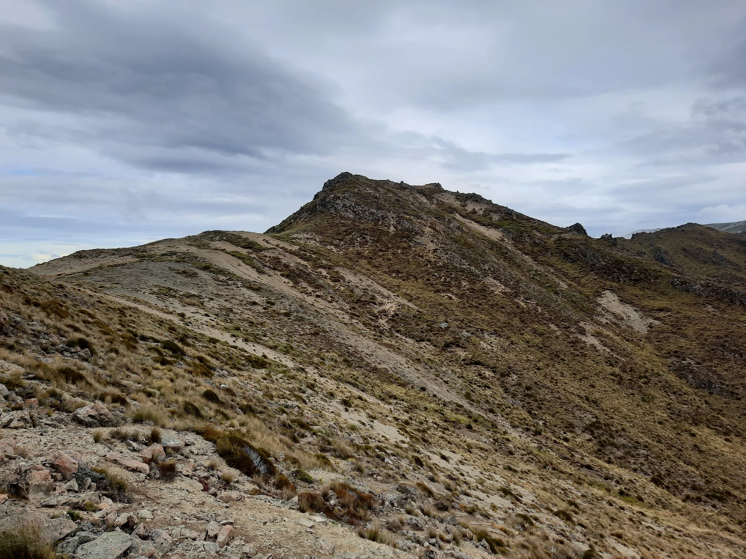
Past the saddle, the previously fairly visible impact track faded in and out. I climbed the tussocky ridge and followed it to Mt Charon. The prominent points along the ridge are a mixture of rock formation and tussock. I skipped some of them by walking below them to the north/east, but I don’t recall which ones.
On the way back, I took a wrong turn to the left (north) down a spur. I don’t recall if there was an impact track or not. It is marked with a purple X on the topomap screenshot.
Had there been a proper track, this would join Robert Ridge (Angelus Hut, Nelson Lakes) as one of my favorite long Northern South Island hikes. As it was, I found it tiring to walk across so much tussock and faint impact track.
If 1 is an easy track, and 4 is using hands and feet on exposed rocks, I give this track a 3 on some slopes and a 2 on less steep slopes. The flat parts are mostly a 2.


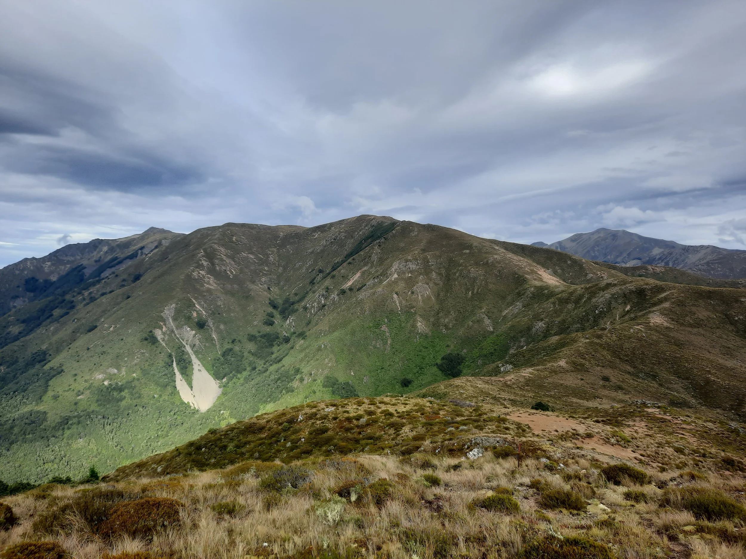
Looking back toward Jacks Pass (obscured). Maukuratawhai center-left, Mt Isobel center, Hanmer Springs barely visible at right.

Farthest left: Miromiro. Left above cloud, Mt Captain. Center-left, San Jago, Point 1695, and (highest) Mt St Patrick. Central Distance: St James and Crimea Ranges. Right distance: Maukuratawhai. Route followed the ridge at right.

Left: Hanmer Plain and Waiau River. Center-right, Mt Captain. RIght, San Jago, Point 1695, and Mt St Patrick.
Possible longer circuit
One runner passed me as I was heading toward Mt Charon. I met him again at Jacks Pass. He had run a big loop around the Styx River, via Mt Captain, San Jago, and Mt St Patrick. I didn’t ask whether he descended the Mt St Patrick ridge just north of the Styx River, or the ski field road north of that spur. He said it took him 7 hours, and he estimated that it might have taken him 12 if he had been walking instead.
Hunting
Most of the route is in a hunting area. Hunters are forbidden to “discharge firearms near tracks, huts, campsites, road-ends or any other public place.” I have hiked in more than 30 hunting areas, and only passed hunters twice - this wasn’t one of those hikes.
Here is the DOC topomap with all hunting areas visible.
Other pages about this hike
https://www.wildernessmag.co.nz/overheated-over-hanmer/ (no GPX file, contrary to their usual practice)
https://www.wildernessmag.co.nz/10-trips-hanmer-range/ (nice 3D map of Hanmer Range)
Other hikes involving Mt Charon
https://ctc.org.nz/newsletters/2014/Apr%2014.pdf (proposal to traverse Benvoirlich from Rogerson Road)
I can’t find a trip report about the hike - only this proposal to do it.
Pages about hiking just to Mt Dumblane
Pages about other nearby hikes
Maukuratawhai (https://ctc.org.nz/index.php/trip-reports?goto=tripreports%2F573)
Mt St Patrick (https://ctc.org.nz/index.php/trip-reports?goto=tripreports%2F416)
Mt Princess (https://hikingscenery.com/mt-princess-ascent-st-james-conservation-area/)
Mt Clara (https://hikingscenery.com/mt-clara-fowlers-pass-st-james-conservation-area/)
Faust, near Lewis Pass
Local info
We are usually told, moreover, that there is no scenery at Hanmer. Needless to say, this is a fallacy, which may have originated in the fact that Hanmer is primarily a health resort, and so the visitors congregate at the baths and gravitate between them and their various residences for the time being. Mount Captain, Mount Charon, Mount Isabel, Mount Perceval, Miro-Miro, are all fine peaks, from which the most magnificent views can be obtained, especially of the Spencer Mountains and of the peaks of Southern Nelson, with their strange mixture of names, e.g., Faerie Queene, Billhook Peak, Mount Una, Black Serpent's Tail, Mount Guinevere, Mount Hatless, etc., this last being a most suggestive name.
The Hanmer Mountains are all pierced by streams, and up each stream are charming spots. The waterfall on the front of Mount Isabel should be visited by all who do not fear a scramble. On Jack's Pass and Jollie's Pass, masses of Celmisias and other beautiful plants may be seen. The Waiau Gorge, near the bridge, has splendid rock scenery, while the view from the garden of the accommodation house nearby, with the turbid Waiau and its island far below, and the broad yellow plain flanked by noble mountains, is extremely beautiful. The scenery as viewed from the coach road is in many places very pleasing, especially where it follows the bank of the Waiau.
—Cockayne, L. ‘A glimpse into the Alps of Canterbury.’ In: W. Reece (ed), 1900. Canterbury old and new: A souvenir of the Jubilee.

Mt Dumblane (center-right) and Mt Charon (left) seen from Hanmer Springs. That street lamp must be proud of itself for being so much taller than the mountain.