North Island, NZ: Scenery
Highlights of landscapes that I photographed while doing something other than hiking on Te Ika-a-Māui (North Island), NZ. See also: Highlights of Auckland.
Lake Taupō and Rotorua
Lake Taupō is the caldera of an active supervolcano. The final two photos are taken during a drive around the lake.


Western Waikato
The first two photos were taken in the Raglan (Whaingaroa) area. I was driving around the ocean-facing slopes of Mt Karioi after finishing my hike.
The next four photos are taken on a drive along the highway between Hamilton and Tongariro. The highway roughly marks the eastern edge of King Country (Te Rohe Pōtae). King Country is named for the second Māori King, Tāwhiao. He and his Kīngitanga movement loyalists retreated into its rugged terrain after the British conquest of Waikato, so that they could live more freely.
The final three photos are taken along the popular Ruakuri Walk, near Waitomo village.


Tongariro (left) and Ngāuruhoe (right), Tongariro National Park
Mount Ngāuruhoe played Mount Doom in The Lord of the Rings films. It is a parasitic cone on the shorter Mount Tongariro. See also my Tongariro Crossing hike.


Hawke’s Bay (Te Matau-a-Māui)
‘Hawke Bay’ is used for the bay itself, while ‘Hawke’s Bay’ is used for the region stretching inland to the Ruahine Range.
The first three photos are at Te Mata Peak in Havelock North, a town south of Napier and Hastings. Like many visitors, I drove up.
The last two photos are on Napier-Taihape Road, also known as Gentle Annie. Stuff.co.nz ranks it second of NZ’s top ten roads.


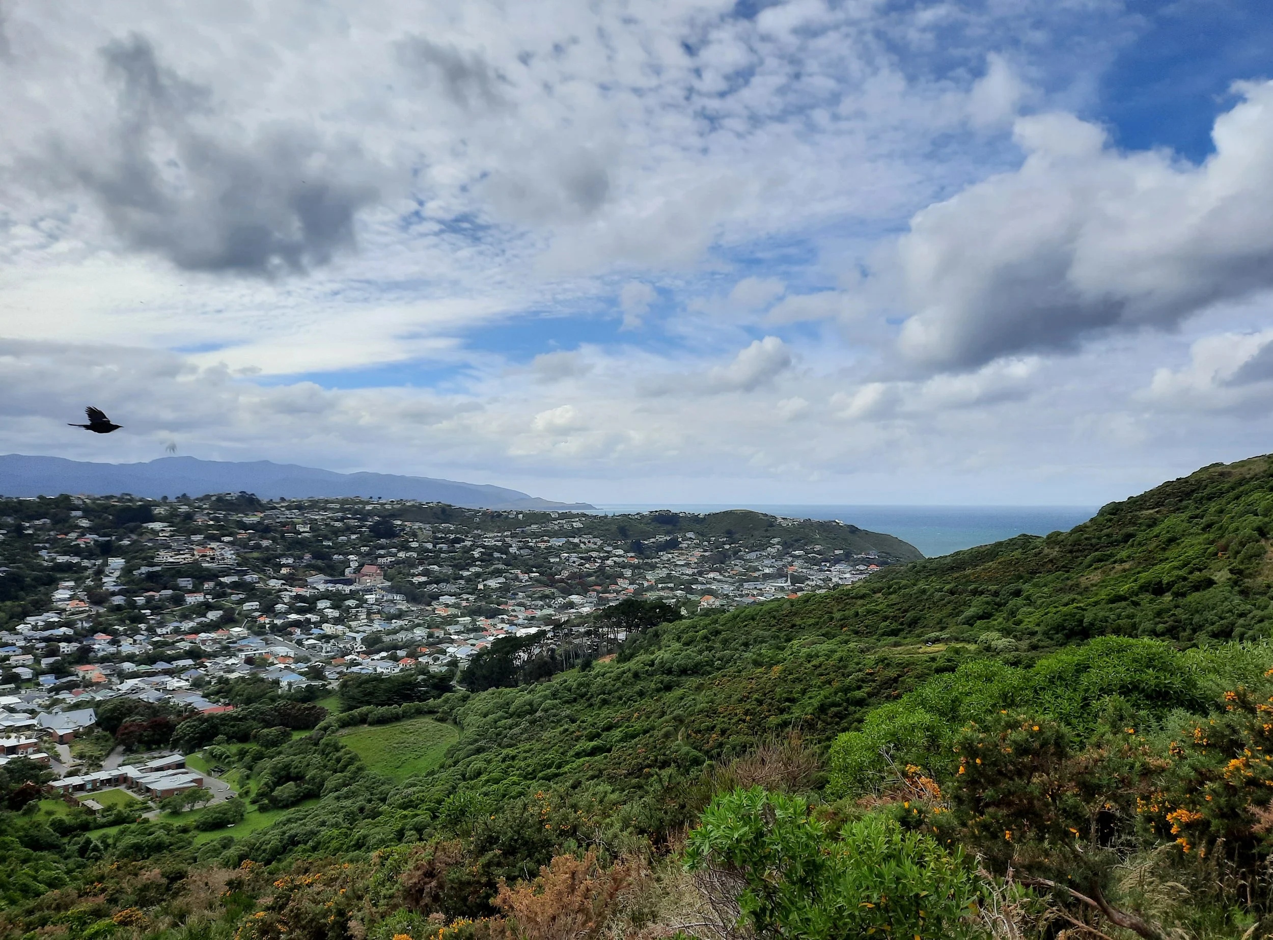
Wellington (Pōneke)
Wellington is a great place for a walk in winter (first three photos) or summer (last three photos), so long as the weather holds up. The last three photos are taken on the City-to-Sea Walkway.
See also my Skyline Walkway hike.