Mt Pisa via Kirtle Burn Track, Cardrona, NZ

The Pisa Range in Otago, South Island separates the Arrowtown-Frankton area to its southwest, the Cromwell area to its east, and the Wānaka area to its north. Its high point is Mt Pisa (1963m).
In Cardrona village, I used the gate access code discussed below, drove up to Waiorau Snow Farm / Southern Hemisphere Proving Grounds snow sports campus, walked across the campus, and followed the Kirtle Burn Track. Outbound I took the ridge (northern) track, and then continued on a detour to the Mt Pisa Summit. Returning from the detour, I took the burn/stream (southern) track, then walked back across the campus in a different place.
Burn means stream. Locals call the Kirtle Burn by its nickname, the Roaring Meg.
The parking lot at the beginning of the hike is about 45 minutes from Wānaka and 25 minutes from Cardrona village.
My route was the easy way to reach the summit. There is also the long and tedious hike up the steeper eastern side of the mountain range, along the Tinwald Burn Ridge Track, starting from near Cromwell.
Access
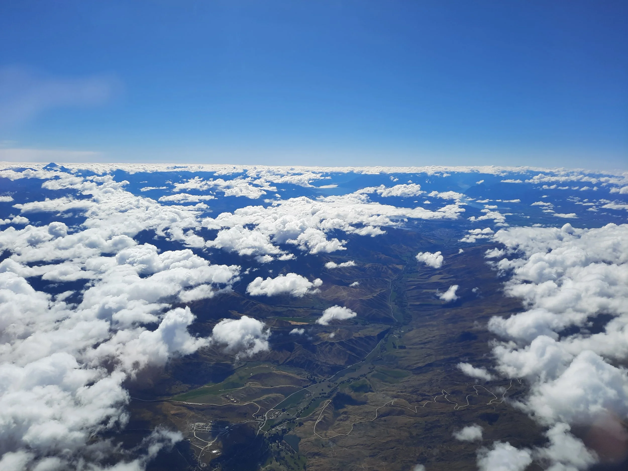
As of 2025, you can pay $20 at https://pisaaccess.co.nz/ to unhide the 4-digit access code which is hidden in the webpage’s source code. This is for the combination lock on the gate at the foot of the road, on the edge of Cardrona village (see photo #2 in the gallery). Then you drive up a long mountain road, Paddy’s Ridge Road (also known as Waiorau Nordic Road), drive through an open gate, and turn right into a parking lot. The last photo on this page shows the road from an airplane.
Time
Including breaks, it took me around 6 hours 50 minutes to the summit of Mt Pisa and back. It would have been at least 30 minutes quicker if I had known the correct routes across the private property.
AllTrails users report that the Snow Farm easement to Kirtle Burn Hut takes 2 hours 3 on average, one way (first downhill through the private property, then uphill to the hut). This one-way does not include the segment from Kirtle Burn Hut to the summit tor.
Route across private land

The ‘YOU ARE HERE’ is near the beginning of the DOC land. The parking lot as at the edge of the gray access road on the bottom of the map.
I parked in the parking lot. From here, there are two easements across the snow sports campus, one across Snow Farm and one across Southern Hemisphere Proving Grounds (SHPG). I recommend taking the longer Snow Farm easement: starting at the parking lot, descend along Merino Glen, then follow River Run to Meadow Hut, and finally follow The Loop for a short distance to the Kirtle Burn trailhead. Here is the best map, on the Snow Farm website featuring TrailForks mapping. The photo of the posted map in this blog post is similar.
Why not take the shorter SHPG easement? Because when I did that outbound, I had to crawl under a locked gate!
The access code webpage has a satellite map showing both easements, but the resolution is too low to see every trail distinctly. The drawn DOC map I’ve pasted on this page doesn’t attempt to show every trail, so I didn’t even draw my route on it. Hikers should download the Snow Farm/TrailForks map that I mention above and this AllTrails map.
Apart from its greater length, the other reason I didn’t take the Snow Farm easement outbound was that it looked like there were some traffic cones restricting access (see photo #9 in the gallery). But I’ve decided this was probably for vehicles, not hikers.

I parked at the purple spot, and crossed private land on trails not clearly drawn on this map to/from the western ends of the Kirtle Burn loop track. See this map for crossing the private land.
Screenshots of the NZ topographic map are licensed as CC BY 4.0 by Toitū Te Whenua Land Information New Zealand (LINZ).
Route across DOC land
According to DOC, the route on public land is 12.38km. I roughly estimate another 7km to cross the Snow Farm easement out-and-back, which is a bit longer than my route, using each easement once.
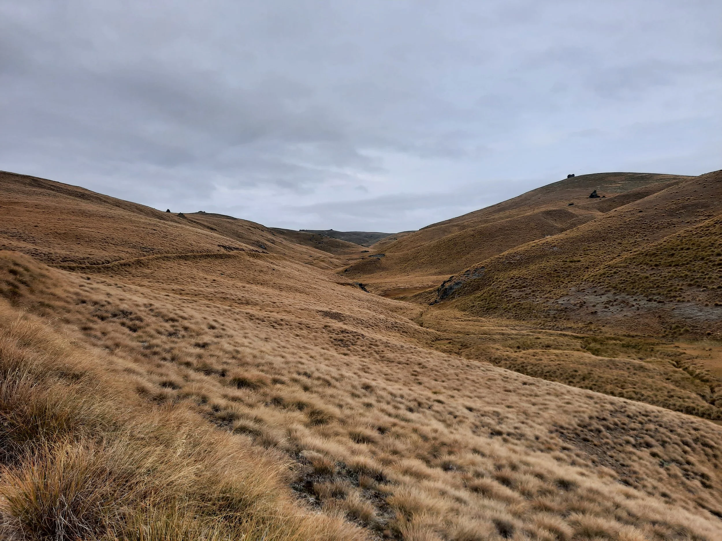
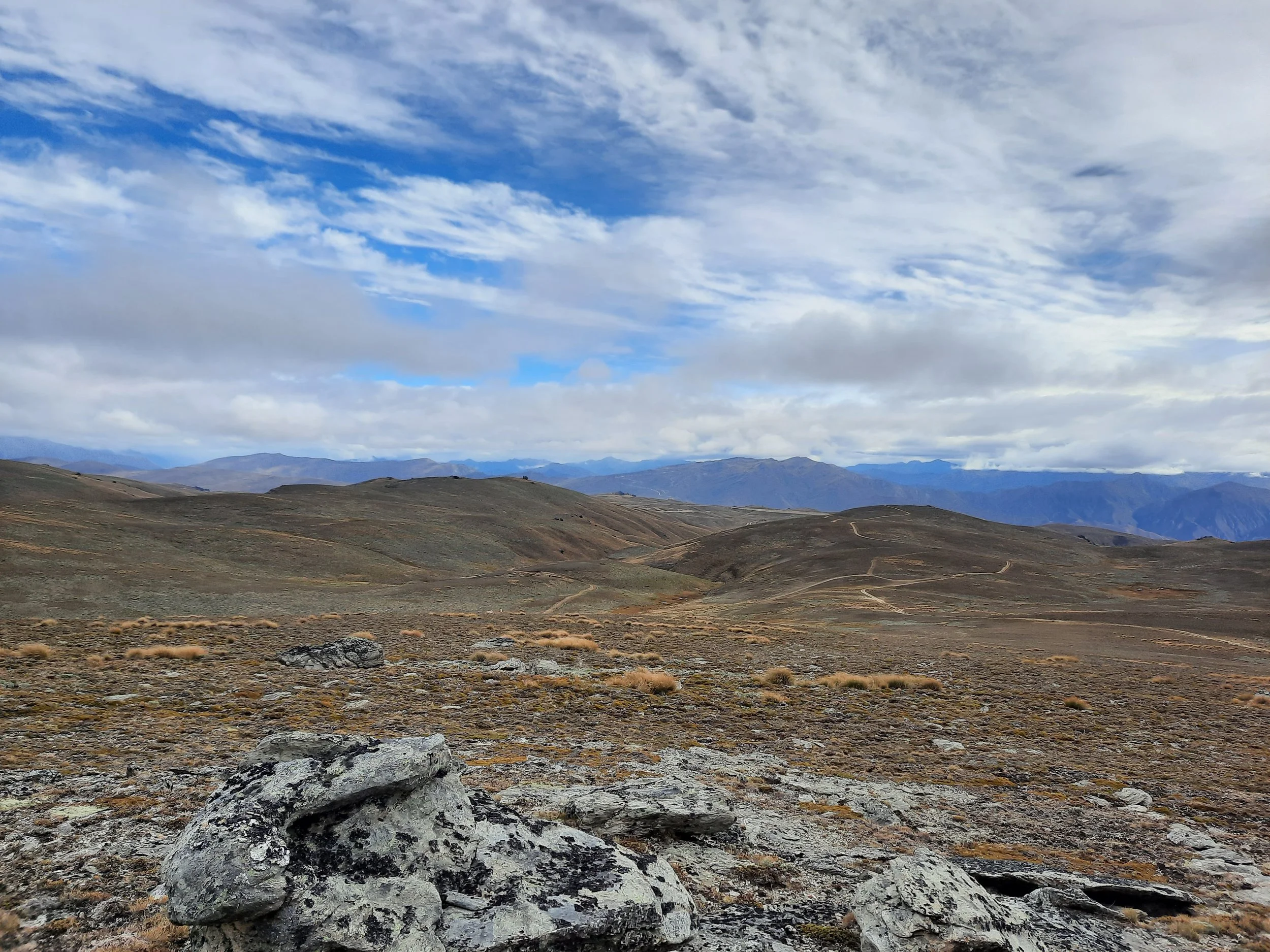
Reaching public land a little north of Meadow Hut, I walked uphill along the northern part of the Kirtle Burn loop track. At first the 4WD track ascends through tussock, and passed a turn-off to the lower part of the loop-track. Then tussock gives way to a vast, slightly slanted/curved, otherwise uninterrupted plateau of small rocks. The final short distance to the summit is off-track, but along an impact track. The summit itself is a tor a few meters high. I climbed part of it, and would have climbed the rest, if not for high wind.
I think there were orange marker poles all the way to the summit tor. Without those, it would be hard to know how to return to the 4WD track in snow, and very hard in a snowstorm. Due to the prevailing northwesterly wind, a snowstorm would be blowing into your face as you tried to retrace your steps to the 4WD track. Of all the non-steep hikes I’ve done, this is one of the ones that would be worst in a snowstorm, because there is no shelter above the folds of the Kirtle Burn valley, apart from the summit tor and a few other tors.
On my way back, I passed two quad-bike riders going uphill. They were the only other people I saw. Shortly before the official three-way junction, I turned south on an impact track and walked downhill, onto lower section of the Kirtle Burn Loop. Kirtle Burn Hut was in view on this unofficial descent. Easily crossing the small Kirtle Burn, I reached Kirtle Burn Hut and rested. After that, I followed the lower Kirtle Burn Track back to Snow Farm, crossing the burn a few more times. The water level was low and the banks were not far apart, so I never got my feet wet.
There was a pink sign indicating I was leaving the Kirtle Burn Track for Snow Farm’s The Loop trail. Shortly after that I passed Meadow Hut. The rest of the route is described in Access section, above.
If 1 is an easy track, and 4 is using hands and feet on exposed rocks, I give this hike a 2 at worst, apart from the small summit tor/outcrop which is a 4.


Hunting
After exiting the private land of Snow Farm, the route is in a hunting area. Hunters are forbidden to “discharge firearms near tracks, huts, campsites, road-ends or any other public place.” I have hiked in more than 30 hunting areas, and only passed hunters three times - this wasn’t one of those hikes.
Here is the DOC topomap with all hunting areas visible.
History
The parts of the Pisa Range where I hiked, both DOC land and Snow Farm, were previously part of the sheep ranch Waiorau Station. So was Mt Cardrona, across the valley. Every autumn they had a muster which started with a full muster, then became a straggle muster, and finally, when needed, a spot muster to catch any remaining stubborn sheep.
The owners who took over in 1964 decided to use the higher-elevation land for snow sports instead, and began doing so in the 1970s. There was no road into this part of the Pisa Range, so skiers were flown to the top by ski-plane. The road I drove to the top was built in the 1980s. The plaque on which I read this information, in Kirtle Burn Hut, didn’t say how the shepherds got to the top of the Pisa Range. I assume they rode horses.
Where does the nickname ‘Roaring Meg’ come from?
In hono(u)r of my friend Meg, I looked up where the Kirtle Burn’s nickname ‘Roaring Meg’ came from. These two sources agree it’s from a 19th-century resident named Maggie, but disagree on the circumstances in which she famously roared. But that is not exactly a contradiction - she may have roared both when being carried across the river, and while working in the pub.
“Roaring Meg, the turbulent stream that plunges into the Kawarau River not far from Cromwell, brings vivid images of a red-headed barmaid named Maggie Brennan. Maggie kept law and order in her grogshop by the force of her voice and the impact of a short-fuse Irish temper. It didn’t take the diggers long to equate the sound and fury of a mountain torrent with Maggie’s forceful character. Roaring Meg the stream became, and though its voice is now muted by a hydro power station, the name and the legend live on.” (https://www.nzgeo.com/stories/place-names/)
“According to the story, an early group of gold miners took two girls with them from a dancing saloon. Reaching the first large stream, they carried the girls across. The one girl, Maggie, made a huge fuss about it and therefore they named the turbulent stream after the noisy red-headed Irish barmaid. The other girl was very calm and silent and they named the second stream according to the tale ‘Gentle Annie’.” (https://medium.com/travel-memoirs/the-roaring-meg-89090bdd68e7)
Other pages about this hike
https://pisaaccess.co.nz/ (access code)
Pages about other hikes to Mt Pisa
https://hikingscenery.com/mt-pisa-via-tinwald-burn-ridge-track/
https://www.alltrails.com/trail/new-zealand/otago/mount-pisa-via-tinwald-burn-ridge-track
https://www.alltrails.com/trail/new-zealand/otago/meg-hut-to-kittle-burn-hut
Pages about other hikes involving Kirtle Burn Hut
Pages about other Pisa Range hikes
Pages about nearby hikes
Mt Pisa seen from elsewhere
The first three pictures show the same range from slightly different angles and elevations, but in rather different lighting conditions.