Roy’s Peak, Wānaka, NZ: Summer vs Winter


The famous lookout is at the lower purple dot. I have clambered along the steep, narrow ridge as far as the second purple dot, but not in snow.
Screenshots of the NZ topographic map are licensed as CC BY 4.0 by Toitū Te Whenua Land Information New Zealand (LINZ).
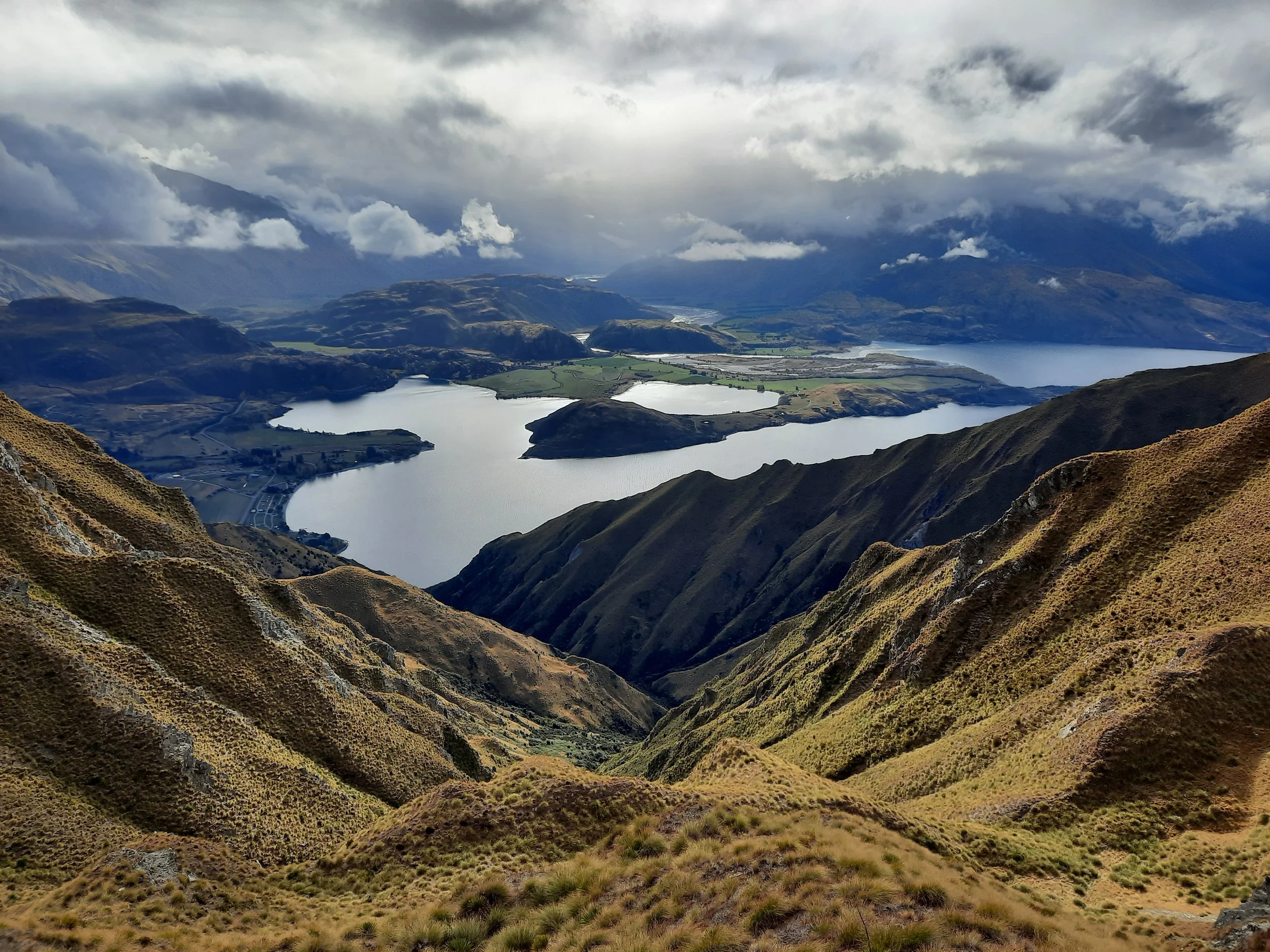
Roy’s Peak (1578m) is a hike beside Lake Wānaka, 10 minutes northwest of the town of Wānaka, Otago, South Island. A few hundred meters below the summit is a famous lookout north over the lake. This view has made the mountain one of the best-known in New Zealand.
By my standards, the peak is a long hike, but the lookout alone is a medium-length hike.
Check out my photos to decide if the view is better with or without snow. I also comment on the difficulty of the track in snow.
DOC warns us that the track is closed for lambing 1 October - 10 November.
Time
DOC says that the return trip to the peak takes 5-6 hours.
AllTrails users report an average of 7 hours 25 minutes on return trips to the peak. Some of them probably turned around at the lookout point.
My times, including breaks:
Without snow, the round-trip to the peak took me around 9 hours. I spent some time waiting for low cloud to clear.
In snow (with spikes on my boots), the round-trip to the lookout took me around 6 hours. The ascent alone took me around 2 hours 45 minutes.
Route
Round-trip, AllTrails reports an elevation gain of 1305 meters and a length of 16.3 kilometers to the summit. The lookout is a few hundred kilometers below the summit.
Driving from Wānaka, there is a medium-sized parking lot on the left side of Wānaka-Mount Aspiring Road. (Continuing on this road leads to the Matukituki Valleys.) I have heard that it fills up quickly on mornings with good weather, and that walking from town is something of a nuisance.
The lower slopes of Roy’s Peak are pasture for sheep and cows. The track is a sometimes grassy, sometimes muddy 4WD track. It does not feel adventurous, yet it is steep in places. The mountain becomes more pleasant once the animals are below us.
The topomap screenshot shows the official lookout (lower purple dot) and the farthest I have continued along the ridge (upper purple dot). Public conservation land ends in the saddle between the upper purple dot and Point 1196.

Possible example of the challenging avalanche terrain mentioned by the DOC worker.
The first hikers in the snow must have had a difficult time, crunching down through 20-35 centimeters of snow with each step. It was easier to walk in their footsteps. My Kahtoola-brand MICROspikes also helped. These are like baby crampons, less effective but much lighter in weight. Other hikers struggled without spikes.
Above 1000 meters, DOC describes the slopes as challenging avalanche terrain. The worker I spoke to at the Wānaka visitor center mentioned the risk of slab avalanches. My safety tips page has some links about avalanche risk
If 1 is an easy track, and 4 is using hands and feet on exposed rocks, I give this a 2 at worst on the steep 4WD track, and a 3 on the narrow impact track leading north from the lookout. I’m not factoring in anything about snow or avalanche risk - just ease of walking in normal circumstances.
Just because the snow pictures have better lighting, doesn’t mean snow is better! It’s like before-after diet advertisements, where the before photo usually shows the person in less flattering lighting.


Hunting
The upper part of the route is in a hunting area. Hunters are forbidden to “discharge firearms near tracks, huts, campsites, road-ends or any other public place.” I have hiked in more than 30 hunting areas, and only passed hunters twice - this wasn’t one of those hikes.
Here is the DOC topomap with all hunting areas visible.
Other pages about this hike
The much longer version of this hike, which goes south over Mt Alpha along the Spots Creek Track
Nearby hikes
Rob Roy Glacier Track (different “Roy”)
https://www.theoutbound.com/new-zealand/hiking/hike-to-the-summit-of-treble-cone (but not quite to the summit)


