108 different day-hikes that I took in NZ, mostly South Island. Several posts about NZ logistics and hikes/travel elsewhere.

The Apprentice via Lewis Tops, Lewis Pass, NZ
Long hike, 20 minutes from Springs Junction & 60 from Hanmer Springs.

Mt Alford, Methven, NZ
Medium-length hike, 15 minutes from Methven.

Short hikes in Central Canterbury, NZ
Ryton Track (Mt Ida), Lake Hill (Lake Heron), Mt Sunday. All 60-70 minutes’ drive from Methven.
Woolshed Creek Hut circuit, Mt Somers village, NZ
Medium-length hike 15 minutes from Mt Somers village.

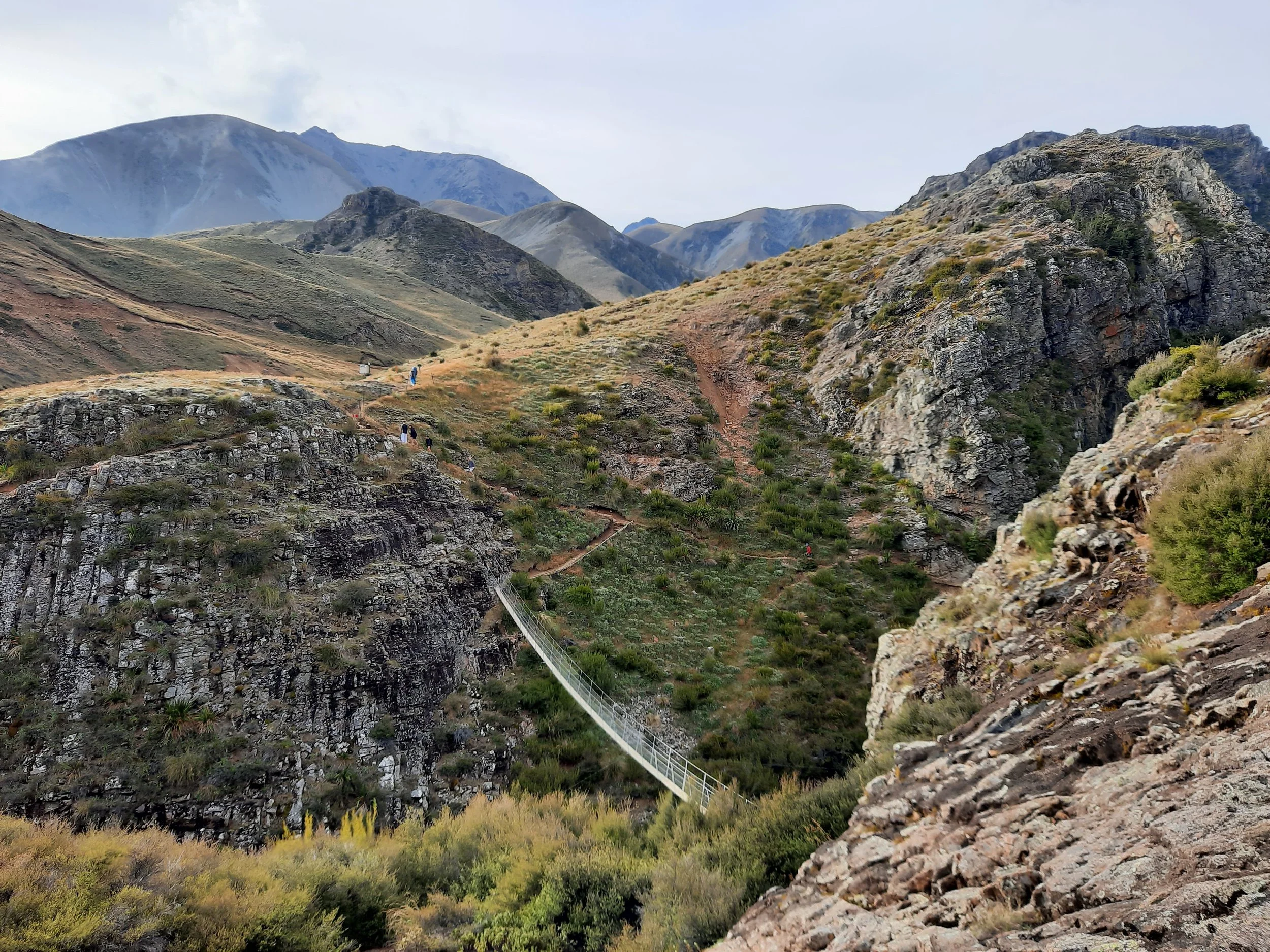
Faust, Lewis Pass, NZ
Long hike near Lewis Pass. 30 minutes from Springs Junction, 45 from Hanmer Springs.

Upper Ōpuke circuit, Mt Hutt forest, Methven, NZ
Short hike from Awa Awa Rata Reserve, 15 minutes from Methven.

Lyttelton-Crater Rim circuit, Christchurch, NZ
Short hike, accessible on foot from Lyttelton, Christchurch.

Point 1966 via Freehold Creek, Twizel, NZ
Very long hike, 30 minutes from Twizel.

Kurow Hill Walkway, Kurow, NZ
Short hike accessible on foot in Kurow, Waitaki Valley.

Ben Ōhau via Greta Track, Twizel, NZ
Medium-length hike, 30 minutes from Twizel.

Mt Isobel via Jack’s Pass, Hanmer Springs, NZ
Short hike from Jacks Pass, 13 minutes from Hanmer Springs. Alternative: accessible on foot from town.

Mt Dumblane to Mt Charon, Hanmer Springs, NZ
Long hike from Jacks Pass, 13 minutes from Hanmer Springs.

Summit Walkway: Hilltop to Mt Sinclair, Banks Peninsula, NZ
Medium-length hike on a portion of the Summit Walkway. 25 minutes from Akaroa, 65 minutes from Christchurch.

Mt Herbert, Banks Peninsula, NZ
Long hike accessible on foot from Diamond Harbour. 45 minutes from Christchurch.

Stony Bay Peak-Flag Peak Circuit, Banks Peninsula, NZ
Medium-length hike accessible on foot from Akaroa. 90 minutes from Christchurch.

Mt Oxford, Oxford, NZ
Medium-length hike 12 minutes from Oxford. 60 minutes from Christchurch

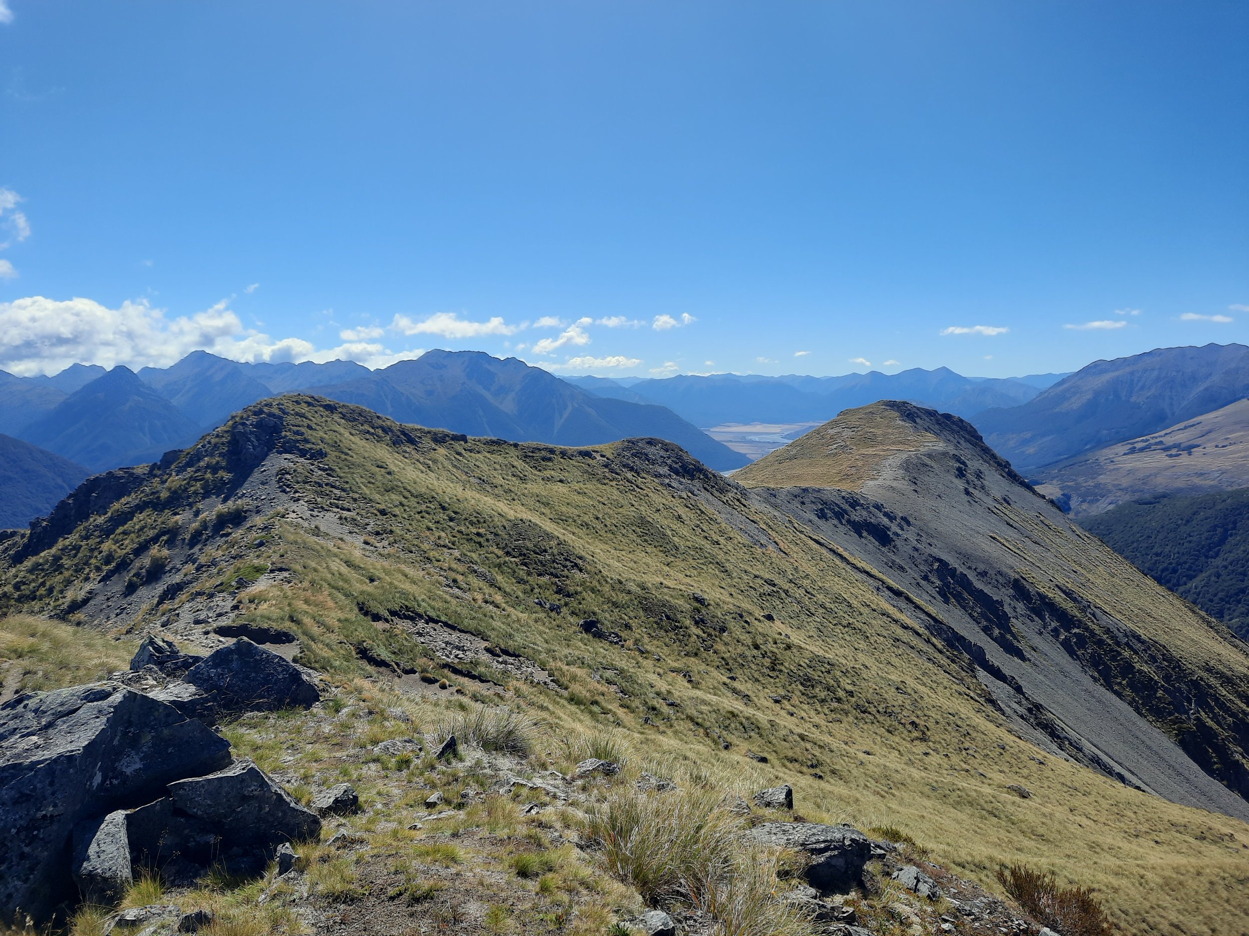
Near Point 1844, Mt Aicken, Arthur’s Pass, NZ
Medium-length hike - turned back due to weather. Accessible on foot, Arthur’s Pass.

Mt Cassidy - Blimit - Temple Col Traverse, Arthur’s Pass, NZ
Very long loop hike accessible on foot from Arthur’s Pass.

Mt Bealey - Avalanche Peak Traverse, Arthur’s Pass, NZ
Very long loop hike accessible on foot from Arthur’s Pass.
Bealey Spur to Point 1581, Arthur’s Pass, NZ
Medium-length hike 12 minutes from Arthur’s Pass.