Hiking in NZ without a car?
Is it possible to go hiking in Aotearoa New Zealand without driving or hitchhiking?
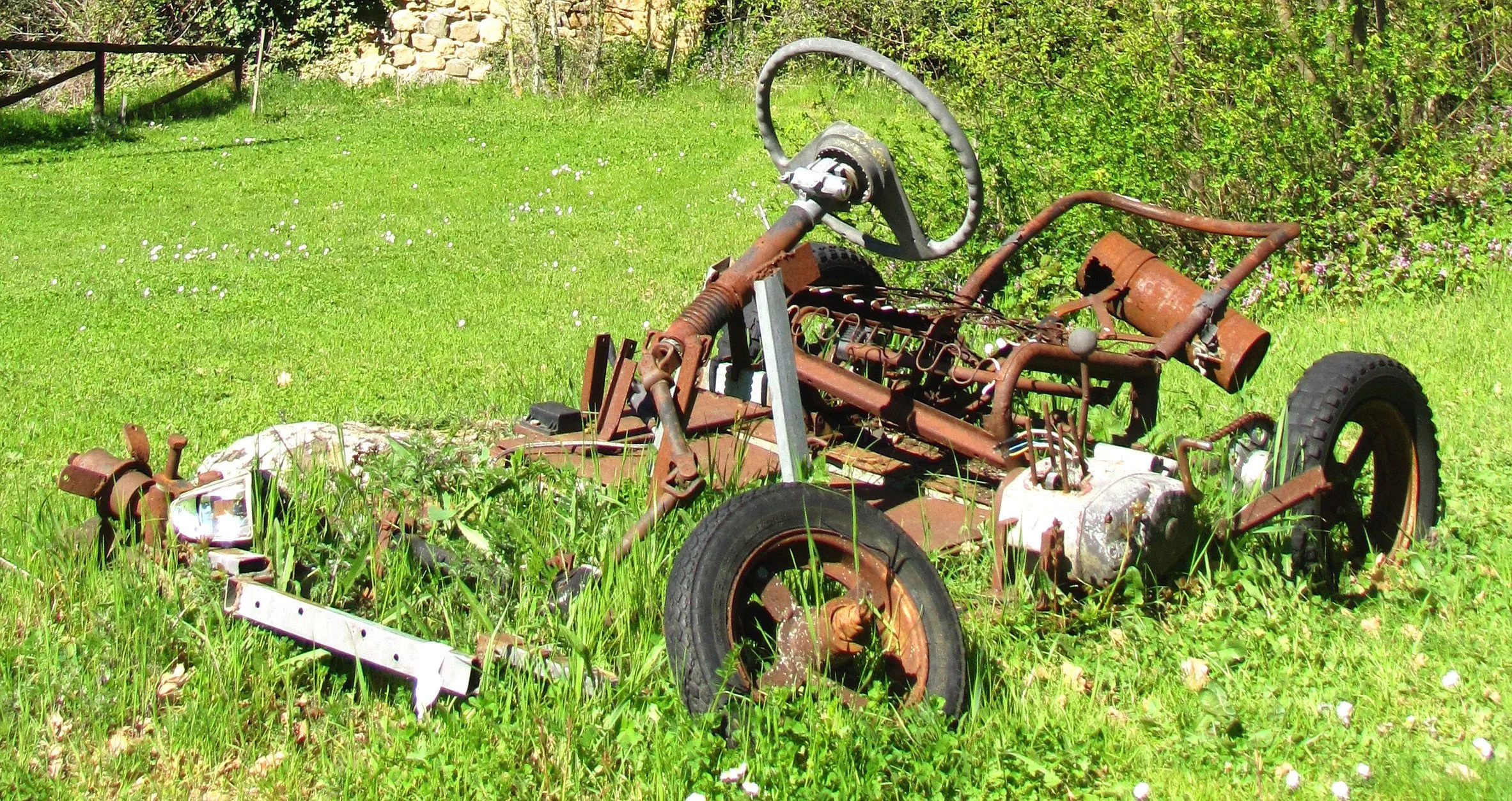
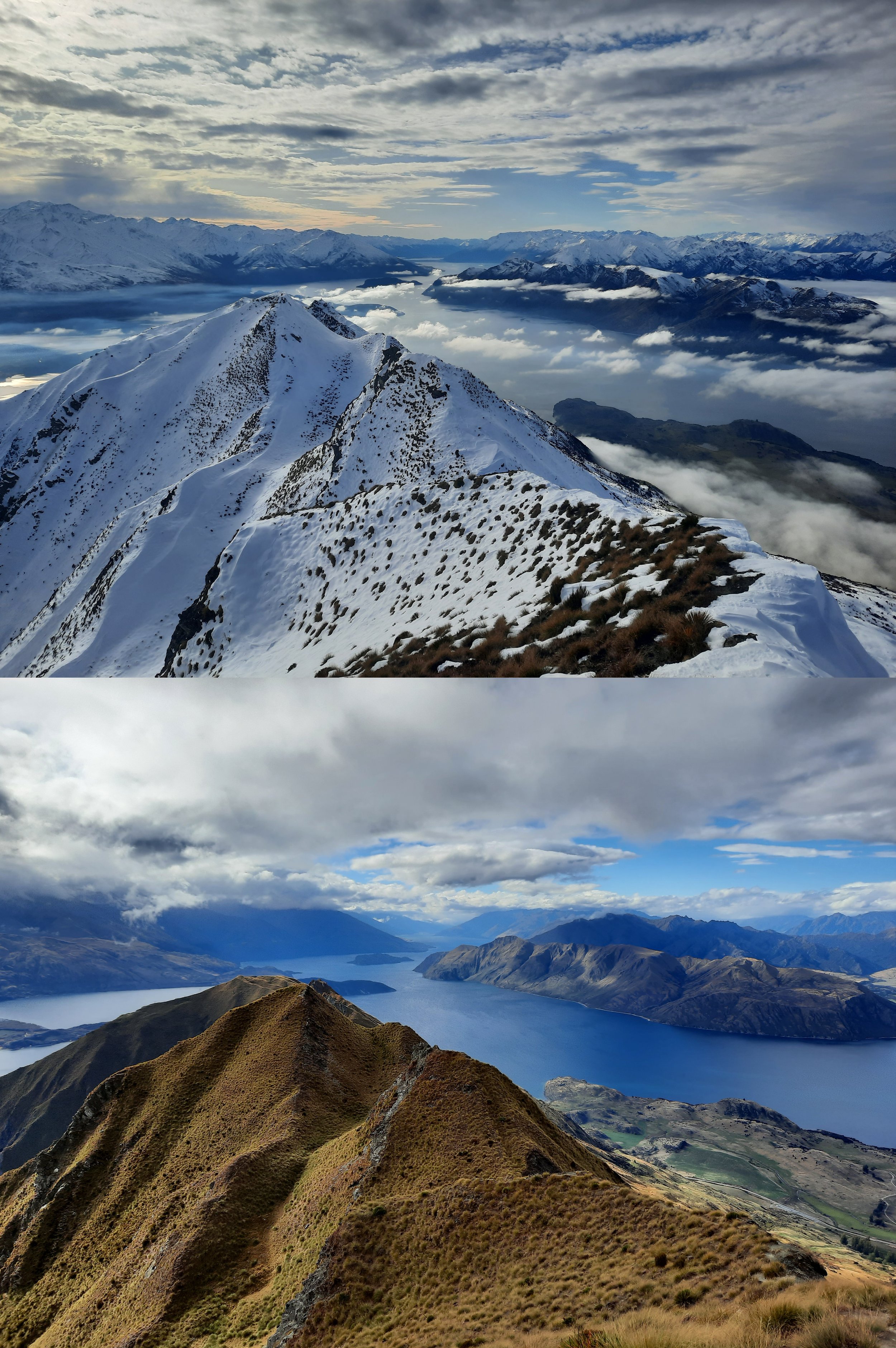
This one is actually from Tuscany, not NZ.
Yes, but it’s not easy, outside of a few areas. This page catalogs day-hikes that I’ve done which are near a bus or shuttle stop, a train station, or a wharf visited by ferries/water taxis - these hikes are indicated by text link to one of my blog posts.
I also list some day-hikes that I’ve only heard of - these are indicated by a bare URL. (If the section has no photos, then I haven’t hiked there yet.)
In summary:
South Island:
For fit and experienced hikers, Arthur’s Pass in Central Canterbury seems like the most convenient place.
For everyone else, the Queenstown/Arrowtown area in Otago seems more appropriate.
North Island has fewer attractive hikes (i.e. the sorts of hikes for which you would choose to visit NZ from overseas). Unsurprisingly, it has fewer car-free hiking opportunities. But,
Wellington and the neighboring Kāpiti Coast have a lot of easy hikes accessible by bus and train.
Villages near Tongariro National Park have a number of competing shuttle companies bringing tourists to some of the island’s most impressive tracks.
This page was written in 2023. I don’t check on the transport operators listed below to make sure they are still in business. The region-specific trail notes on the government-run website for the Te Araroa trail are a good place to see recommended transport operators (https://www.teararoa.org.nz/before-you-go/maps-and-notes-download/) near some of these hikes. Jub has also collected a lot of links (https://churnewzealand.com/nz-hiking-shuttles-track-transport/).
North Island
Auckland
Why visit? There are a lot of small volcanoes - see the end of this section.
Access from abroad: Arrive at Auckland Airport.
Take the SkyDrive shuttle (https://www.skydrive.co.nz/) from the airport to Sky Casino, a convenient centrally located stop in downtown Auckland.
Other options (https://www.aucklandairport.co.nz/transport/public-transport)
Access from the south:
by Northern Explorer train from Wellington, Paraparaumu (Kāpiti Coast), Palmerston North (Palmy), Ohakune, (Tongariro) National Park, Hamilton (https://railnewzealand.com/train-services/the-northern-explorer)
by InterCity bus from Hamilton or Tauranga (https://www.intercity.co.nz/north-island-buses/bus-tauranga-to-auckland)
Getting around
Rangitoto Island day-hike, accessed by private ferry (https://www.fullers.co.nz/timetables-and-fares/?from=AUCK&to=RANG)
visit small volcanic mounds (sturdy shoes are good, but hiking shoes/boots aren’t necessary)
easier to access by bus or train: Mt Eden (Maungawhau) and One Tree Hill (Maungakiekie), both in Central Auckland
easier to access by ferry: Mt Victoria (Takarunga) and North Head (Maungauika), both in Devonport, North Shore
there are 53 in total - for now (https://nztraveltips.com/auckland-volcanoes/)
National Park village, Tongariro National Park
Why visit? Tongariro National Park is one of the two most famous hiking destinations on North Island. The other is the Mt Taranaki area, Egmont National Park.
Arriving from the north
Northern Explorer train from Auckland or Hamilton (https://railnewzealand.com/train-services/the-northern-explorer)
InterCity bus from Auckland or Hamilton (https://www.intercity.co.nz/north-island-buses/bus-hamilton-to-palmerston-north)
Arriving from the south
Northern Explorer train from Palmerston North (Palmy), Paraparaumu (Kāpiti Coast) or Wellington (https://railnewzealand.com/train-services/the-northern-explorer)
InterCity bus from Palmerston North (Palmy) (https://www.intercity.co.nz/north-island-buses/bus-palmerston-north-to-auckland)
Getting around
You can book individual seats in small-group shuttles to access the trailheads of Tongariro Crossing.
Search these 3 locations - National Park, Ohakune, and Tongariro National Park - for track transport (https://www.newzealand.com/in/custom-transfers/)
Take a shuttle to Whakapapa village (on the slopes of Mt Ruapehu) and stay there for a variety of hikes doable on foot, such as Dome Summit of Mt Ruapehu, Taranaki Falls, and Tama Lakes.
Mt Taranaki (Egmont National Park), near New Plymouth in the far western Taranaki Region
Why visit? Along with Tongariro National Park’s hikes, the hikes up and across Mt Taranaki are widely considered the most scenic in North Island. (My priorities are Fantham’s Peak and the challenging Mt Taranaki summit route.)
New Plymouth Airport has domestic flights. From there, there are taxis and Scott’s Airport Shuttle (https://nplairport.co.nz/shuttles/).
Access to New Plymouth from Hamilton and Auckland (to the north)
Access to New Plymouth from Whanganui (to the southeast)
Getting to trailheads from New Plymouth:
https://book.isite.nz/taranaki-mountain-shuttle (the i-sites are tourist info centers)
Kāpiti Coast, near Wellington
Why visit? There are a lot of short and medium-length hikes on forested hills.
I recommend searching Jub’s blog ChurNewZealand.com for ‘kapiti’ to see these hikes. This blogpost contains several.
Access to Paraparaumu (from the north):
Northern Explorer train from Auckland, Hamilton, National Park, Ohakune, Palmerston North (Palmy) (https://railnewzealand.com/train-services/the-northern-explorer)
Access to various Kāpiti Coast towns from Wellington (to the south)
train stations along the Kapiti Line (https://www.metlink.org.nz/service/KPL/timetable)
buses (https://www.kapiticoast.govt.nz/our-district/visiting-kapiti/public-and-community-transport/)
One could do day-trips from Wellington or Porirua (just north of Wellington), or stay in towns on the Kapiti Line which have trailheads.
Wellington, aka Windy Welly
Why visit? Wellington offers a variety of hikes, including
Skyline Walkway on the edge of the city
within the city (with no need for hiking boots)
day-trips to
Belmont Regional Park (https://jontynz.com/2021/02/19/puke-ariki-traverse-belmont-regional-park/)
the Kāpiti Coast (above)
Access from abroad: Arrive at Wellington International Airport. Follow instructions here (https://www.wellingtonairport.co.nz/transport/).
Access from the north
by Northern Explorer train from Auckland, Hamilton, National Park, Ohakune, and Palmerston North (Palmy) (https://railnewzealand.com/train-services/the-northern-explorer)
by Kapiti Line from Waikanae, Paraparaumu, Paekariki (https://www.metlink.org.nz/service/KPL/timetable)
by Wairarapa Line from Masterton and Carterton (https://www.metlink.org.nz/service/WRL/timetable)
Access from South Island: see ferry below
Getting around
day-trips to Kāpiti Coast (see above section)
Inter-island ferries from Wellington to Picton
Two ferries depart from different terminals in Wellington for Picton, a town in the Marlborough Sounds of South Island.
As of 2023, Interislander is less reliable than Bluebridge. But both are unreliable compared to any other form of transportation! Some people avoid the risk of ferry problems by just taking short flights from Wellington to Nelson or to Blenheim, and vice versa.
Here is a guide to the ferries from another blogger: https://myqueenstowndiary.com/ferry-to-the-south-island/.
South Island
Picton, Marlborough Sounds
Why visit? There are short hikes accessible on foot from town, as well as the multi-day Queen Charlotte Track, which is accessed by boat.
walks in Picton and along Queen Charlotte Sound (https://www.alltrails.com/new-zealand/marlborough/picton)
Queen Charlotte track transport (https://www.qctrack.co.nz/transport/)
Arrival by ferry from Wellington: see above.
Arriving from Nelson
InterCity bus from Nelson (https://www.intercity.co.nz/south-island-buses/bus-blenheim-to-nelson)
Arriving from the south
municipal bus 3 from Blenheim (https://www.marlborough.govt.nz/services/bus-services/bus-routes-in-marlborough/bus-route-3-blenheim-picton)
Intercity Bus from Blenheim, Kaikōura, and Christchurch (https://www.intercity.co.nz/south-island-buses/bus-picton-to-christchurch)
Coastal Pacific train from Blenheim, Kaikōura, and Christchurch (https://railnewzealand.com/train-services/the-coastal-pacific)
Nelson, nestled between the Marlborough Sounds and the Tasman District
Why visit? See here and zoom in for a thorough clickable map of routes. Some things I noticed:
It is possible to walk from the city’s eastern Maitai neighborhood (around Nile St) into the adjacent mountains on various overlapping circuit and out-and-back tracks, although taking a taxi or a bicycle to the Maitai Dam area and then hiking from there would be much more pleasant.
Dun Mountain is a high point of various routes (https://nelsontrails.co.nz/dun-mountain-summit/).
Saddle Hill is to its north (https://nelsontrails.co.nz/saddle-hill/).
The trip reports that I’ve read and the photos that I’ve seen don’t impress me.
The much smaller hill Botanical Hill (https://www.theoutbound.com/new-zealand/hiking/hike-up-botanical-hill) is a pleasant walk in Maitai itself.
South of Maitai, the neighborhood called The Brook appears to offer walking access to the Brook Waimārama Sanctuary, a wildlife park. The city’s tourist info worker recommended it to me as the most interesting forest walk in the area.
Tracks on Grampians hill can be accessed from Nelson South or from The Brook.
Nelson Airport has domestic flights. From there:
municipal bus (https://www.nelsonairport.co.nz/public-transport)
shuttles (https://nelsonshuttles.com/)
Access from Picton and Blenheim (to the east)
Access from St Arnaud (to the south): see below.
Getting around
municipal bus (https://ebus.nz/, formerly NBus)
St Arnaud, Nelson Lakes, Tasman Region
Why visit? St Arnaud is a village on the shore of Lake Rotoiti which offers two proper hikes.
The St Arnaud Range Track trailhead is in the village. This hike can be extended much further north than I went.
The track for Mt Robert, which is the starting point of the famous Angelus Hut hike along Robert Ridge, is further away but still a plausible walking distance from town, along Mt Robert Rd.
The trailhead is probably a particularly good destination for hitchhiking. First, it’s a popular hike. Second, any driver driving toward the trailhead will realize that that’s where every hitchhiker is going, too. (There is no other outlet, so they would have to pull a U-turn to kidnap you.)
Access from Nelson (to the north)
private shuttles (e.g. https://www.nelsonlakesshuttles.co.nz/prices.html)
That shuttle company provides access to a lot of other trailheads in the area, such as Red Hills, which can be useful for both day-hikes and the Te Araroa trail.
Blenheim, Marlborough wine-country
Why visit? The main non-car attraction in this area is probably bicycling to vineyards for wine tastings. Otherwise, there are the Wither Hills, a pleasant farm park on the southern outskirts of the city.
Marlborough Airport is a domestic airport. Transport from there includes buses (https://www.marlboroughairport.co.nz/transport-details/buses) and shuttles (https://www.marlboroughairport.co.nz/transport-details/taxis-and-shuttles).
Getting to Blenheim from Picton (to the north)
municipal bus (https://www.marlborough.govt.nz/services/bus-services/bus-routes-in-marlborough/bus-route-3-blenheim-picton)
InterCity bus (https://www.intercity.co.nz/south-island-buses/bus-blenheim-to-nelson)
Coastal Pacific train (https://railnewzealand.com/train-services/the-coastal-pacific)
Getting to Blenheim from the south
Coastal Pacific train from Kaikōura and Christchurch (https://railnewzealand.com/train-services/the-coastal-pacific)
Getting around
From the train station in Central Blenheim, it’s possible to walk to the Wither Hills.
Municipal bus route 2 goes near the Wither Hills (https://www.marlborough.govt.nz/services/bus-services/bus-routes-in-marlborough/bus-route-2-redwoodtown-witherlea-south-route)
Kaikōura, Canterbury
Why visit?
The Kaikōura Peninsula Walkway is not a proper hike, but it is one of the most scenic coast walks in NZ (https://www.doc.govt.nz/parks-and-recreation/places-to-go/marlborough/places/kaikoura-area/things-to-do/tracks/kaikoura-peninsula-walkway/)
Mt Fyffe is accessible by bicycle (I rented one from a shop on West End) or private shuttle (https://www.kaikoura.co.nz/listing/kaikoura-shuttles)
Access from Picton and Blenheim (to the north)
InterCity bus (https://www.intercity.co.nz/south-island-buses/bus-blenheim-to-nelson)
Coastal Pacific train (https://railnewzealand.com/train-services/the-coastal-pacific)
Access from Christchurch (to the southwest)
InterCity bus (https://www.intercity.co.nz/south-island-buses/bus-blenheim-to-nelson)
Coastal Pacific train (https://railnewzealand.com/train-services/the-coastal-pacific)
Hanmer Springs, northern Canterbury
Why visit? Hanmer Springs is a resort village with a few hikes one can do on foot from town:
It is easy to hike up Mt Isobel.
Further away but still a plausible walk is Mt Dumblane, which I traversed to Mt Charon.
Conical Hill and Hanmer Forest together make a decent though unchallenging walk (https://visithurunui.co.nz/listings/listing/conical-hill-and-heritage-forest).
Access from Christchurch (to the south):
private shuttle (https://www.hanmerconnection.co.nz/Daily-Service/)
Lyttelton, Christchurch, Central Canterbury
The port suburb of Lyttelton is the only scenic part of Christchurch proper. I haven’t hiked there, but I enjoyed the view driving over the Port Hills, which separate Lyttelton from the rest of the city. There are various hikes (https://www.bankspeninsulawalks.co.nz/lyttelton-walks/).
Access Christchurch from abroad: Arrive at Christchurch International Airport.
Access Lyttelton from Central Christchurch or the airport (to the northwest):
bus from airport to Lyttelton: https://www.metroinfo.co.nz/timetables/8-port-to-port/
Diamond Harbour, Banks Peninsula, Central Canterbury
The village of Diamond Harbour is south across Lyttelton Harbour from Lyttelton. From the village, I hiked the peninsula’s highest peak, Mt Herbert (see more options at https://www.bankspeninsulawalks.co.nz/diamond-harbour-walks/).
Accessing Diamond Harbour from Christchurch (to the north)
ferry from Lyttelton, Christchurch to Diamond Harbour: https://www.metroinfo.co.nz/timetables/f-diamond-harbour-ferry/
Akaroa, Banks Peninsula, Christchurch
From the village of Akaroa, I hiked the Stony Bay Peak - Flag Peak circuit. Although lower in elevation than Mt Herbert (above), the terrain is more fun and the views are more dramatic.
Accessing Akaroa from Christchurch:
French Connection bus service, or a taxi: https://www.christchurchnz.com/explore/getting-around/akaroa-visitor-information
Castle Hill village, Central Canterbury
Castle Hill holiday village is a dubious place to stay without a car, because there is nowhere to buy food. However, it is a great place for hiking in the Craigieburn Range, e.g. the Mt Cloudsley-Mt Enys traverse.
Access from Christchurch (to the southeast) or Arthur’s Pass and Greymouth (to the northwest)
Arthur's Pass village, Central Canterbury
The village of Arthur’s Pass seems like the best place to stay for people who like challenging day-hikes - drivers and non-drivers alike. These four are all accessible on foot:
Avalanche Peak (https://www.arthurspass.com/index.php?page=49 - best website for Arthur’s Pass)
some of the other hikes here are also accessible on foot from the village (https://hikingscenery.com/category/new-zealand/arthurs-pass-national-park/)
General access (https://www.arthurspass.com/index.php?page=6)
Access from Christchurch (to the southeast) or Greymouth (to the northwest)
Lake Tekapo, Mackenzie Basin, Canterbury
If you happen to be taking an InterCity bus from Christchurch to Queenstown (https://www.intercity.co.nz/south-island-buses/bus-christchurch-to-queenstown), or vice versa, then Lake Tekapo is a good place to stop for a night for the great view from the short Mt John hike.
Mt Cook village, Mackenzie Basin, Canterbury
Aoraki (Mt Cook) is the highest mountain in NZ. You can gaze at it from day-hikes accessible on foot from Mt Cook village.
Mueller Hut, the extension of Sealy Tarns (https://www.doc.govt.nz/parks-and-recreation/places-to-go/canterbury/places/aoraki-mount-cook-national-park/things-to-do/tracks/mueller-hut-route/)
Mt Wakefield (https://www.theoutbound.com/new-zealand/hiking/climb-mt-wakefield)
Sebastopol Peak (https://hikingscenery.com/sebastopol-via-red-tarns)
full list of short walks/hikes, including some requiring several hours walking along the roads (https://triptins.com/mt-cook-hikes/)
Access from Christchurch (to the northeast)
InterCity bus (https://www.intercity.co.nz/south-island-buses/bus-mt-cook-to-christchurch)
list of several shuttles (https://alpineguides.co.nz/faq-travel)
Access from Queenstown (to the southwest)
InterCity bus (https://www.intercity.co.nz/south-island-buses/bus-mt-cook-to-queenstown)
list of several shuttles (https://alpineguides.co.nz/faq-travel)
Makarora, Queenstown Lakes region, Otago
Mt Shrimpton is accessible on foot from the village (https://www.doc.govt.nz/parks-and-recreation/places-to-go/otago/places/mount-aspiring-national-park/things-to-do/tracks/mount-shrimpton-track/).
Access from Wānaka and Queenstown, or from Franz Josef and Haast (in the other direction)
https://www.intercity.co.nz/south-island-buses/bus-queenstown-to-franz-josef - you want the stop for Makarora, not the stop for Makarora Country Cafe (farther south)
Wānaka, Queenstown Lakes region, Otago
Roy’s Peak, one of NZ’s most famous hikes, is about an hour on foot from town. It is closed during spring lambing.
There is also a much shorter hike, Mt Iron, at the edge of town (https://www.doc.govt.nz/parks-and-recreation/places-to-go/otago/places/wanaka-area/things-to-do/mount-iron-track/).
Access from Christchurch and Tekapo (to the north)
Access from Cromwell, Queenstown, and/or Dunedin (to the south)
Getting to trailheads (https://www.lakewanaka.co.nz/things-to-do/walking-and-hiking/track-transport/)
It seems that the West Matukituki private shuttle is no longer operational. This is unfortunate, as even people with rental cars may not wish to attempt the road.
Cardrona, Queenstown Lakes region, Otago
Cardrona is a hamlet on the high-altitude Cardrona-Crown Range Rd, which connects Wānaka with the Frankton-Arrowtown area.
Two kilometers from the Cardrona Hotel, along an unnamed but probably quiet road on the opposite side of the Cardrona River from Cardrona-Crown Range Rd, is the trailhead for the Meg Hut Pack Track (https://www.doc.govt.nz/parks-and-recreation/places-to-go/otago/places/pisa-conservation-area/things-to-do/roaring-meg-pack-track/). The day-hike version of this would probably involve turning around at Tuohy’s Saddle (1140m).
Not far from the Meg Hut Pack Track trailhead, on the opposite side of Cardrona-Crown Range Rd, is Cardrona Ski Field Road. The ski field operators allow summer hiking on Mt Cardrona (https://www.cardrona.com/summer/experience/walking-hiking/). I probably wouldn’t choose to gain nearly 1200m of elevation on a very long ski field road just to start that hike. Similar views are available from the Crown Peak (see the Arrowtown section, just below).
Access from Queenstown center, Frankton, and Wānaka
private bus: https://www.ritchies.co.nz/wanaka
Arrowtown, Queenstown Lakes region, Otago
Arrowtown offers two decent day-hikes, Brow Peak and Crown Peak, as well as a variety of smaller options (https://qeiinationaltrust.org.nz/wp-content/uploads/2018/01/Mahu-Whenua-Walking-Tracks-Arrowtown-Tracks.pdf).
Access from Queenstown center, Queenstown airport, and Frankton
Queenstown and Frankton, Queenstown Lakes region, Otago
From Queenstown center, one can
hike to the summit of Ben Lomond and its lesser-known twin Bowen Peak
walk up Queenstown Hill
take a bus up to the Remarkables ski field, in ski season at least (https://www.theremarkables.co.nz/ski-bus/)
traverse the Doolan’s Creek Headwaters to Point 2008 or Ben Cruachan (but I wouldn’t do this in snow)
take a taxi or a bus to Arthur’s Point, and walk back to Queenstown on Moonlight Track and Ben Lomond track
take a bus to Arrowtown and hike (see above)
take a water taxi across the Frankton Arm of Lake Wakatipu to Kelvin Peninsula, hike south along the lake to Jack’s Point (https://hikingscenery.com/jacks-point-track-queenstown-area/), and take a municipal bus from Jack’s Point village back to Queenstown
Access from Christchurch (to the northeast)
Access from Dunedin
From Frankton airport to Queenstown centre, Arthur’s Point, Arrowtown, and Kelvin Heights:
Track transport
Glenorchy, Queenstown Lakes region, Otago
From the village of Glenorchy, one can walk south along the highway to the trailheads for Black Peak/Mt McIntosh and Mt Alaska/Mt Judah/Heather Jock Loop.
Access from Queenstown
private shuttle (https://www.infotrack.co.nz/routeburn-track-transport/)
The same shuttle company connects Glenorchy with the more remote trailheads for:
the Routeburn Track, part of which can be done as a day-hike (https://triptins.com/routeburn-track-day-hike/)
they also connect Queenstown with The Divide, in Fiordland; this is the other trailhead of the multi-day Routeburn Track through-hike
a circuit involving Sugarloaf Track and Lake Sylvan - Rockburn Track (https://www.doc.govt.nz/parks-and-recreation/places-to-go/otago/places/mount-aspiring-national-park/things-to-do/tracks/sugarloaf-rockburn-track/)
Te Anau, Fiordland, Southland
Why visit?
The main hiking reason is the multi-day Kepler Track.
But it’s possible to do the first part of the track as a day-trip, e.g. only to the summit of Mt Luxmore (https://www.weseektravel.com/kepler-track-day-walk-mount-luxmore-summit/).
Access from Queenstown (to the northeast):
Access from Invercargill (to the southeast):
Catch-a-Bus South (https://www.catchabussouth.com/invercargilltoteanau.html)
Track transport:
Kepler Track water taxi (https://www.fiordlandoutdoors.co.nz/transport-and-experiences/kepler-track-transport/)
It saves time, but I’m skeptical that there is enough time to take the first outbound boat, hike to the summit of Mt Luxmore and return in time for the last return boat. Thus walking outbound from town may be necessary to take the return boat; or, walking back to town may be necessary after having taken the outbound boat.
Sample itinerary for fit, experienced, obsessive hikers who can’t/won’t drive
This suggested itinerary is 21 nights. I don’t see much point in coming all the way from the Northern Hemisphere to New Zealand for less time than that.
Simple version: If you want to maximize hiking opportunities per location and minimize travel time, then Wellington, Christchurch (to access Arthur’s Pass by train), and Queenstown-Frankton seem like the three best choices, so I recommend taking flights between them. There is at least a week’s worth of hiking in each one.
If you yearn to traverse both islands, then try:
North Island
arrive at Auckland Airport
1 nights Auckland. (Rangitoto Island if staying a second night)
4 nights near Tongariro National Park. Tongariro Crossing and Mt Ruapehu. Requires at least one small-group shuttle.
2 nights Wellington. Skyline Walkway or a Kāpiti Coast hike.
take ferry to Picton, or plane to Blenheim
South Island
train from Picton or Blenheim to Christchurch
1 night Lyttelton, Christchurch. (a Port Hills hike; or Mt Herbert, Diamond Harbour if staying a second night)
train to Arthur’s Pass
4 nights Arthur’s Pass
train back to Christchurch
bus to Lake Tekapo, bus to Mt Cook (I haven’t checked timetables to see if this can be done the same day as the train)
2 nights Mt Cook (Mueller Hut)
bus to Queenstown
7 nights Queenstown-Frankton (Ben Lomond/Bowen Peak, Queenstown Hill; bus to Arthur’s Point for Moonlight Walkway; bus to Jack’s Point, then walk to Kelvin Peninsula and take water taxi back; bus to Arrowtown for Brow Peak, Crown Peak, or the lesser hikes; shuttle to Wānaka for Roy’s Peak (less hectic if staying overnight)
return by airplane to Christchurch or Auckland
For 14 nights, skip North Island. Start in Queenstown rather than Christchurch, to build up fitness for the most strenuous hikes (Mueller Hut and various hikes at Arthur’s Pass).
For 7 nights, spend the whole time Queenstown or Arthur’s Pass. Choose between them based on your fitness and whether you really like the look of the Otago Lakes. (Arthur’s Pass has a few tarns but no lakes.)
Municipal bus/train cards
Bee Card, used in various regions (https://beecard.co.nz/Contact)
Auckland Transport Hop card, used in Auckland (https://at.govt.nz/bus-train-ferry/at-hop-card)
Bus and train route links
https://www.intercity.co.nz/travel-info/route-map (usually the cheapest way to reach somewhere)
consider their Flexi-Pass and their TravelPass
https://www.kiwiexperience.com/ (hop on, hop off)
https://nzpocketguide.com/places-in-new-zealand-only-accessible-by-bus/: Farewill Spit (northwestern tip of South Island), Ninety Mile Beach (in Northland, north of Auckland), Skippers Rd (Queenstown), Nevis Rd (Queenstown), North Coromandel (between Auckland and Tauranga)
Air travel links
https://www.newzealand.com/in/domestic-flights/ (list of airports)
I’ve mostly rented cars to go hiking in NZ. But I remember the struggle of car-free hiking from when I lived in Scotland and Japan, so I wanted to share this car-free transport info with anyone who is in that same boat.
Please let me know of any transport operators I have missed, and which aren’t covered on webpages I did include that list several operators. I will only post links to full webpages, not Facebook pages, because I see a website as a proxy for durability, which is a proxy for quality.
